Geodata Germany 22.02
The database contain geodata of the Federal Republic of Germany with geo referenced towns, municipalities, town quarters, administrative units, postal codes, telephone preselections, nature areas, landscapes, climatic zones for proximity searches ec.
Product Specifications
| User Rating: | item has less then 1 vote |
|
| FileCart Rating | ||
| Submitted by: | xyxyxy | |
| Homepage | Visit Homepage | |
| License | Data Only | |
| Price | $175 | |
| Downloads | 704 | |
| OS Support | Windows Install Only | |
| File Name | geodatde.zip | |
| File Size | 3.05 MB ( 3,125 KB ) | |
| Published | Aug 25, 2006 (20 years ago) | |
| Updated | Jan 25, 2018 (8 years ago) | |
Follow Us!
Latest Searches
neovia nutrição animal site 2 minutes ago
Gheorghe Dem. Teodorescu 2 minutes ago
can we get passport book in india post payment bank for lic policy 3 minutes ago
Water drop flag and baffle 3 minutes ago
nvz area in carton full form 4 minutes ago
dti registration 5 minutes ago
www.Fsapk.cn 9 minutes ago
30th anniversary pokemon 10 minutes ago
cào dalab tranh cãi 11 minutes ago
Popular Searches
id cards 602 times
2025 489 times
2024 386 times
Softperfect 328 times
2026 274 times
Database Workbench Pro 258 times
TeraByte Drive Image Backup and Restore 255 times
Elcomsoft Phone Breaker 251 times
ia que faz video com imagem 18 251 times
Product Details
| Requirements: | All systems, only data |
| Release Info: | Major Update on Jan 22, 2018 |
| Release Notes: | All databases actualized on level 1st January 2018. Reactivated License Plates entered in database KREIS. All Town-Databases ORT????? with most plausible telephone pre-selection. All Town-Databases ORT????? with unique record ID for easy updating. 8100 new urban districts added to ORTTL????. |
| Related Tags: | geo data geodata coordinate coordinates |
Reviews
Reviews of Geodata Germany 22.02
You can be the first to write a review of Geodata Germany!Other products submitted by this publisher
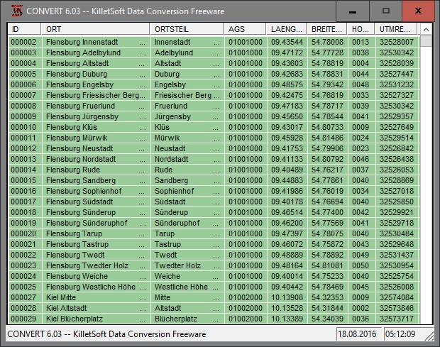
The freeware program CONVERT from KilletSoft converts databases and files between the dBase, CSV and SDF data formats and the character sets ANSI, ASCII, UTF8 and Unicode. Thus the import of the data in any DBMS will be possible.
DRAGSENSDRAGSENS Geo Software is used for the exact position estimation of a towed body, sensor, camera, array or net, dragged behind a ship, aircraft or vehicle. The software allows a real-time estimation of the position of a dragged sensor.
Geodata GermanyThe database contain geodata of the Federal Republic of Germany with geo referenced towns, municipalities, town quarters, administrative units, postal codes, telephone preselections, nature areas, landscapes, climatic zones for proximity searches ec.
Geodata GermanyThe database contain geodata of the Federal Republic of Germany with geo referenced towns, municipalities, town quarters, administrative units, postal codes, telephone preselections, nature areas, landscapes, climatic zones for proximity searches ec.
Geodata InternationalGeodata International - World-wide database of countries with georeferenced towns, municipalities, postal codes and administrative units with WGS84 and UTM coordinates and elevations for geocoding, proximity search, navigation, distance calculation.
Most Viewed Windows Database Tools
EMS SQL Manager for SQL Server 3.9
DBF Viewer 2000 6.55
DataNumen Access Repair 2.2
PHP DataGrid AJAX Enabled Web Control 8.2.7
Universal SQL Editor 1.9.2.2
Excel-Mysql converter 3.0
xBaseView Database Explorer 11.0
Data Loader 4.8
Altova MapForce Enterprise Edition 2017sp2
Most Downloaded Windows Database Tools
DBF Viewer 2000 6.55
xBaseView Database Explorer 11.0
Excel-Mysql converter 3.0
Data Loader 4.8
Universal SQL Editor 1.9.2.2
PHP DataGrid AJAX Enabled Web Control 8.2.7
dbForge Studio for Oracle 4.5
DBScribe for SQL Server 1.4
DataNumen Access Repair 2.2