Geodata Germany 25.02
The database contain geodata of the Federal Republic of Germany with geo referenced towns, municipalities, town quarters, administrative units, postal codes, telephone preselections, nature areas, landscapes, climatic zones for proximity searches ec.
Product Specifications
| User Rating: |
Geodata Germany 24.08
4.5
out of 5
(based on 1 ratings)
|
|
| FileCart Rating | ||
| Submitted by: | xyxyxy | |
| Homepage | Visit Homepage | |
| License | Data Only | |
| Price | $175 | |
| Downloads | 639 | |
| OS Support | Windows Install Only | |
| File Name | geodatde.zip | |
| File Size | 3.16 MB ( 3,232 KB ) | |
| Published | Oct 20, 2006 (20 years ago) | |
| Updated | Feb 13, 2017 (9 years ago) | |
Follow Us!
Latest Searches
Leanne Nielsen ny 5 minutes ago
sofva 6 minutes ago
porque los pobres gastan mas libremente que los ricos 7 minutes ago
Real app PC re 8 minutes ago
14. Es una reacción química en la que un átomo, molécula o ion pierde electrones. Este proceso suele implicar la unión de oxígeno u otro agente oxidante, pero no siempre es necesario. 9 minutes ago
vbnm.o*0 4 7 11 minutes ago
The Select is the bone of the upper arm. 11 minutes ago
Functional Metabolism of Aromatic Precursors in Hanseniaspora: A Source of Natural Bioactive Compounds 11 minutes ago
code efootball 12 minutes ago
Popular Searches
id cards 602 times
2025 470 times
2024 386 times
Softperfect 327 times
Database Workbench Pro 258 times
2026 258 times
TeraByte Drive Image Backup and Restore 255 times
Elcomsoft Phone Breaker 251 times
ia que faz video com imagem 18 245 times
Product Details
| Requirements: | All systems, only data |
| Release Info: | Major Update on Jun 09, 2021 |
| Release Notes: | All tables updated to the data status of 1 January 2021. Table LASTEN supplemented with snow loads >3 and >3a. DHDN coordinates in degree notation and Google Plus codes added. Formerly municipial free areas added and landscapes completed. Snow and wind loads and solar radiation from all locations. |
| Related Tags: | geodata cities towns municipalities postal codes |
Reviews
Reviews of Geodata Germany 25.02
You can be the first to write a review of Geodata Germany!Other products submitted by this publisher
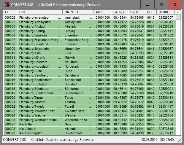
The freeware program CONVERT from KilletSoft converts databases and files between the dBase, CSV and SDF data formats and the character sets ANSI, ASCII, UTF8 and Unicode. Thus the import of the data in any DBMS will be possible.
DRAGSENSDRAGSENS Geo Software is used for the exact position estimation of a towed body, sensor, camera, array or net, dragged behind a ship, aircraft or vehicle. The software allows a real-time estimation of the position of a dragged sensor.
Geodata GermanyThe database contain geodata of the Federal Republic of Germany with geo referenced towns, municipalities, town quarters, administrative units, postal codes, telephone preselections, nature areas, landscapes, climatic zones for proximity searches ec.
Geodata GermanyThe database contain geodata of the Federal Republic of Germany with geo referenced towns, municipalities, town quarters, administrative units, postal codes, telephone preselections, nature areas, landscapes, climatic zones for proximity searches ec.
Geodata InternationalGeodata International - World-wide database of countries with georeferenced towns, municipalities, postal codes and administrative units with WGS84 and UTM coordinates and elevations for geocoding, proximity search, navigation, distance calculation.
Most Viewed Windows Database Tools
EMS SQL Manager for SQL Server 3.9
DBF Viewer 2000 6.55
DataNumen Access Repair 2.2
PHP DataGrid AJAX Enabled Web Control 8.2.7
Universal SQL Editor 1.9.2.2
Excel-Mysql converter 3.0
xBaseView Database Explorer 11.0
Data Loader 4.8
Altova MapForce Enterprise Edition 2017sp2
Most Downloaded Windows Database Tools
DBF Viewer 2000 6.55
xBaseView Database Explorer 11.0
Excel-Mysql converter 3.0
Data Loader 4.8
Universal SQL Editor 1.9.2.2
PHP DataGrid AJAX Enabled Web Control 8.2.7
dbForge Studio for Oracle 4.5
DBScribe for SQL Server 1.4
DataNumen Access Repair 2.2