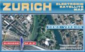
Transnavicom Satellite Map of Zurich 1.0
Demo-version of Satellite Map of Zurich! The newest developments and progressive experience of Transnavi.com give a chance to create such high-quality and unique products! Satellite technologies are available to everybody!
Product Specifications
| User Rating: | item has less then 1 vote |
|
| FileCart Rating | ||
| Submitted by: | transnavicom | |
| Homepage | Visit Homepage | |
| License | Demo | |
| Price | $0.00 | |
| Downloads | 597 | |
| OS Support | Windows Install and Uninstall | |
| File Name | Setup_ZurichDemo.exe | |
| File Size | 18.76 MB ( 19,215 KB ) | |
| Published | Mar 02, 2007 (19 years ago) | |
| Updated | Jun 04, 2012 (14 years ago) | |
Follow Us!
Latest Searches
Haply gitlab 5 minutes ago
kudus ke jekulo kudus 10 minutes ago
Event driven analog computing powers real time intelligent haptic perception 14 minutes ago
poe network switch 15 minutes ago
plant zombie pc free download 15 minutes ago
Which hormone causes milk ejection from the breast?Group of answer choicesProlactinOxytocinProgesteroneInsulin Flag question: Question 4Question 4 17 minutes ago
If mc018 1.jpg and g(x) = 5x – 4, what is the domain of mc018 2.jpg?highlight=0 21 minutes ago
UniMedSeg : Towards Universal Medical Image Segmentation with Multimodal Foundation Models 22 minutes ago
hnb e calendar 2026 26 minutes ago
Popular Searches
id cards 602 times
2025 430 times
2024 385 times
Softperfect 319 times
Database Workbench Pro 258 times
TeraByte Drive Image Backup and Restore 255 times
Elcomsoft Phone Breaker 251 times
Elcomsoft Phone Viewer 232 times
ia que faz video com imagem 18 228 times
Product Details
Demo-version of Satellite Map of Zurich! The newest developments and progressive experience of Transnavicom (www.transnavi.com), professionalism of our specialists, aspiration and wish to do our favourite thing give us a chance to create such high-quality and unique products! Face the reality! Your dreams are coming true with satellite maps from Transnavi.com. In the demo-version you can get acquainted with a district of Zurich, use address-search functions and measure the distance between any number of points!
Basic properties of the programme demo-version:
Spatial resolution - 60 centimeters in one pixel allows to have a detailed look at buildings, smallest curves of streets, cars on the streets, elements of road marking and even crowds of people on Zurich streets.
Multilevel scaling function enables changing zooming in and out ranging from a panoramic view of the city to the detailed configuration of the building.
Quick navigation enables to move quickly on the map in any direction. Moving is fulfilled simultaneously with the mouse movement without any pauses on the monitor.
Searching system by the name of the street and postal address.
Revealing information about objects. When pointing the cursor at the object (street, building, a reference window with information about this object appears.
The functional Navigator function makes the orientation and navigation around the map easier.
Measuring distances of the map between any number of consequently put points.
Printing any fragment of the map of any scale model.
Changing and customer-friendly interface of the programme.
Possibility to choose the operation language: English, German, Russian. After choosing the language all interface elements, including messages, hints, names of objects in data bases (streets, districts).
| Requirements: | Pentium II 233 MHz, RAM 128 Mb, SVGA 2 Mb, CD-ROM 4x, Windows 98, ME, 2000, XP. |
| Release Info: | New Release on Jan 10, 2007 |
| Related Tags: | electronic map Zurich satellite map |
Reviews
You must be logged in to write a review
Reviews of Transnavicom Satellite Map of Zurich 1.0
You can be the first to write a review of Transnavicom Satellite Map of Zurich!