
Navi 0.3.30-beta
Offline-first navigation with terrain-aware eco routing
Download
49.17 MB · navi-0.3.30-beta.apk
44downloads
0this week
FreeFreeware
0reviews
Screenshots
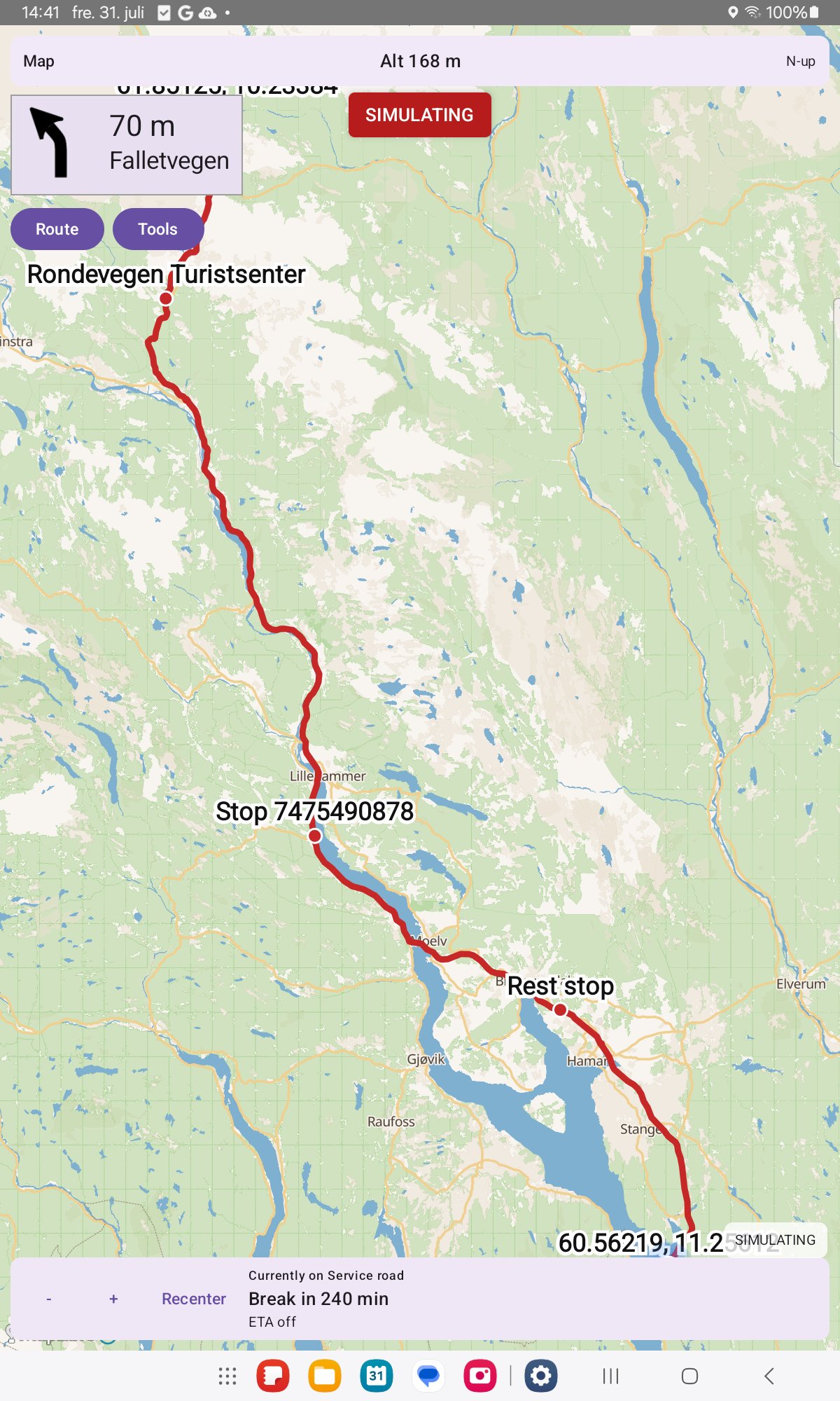
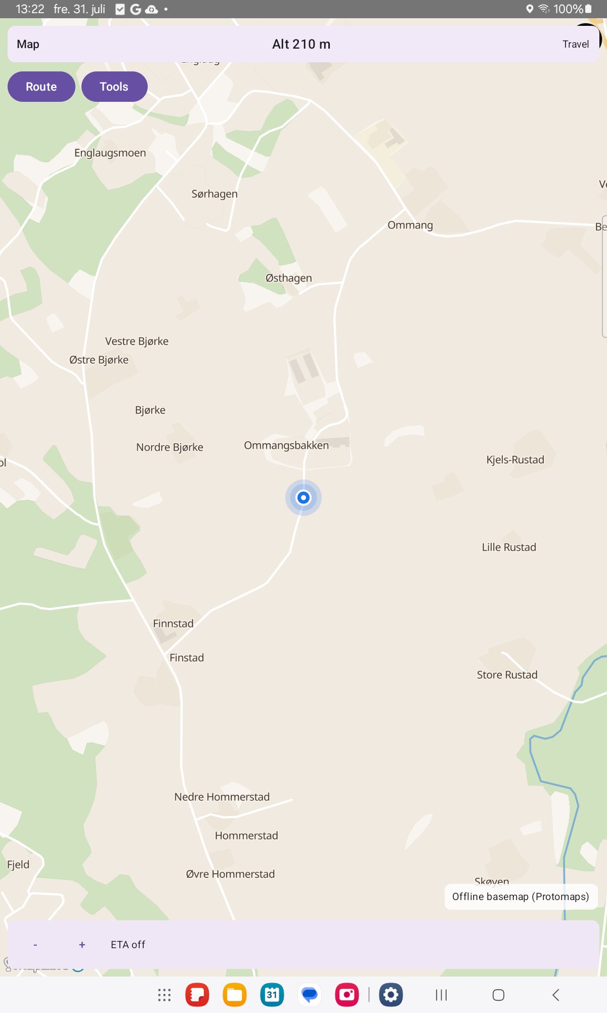
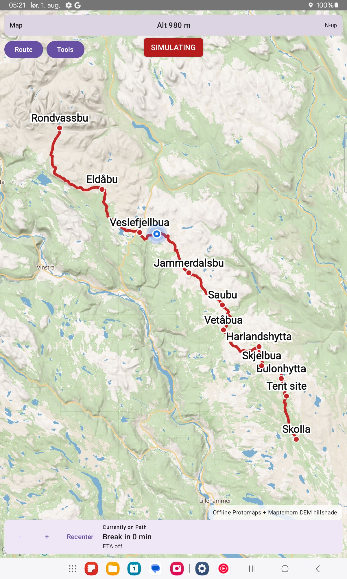
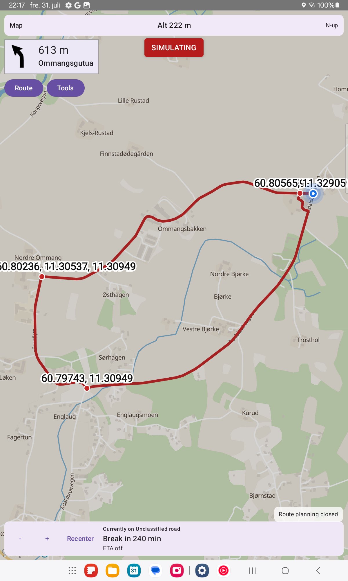
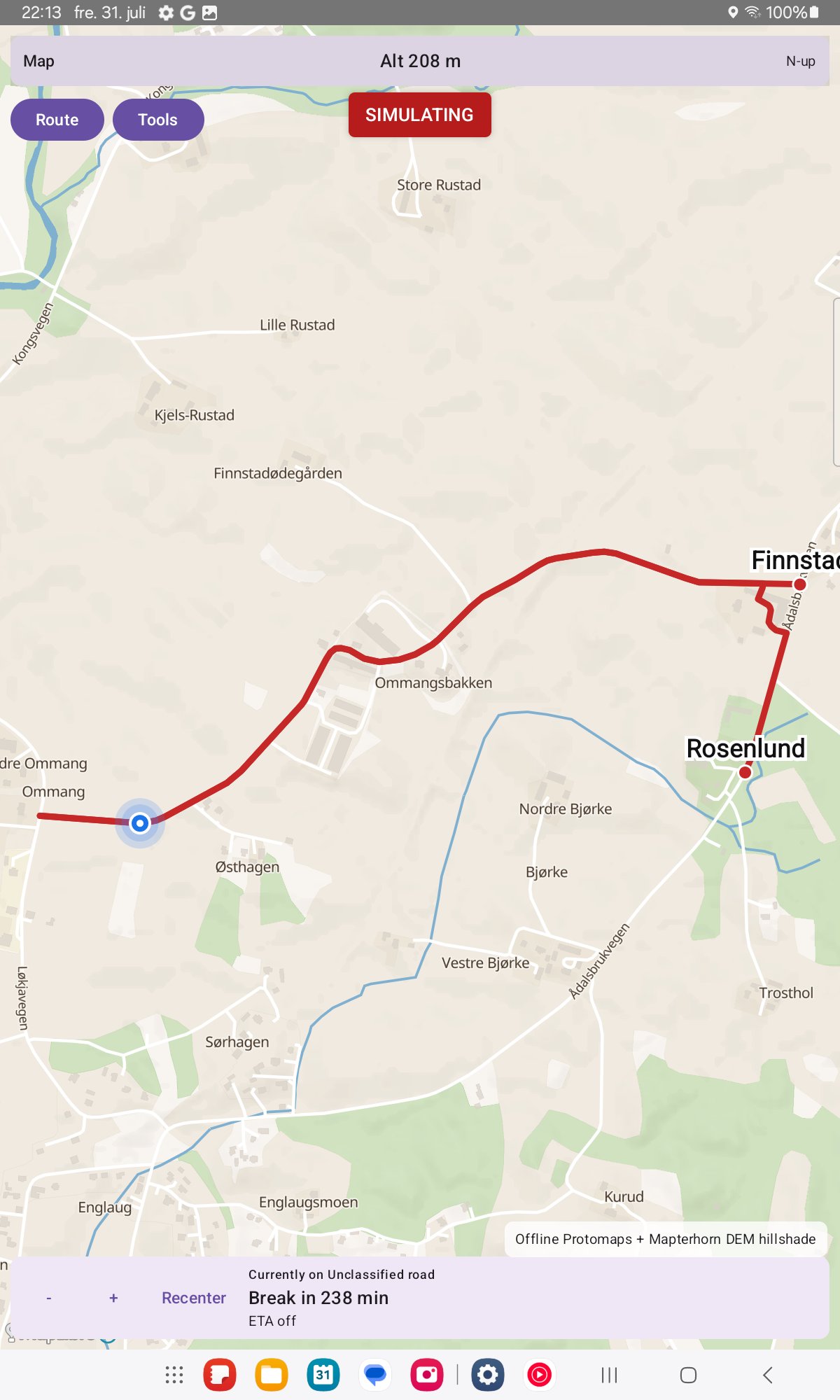
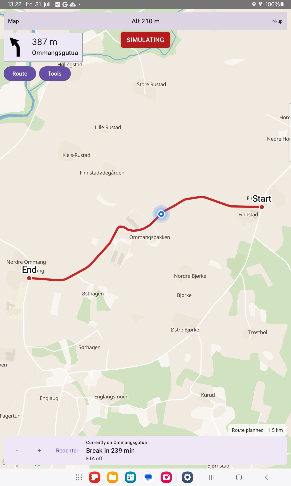
About Navi
Navi is an offline-first navigation app. Download map data once, then plan and follow routes on the device without needing the internet for every trip.
Before first use: Navi does not come with a ready-made routing database, unlike many commercial navigation devices whose maker ships precomputed maps. Open the Tools menu and use Download region to get your region. Navi then downloads the map data and builds its routing and search databases on the device. This takes about 5 to 22 minutes per region depending on its size, for example about 5 minutes for a small country like Luxembourg and 20 to 22 minutes for a large region like Østlandet on a mid-range tablet. Route planning does not work until this is finished.
Travel modes include car, bicycle, e-bike, hiking, motorcycle, truck, and motorhome. Optional vehicle size limits skip roads that are too tight. Avoidances cover motorways and fast expressways, tolls, and ferries.
Eco routing prefers gentler, less energy-hungry roads by taking hills into account. Hiking and cycling can optionally prefer marked long-distance and pilgrim-style trails, with normal paths used when a marked trail has a gap.
Download a region (OpenStreetMap extract), an offline basemap, and optional elevation/terrain data in Tools. A background indexing job builds compact routing packs so later plans are fast; you can still plan while indexing runs. Map updates are never silent — only when you ask.
On the road:
• Place search, From / Via / To, GPS fill, map mark and saved places
• Off-route detection and reroute
• Break and rest suggestions, including truck driving-time rules where known
• Drive bars with altitude and trip ETA
• GPS follow, and north-up / compass / direction-of-travel map rotation
• Optional experimental 3D hill shading and map tilt
Navi is free and open source (GPL-3.0-or-later). There are no ads and no tracking. Network use is for downloads and updates you choose — not for silent data collection.
Before first use: Navi does not come with a ready-made routing database, unlike many commercial navigation devices whose maker ships precomputed maps. Open the Tools menu and use Download region to get your region. Navi then downloads the map data and builds its routing and search databases on the device. This takes about 5 to 22 minutes per region depending on its size, for example about 5 minutes for a small country like Luxembourg and 20 to 22 minutes for a large region like Østlandet on a mid-range tablet. Route planning does not work until this is finished.
Travel modes include car, bicycle, e-bike, hiking, motorcycle, truck, and motorhome. Optional vehicle size limits skip roads that are too tight. Avoidances cover motorways and fast expressways, tolls, and ferries.
Eco routing prefers gentler, less energy-hungry roads by taking hills into account. Hiking and cycling can optionally prefer marked long-distance and pilgrim-style trails, with normal paths used when a marked trail has a gap.
Download a region (OpenStreetMap extract), an offline basemap, and optional elevation/terrain data in Tools. A background indexing job builds compact routing packs so later plans are fast; you can still plan while indexing runs. Map updates are never silent — only when you ask.
On the road:
• Place search, From / Via / To, GPS fill, map mark and saved places
• Off-route detection and reroute
• Break and rest suggestions, including truck driving-time rules where known
• Drive bars with altitude and trip ETA
• GPS follow, and north-up / compass / direction-of-travel map rotation
• Optional experimental 3D hill shading and map tilt
Navi is free and open source (GPL-3.0-or-later). There are no ads and no tracking. Network use is for downloads and updates you choose — not for silent data collection.
| Release info | Update on Oct 30, 2026 |
|---|---|
| Release notes | Full Changelog: https://github.com/Supermagnum/Navi/compare/v0.3.29-beta...v0.3.30-beta |
| Listing data | F-Droid |
Reviews
No reviews yet. Be the first to review Navi.
Used Navi? Tell other visitors what you thought.
Log in to write a reviewOther products by this publisher
- "No Distractions" for YouTube 4.10 ----
- #Bible 11.6.1 "Incredible App - My sister shared this app with me a few weeks ago and it is truly incredible.
- #filmphotography 1.4.2 So, you decided to shoot on film?
- #LookBusy Fake Calendar Events 1.0.6 Look Busy scans your work calendar for open time slots and fills them with realistic-looking (but secretly fake) work events.
- #Small Talk Is Canceled 1.0.2 #Small Talk Is Canceled — Conversations That Matter
Most viewed Android Navigation & Maps
-
1
 Transito 0.10.0.9
Public transit app to download GTFS data & calculate routes offline
-
2
 CairnGPS 1.3.0
Hike tracking, live GNSS satellite view, achievements. Works fully offline
-
3
 osm2gmaps 0.12.0
Convert coordinates and map links between formats, services and apps
-
4
 XCSoar 7.46.1
Tactical glide computer and maps
- 5 GPS Locker 0.1.1 Keep the GPS locked at all times on an Android device.
-
6
 OSM Dashboard for OpenTracks 6.10.0
OpenStreetMap dashboard for OpenTracks
-
7
 Paris Transport Traffic 6.0
Traffic information for subway/tramway... (Paris and suburbs)
- 8 Garage 1.3.9 A modern, privacy-focused, comprehensive vehicle management app.
-
9
 MapFlip - Apple to Google 1.4.4
Open links in navigation apps: automatic map redirect, route & directions.
-
10
 RailTrip 1.6.5
Travel through the train stations to stamp your visa!
Most downloaded Android Navigation & Maps
- 1 Garage 1.3.9 A modern, privacy-focused, comprehensive vehicle management app.
- 2 Every Door 7.1 Mobile OpenStreetMap editor for POI & micromapping
-
3
 TyphoonEye 1.3.3
Typhoon tracks, forecasts and alerts for the Northwest Pacific
-
4
XCSoar 7.46.1
Tactical glide computer and maps
-
5
 OpenTopoMap Viewer 1.42
Online client for maps from OTM project, import GPX and show own location
-
6
 OSMfocus Reborn 1.9.13
Examine OpenStreetMap (OSM) elements to "focus" your view of the map
-
7
 BoatSpeedy 1.5.2
Route planner for canoes and boats, GPS speedometer and battery analytics
-
8
 Tower Collector 3.0.2
Join the community and collect cell towers locations from your area!
-
9
 Phantasialand Wait Times 2.2.0
Live wait times for Phantasialand rides
-
10
CairnGPS 1.3.0
Hike tracking, live GNSS satellite view, achievements. Works fully offline