
CairnGPS 1.3.0
Hike tracking, live GNSS satellite view, achievements. Works fully offline
Download
2.99 MB · CairnGPS-1.3.0.apk
34downloads
0this week
FreeFreeware
0reviews
Screenshots
About CairnGPS
CairnGPS turns your phone into a real GNSS receiver.
Watch the satellites that locate you in real time from all constellations on a 3D globe, a sky plot and a detailed list. Record your hikes, drop waypoints, unlock achievements.
The app reads your device's raw GPS through Android's own LocationManager rather than going through Google Play Services. It contains no Google libraries at all, needs no account and no network connection: everything works fully offline, and every position, track and waypoint stays on your phone.
REAL-TIME POSITION
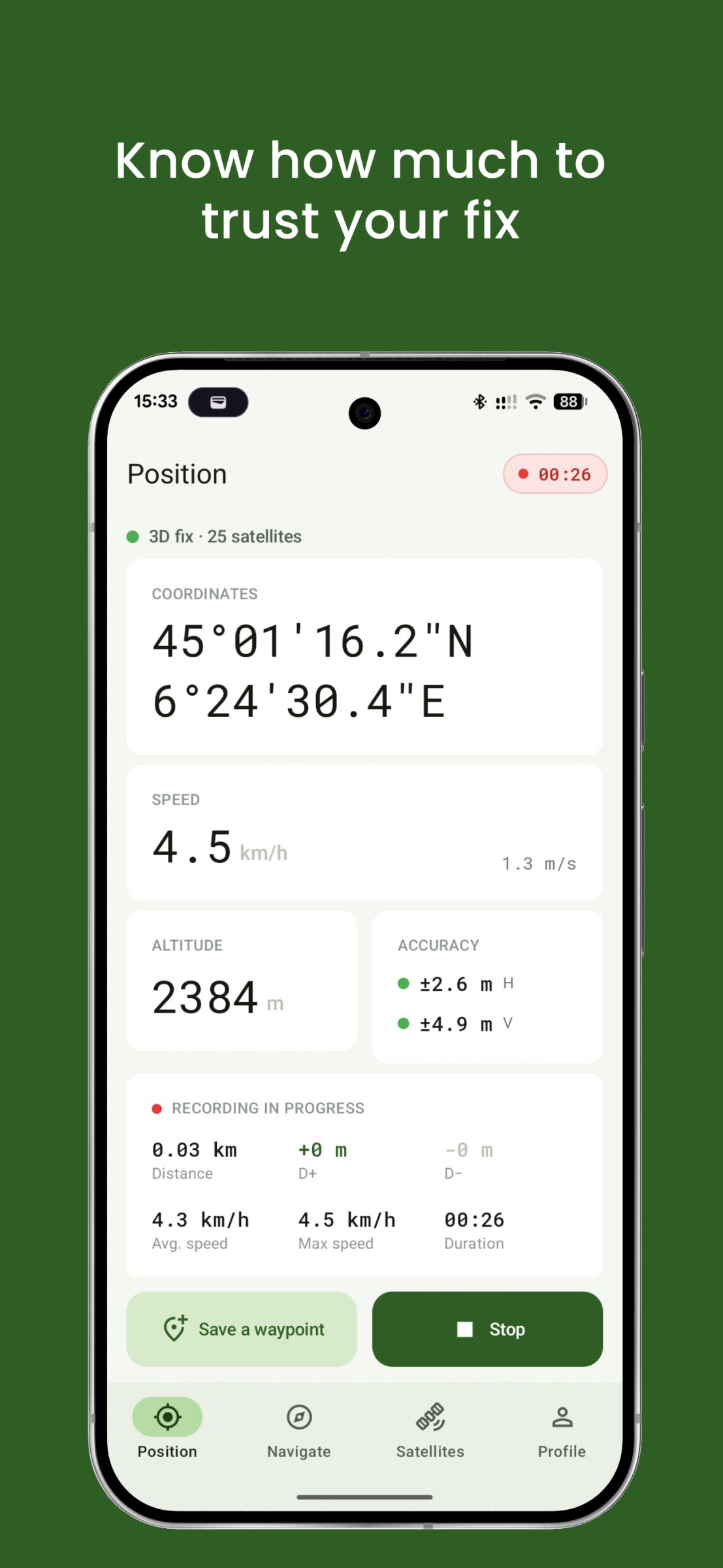
Coordinates in decimal degrees or DMS, geoid-corrected altitude using the EGM96 model, speed in km/h and m/s, horizontal and vertical accuracy with a colour indicator. You always know how much to trust your fix.
FULL SATELLITE VIEW
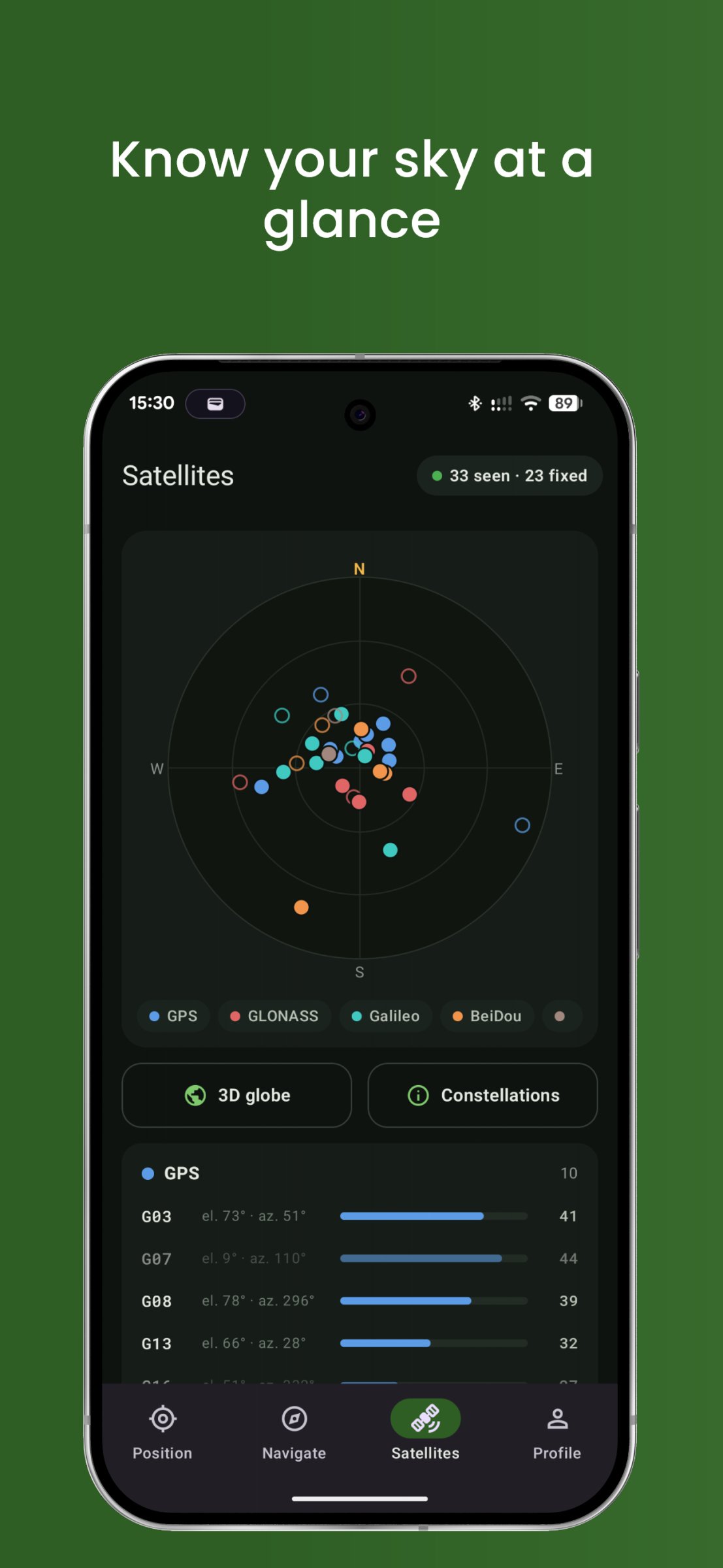
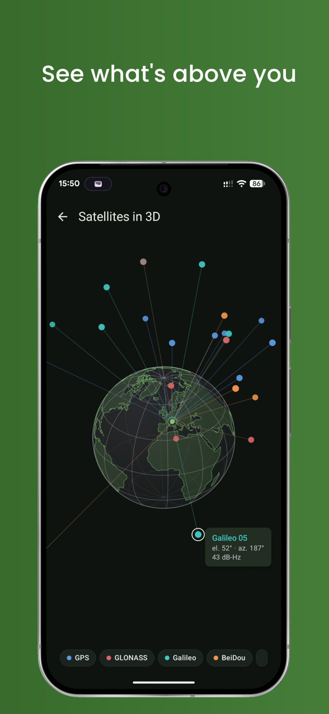
Every visible satellite listed, constellation by constellation. An azimuth and elevation sky plot. And a custom-built 3D globe showing the real geometry of the constellation above you: you finally see where your GNSS signals are coming from.
COMPASS
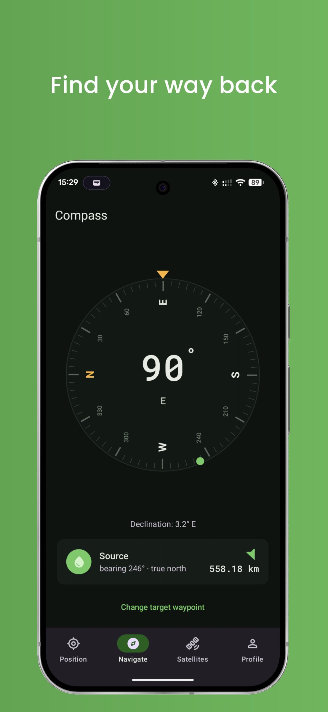
Heading dial referenced to magnetic or true north, your choice. Point-to-point navigation with arrow, distance and bearing to any waypoint you pick.
TRACK RECORDING
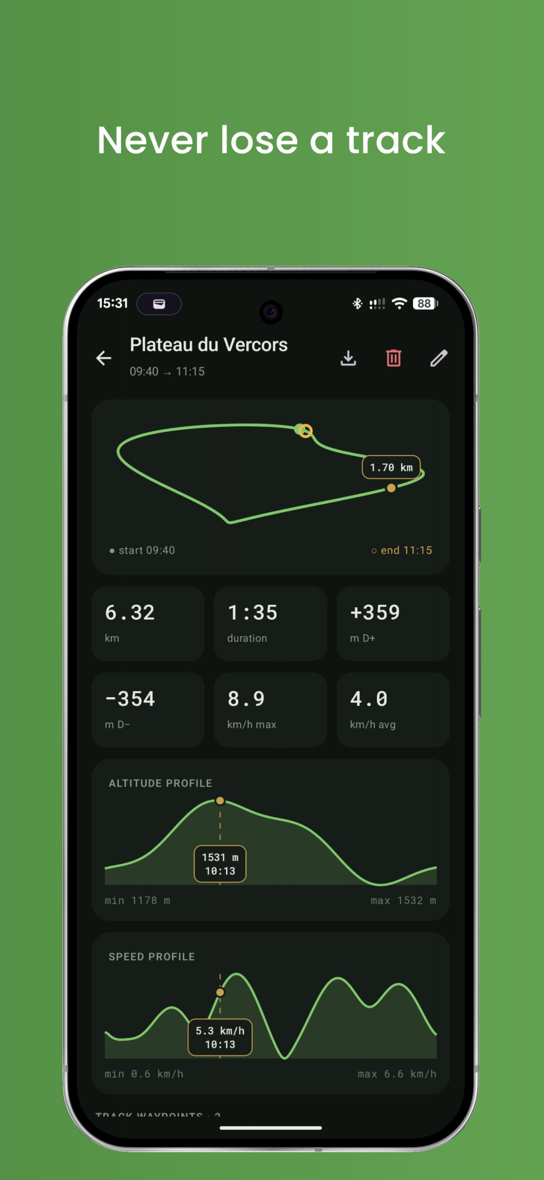
Start a session and put the phone back in your pocket. Distance covered, average and maximum speed, elevation gain and loss, minimum and maximum altitude.
WAYPOINTS
Mark what matters (water source, campsite, trailhead, etc.) with customizable icons. Every waypoint stays linked to the session it was dropped in.
TRIP LOG
Browse all your past sessions with elevation profile, route trace and full statistics. GPX export so you can open your tracks anywhere.
ACHIEVEMENTS AND LEVELS
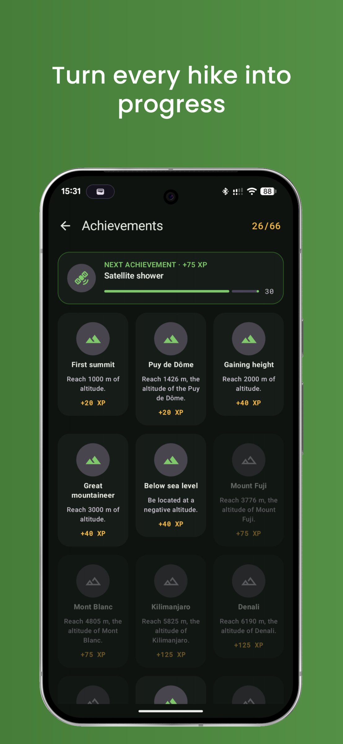
Over 25 achievements across families: altitude, from your first summit to Kilimanjaro. Speed. Simultaneous satellites. Total distance. Number of trips. Plus a few special ones: cross the 45th parallel north, get tracked on both sides of the equator, drop a waypoint before 6 a.m. Every achievement earns XP and levels you up, and your personal records carry over from trip to trip.
BUILT FOR THE OUTDOORS
Readable in direct sunlight, light and dark themes, controlled battery use, metric or imperial units, backup and restore of your data.
PLEASE NOTE
CairnGPS is a GNSS tool and a trip log, not a mapping app: it does not display a base map and does not calculate routes. It complements your map app rather than replacing it.
PERMISSIONS
Precise location is required, including in the background while a session is recording, so the app can keep following your route with the screen off. Recording never starts on its own: it begins only on an explicit action, and a persistent notification shows it at all times.
License: AGPL-3.0-only
Watch the satellites that locate you in real time from all constellations on a 3D globe, a sky plot and a detailed list. Record your hikes, drop waypoints, unlock achievements.
The app reads your device's raw GPS through Android's own LocationManager rather than going through Google Play Services. It contains no Google libraries at all, needs no account and no network connection: everything works fully offline, and every position, track and waypoint stays on your phone.
REAL-TIME POSITION
Coordinates in decimal degrees or DMS, geoid-corrected altitude using the EGM96 model, speed in km/h and m/s, horizontal and vertical accuracy with a colour indicator. You always know how much to trust your fix.
FULL SATELLITE VIEW
Every visible satellite listed, constellation by constellation. An azimuth and elevation sky plot. And a custom-built 3D globe showing the real geometry of the constellation above you: you finally see where your GNSS signals are coming from.
COMPASS
Heading dial referenced to magnetic or true north, your choice. Point-to-point navigation with arrow, distance and bearing to any waypoint you pick.
TRACK RECORDING
Start a session and put the phone back in your pocket. Distance covered, average and maximum speed, elevation gain and loss, minimum and maximum altitude.
WAYPOINTS
Mark what matters (water source, campsite, trailhead, etc.) with customizable icons. Every waypoint stays linked to the session it was dropped in.
TRIP LOG
Browse all your past sessions with elevation profile, route trace and full statistics. GPX export so you can open your tracks anywhere.
ACHIEVEMENTS AND LEVELS
Over 25 achievements across families: altitude, from your first summit to Kilimanjaro. Speed. Simultaneous satellites. Total distance. Number of trips. Plus a few special ones: cross the 45th parallel north, get tracked on both sides of the equator, drop a waypoint before 6 a.m. Every achievement earns XP and levels you up, and your personal records carry over from trip to trip.
BUILT FOR THE OUTDOORS
Readable in direct sunlight, light and dark themes, controlled battery use, metric or imperial units, backup and restore of your data.
PLEASE NOTE
CairnGPS is a GNSS tool and a trip log, not a mapping app: it does not display a base map and does not calculate routes. It complements your map app rather than replacing it.
PERMISSIONS
Precise location is required, including in the background while a session is recording, so the app can keep following your route with the screen off. Recording never starts on its own: it begins only on an explicit action, and a persistent notification shows it at all times.
License: AGPL-3.0-only
| Release info | Update on Nov 01, 2026 |
|---|---|
| Release notes | Bug Fixes • Clamp speed to non-negative values (#15) Features • GNSS spoofing and jamming detection (#16) |
| Listing data | F-Droid |
Reviews
No reviews yet. Be the first to review CairnGPS.
Used CairnGPS? Tell other visitors what you thought.
Log in to write a reviewOther products by this publisher
- "No Distractions" for YouTube 4.10 ----
- #Bible 11.6 "Incredible App - My sister shared this app with me a few weeks ago and it is truly incredible.
- #filmphotography 1.4.2 So, you decided to shoot on film?
- $quirrel 1.5.1 $quirrel Budget & Finance helps you plan each paycheck, track spending, manage debt, and see what is safe to spend before the next payday.
- % Percentage Calculator Pro 1.41 This is the Pro version of % Percentage Calculator.
Most viewed Android Navigation & Maps
-
1
CairnGPS 1.3.0
Hike tracking, live GNSS satellite view, achievements. Works fully offline
-
2
 osm2gmaps 0.11.0
Convert coordinates and map links between formats, services and apps
-
3
 RailTrip 1.6.5
Travel through the train stations to stamp your visa!
-
4
 XCSoar 7.46.1
Tactical glide computer and maps
-
5
 Wind Bubble 1.0.3
See where the wind hits you, on top of your navigation app.
- 6 GPS Locker 0.1.1 Keep the GPS locked at all times on an Android device.
- 7 CountryCount 1.0.1 Track countries, visualize your progress, and explore where you’re going next.
- 8 Helsinki Timetables 1.6 Show timetables for public transport in Helsinki city and region
-
9
 Transito 0.10.0.9
Public transit app to download GTFS data & calculate routes offline
- 10 Bahn-Vorhersage 0.8.2 Ranking for train journeys according to their reliability. (German only)
Most downloaded Android Navigation & Maps
-
1
 TyphoonEye 1.3.3
Typhoon tracks, forecasts and alerts for the Northwest Pacific
-
2
 OSMfocus Reborn 1.9.13
Examine OpenStreetMap (OSM) elements to "focus" your view of the map
-
3
XCSoar 7.46.1
Tactical glide computer and maps
- 4 Every Door 7.1 Mobile OpenStreetMap editor for POI & micromapping
- 5 Haltestellenanzeige (Display Monitor) 1.2 Displays the departure times of all stops in Germany (Display Monitor).
-
6
 OpenTopoMap Viewer 1.41
Online client for maps from OTM project, import GPX and show own location
-
7
 Phantasialand Wait Times 2.2.0
Live wait times for Phantasialand rides
-
8
 MapFlip - Apple to Google 1.4.3
Open links in navigation apps: automatic map redirect, route & directions.
- 9 Garage 1.3.8 A modern, privacy-focused, comprehensive vehicle management app.
-
10
 Tower Collector 3.0.2
Join the community and collect cell towers locations from your area!