Kwik EFIS 8.10
Aviation Glass Cockpit / EFIS with ADS-B Traffic display
Download
14.32 MB · player.efis.pfd_110.apk
26downloads
0this week
FreeFreeware
0reviews
Screenshots
About Kwik EFIS
Kwik EFIS is a Glass Cockpit application designed to work on most Android devices. It provides a modern aviation glass cockpit attitude and flight instrument display.
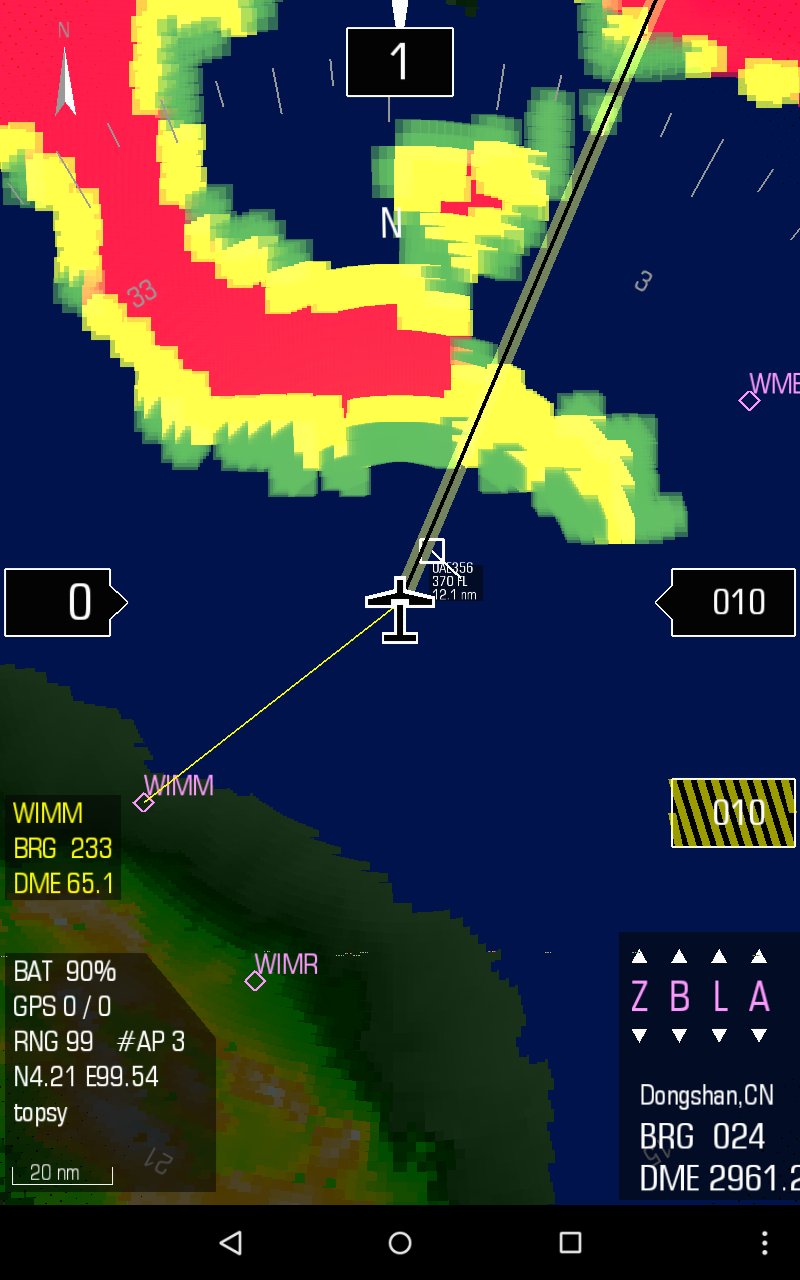
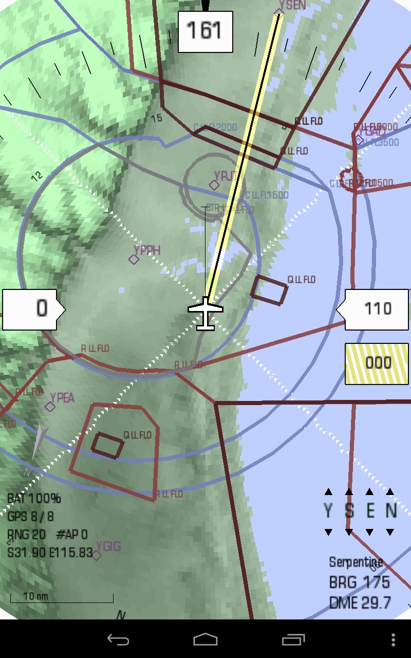
Digital Moving Map
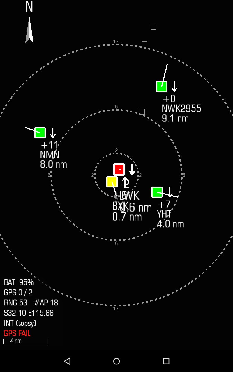
The built in map module provides situational awareness and and navigation functionality. EFIS can optionally integrate with the Stratux ADS-B/AHRS to provide real-time traffic overlay.
Synthetic Vision
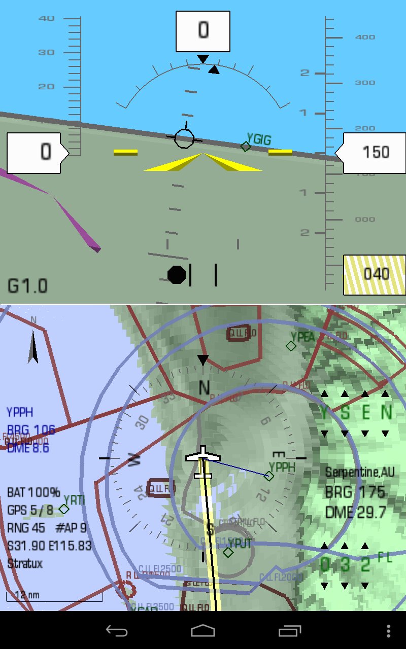
Synthetic vision is built from the USGS 3 arc second Digital Elevation Model data. If enabled, it also allows for some terrain collision detection. The required terrain data packages are available via F-Droid, see:
[link removed] - North America, Canada
[link removed] - Europe, Russia
[link removed] - Sahara / North Africa, India / Indonesia, Japan
[link removed] - Southern Africa, Australia / New Zealand
[link removed] - South America
[link removed] - Antarctica / South Pole
Flight Director
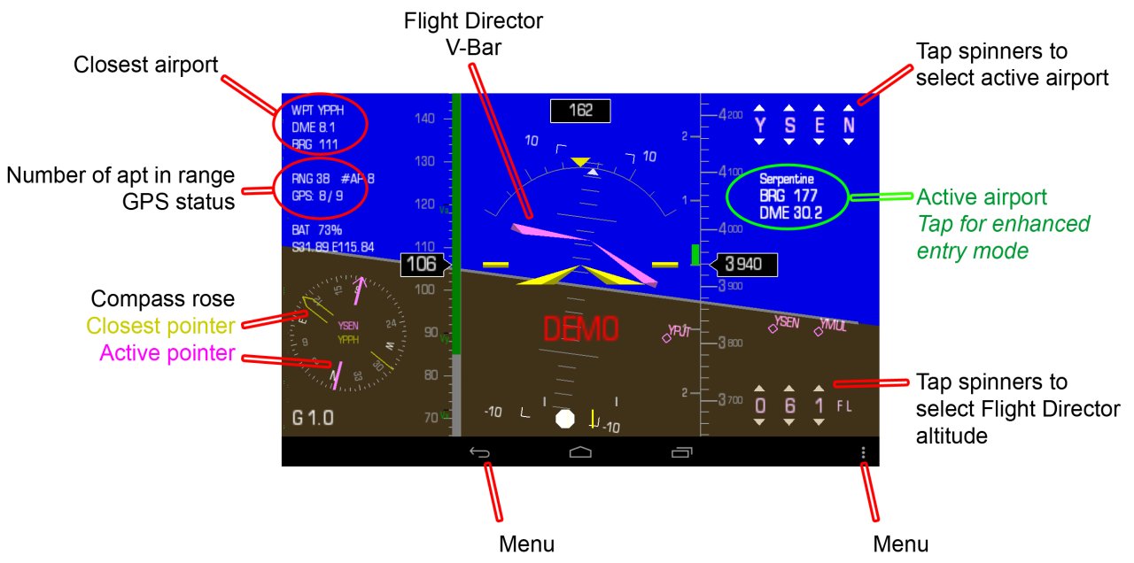
Kwik EFIS has a fully functional flight director built in. It uses the standard V-Bar symbology common to modern flight directors. The target waypoint and altitude is set on-screen by means of the spinner controls on the right top and bottom of the screen.
Airspace
Airspace data is provided from Worldwide Soaring Services Turnpoint Exchange Airspace ([link removed])
ADS-B/AHRS
In addition to the internal sensors, a low cost Stratux ADS-B/AHRS can be selected as the input source. See [link removed] for more information.
Simulator
There is a simulation mode available in the application. The Flight director is used to select a waypoint and altitude and the simulator will generate the GPS movements to navigate to the selected waypoint. The speed is set at the typical cruise for the currently selected aircraft.
Installation
For application and installation help, see: [link removed]
License: Apache-2.0
Digital Moving Map
The built in map module provides situational awareness and and navigation functionality. EFIS can optionally integrate with the Stratux ADS-B/AHRS to provide real-time traffic overlay.
Synthetic Vision
Synthetic vision is built from the USGS 3 arc second Digital Elevation Model data. If enabled, it also allows for some terrain collision detection. The required terrain data packages are available via F-Droid, see:
[link removed] - North America, Canada
[link removed] - Europe, Russia
[link removed] - Sahara / North Africa, India / Indonesia, Japan
[link removed] - Southern Africa, Australia / New Zealand
[link removed] - South America
[link removed] - Antarctica / South Pole
Flight Director
Kwik EFIS has a fully functional flight director built in. It uses the standard V-Bar symbology common to modern flight directors. The target waypoint and altitude is set on-screen by means of the spinner controls on the right top and bottom of the screen.
Airspace
Airspace data is provided from Worldwide Soaring Services Turnpoint Exchange Airspace ([link removed])
ADS-B/AHRS
In addition to the internal sensors, a low cost Stratux ADS-B/AHRS can be selected as the input source. See [link removed] for more information.
Simulator
There is a simulation mode available in the application. The Flight director is used to select a waypoint and altitude and the simulator will generate the GPS movements to navigate to the selected waypoint. The speed is set at the typical cruise for the currently selected aircraft.
Installation
For application and installation help, see: [link removed]
License: Apache-2.0
| Release info | Update on Oct 27, 2026 |
|---|---|
| Release notes | REL_110 (2026-10-25) ------------------- * Maintenance Release * Improve airspace load performance (Cache) * Airspace: AE, AF, AG, AL, AM, AO, AR, AT, AU, AZ, BA, BE, BF, BG, BH, BJ, BN, BW, BY, CA, CF, CG, CH, CL, CM, CN, CO, CR, CU, CY, CZ, DE, DJ, DK, DZ, EE, EG, ES, FI, FR, GA, GB, GE, GH, GL, GR, GW, GY, HK, HR, HU, ID, IE, IL, IN, IR, IS, IT, JP, KE, KH, KI, KM, KP, KZ, LA, LB, LK, LT, LU, LV, LY, MA, MD, MG, MK, ML, MM, MN, MR, MU, MV, MW, MX, MY, MZ, NA, NC, NE, NL, NO, NP, NZ, OM, PA, P |
| Listing data | F-Droid |
Reviews
No reviews yet. Be the first to review Kwik EFIS.
Used Kwik EFIS? Tell other visitors what you thought.
Log in to write a reviewOther products by this publisher
- "No Distractions" for YouTube 4.10 ----
- #Bible 11.6.1 "Incredible App - My sister shared this app with me a few weeks ago and it is truly incredible.
- #filmphotography 1.4.2 So, you decided to shoot on film?
- #LookBusy Fake Calendar Events 1.0.6 Look Busy scans your work calendar for open time slots and fills them with realistic-looking (but secretly fake) work events.
- #Small Talk Is Canceled 1.0.2 #Small Talk Is Canceled — Conversations That Matter
Most viewed Android Navigation & Maps
-
1
 Transito 0.10.0.9
Public transit app to download GTFS data & calculate routes offline
-
2
 CairnGPS 1.3.0
Hike tracking, live GNSS satellite view, achievements. Works fully offline
-
3
 osm2gmaps 0.12.0
Convert coordinates and map links between formats, services and apps
-
4
 XCSoar 7.46.1
Tactical glide computer and maps
- 5 GPS Locker 0.1.1 Keep the GPS locked at all times on an Android device.
-
6
 OSM Dashboard for OpenTracks 6.10.0
OpenStreetMap dashboard for OpenTracks
-
7
 Paris Transport Traffic 6.0
Traffic information for subway/tramway... (Paris and suburbs)
- 8 Garage 1.3.9 A modern, privacy-focused, comprehensive vehicle management app.
-
9
 MapFlip - Apple to Google 1.4.4
Open links in navigation apps: automatic map redirect, route & directions.
-
10
 RailTrip 1.6.5
Travel through the train stations to stamp your visa!
Most downloaded Android Navigation & Maps
- 1 Garage 1.3.9 A modern, privacy-focused, comprehensive vehicle management app.
- 2 Every Door 7.1 Mobile OpenStreetMap editor for POI & micromapping
-
3
 TyphoonEye 1.3.3
Typhoon tracks, forecasts and alerts for the Northwest Pacific
-
4
XCSoar 7.46.1
Tactical glide computer and maps
-
5
 StarPath 0.22
Live Google Maps turns for Amazfit watches and Zepp devices.
-
6
 OpenTopoMap Viewer 1.42
Online client for maps from OTM project, import GPX and show own location
-
7
 OSMfocus Reborn 1.9.13
Examine OpenStreetMap (OSM) elements to "focus" your view of the map
-
8
 BoatSpeedy 1.5.2
Route planner for canoes and boats, GPS speedometer and battery analytics
-
9
 Tower Collector 3.0.2
Join the community and collect cell towers locations from your area!
-
10
 Phantasialand Wait Times 2.2.0
Live wait times for Phantasialand rides