Datum 1.6.11
Offline topo, satellite and public land maps. No account, no ads, no tracking.
Download
2.90 MB
15downloads
6this week
FreeFreeware
0reviews
Screenshots
About Datum
A fully offline topographic, satellite and trail map for Android, built for the moment you lose signal and still need to know where you are.
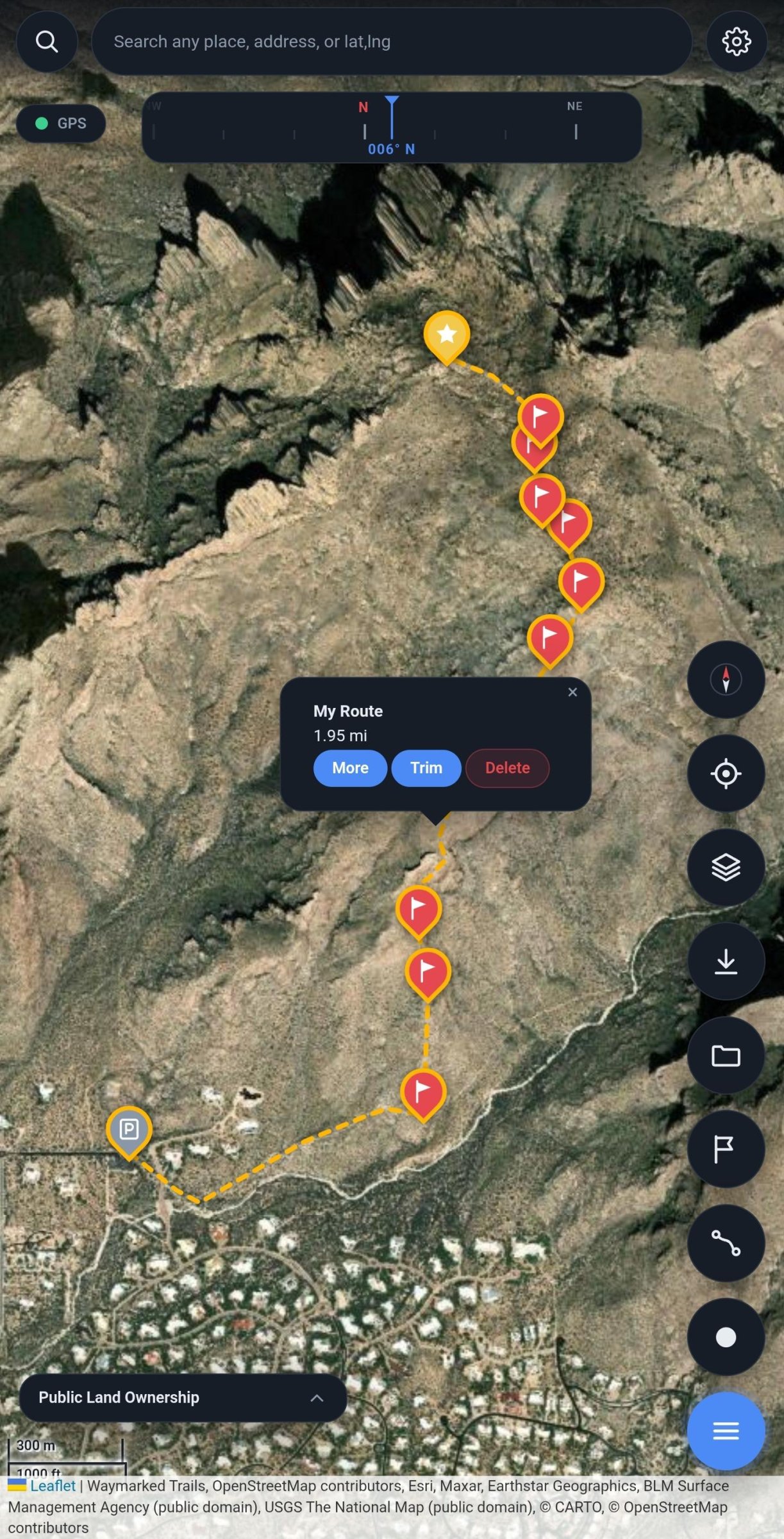
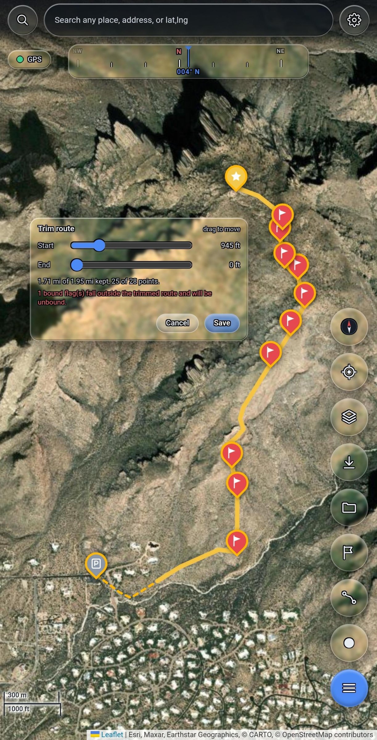
Download a region before you leave and everything keeps working with no connection: the map, GPS position, waypoints, route planning and track recording. Satellite imagery, USGS topographic contours, trails, public land ownership, borders and street labels are all cached on the device rather than fetched on demand.
Features:
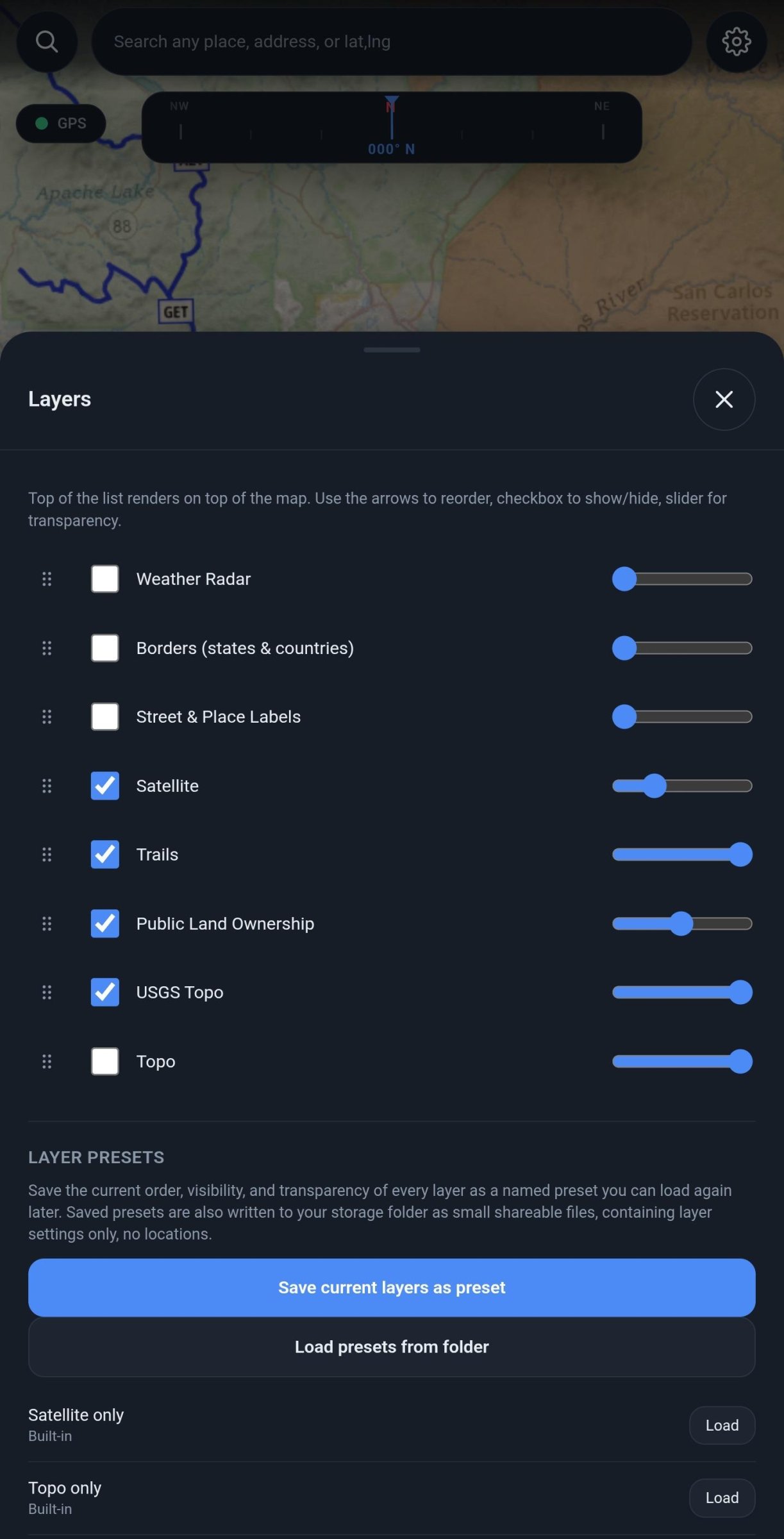
* Seven map layers that can be reordered, hidden, and given independent transparency, so contours can be read through imagery
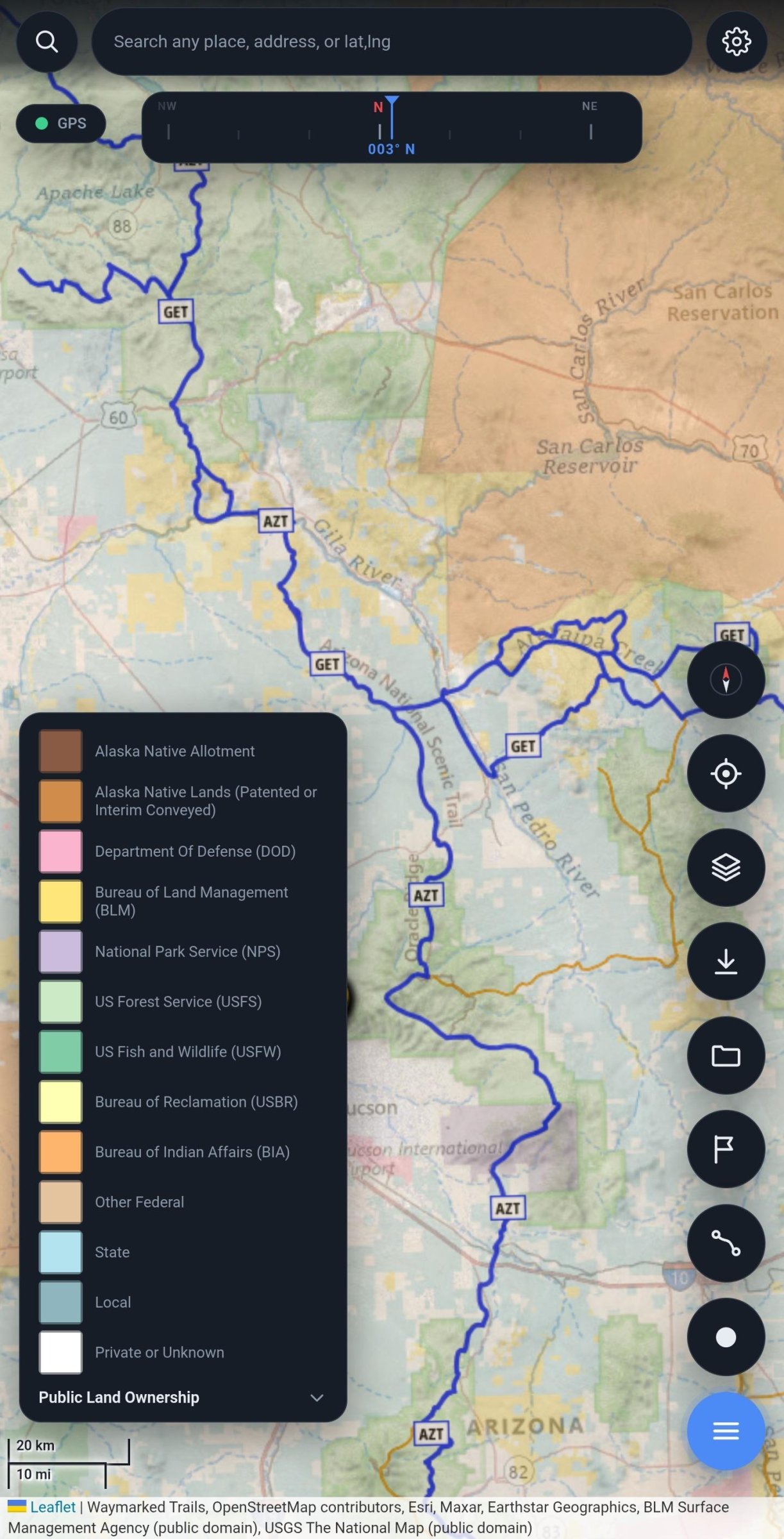
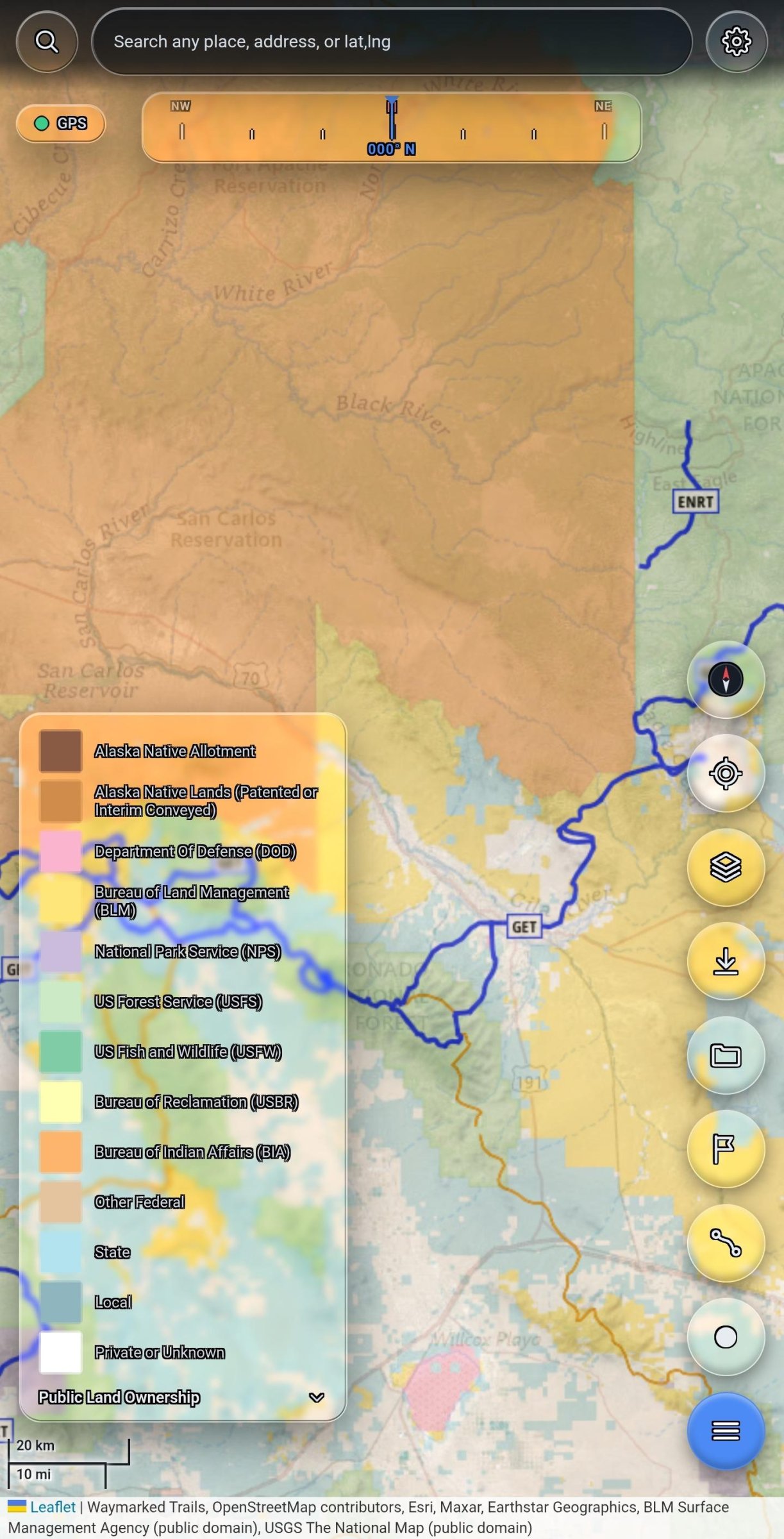
* Public land ownership from the BLM Surface Management Agency dataset, showing BLM, Forest Service, state, tribal and private land
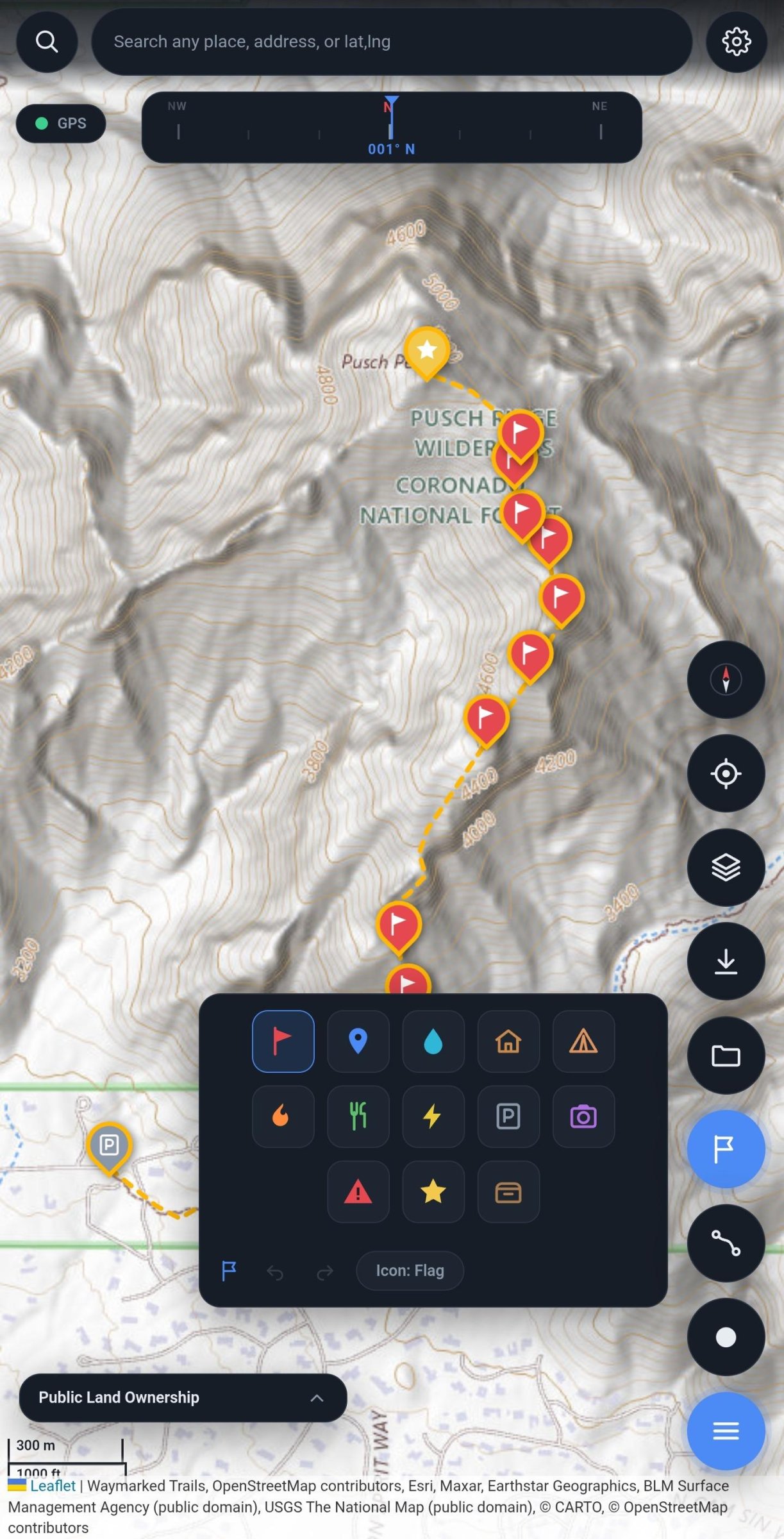
* USGS topographic contours labelled in feet, plus OpenTopoMap in metres
* Waypoints with thirteen icon types, undo and redo
* Route planning, either point by point or by connecting waypoints, with trimming and turn by turn navigation
* Track recording with live distance and elapsed time
* Sessions, so each trip's waypoints, routes and tracks stay separate
* Layer presets that can be saved and shared, containing settings only and no locations
Your data is written to a folder you choose as standard GPX files as you create them, so it opens in other outdoor applications with no export step, and nothing is locked in a proprietary format. Timestamps are left out of shared files by default, because a path shows where a trail goes while timestamps also show what hours you were out.
There is no account, no advertising, no analytics and no server.
Note on the anti-feature flag: the satellite imagery layer is served by Esri, a proprietary service. Every other layer comes from public domain government or openly licensed sources. Place search uses Nominatim. All network access is initiated by the user; nothing is contacted in the background.
License: MIT
Download a region before you leave and everything keeps working with no connection: the map, GPS position, waypoints, route planning and track recording. Satellite imagery, USGS topographic contours, trails, public land ownership, borders and street labels are all cached on the device rather than fetched on demand.
Features:
* Seven map layers that can be reordered, hidden, and given independent transparency, so contours can be read through imagery
* Public land ownership from the BLM Surface Management Agency dataset, showing BLM, Forest Service, state, tribal and private land
* USGS topographic contours labelled in feet, plus OpenTopoMap in metres
* Waypoints with thirteen icon types, undo and redo
* Route planning, either point by point or by connecting waypoints, with trimming and turn by turn navigation
* Track recording with live distance and elapsed time
* Sessions, so each trip's waypoints, routes and tracks stay separate
* Layer presets that can be saved and shared, containing settings only and no locations
Your data is written to a folder you choose as standard GPX files as you create them, so it opens in other outdoor applications with no export step, and nothing is locked in a proprietary format. Timestamps are left out of shared files by default, because a path shows where a trail goes while timestamps also show what hours you were out.
There is no account, no advertising, no analytics and no server.
Note on the anti-feature flag: the satellite imagery layer is served by Esri, a proprietary service. Every other layer comes from public domain government or openly licensed sources. Place search uses Nominatim. All network access is initiated by the user; nothing is contacted in the background.
License: MIT
| Release info | New Release on Oct 27, 2026 |
|---|---|
| Release notes | Storage folder is now chosen with Android's folder picker, fixing setup in Documents after a reinstall. Updating? Pick your Datum folder once when asked; nothing is moved. Smaller R8-optimized build, new Ko-fi link, and the old RainViewer credit is gone. |
| Listing data | F-Droid |
Reviews
No reviews yet. Be the first to review Datum.
Used Datum? Tell other visitors what you thought.
Log in to write a reviewOther products by this publisher
- "No Distractions" for YouTube 4.10 ----
- #Bible 11.6 "Incredible App - My sister shared this app with me a few weeks ago and it is truly incredible.
- #filmphotography 1.4.2 So, you decided to shoot on film?
- $quirrel 1.5.1 $quirrel Budget & Finance helps you plan each paycheck, track spending, manage debt, and see what is safe to spend before the next payday.
- % Percentage Calculator Pro 1.41 This is the Pro version of % Percentage Calculator.
Most viewed Android Navigation & Maps
-
1
 CairnGPS 1.3.0
Hike tracking, live GNSS satellite view, achievements. Works fully offline
-
2
 osm2gmaps 0.12.0
Convert coordinates and map links between formats, services and apps
-
3
 Transito 0.10.0.9
Public transit app to download GTFS data & calculate routes offline
-
4
 XCSoar 7.46.1
Tactical glide computer and maps
-
5
 Wind Bubble 1.0.3
See where the wind hits you, on top of your navigation app.
-
6
 RailTrip 1.6.5
Travel through the train stations to stamp your visa!
- 7 GPS Locker 0.1.1 Keep the GPS locked at all times on an Android device.
- 8 Helsinki Timetables 1.6 Show timetables for public transport in Helsinki city and region
- 9 Bahn-Vorhersage 0.8.3 Ranking for train journeys according to their reliability. (German only)
- 10 CountryCount 1.0.1 Track countries, visualize your progress, and explore where you’re going next.
Most downloaded Android Navigation & Maps
-
1
XCSoar 7.46.1
Tactical glide computer and maps
- 2 Every Door 7.1 Mobile OpenStreetMap editor for POI & micromapping
-
3
 TyphoonEye 1.3.3
Typhoon tracks, forecasts and alerts for the Northwest Pacific
-
4
 OpenTopoMap Viewer 1.42
Online client for maps from OTM project, import GPX and show own location
-
5
 BikeRoutePlanner 1.11-20
Plan bike routes with bbbike, save them as GPX and navigate in OsmAnd
-
6
 OSMfocus Reborn 1.9.13
Examine OpenStreetMap (OSM) elements to "focus" your view of the map
-
7
 BoatSpeedy 1.5.2
Route planner for canoes and boats, GPS speedometer and battery analytics
- 8 Haltestellenanzeige (Display Monitor) 1.2 Displays the departure times of all stops in Germany (Display Monitor).
-
9
CairnGPS 1.3.0
Hike tracking, live GNSS satellite view, achievements. Works fully offline
-
10
 StarPath 0.22
Live Google Maps turns for Amazfit watches and Zepp devices.