Bivouac 2.7.2
Plan multi-day hikes, relive and analyse the ones already done
Download
3.69 MB · Bivouac-2.7.2.apk
25downloads
19this week
FreeFreeware
0reviews
Screenshots
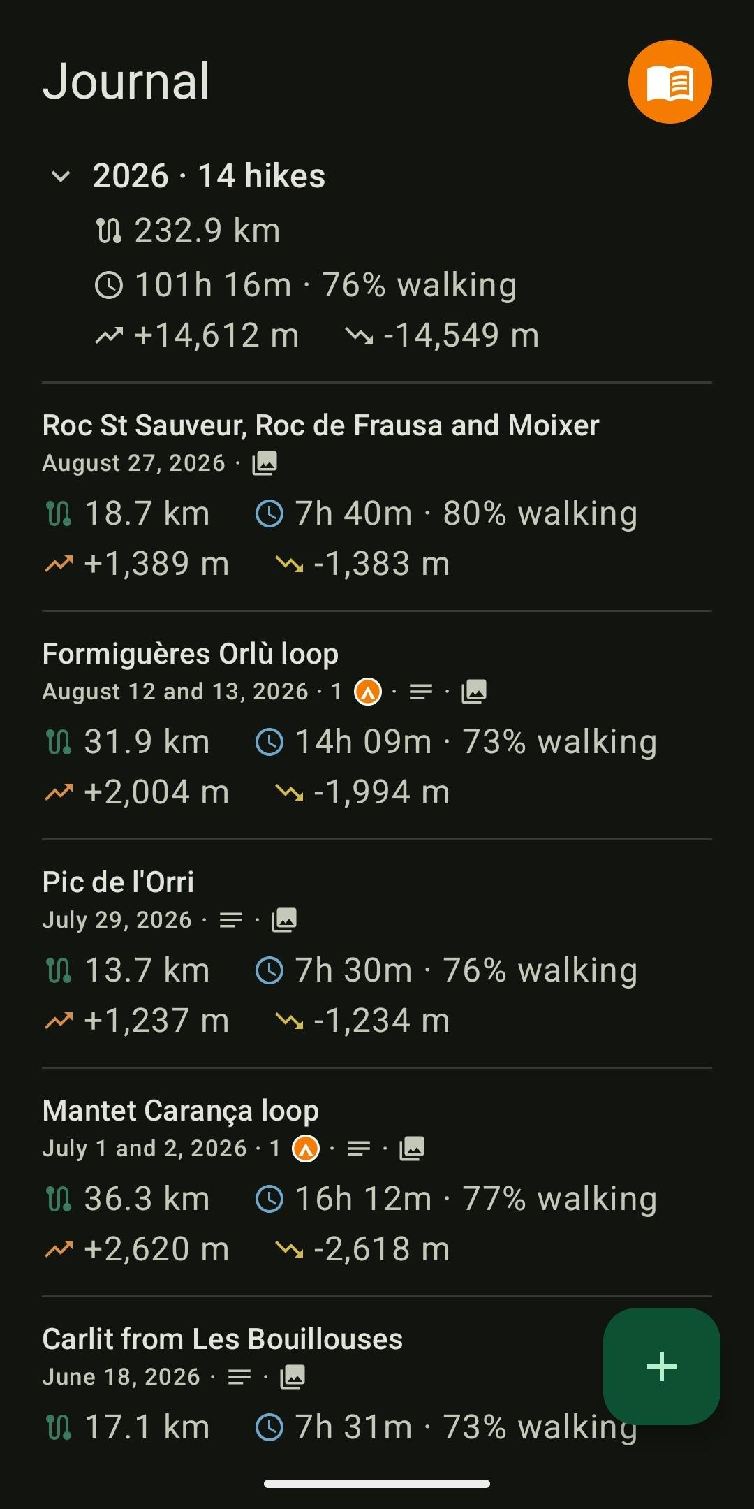
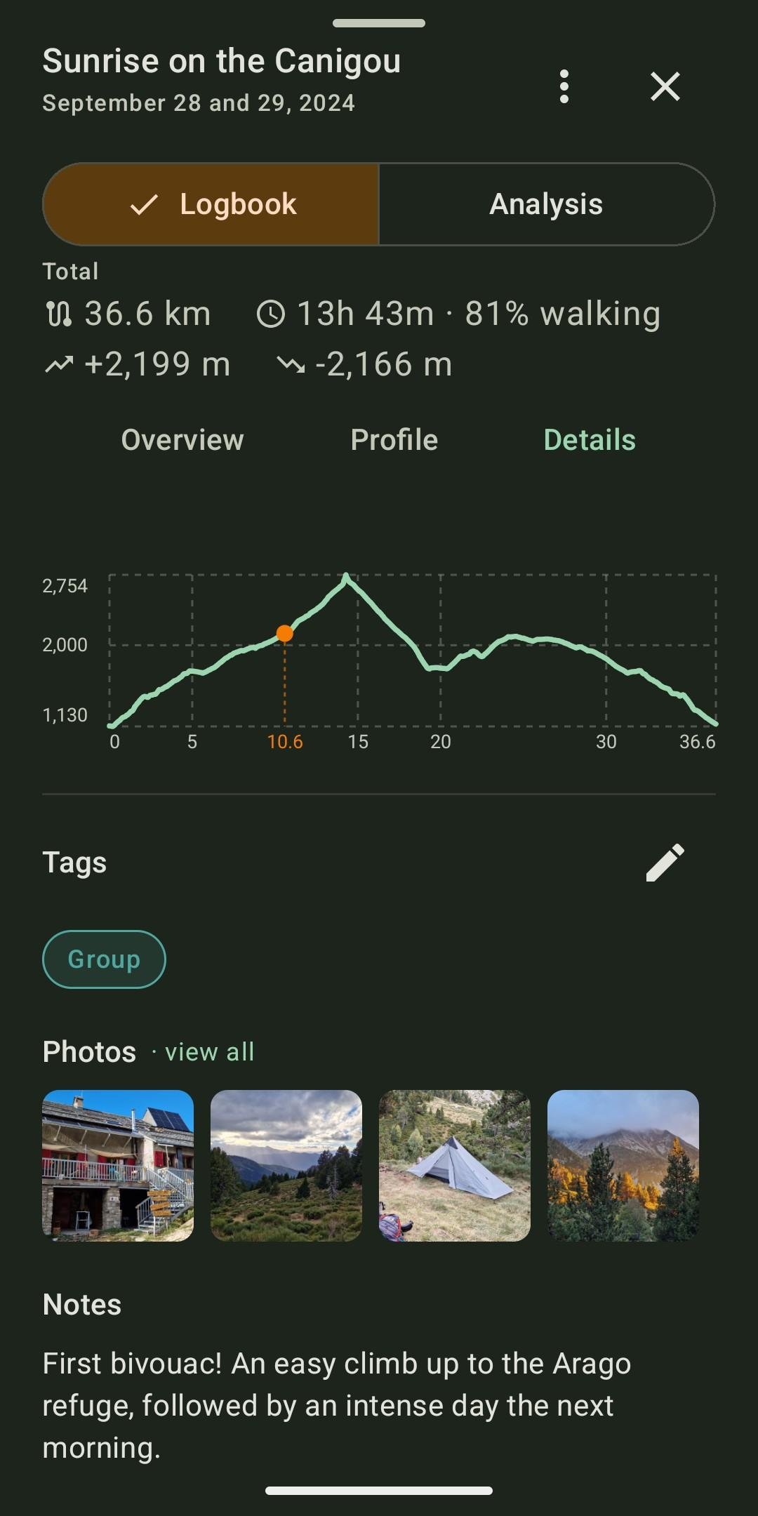
About Bivouac
Bivouac splits a GPX track into stages around bivouac spots, then keeps every outing in a journal, with its photos and its figures. It is for before and after the outing: planning multi-day hikes, then reliving and analysing the ones already done.
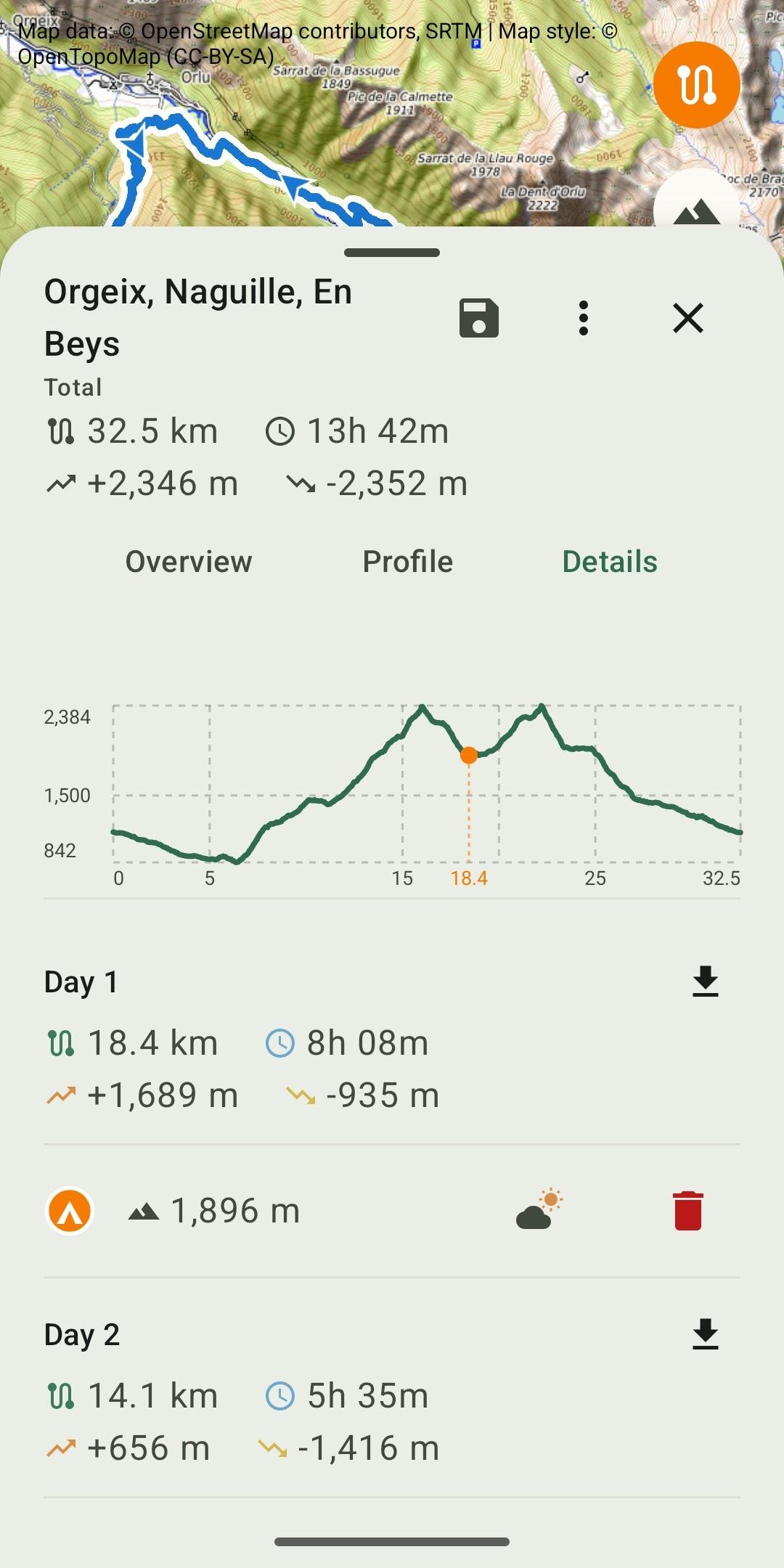
Plan: import a GPX track of one or several days, place the bivouacs on the route. Distance, elevation and estimated duration are recalculated for each stage. Altitude and a weather link for each bivouac, export of a stage as GPX, a bank of prepared tracks.
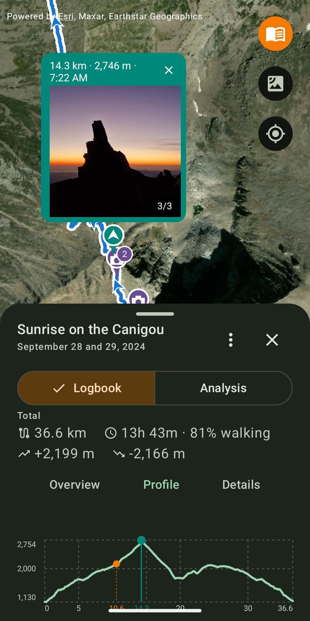
Remember: keep every completed hike with a note, tags, and photos placed on the track where they were taken. The selection screen offers the photos taken during the hike first, with access to the whole gallery. Each photo can be cropped, captioned or moved along the track, and opens full screen.
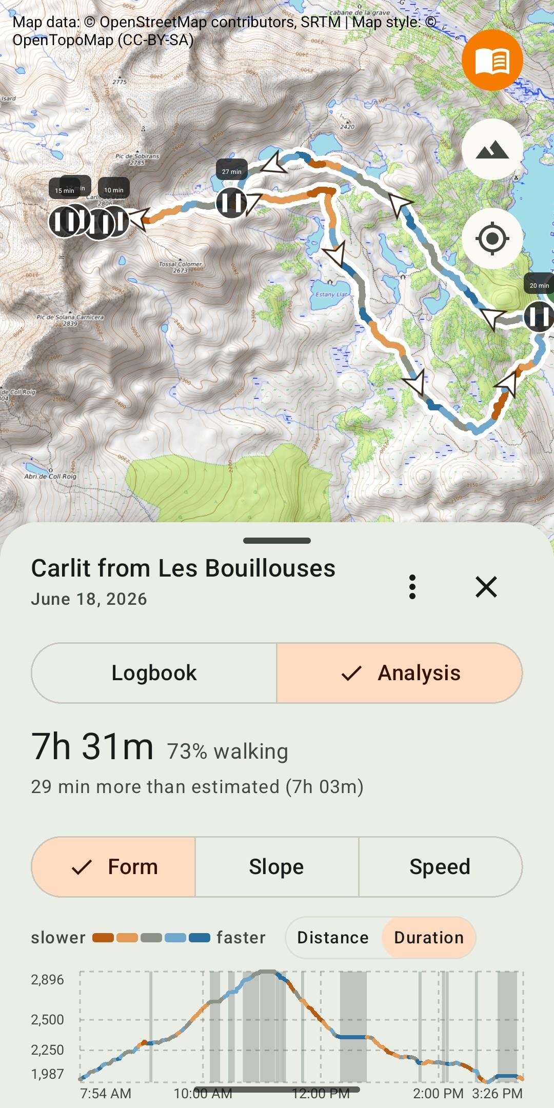
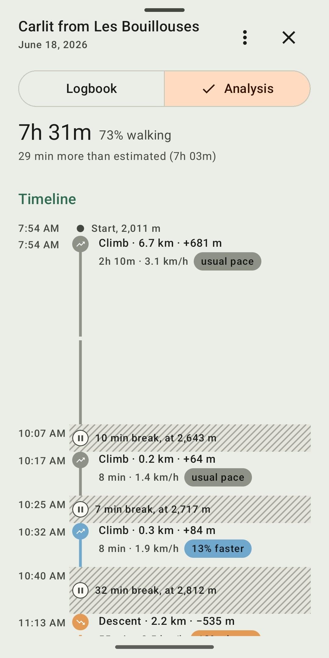
Analyse: see your form on the day, the slope or the speed along the track, read each section, compare with the usual pace and with the estimate, separate walking time from breaks. A timeline of the outing shows climbs, descents and breaks, nights at the bivouac included.
Measure: totals, month-by-month progress and personal records, with actual duration and walking share. Each record leads back to the hike it comes from.
No account, no tracking, no collection:
* Everything on the device: tracks, journal and photos are stored on the device, with nothing sent to a server run by the developer.
* No account, no ads, no tracking: no usage statistics, no tracker, no crash reports.
* No location tracking: the app never accesses the device's location.
* Free software under the GPL-3.0 licence: the source code is public.
The app's only network connection: downloading map tiles. The satellite layer (Esri) and the weather link (Meteoblue), which are non-free services, are turned off by a single switch in Settings.
Photos: to place a photo on the track, Bivouac reads the GPS position stored in the photo. This needs read access to images and the "media location" permission, both requested only on first use of photos. The feature can be turned off in Settings, and photos never leave the device.
What Bivouac does not do: no guidance, no track recording, no social network. Tracks come from the watch, the GPS or the app used during the outing, in GPX format.
Interface in English and French, following the device's language. Android 8 and later.
Website: [link removed]
License: GPL-3.0-only
Plan: import a GPX track of one or several days, place the bivouacs on the route. Distance, elevation and estimated duration are recalculated for each stage. Altitude and a weather link for each bivouac, export of a stage as GPX, a bank of prepared tracks.
Remember: keep every completed hike with a note, tags, and photos placed on the track where they were taken. The selection screen offers the photos taken during the hike first, with access to the whole gallery. Each photo can be cropped, captioned or moved along the track, and opens full screen.
Analyse: see your form on the day, the slope or the speed along the track, read each section, compare with the usual pace and with the estimate, separate walking time from breaks. A timeline of the outing shows climbs, descents and breaks, nights at the bivouac included.
Measure: totals, month-by-month progress and personal records, with actual duration and walking share. Each record leads back to the hike it comes from.
No account, no tracking, no collection:
* Everything on the device: tracks, journal and photos are stored on the device, with nothing sent to a server run by the developer.
* No account, no ads, no tracking: no usage statistics, no tracker, no crash reports.
* No location tracking: the app never accesses the device's location.
* Free software under the GPL-3.0 licence: the source code is public.
The app's only network connection: downloading map tiles. The satellite layer (Esri) and the weather link (Meteoblue), which are non-free services, are turned off by a single switch in Settings.
Photos: to place a photo on the track, Bivouac reads the GPS position stored in the photo. This needs read access to images and the "media location" permission, both requested only on first use of photos. The feature can be turned off in Settings, and photos never leave the device.
What Bivouac does not do: no guidance, no track recording, no social network. Tracks come from the watch, the GPS or the app used during the outing, in GPX format.
Interface in English and French, following the device's language. Android 8 and later.
Website: [link removed]
License: GPL-3.0-only
| Release info | Update on Nov 07, 2026 |
|---|---|
| Release notes | English Lighter app: • The code is now optimised and shrunk at build time: the APK goes from 16.5 MB to about 4 MB Journal photos: • A photo whose GPS position is far from the track (more than 500 m), but taken within two minutes of a recorded point, is now placed by its time and marked approximate • Thumbnails now flag photos that have no position on the track • Thumbnail badges change: approximate position, a pin with a question mark (instead of the crosshair); photo removed from the map, a crossed-out eye (instead of the crossed-out pin, which now flags a photo with no position) Journal: • Importing several files: when a file has no times, the days are ordered by the natural order of their names, "day 2" before "day 10" • Analysis: duration labels of nearby breaks stack instead of overlapping Map: • The recentre button gets a framing icon, so it is no longer mistaken for the location button Français Application allégée : • Le code est désormais optimisé et réduit à la compilation : l'APK passe de 16,5 Mo à environ 4 Mo Photos du Journal : • Une photo dont la position GPS est loin de la trace (plus de 500 m), mais prise à moins de deux minutes d'un point enregistré, est désormais placée d'après son heure et marquée approximative • Les vignettes signalent les photos qui n'ont pas de position sur la trace • Les badges des vignettes changent : position approximative, une épingle avec un point d'interrogation (au lieu du viseur) ; photo retirée de la carte, un œil barré (au lieu de l'épingle barrée, qui signale désormais une photo sans position) Journal : • Import de plusieurs fichiers : quand un fichier n'a pas d'heure, les jours sont rangés dans l'ordre naturel de leurs noms, « jour 2 » avant « jour 10 » • Analyse : les étiquettes de durée de pauses proches s'empilent au lieu de se recouvrir Carte : • Le bouton de recentrage prend une icône de cadrage, pour ne plus être confondu avec la position --- SHA-256 Bivouac-2.7.2.apk… |
| Listing data | F-Droid |
Reviews
No reviews yet. Be the first to review Bivouac.
Used Bivouac? Tell other visitors what you thought.
Log in to write a reviewOther products by this publisher
- "No Distractions" for YouTube 4.10 ----
- #Bible 11.6 "Incredible App - My sister shared this app with me a few weeks ago and it is truly incredible.
- #filmphotography 1.4.2 So, you decided to shoot on film?
- $quirrel 1.5.1 $quirrel Budget & Finance helps you plan each paycheck, track spending, manage debt, and see what is safe to spend before the next payday.
- % Percentage Calculator Pro 1.41 This is the Pro version of % Percentage Calculator.
Most viewed Android Navigation & Maps
-
1
 CairnGPS 1.3.0
Hike tracking, live GNSS satellite view, achievements. Works fully offline
-
2
 osm2gmaps 0.12.0
Convert coordinates and map links between formats, services and apps
-
3
 Transito 0.10.0.9
Public transit app to download GTFS data & calculate routes offline
-
4
 XCSoar 7.46.1
Tactical glide computer and maps
-
5
 Wind Bubble 1.0.3
See where the wind hits you, on top of your navigation app.
-
6
 RailTrip 1.6.5
Travel through the train stations to stamp your visa!
- 7 GPS Locker 0.1.1 Keep the GPS locked at all times on an Android device.
- 8 Helsinki Timetables 1.6 Show timetables for public transport in Helsinki city and region
- 9 Bahn-Vorhersage 0.8.3 Ranking for train journeys according to their reliability. (German only)
- 10 CountryCount 1.0.1 Track countries, visualize your progress, and explore where you’re going next.
Most downloaded Android Navigation & Maps
-
1
XCSoar 7.46.1
Tactical glide computer and maps
-
2
 TyphoonEye 1.3.3
Typhoon tracks, forecasts and alerts for the Northwest Pacific
- 3 Every Door 7.1 Mobile OpenStreetMap editor for POI & micromapping
-
4
 OpenTopoMap Viewer 1.42
Online client for maps from OTM project, import GPX and show own location
-
5
 BikeRoutePlanner 1.11-20
Plan bike routes with bbbike, save them as GPX and navigate in OsmAnd
-
6
 OSMfocus Reborn 1.9.13
Examine OpenStreetMap (OSM) elements to "focus" your view of the map
-
7
 BoatSpeedy 1.5.2
Route planner for canoes and boats, GPS speedometer and battery analytics
-
8
 Phantasialand Wait Times 2.2.0
Live wait times for Phantasialand rides
- 9 Haltestellenanzeige (Display Monitor) 1.2 Displays the departure times of all stops in Germany (Display Monitor).
-
10
CairnGPS 1.3.0
Hike tracking, live GNSS satellite view, achievements. Works fully offline