
Swiss DroneMap 1.1.2
Swiss Drone Map is an interactive drone map for planning drone flights in Switzerland.
Download
126.46 MB
16downloads
1this week
FreeCommercial
0reviews
Screenshots
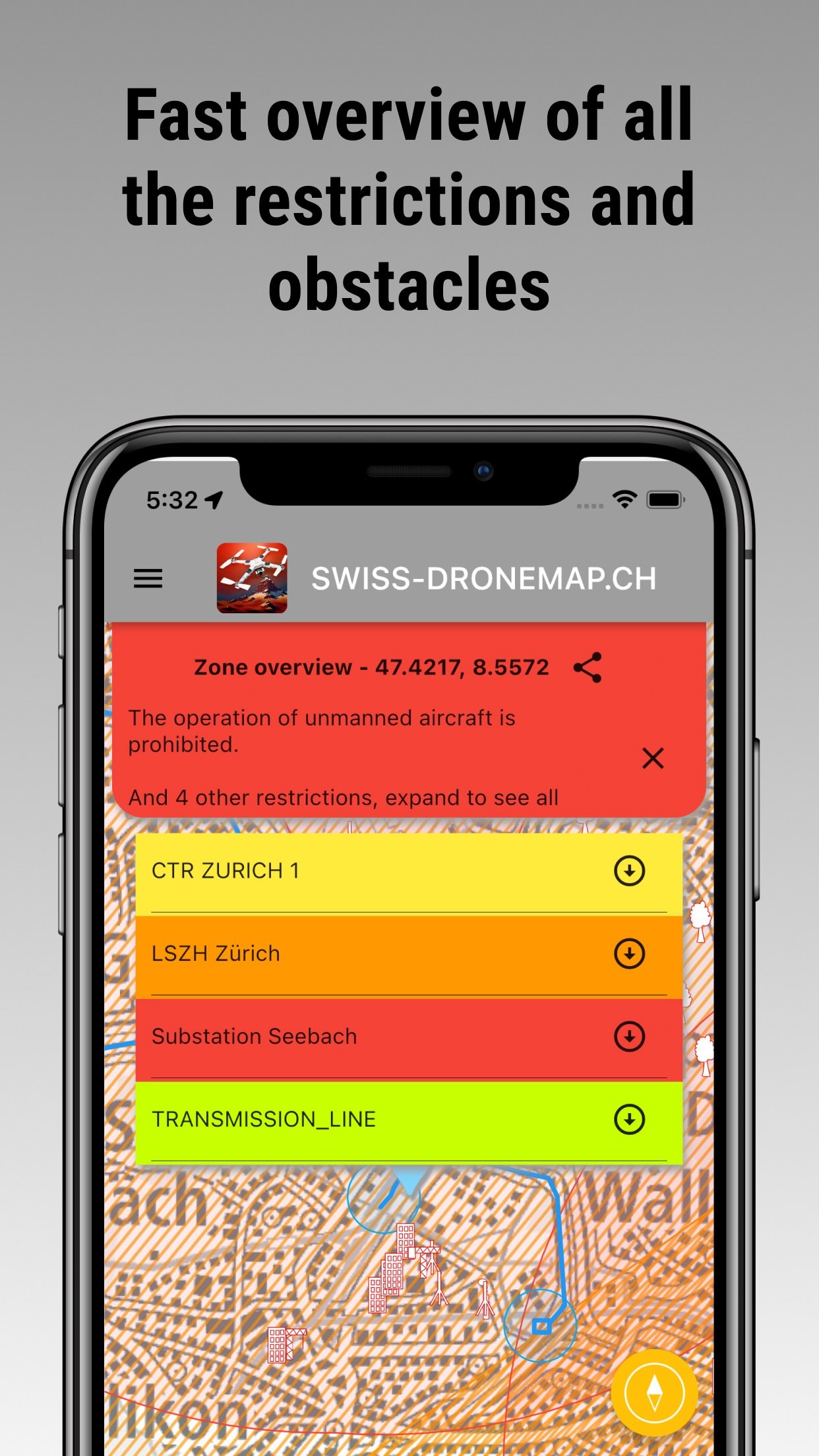
About Swiss DroneMap
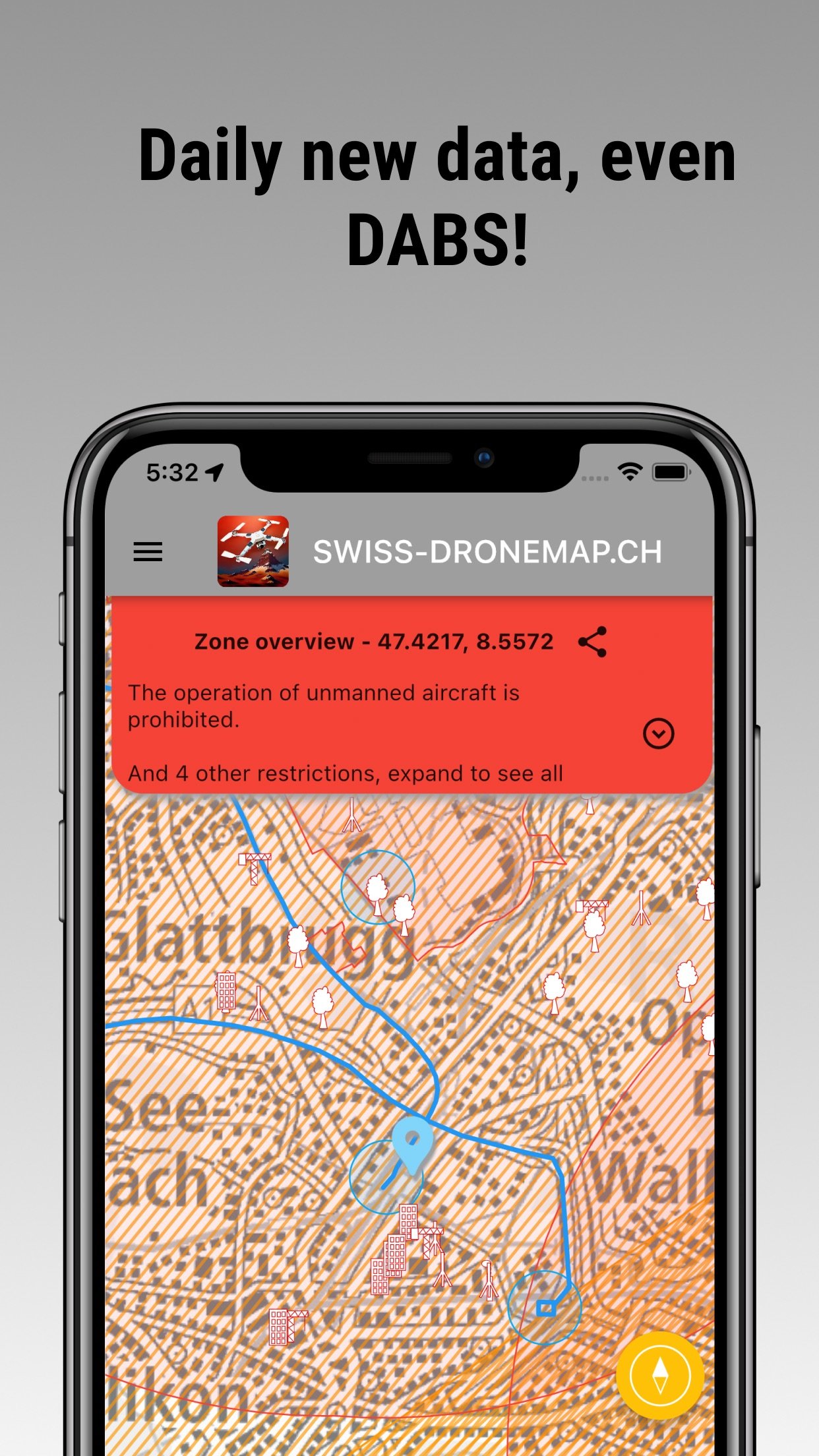
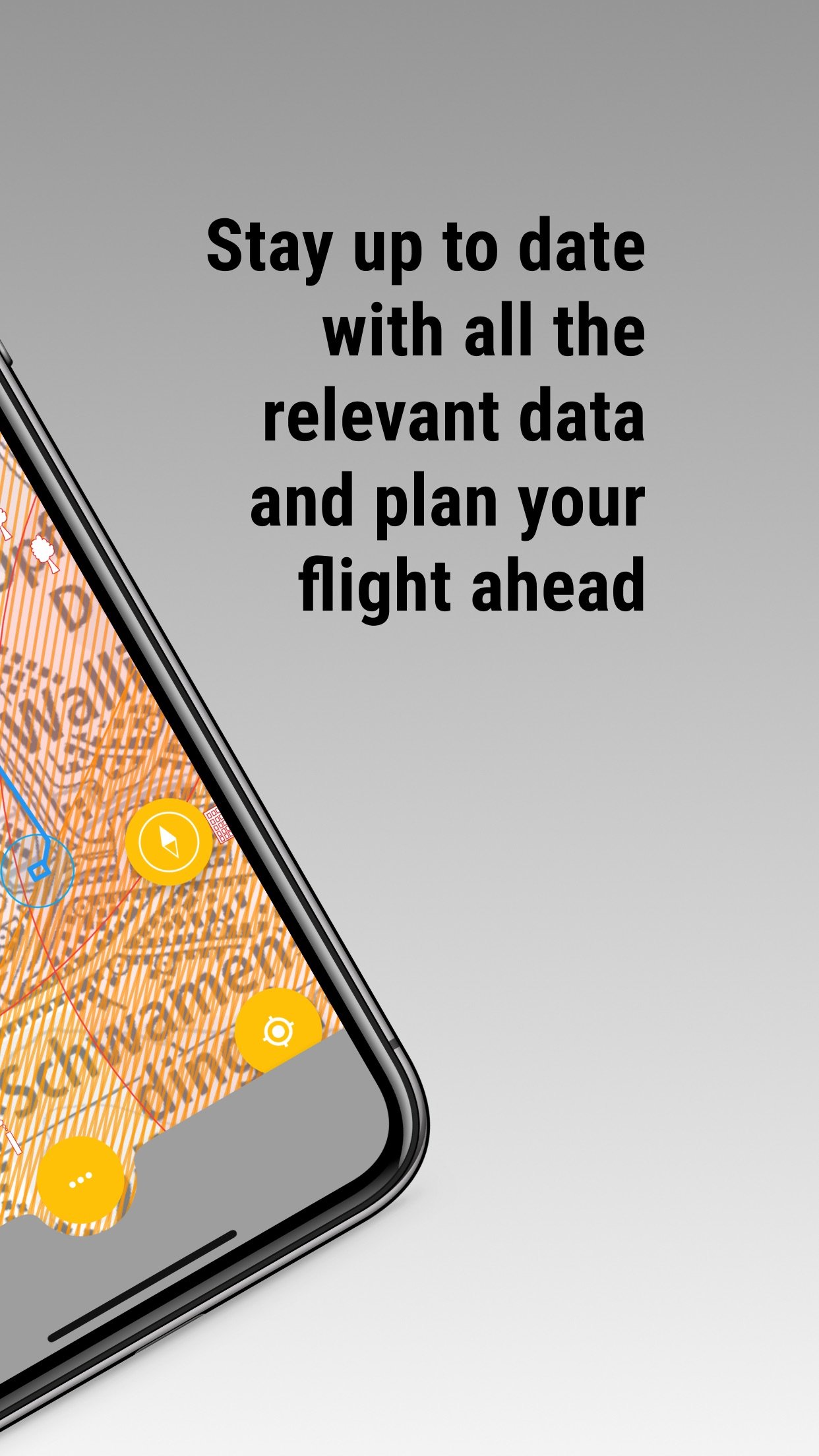
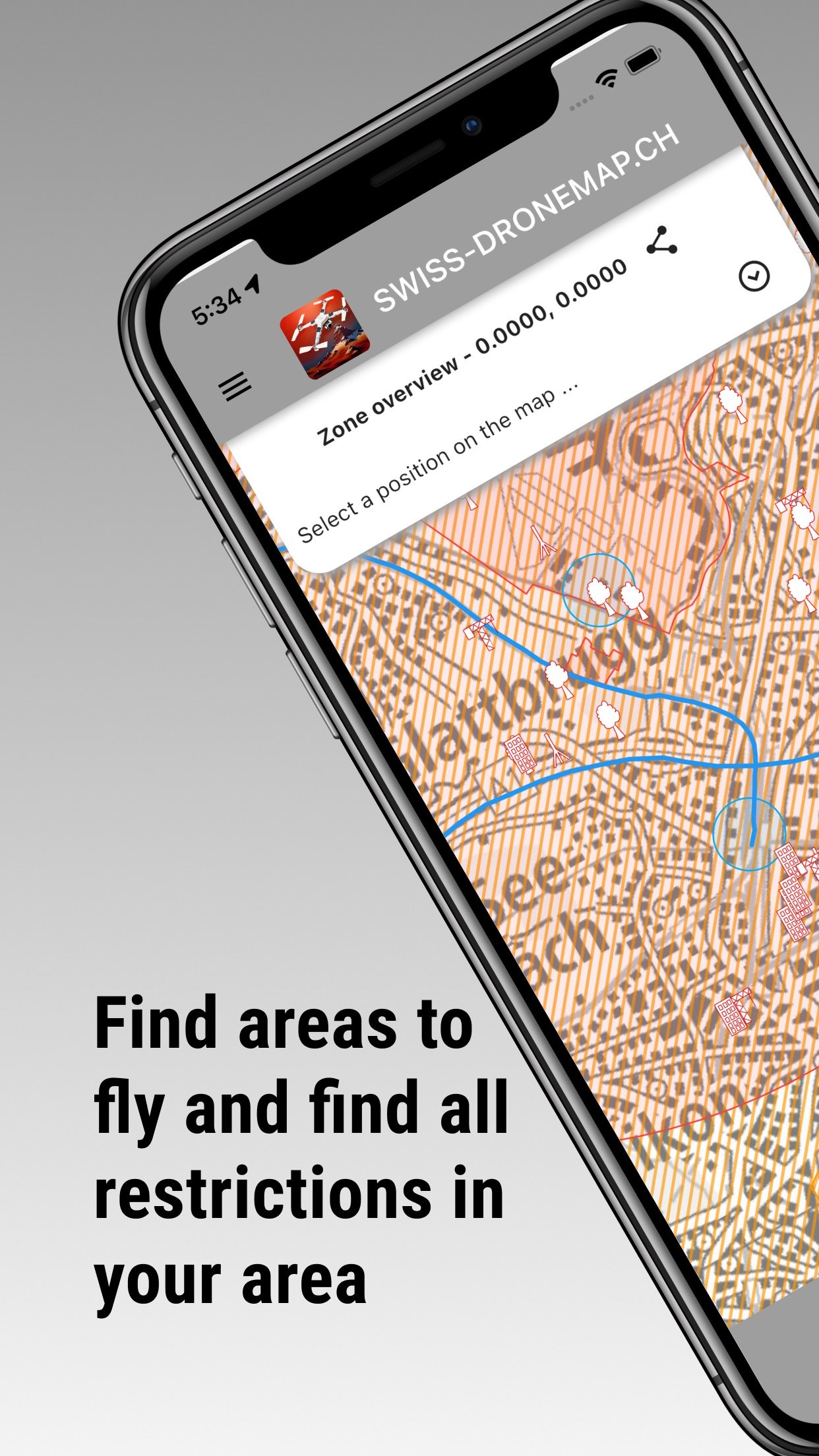
Swiss Drone Map is an interactive drone map for planning drone flights in Switzerland. Check drone zones, airspace restrictions, airports, protected areas, aviation obstacles, NOTAM and DABS information directly on the map.
The app helps recreational and professional drone pilots assess a planned flight location and collect important information before take-off. You can also store and manage personal documents required for private or commercial drone operations.
SWISS DRONE MAP
The drone map of Switzerland includes:
• national and cantonal drone airspace restrictions
• airports, heliports and control zones (CTR)
• hospital helipads
• military areas
• prisons and critical infrastructure
• nuclear power plants
• nature reserves and wildlife protection areas
• energy and gas infrastructure
• aviation obstacles such as buildings, masts and power lines
• nearby parking locations
• seven different base map styles
NOTAM, DABS AND LIVE AIR TRAFFIC
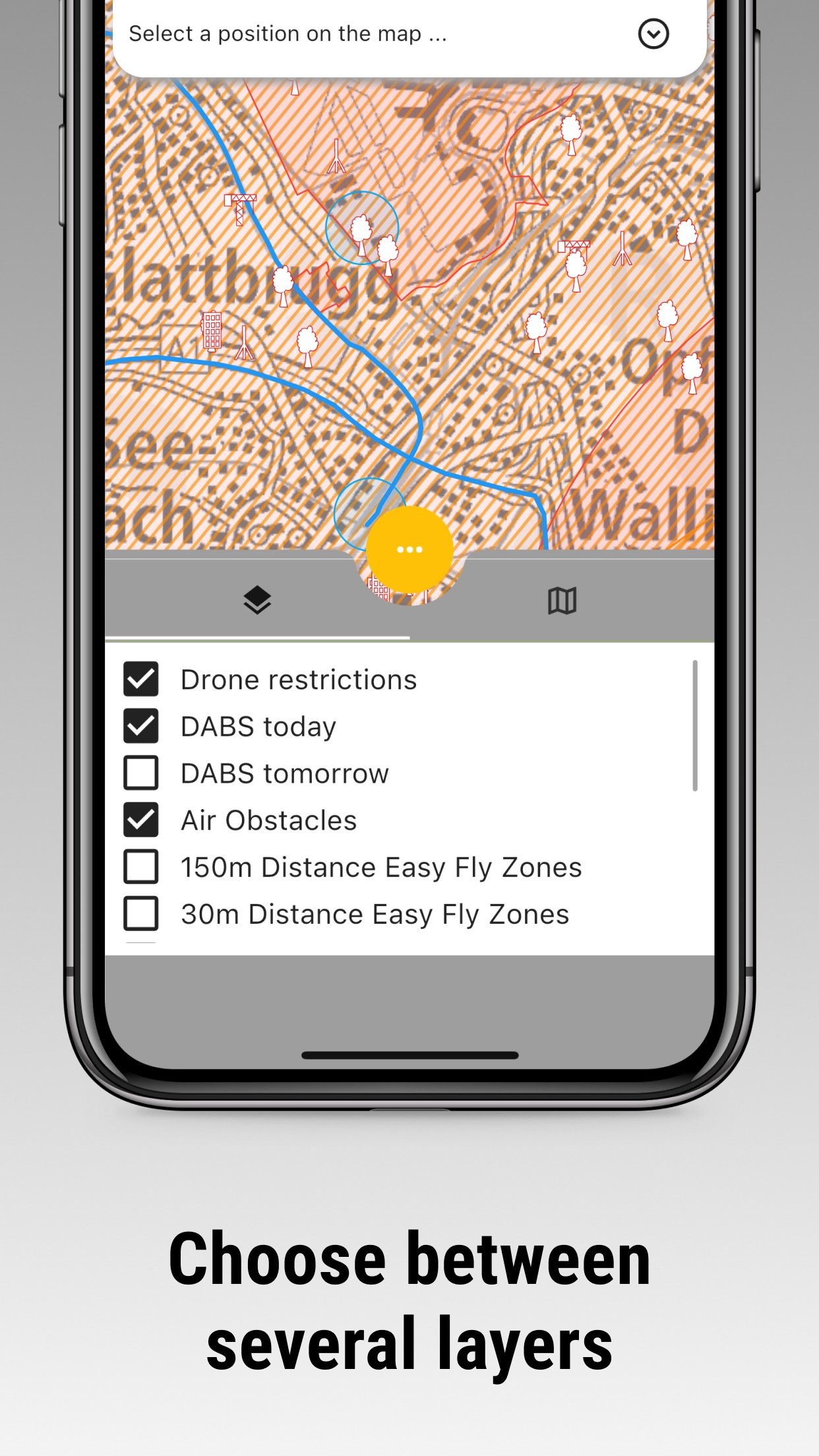
Swiss Drone Map provides access to current NOTAM and DABS information for today and tomorrow. Publicly available position data for aircraft and helicopters can also be displayed on the map.
Live traffic data is provided for information only. It may be incomplete or delayed and must not be used for navigation, separation, collision avoidance or other operational decisions.
EASY-FLY ZONES
The Easy-Fly view visualises distances of 30 and 150 metres from settlements, forests, railway lines and power lines. It provides a quick first assessment of a planned drone flight area but does not replace a legal review or an on-site risk assessment.
DOCUMENTS FOR DRONE PILOTS
Store important documents directly in the app:
• remote pilot certificate from UAS.gate or EASA
• UAS operator registration number for private or commercial use
• proof of insurance
• additional personal flight and operating documents
CHECK AIRSPACE AND NO-FLY ZONES
Before every drone flight, check whether restrictions, authorisation requirements or temporary no-fly zones apply at the planned location. The Swiss drone map helps you identify possible conflicts with aircraft, helicopters, protected areas and critical infrastructure.
Ignoring applicable drone regulations may result in fines or other legal consequences. Always verify the latest information provided by the responsible authorities and assess the actual conditions at the flight location.
UPDATES AND DATA SOURCES
Flight-related map data is updated regularly, usually every day. Links to NOTAM and DABS information are refreshed regularly.
The map is based on publicly available official and open data sources:
• Swiss Federal Geoportal / swisstopo – map.geo.admin.ch
• Swiss Federal Office of Civil Aviation, FOCA – bazl.admin.ch
• DABS and NOTAM information – skybriefing.com
• live air traffic data – OpenSky Network
External content opens directly on the website of the original provider. Government data is not presented as an independent official publication by this app.
DISCLAIMER
Swiss Drone Map is an independent application. It is not affiliated with, endorsed by or representative of any government authority or public organisation.
All information is provided solely to support drone flight planning. Information may be incomplete, delayed or inaccurate. The app does not issue flight authorisations and does not confirm that a drone flight is legally permitted at a specific location.
Before every flight, consult the responsible authorities for current regulations, permits and restrictions. Also consider local rules, temporary restrictions, property rights, privacy, nature protection and the actual situation at the flight location.
Fly responsibly and discover Switzerland from above.
The app helps recreational and professional drone pilots assess a planned flight location and collect important information before take-off. You can also store and manage personal documents required for private or commercial drone operations.
SWISS DRONE MAP
The drone map of Switzerland includes:
• national and cantonal drone airspace restrictions
• airports, heliports and control zones (CTR)
• hospital helipads
• military areas
• prisons and critical infrastructure
• nuclear power plants
• nature reserves and wildlife protection areas
• energy and gas infrastructure
• aviation obstacles such as buildings, masts and power lines
• nearby parking locations
• seven different base map styles
NOTAM, DABS AND LIVE AIR TRAFFIC
Swiss Drone Map provides access to current NOTAM and DABS information for today and tomorrow. Publicly available position data for aircraft and helicopters can also be displayed on the map.
Live traffic data is provided for information only. It may be incomplete or delayed and must not be used for navigation, separation, collision avoidance or other operational decisions.
EASY-FLY ZONES
The Easy-Fly view visualises distances of 30 and 150 metres from settlements, forests, railway lines and power lines. It provides a quick first assessment of a planned drone flight area but does not replace a legal review or an on-site risk assessment.
DOCUMENTS FOR DRONE PILOTS
Store important documents directly in the app:
• remote pilot certificate from UAS.gate or EASA
• UAS operator registration number for private or commercial use
• proof of insurance
• additional personal flight and operating documents
CHECK AIRSPACE AND NO-FLY ZONES
Before every drone flight, check whether restrictions, authorisation requirements or temporary no-fly zones apply at the planned location. The Swiss drone map helps you identify possible conflicts with aircraft, helicopters, protected areas and critical infrastructure.
Ignoring applicable drone regulations may result in fines or other legal consequences. Always verify the latest information provided by the responsible authorities and assess the actual conditions at the flight location.
UPDATES AND DATA SOURCES
Flight-related map data is updated regularly, usually every day. Links to NOTAM and DABS information are refreshed regularly.
The map is based on publicly available official and open data sources:
• Swiss Federal Geoportal / swisstopo – map.geo.admin.ch
• Swiss Federal Office of Civil Aviation, FOCA – bazl.admin.ch
• DABS and NOTAM information – skybriefing.com
• live air traffic data – OpenSky Network
External content opens directly on the website of the original provider. Government data is not presented as an independent official publication by this app.
DISCLAIMER
Swiss Drone Map is an independent application. It is not affiliated with, endorsed by or representative of any government authority or public organisation.
All information is provided solely to support drone flight planning. Information may be incomplete, delayed or inaccurate. The app does not issue flight authorisations and does not confirm that a drone flight is legally permitted at a specific location.
Before every flight, consult the responsible authorities for current regulations, permits and restrictions. Also consider local rules, temporary restrictions, property rights, privacy, nature protection and the actual situation at the flight location.
Fly responsibly and discover Switzerland from above.
| Release info | New Release on Sep 01, 2026 |
|---|---|
| Release notes | Removed ADS-B |
| Listing data | App Store |
Reviews
No reviews yet. Be the first to review Swiss DroneMap.
Used Swiss DroneMap? Tell other visitors what you thought.
Log in to write a reviewOther products by this publisher
- "No Distractions" for YouTube 4.10 ----
- #Bible 11.6 "Incredible App - My sister shared this app with me a few weeks ago and it is truly incredible.
- #filmphotography 1.4.2 So, you decided to shoot on film?
- $quirrel 1.5.1 $quirrel Budget & Finance helps you plan each paycheck, track spending, manage debt, and see what is safe to spend before the next payday.
- % Percentage Calculator Pro 1.41 This is the Pro version of % Percentage Calculator.
Most viewed iOS Navigation
-
1
 Compass App 1.0.5
Find your direction with style.
-
2
 CARFACE Car Widgets & Lyrics 1.2.0
Make every drive feel more personal with CarFace.
-
3
 iGlide Lite 2.9.66
NaviLogic iGlide - the Soaring Navigation app for iOS
-
4
 Turo 26.45.0
Turo is a better car rental app for travelers who want to rent a car without the rental counter.
-
5
 Open Road 1.2
Open Road is the one driving app for your iPhone.
-
6
 Fly Delta 7.17.3
Welcome to Fly Delta, Delta’s award winning iOS app.
-
7
 Amtrak 6.1.8
Discover the convenience of traveling with Amtrak.
-
8
 Kruger Birding by Firefinch 7.6.0
Go birding in South Africa's foremost birding spot: the world renowned Kruger National Park!
-
9
 Uber 3.747.10000
Join the millions of riders who trust Uber for their everyday travel needs.
-
10
 Lyft 2026.42.3
Get where you’re going with Lyft.
Most downloaded iOS Navigation
-
1
 Live Traffic 2.4
Navigate the globe with live traffic updates, satellite views, and location tools that make every journey clearer, smarter, and more confident from the very first tap.
-
2
 Peru’s Best 2.5
PERU’S BEST is the ideal travel guide to this extraordinary country.
-
3
 Grand Egyptian Museum (GEM) 0.1.060
You could call this a coincidence but the acronym of the Grand Egyptian Museum is an apt title for the GEM, which is truly one!
-
4
 Pocket Luach Deluxe 60058
Pocket Luach Deluxe is a Jewish calendar, zmanim, Siddur, Tehillim, and personal-event companion for iPhone, iPad, and Apple Watch.
-
5
 Outdoor Photography Magazine 7.2.10
Outdoor Photography is the magazine for photographers who are passionate about being out in wild places, seeing inspiring nature and having great adventures.
-
6
 Passeporté 1.3.2
Passeporté reads the NFC chip in your biometric passport or national eID card, verifies its authenticity, and stores the data securely on your device.
-
7
 Great Circle Map 1.7.5
A globe you can turn in any direction, including straight over the poles.
-
8
 UK Map 4.12
* Unlimited free map downloads based on Ordnance Survey® OpenData, at 1:25,000 and 1:10,000 scales, and now also paid map downloads at 1:50,000, 1:25,000 and 1:10,000 scales, just like the paper maps.
-
9
 Cell Phone Towers World Map 1.1.6
219 countres !! The world's largest Database of Cell & Net Towers
-
10
 Connecticut-Parks & Trails 1.0
App Feature