
12downloads
1this week
FreeFreeware
0reviews
Screenshots
About Spartan Forge
Plan smarter. Scout farther. Hunt better with Spartan Forge Hunt+.
Spartan Forge combines advanced mapping, high-resolution UAV imagery, customizable LiDAR, AI-powered deer movement predictions, weather, property data, and field planning tools in one hunting platform -- built for hunters, by hunters.
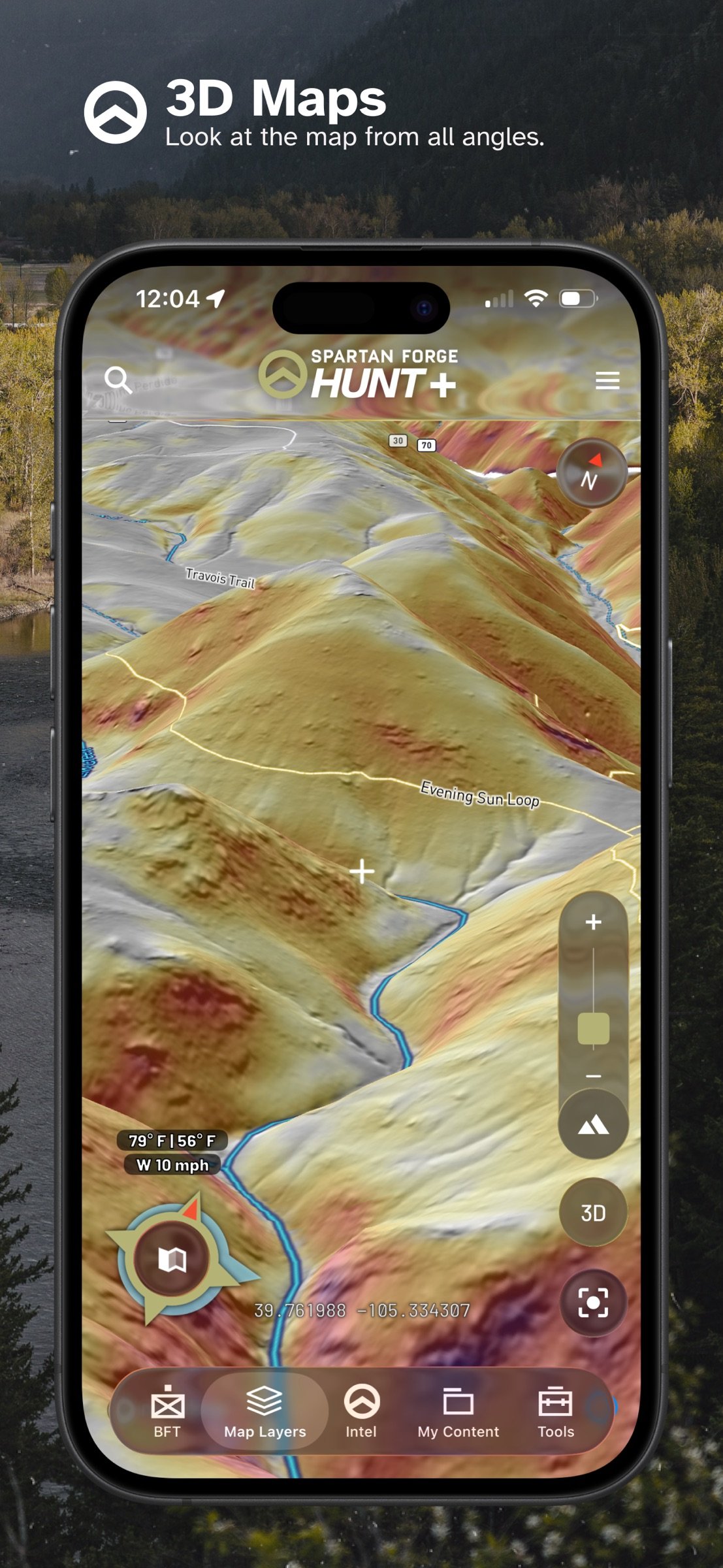
See more of the ground before you step foot on it. Explore UAV and satellite imagery, LiDAR, terrain features, crop data, property boundaries, hunt units, and customizable map layers. Save presets and download maps for offline use.
Turn scouting into a visual plan with BattleMap. Freehand draw on your map, add text, mark routes, visualize thermals, plan stalks, lay out deer drives, and build strategies around the terrain you hunt.
Scout smarter with historical weather, wind data, sun exposure, terrain information, and Spartan Forge's Deer Prediction model.
KEY FEATURES
o HIGH-RESOLUTION UAV & HISTORICAL IMAGERY
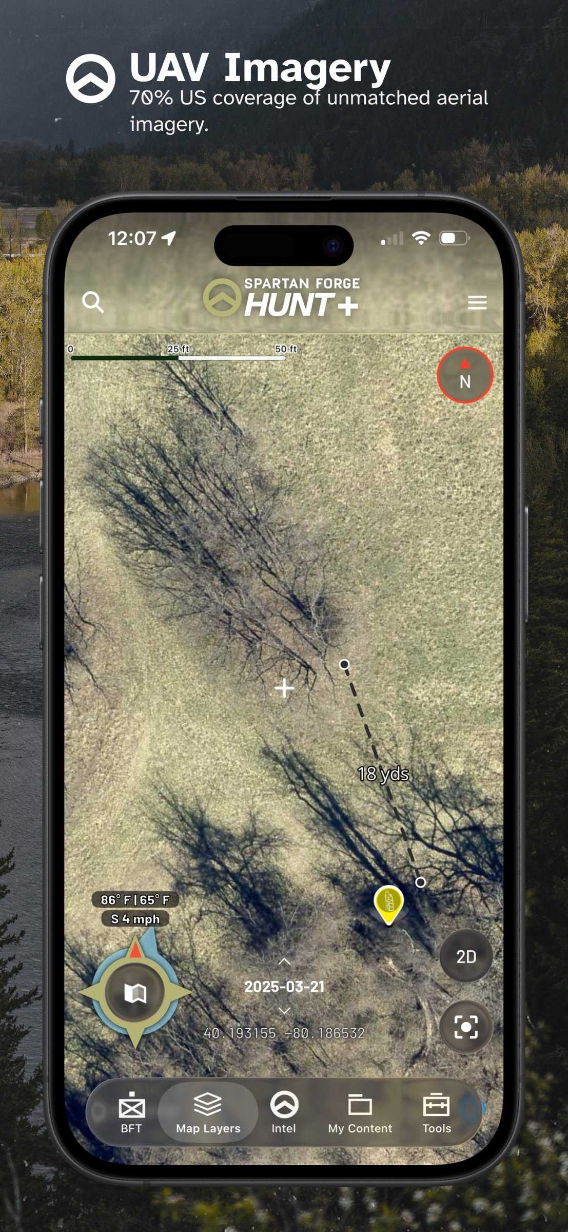
Explore 5-15 cm UAV imagery with historical coverage dating back to 2016, plus historical satellite imagery through Sat-1. See trees, habitat changes, access routes, timber cuts, and other details traditional satellite maps may miss.
o CUSTOMIZABLE LIDAR
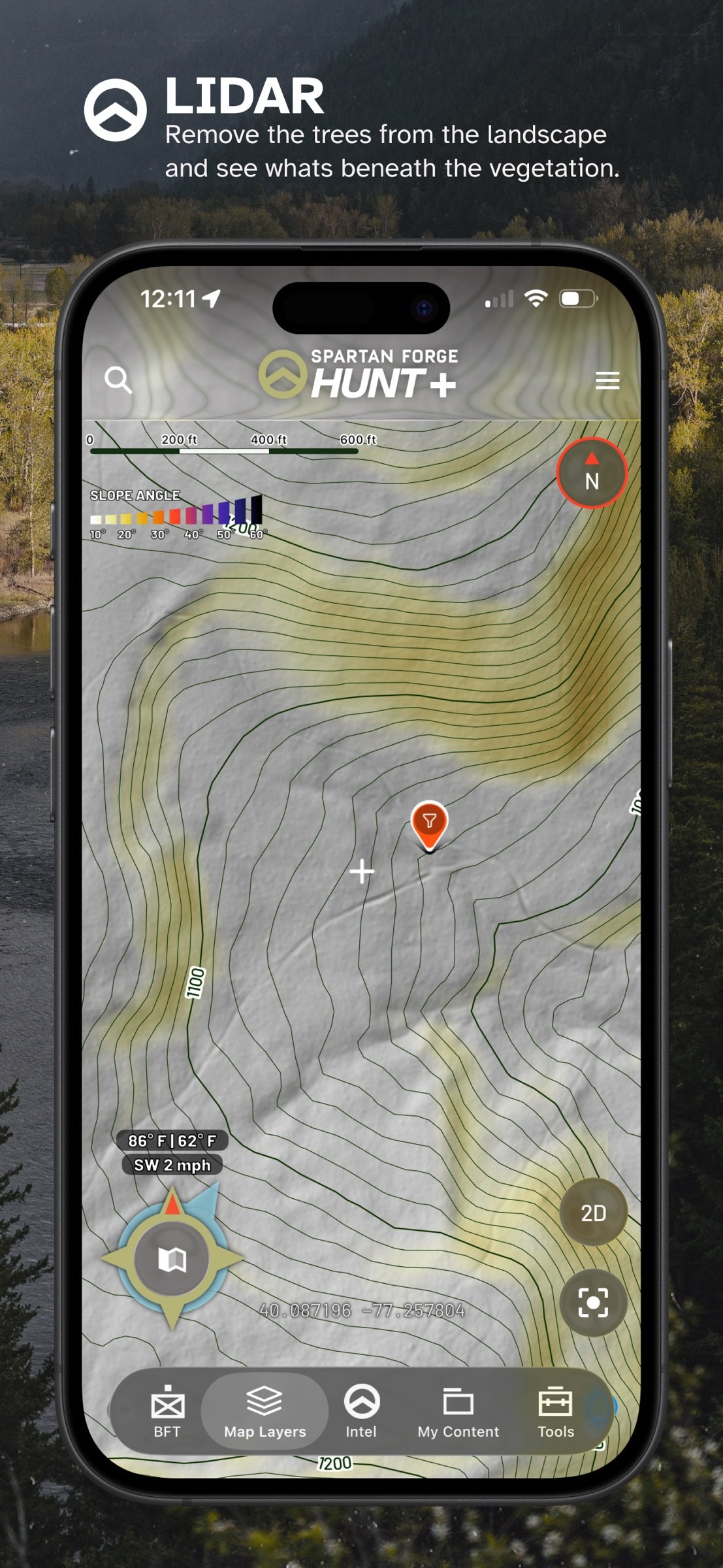
See terrain beneath the canopy with high-resolution LiDAR. Identify benches, drainages, game trails, old logging roads, subtle terrain changes, rock features, and more. Customize LiDAR settings to emphasize what matters most.
o BATTLEMAP
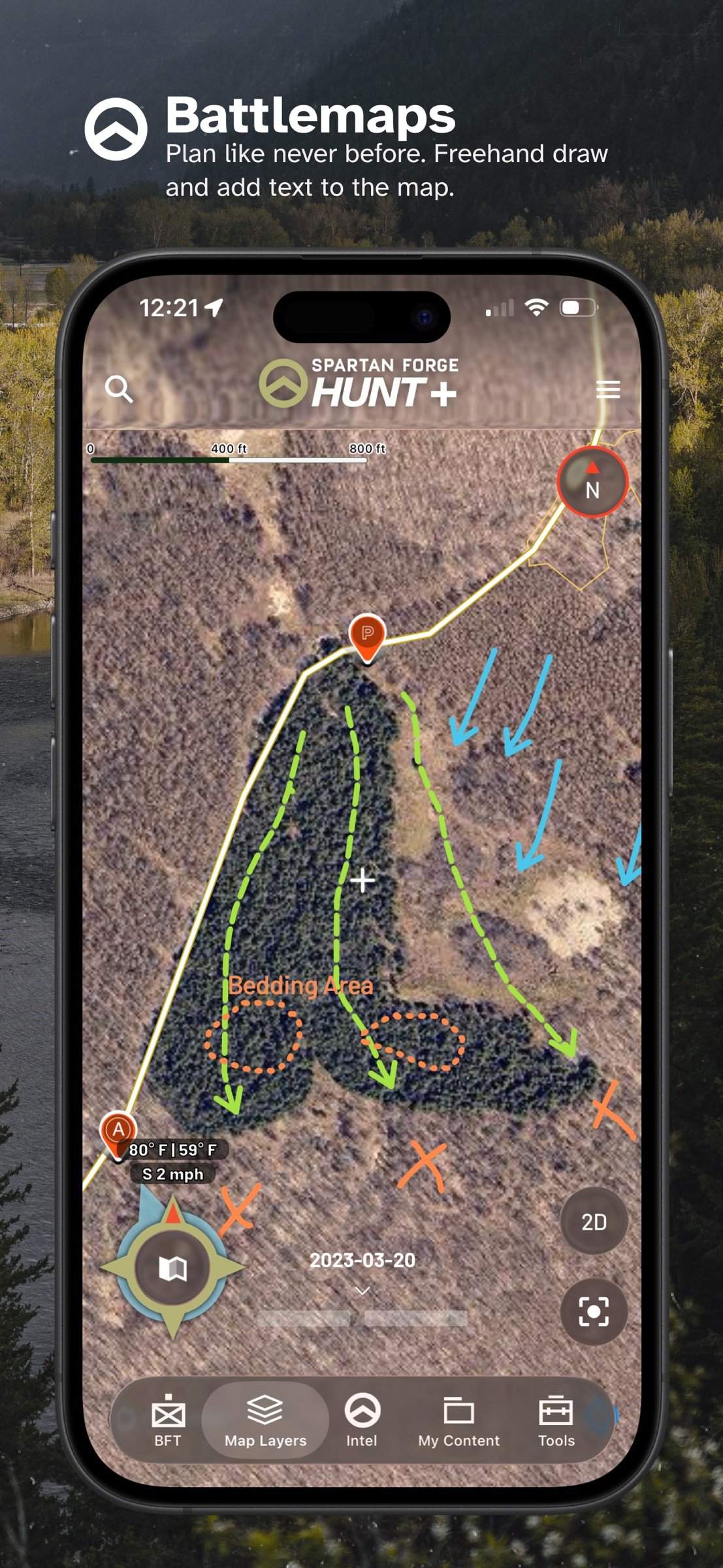
Draw freehand on the map, add text, create arrows, and customize line size, color, and style. Map access routes, thermals, deer drives, stalks, decoy spreads, stand approaches, and more. Save and access BattleMaps on mobile and web.
o DEER PREDICTION
Use Spartan Forge's deer movement prediction model, built using GPS-collared deer data and environmental conditions from across the U.S., to better understand potential deer movement and activity.
o HISTORICAL WIND & WEATHER
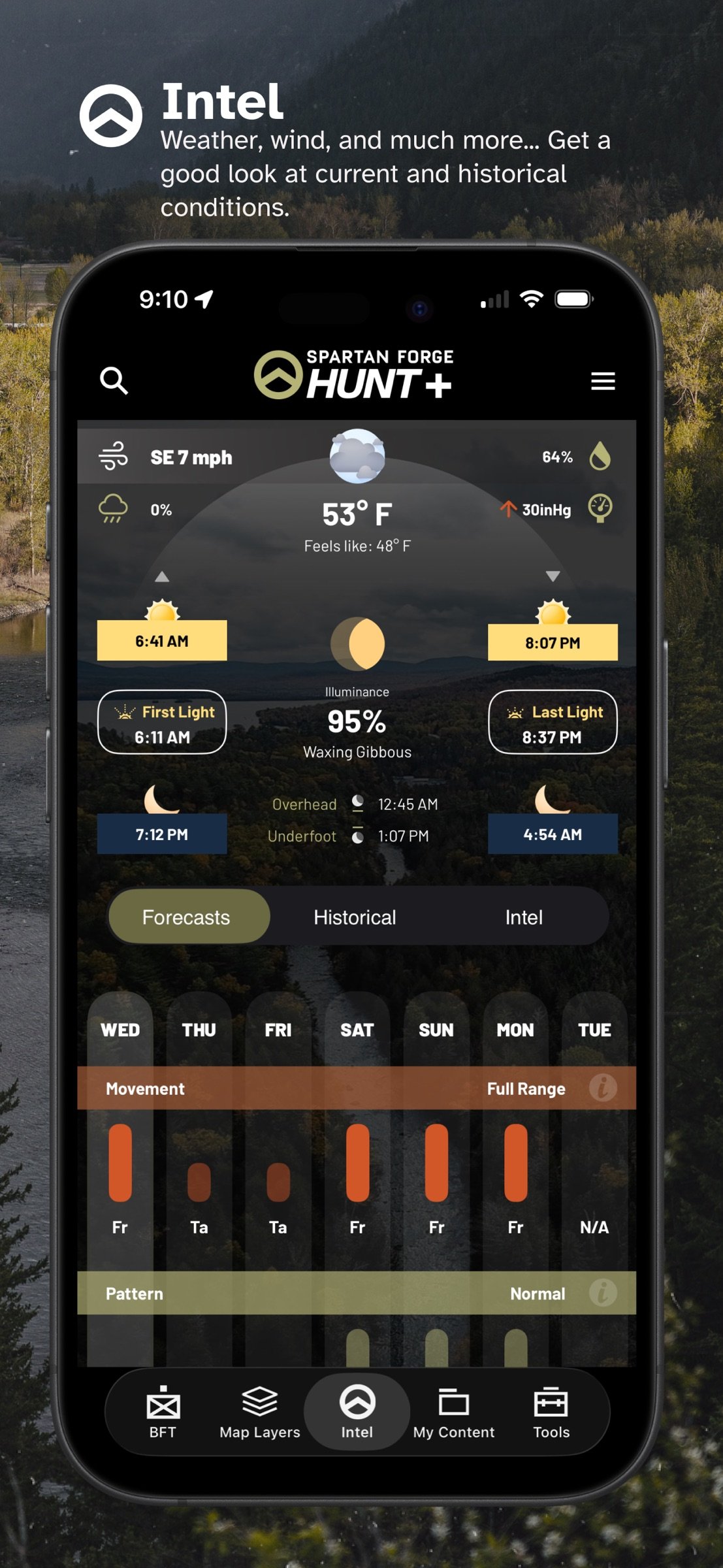
Research historical wind and weather conditions, view forecasts, and use weather information directly from your map.
o ADVANCED MAP CUSTOMIZATION
Combine imagery, LiDAR, property information, terrain layers, crop data, weather, sun exposure, and other overlays. Save presets for fast switching in the field.
o OFFLINE MAPS
Download supported satellite, topo, hybrid, and other maps before your hunt so critical information remains available beyond cell service.
o PRIVATE & PUBLIC LAND DATA
View property boundaries and ownership information, identify public hunting ground, mark access, and stay informed when saved parcels change ownership.
o PIN SHARING & BLUE FORCE TRACKER
Share individual pins with hunting partners or use Blue Force Tracker to automatically share pins within a defined area.
o EAGLEEYE (Web Only)
View terrain and imagery from side-angle perspectives to better understand ridges, valleys, and access routes.
o CYBERSCOUT AI (Web Only)
Ask CyberScout hunting-related questions and get AI-powered guidance for scouting, planning, gear, and more.
o MOBILE + DESKTOP SYNC
Plan from your desktop, then take your information into the field. Maps, pins, BattleMaps, and other content stay synced across supported devices.
MEMBERSHIP OPTIONS
? FREE
Get started with default maps, weather, basic property ownership, pins, and essential planning tools.
? PAID MEMBERSHIP -- ONE PRICE, ALL STATES
Choose a monthly or yearly membership and unlock Spartan Forge Hunt+ across every state, including advanced mapping, property boundaries, Deer Prediction, CyberScout, UAV and historical imagery, LiDAR, BattleMap, Blue Force Tracker, offline maps, and more.
One platform. More information. Better decisions in the field.
Terms of Use:
[link removed]
Questions or feedback?
Contact support@spartanforge.tech
Spartan Forge combines advanced mapping, high-resolution UAV imagery, customizable LiDAR, AI-powered deer movement predictions, weather, property data, and field planning tools in one hunting platform -- built for hunters, by hunters.
See more of the ground before you step foot on it. Explore UAV and satellite imagery, LiDAR, terrain features, crop data, property boundaries, hunt units, and customizable map layers. Save presets and download maps for offline use.
Turn scouting into a visual plan with BattleMap. Freehand draw on your map, add text, mark routes, visualize thermals, plan stalks, lay out deer drives, and build strategies around the terrain you hunt.
Scout smarter with historical weather, wind data, sun exposure, terrain information, and Spartan Forge's Deer Prediction model.
KEY FEATURES
o HIGH-RESOLUTION UAV & HISTORICAL IMAGERY
Explore 5-15 cm UAV imagery with historical coverage dating back to 2016, plus historical satellite imagery through Sat-1. See trees, habitat changes, access routes, timber cuts, and other details traditional satellite maps may miss.
o CUSTOMIZABLE LIDAR
See terrain beneath the canopy with high-resolution LiDAR. Identify benches, drainages, game trails, old logging roads, subtle terrain changes, rock features, and more. Customize LiDAR settings to emphasize what matters most.
o BATTLEMAP
Draw freehand on the map, add text, create arrows, and customize line size, color, and style. Map access routes, thermals, deer drives, stalks, decoy spreads, stand approaches, and more. Save and access BattleMaps on mobile and web.
o DEER PREDICTION
Use Spartan Forge's deer movement prediction model, built using GPS-collared deer data and environmental conditions from across the U.S., to better understand potential deer movement and activity.
o HISTORICAL WIND & WEATHER
Research historical wind and weather conditions, view forecasts, and use weather information directly from your map.
o ADVANCED MAP CUSTOMIZATION
Combine imagery, LiDAR, property information, terrain layers, crop data, weather, sun exposure, and other overlays. Save presets for fast switching in the field.
o OFFLINE MAPS
Download supported satellite, topo, hybrid, and other maps before your hunt so critical information remains available beyond cell service.
o PRIVATE & PUBLIC LAND DATA
View property boundaries and ownership information, identify public hunting ground, mark access, and stay informed when saved parcels change ownership.
o PIN SHARING & BLUE FORCE TRACKER
Share individual pins with hunting partners or use Blue Force Tracker to automatically share pins within a defined area.
o EAGLEEYE (Web Only)
View terrain and imagery from side-angle perspectives to better understand ridges, valleys, and access routes.
o CYBERSCOUT AI (Web Only)
Ask CyberScout hunting-related questions and get AI-powered guidance for scouting, planning, gear, and more.
o MOBILE + DESKTOP SYNC
Plan from your desktop, then take your information into the field. Maps, pins, BattleMaps, and other content stay synced across supported devices.
MEMBERSHIP OPTIONS
? FREE
Get started with default maps, weather, basic property ownership, pins, and essential planning tools.
? PAID MEMBERSHIP -- ONE PRICE, ALL STATES
Choose a monthly or yearly membership and unlock Spartan Forge Hunt+ across every state, including advanced mapping, property boundaries, Deer Prediction, CyberScout, UAV and historical imagery, LiDAR, BattleMap, Blue Force Tracker, offline maps, and more.
One platform. More information. Better decisions in the field.
Terms of Use:
[link removed]
Questions or feedback?
Contact support@spartanforge.tech
| Release info | Update on Nov 04, 2026 |
|---|---|
| Release notes | Bug Fixes |
| Listing data | App Store |
Reviews
No reviews yet. Be the first to review Spartan Forge.
Used Spartan Forge? Tell other visitors what you thought.
Log in to write a reviewOther products by this publisher
- "No Distractions" for YouTube 4.10 ----
- #Bible 11.6.1 "Incredible App - My sister shared this app with me a few weeks ago and it is truly incredible.
- #filmphotography 1.4.2 So, you decided to shoot on film?
- $quirrel 1.5.1 $quirrel Budget & Finance helps you plan each paycheck, track spending, manage debt, and see what is safe to spend before the next payday.
- % Percentage Calculator Pro 1.41 This is the Pro version of % Percentage Calculator.
Most viewed iOS Navigation
-
1
 Compass App 1.0.5
Find your direction with style.
-
2
 CARFACE Car Widgets & Lyrics 1.2.1
Make every drive feel more personal with CarFace.
-
3
 Open Road 1.2
Open Road is the one driving app for your iPhone.
-
4
 iGlide Lite 2.9.66
NaviLogic iGlide - the Soaring Navigation app for iOS
-
5
 Turo 26.46.0
Turo is a better car rental app for travelers who want to rent a car without the rental counter.
-
6
 Fly Delta 7.17.3
Welcome to Fly Delta, Delta’s award winning iOS app.
-
7
 Pocket Luach Deluxe 60058
Pocket Luach Deluxe is a Jewish calendar, zmanim, Siddur, Tehillim, and personal-event companion for iPhone, iPad, and Apple Watch.
-
8
 Amtrak 6.1.8
Discover the convenience of traveling with Amtrak.
-
9
 Uber 3.748.10001
Join the millions of riders who trust Uber for their everyday travel needs.
-
10
 Lyft 2026.44.3
Get where you’re going with Lyft.
Most downloaded iOS Navigation
-
1
 Live Traffic 2.4
Navigate the globe with live traffic updates, satellite views, and location tools that make every journey clearer, smarter, and more confident from the very first tap.
-
2
 Peru’s Best 2.5
PERU’S BEST is the ideal travel guide to this extraordinary country.
-
3
 Outdoor Photography Magazine 7.2.10
Outdoor Photography is the magazine for photographers who are passionate about being out in wild places, seeing inspiring nature and having great adventures.
-
4
 Grand Egyptian Museum (GEM) 0.1.060
You could call this a coincidence but the acronym of the Grand Egyptian Museum is an apt title for the GEM, which is truly one!
-
5
Pocket Luach Deluxe 60058
Pocket Luach Deluxe is a Jewish calendar, zmanim, Siddur, Tehillim, and personal-event companion for iPhone, iPad, and Apple Watch.
-
6
 Passeporté 1.3.2
Passeporté reads the NFC chip in your biometric passport or national eID card, verifies its authenticity, and stores the data securely on your device.
-
7
 Great Circle Map 1.7.5
A globe you can turn in any direction, including straight over the poles.
-
8
 UK Map 4.12
* Unlimited free map downloads based on Ordnance Survey® OpenData, at 1:25,000 and 1:10,000 scales, and now also paid map downloads at 1:50,000, 1:25,000 and 1:10,000 scales, just like the paper maps.
-
9
 Connecticut-Parks & Trails 1.0
App Feature
-
10
 Cell Phone Towers World Map 1.1.6
219 countres !! The world's largest Database of Cell & Net Towers