Range Finder Tool 3.0
Turn your iPhone or iPad into a practical field toolkit for camera measurement, maps, waypoints, compass work, and astronomical planning.
Download
24.39 MB
18downloads
2this week
FreeCommercial
0reviews
Screenshots
About Range Finder Tool
Turn your iPhone or iPad into a practical field toolkit for camera measurement, maps, waypoints, compass work, and astronomical planning.
RangeFinder brings the instruments you need into one focused app. Estimate a distance, inspect an angle, save a waypoint, measure a shape on the map, or plan around sunlight without breaking your workflow.
CAMERA INSTRUMENTS
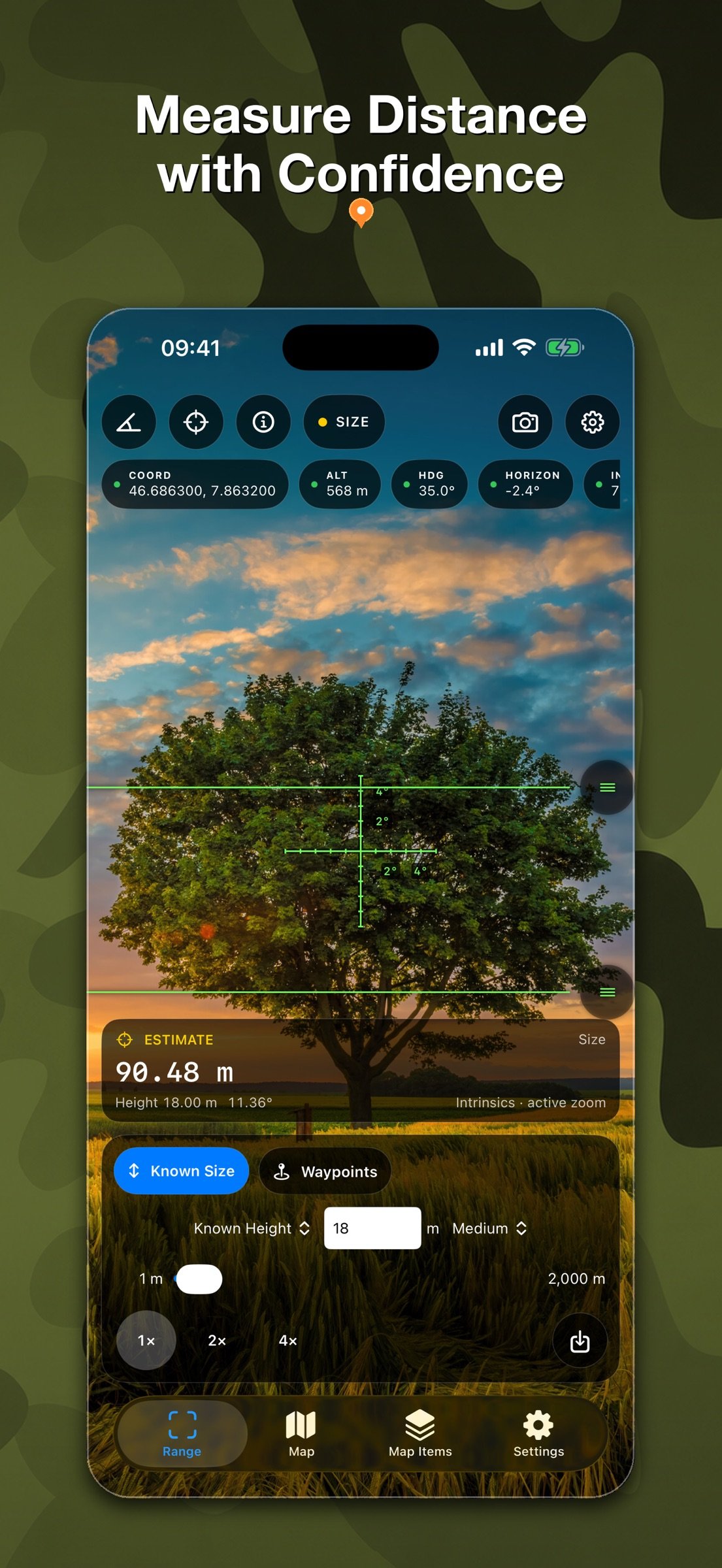
• Estimate distance or height from an object of known size.
• Measure distance with LiDAR on compatible devices.
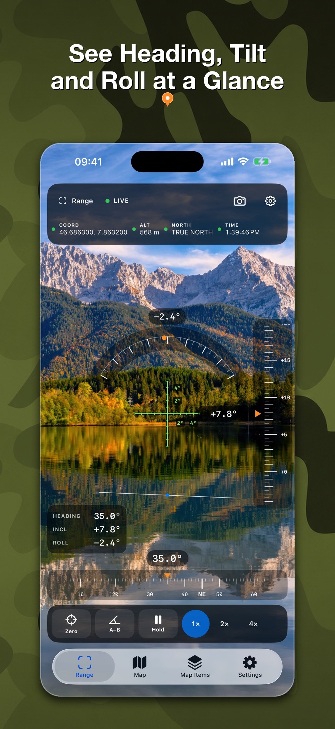
• Read heading, inclination, and roll, then capture an A–B angle.
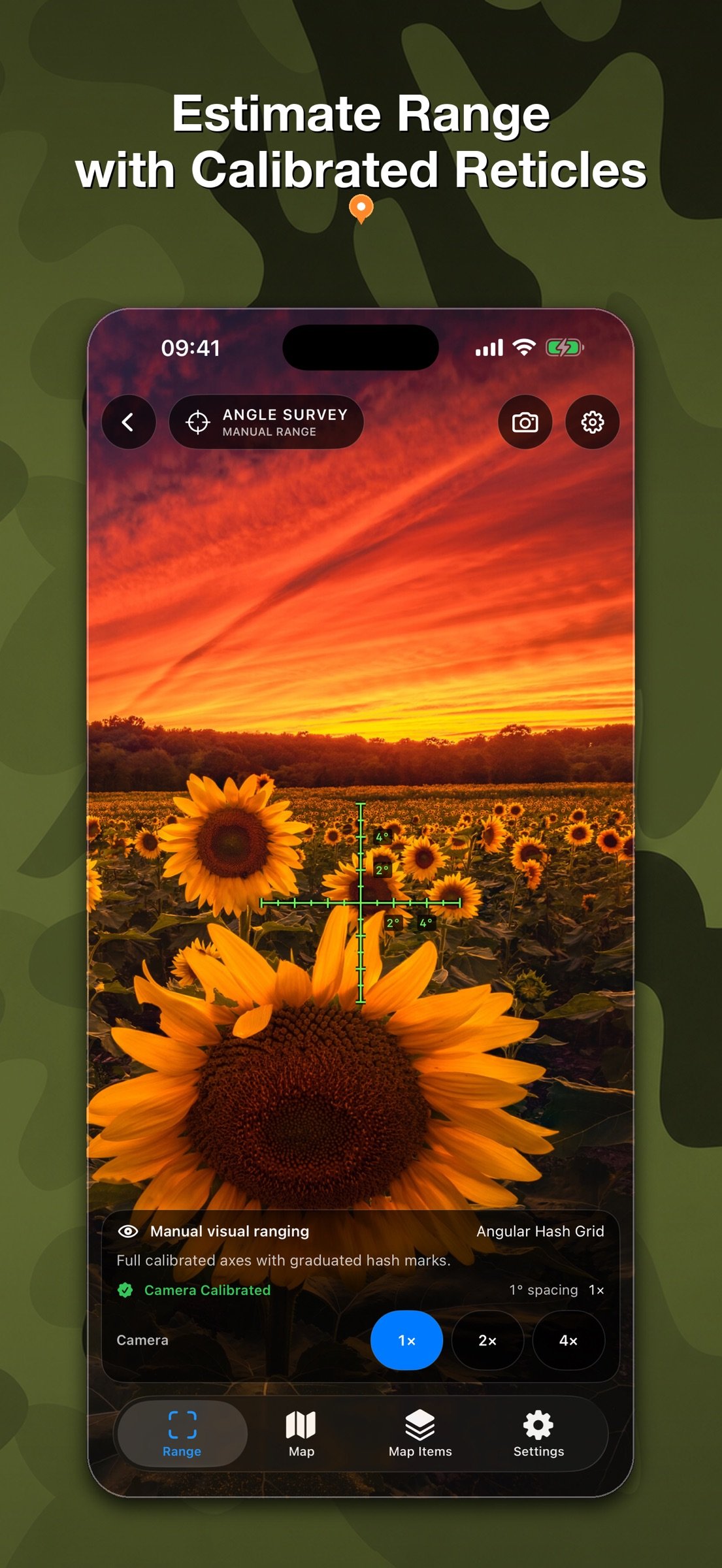
• Use Angle Survey with crisp, calibrated vector reticles.
• Save camera, reticle, measurement, or full-screen compositions.
MAPS THAT GO WITH YOU
• Work with raster maps and detailed OSM vector maps up to zoom level 19.
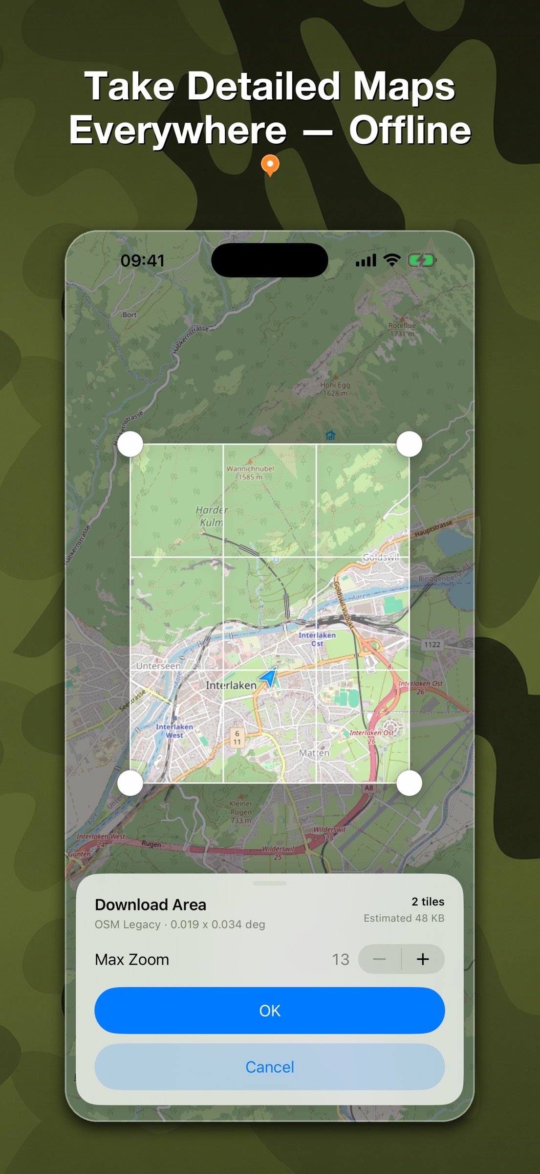
• Download supported map areas for use away from a connection.
• Start with 512 MB of offline-map storage; save your first offline map to receive another 512 MB.
• Search and inspect coordinates in Decimal Degrees, DMS, UTM, MGRS, Plus Codes, and GeoHash.
WAYPOINTS WITH CONTEXT
• Create waypoints on the map or from a photo’s GPS metadata.
• Choose from 175 icons so every place is easy to recognize.
• Add notes, photos, and voice messages.
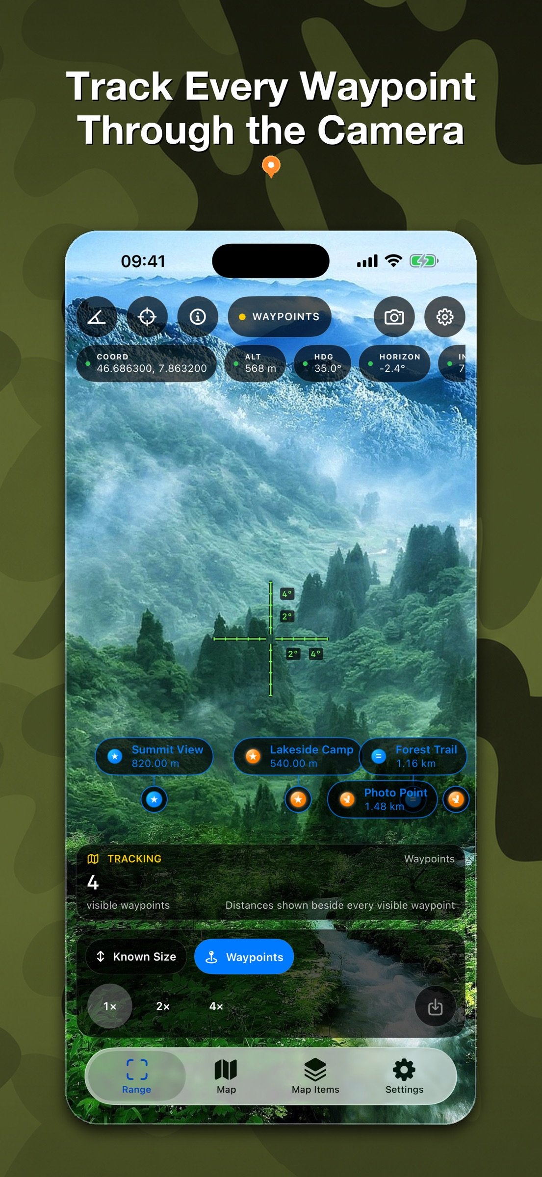
• Track selected waypoints on the map, compass, and live camera with their name and distance.
MEASURE AND PLAN
• Draw distances, polylines, angles, rectangles, polygons, areas, and circles directly on the map.
• Use magnetic or true north, waypoint bearings, map rotation, and compass calibration.
• Plan with sunrise, sunset, civil, nautical, and astronomical twilight, golden and blue hours, Moon phase, and planet positions—calculated on device.
SAVE YOUR FIELDWORK
Keep range observations, captures, waypoints, attachments, and map measurements organized for later. A safe migration assistant can bring compatible waypoints, media, and settings forward from the previous app.
Camera frames and photo-location analysis are processed on your device. Availability and quality depend on device sensors, permissions, lighting, surface conditions, and location accuracy. Measurements are estimates and are not intended for safety-critical surveying or navigation.
License: Commercial
RangeFinder brings the instruments you need into one focused app. Estimate a distance, inspect an angle, save a waypoint, measure a shape on the map, or plan around sunlight without breaking your workflow.
CAMERA INSTRUMENTS
• Estimate distance or height from an object of known size.
• Measure distance with LiDAR on compatible devices.
• Read heading, inclination, and roll, then capture an A–B angle.
• Use Angle Survey with crisp, calibrated vector reticles.
• Save camera, reticle, measurement, or full-screen compositions.
MAPS THAT GO WITH YOU
• Work with raster maps and detailed OSM vector maps up to zoom level 19.
• Download supported map areas for use away from a connection.
• Start with 512 MB of offline-map storage; save your first offline map to receive another 512 MB.
• Search and inspect coordinates in Decimal Degrees, DMS, UTM, MGRS, Plus Codes, and GeoHash.
WAYPOINTS WITH CONTEXT
• Create waypoints on the map or from a photo’s GPS metadata.
• Choose from 175 icons so every place is easy to recognize.
• Add notes, photos, and voice messages.
• Track selected waypoints on the map, compass, and live camera with their name and distance.
MEASURE AND PLAN
• Draw distances, polylines, angles, rectangles, polygons, areas, and circles directly on the map.
• Use magnetic or true north, waypoint bearings, map rotation, and compass calibration.
• Plan with sunrise, sunset, civil, nautical, and astronomical twilight, golden and blue hours, Moon phase, and planet positions—calculated on device.
SAVE YOUR FIELDWORK
Keep range observations, captures, waypoints, attachments, and map measurements organized for later. A safe migration assistant can bring compatible waypoints, media, and settings forward from the previous app.
Camera frames and photo-location analysis are processed on your device. Availability and quality depend on device sensors, permissions, lighting, surface conditions, and location accuracy. Measurements are estimates and are not intended for safety-critical surveying or navigation.
License: Commercial
| Release info | New Release on Aug 04, 2026 |
|---|---|
| Release notes | RangeFinder 3.0 is a major new release, rebuilt as a modern field toolkit. • Meet the new Range, Angle, and Angle Survey instruments with shared camera, reticle, capture, and sensor settings. • Use a calibrated vector-reticle library with Fine Cross as the default. Save your first instrument photo to unlock six bonus reticles. • Explore raster and OSM vector maps, download supported offline areas, manage storage, and zoom vector maps up to level 19. • Create waypoints from a photo’s GPS metadata, attach photos and voice messages, and track selected waypoints on the map, compass, and live camera. • Measure distances, angles, shapes, and areas on the map, with improved coordinate search and inspection. • Plan outdoors with compass tools and on-device Sun, Moon, planet, twilight, golden-hour, and blue-hour calculations. • Bring compatible waypoints, media, and settings forward safely from the previous app. This update also includes extensive performance, accessibility, localization, camera-capture, and offline-map improvements. |
| Listing data | App Store |
Reviews
No reviews yet. Be the first to review Range Finder Tool.
Used Range Finder Tool? Tell other visitors what you thought.
Log in to write a reviewOther products by this publisher
- "No Distractions" for YouTube 4.10 ----
- #Bible 11.6 "Incredible App - My sister shared this app with me a few weeks ago and it is truly incredible.
- #filmphotography 1.4.2 So, you decided to shoot on film?
- $quirrel 1.5.1 $quirrel Budget & Finance helps you plan each paycheck, track spending, manage debt, and see what is safe to spend before the next payday.
- % Percentage Calculator Pro 1.41 This is the Pro version of % Percentage Calculator.
Most viewed iOS Navigation
-
1
 Compass App 1.0.5
Find your direction with style.
-
2
 CARFACE Car Widgets & Lyrics 1.2.0
Make every drive feel more personal with CarFace.
-
3
 iGlide Lite 2.9.66
NaviLogic iGlide - the Soaring Navigation app for iOS
-
4
 Turo 26.45.0
Turo is a better car rental app for travelers who want to rent a car without the rental counter.
-
5
 Open Road 1.2
Open Road is the one driving app for your iPhone.
-
6
 Fly Delta 7.17.3
Welcome to Fly Delta, Delta’s award winning iOS app.
-
7
 Amtrak 6.1.8
Discover the convenience of traveling with Amtrak.
-
8
 Kruger Birding by Firefinch 7.6.0
Go birding in South Africa's foremost birding spot: the world renowned Kruger National Park!
-
9
 Uber 3.747.10000
Join the millions of riders who trust Uber for their everyday travel needs.
-
10
 Lyft 2026.42.3
Get where you’re going with Lyft.
Most downloaded iOS Navigation
-
1
 Live Traffic 2.4
Navigate the globe with live traffic updates, satellite views, and location tools that make every journey clearer, smarter, and more confident from the very first tap.
-
2
 Peru’s Best 2.5
PERU’S BEST is the ideal travel guide to this extraordinary country.
-
3
 Grand Egyptian Museum (GEM) 0.1.060
You could call this a coincidence but the acronym of the Grand Egyptian Museum is an apt title for the GEM, which is truly one!
-
4
 Pocket Luach Deluxe 60058
Pocket Luach Deluxe is a Jewish calendar, zmanim, Siddur, Tehillim, and personal-event companion for iPhone, iPad, and Apple Watch.
-
5
 Outdoor Photography Magazine 7.2.10
Outdoor Photography is the magazine for photographers who are passionate about being out in wild places, seeing inspiring nature and having great adventures.
-
6
 Passeporté 1.3.2
Passeporté reads the NFC chip in your biometric passport or national eID card, verifies its authenticity, and stores the data securely on your device.
-
7
 Great Circle Map 1.7.5
A globe you can turn in any direction, including straight over the poles.
-
8
 UK Map 4.12
* Unlimited free map downloads based on Ordnance Survey® OpenData, at 1:25,000 and 1:10,000 scales, and now also paid map downloads at 1:50,000, 1:25,000 and 1:10,000 scales, just like the paper maps.
-
9
 Cell Phone Towers World Map 1.1.6
219 countres !! The world's largest Database of Cell & Net Towers
-
10
 Connecticut-Parks & Trails 1.0
App Feature