24downloads
3this week
FreeCommercial
0reviews
Screenshots
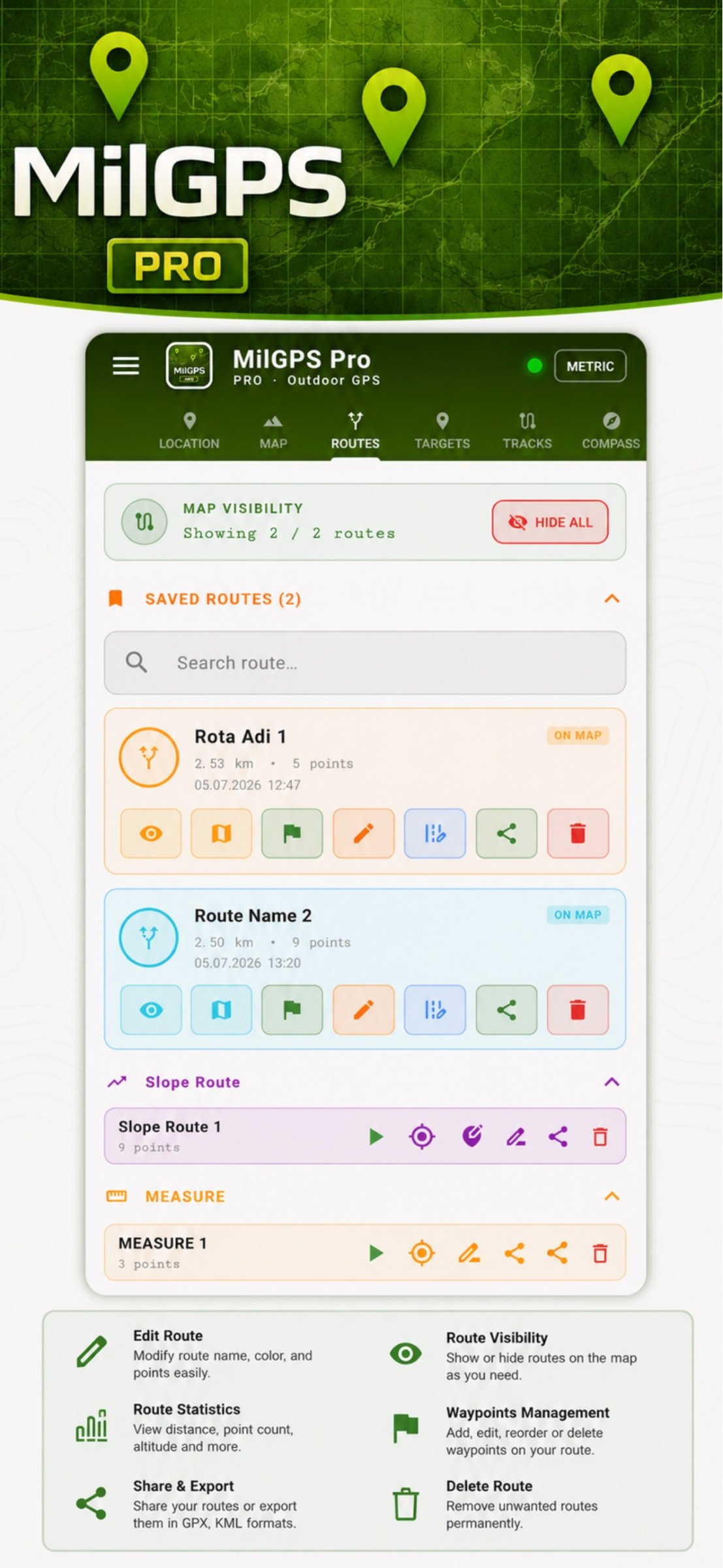
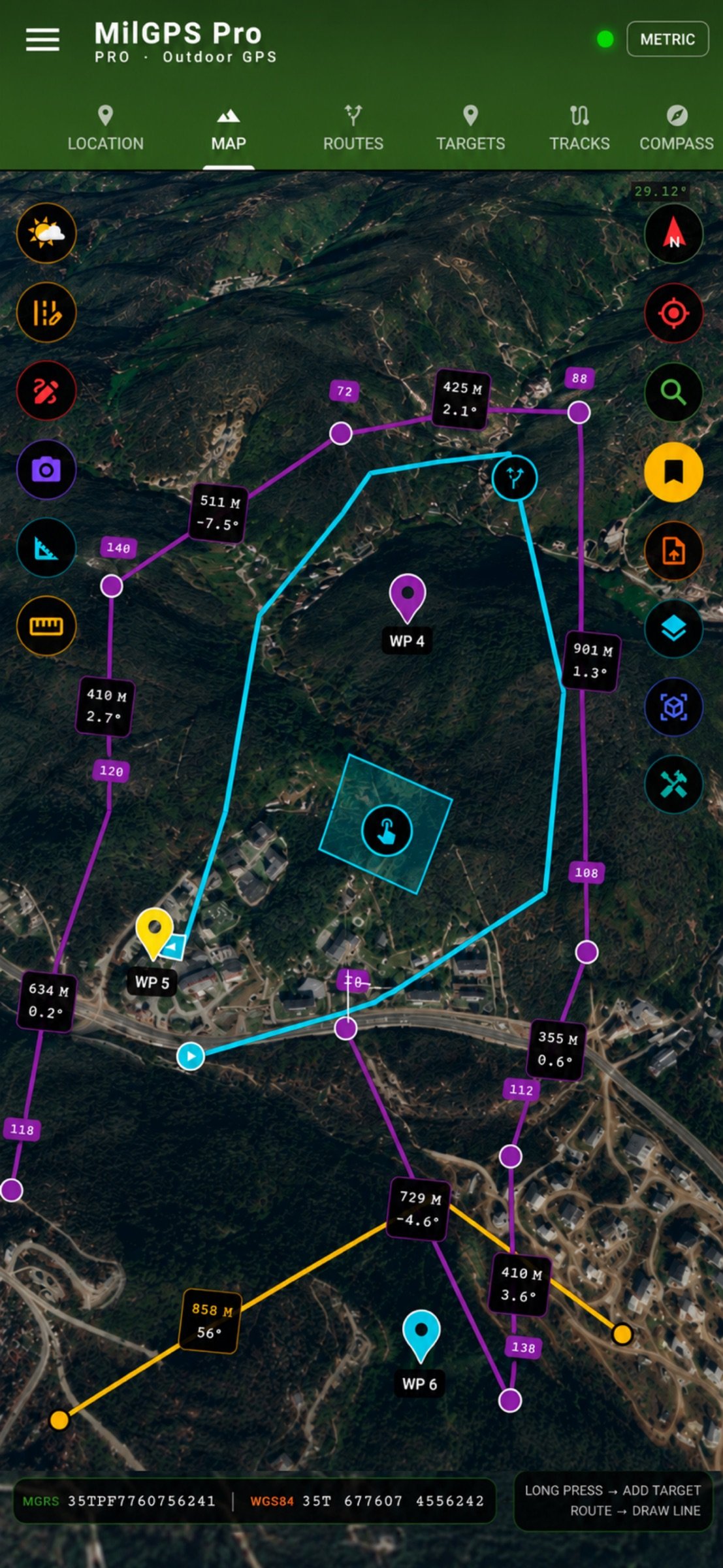
About MilGPS PRO
MilGPS PRO — Professional Military GPS Navigation
MilGPS PRO is a professional-grade military GPS navigation app that puts everything you need in the field into a single application. Built for terrain, operations, and navigation.
LOCATION & COORDINATE SYSTEMS
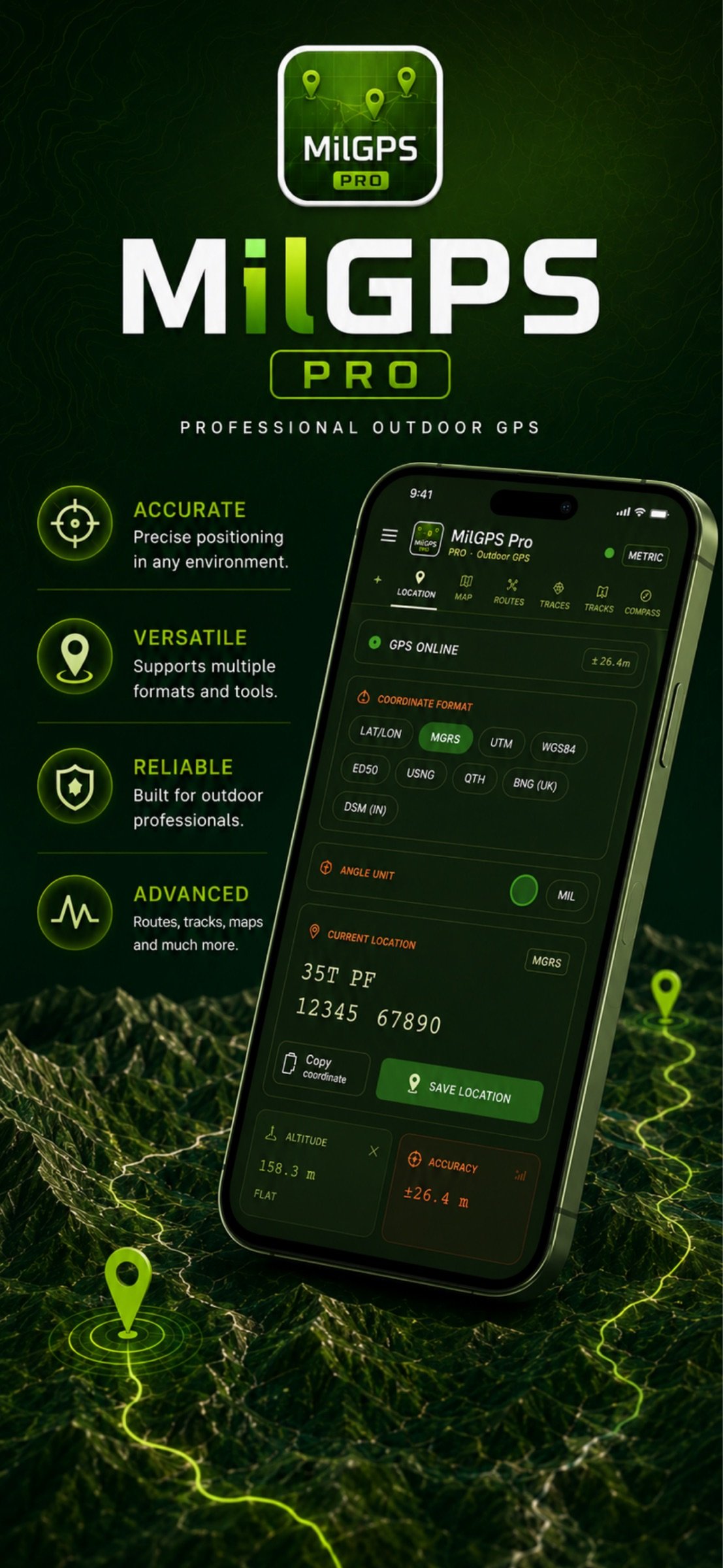
- MGRS (Military Grid Reference System) — full 10-digit precision
- UTM coordinate system
- USNG (US National Grid)
- QTH Locator
- Decimal and DMS LAT/LON formats
- One-tap format switching
- Instant coordinate copy
ADVANCED MAP SYSTEM
- 6 map layers: Satellite, Topographic, Road, Hybrid, Terrain, Bing Satellite
- Military grid line overlay
- Hillshade relief, contour lines, and road name overlays
- Layer transparency control
- Map search by coordinate (MGRS, LAT/LON, DMS)
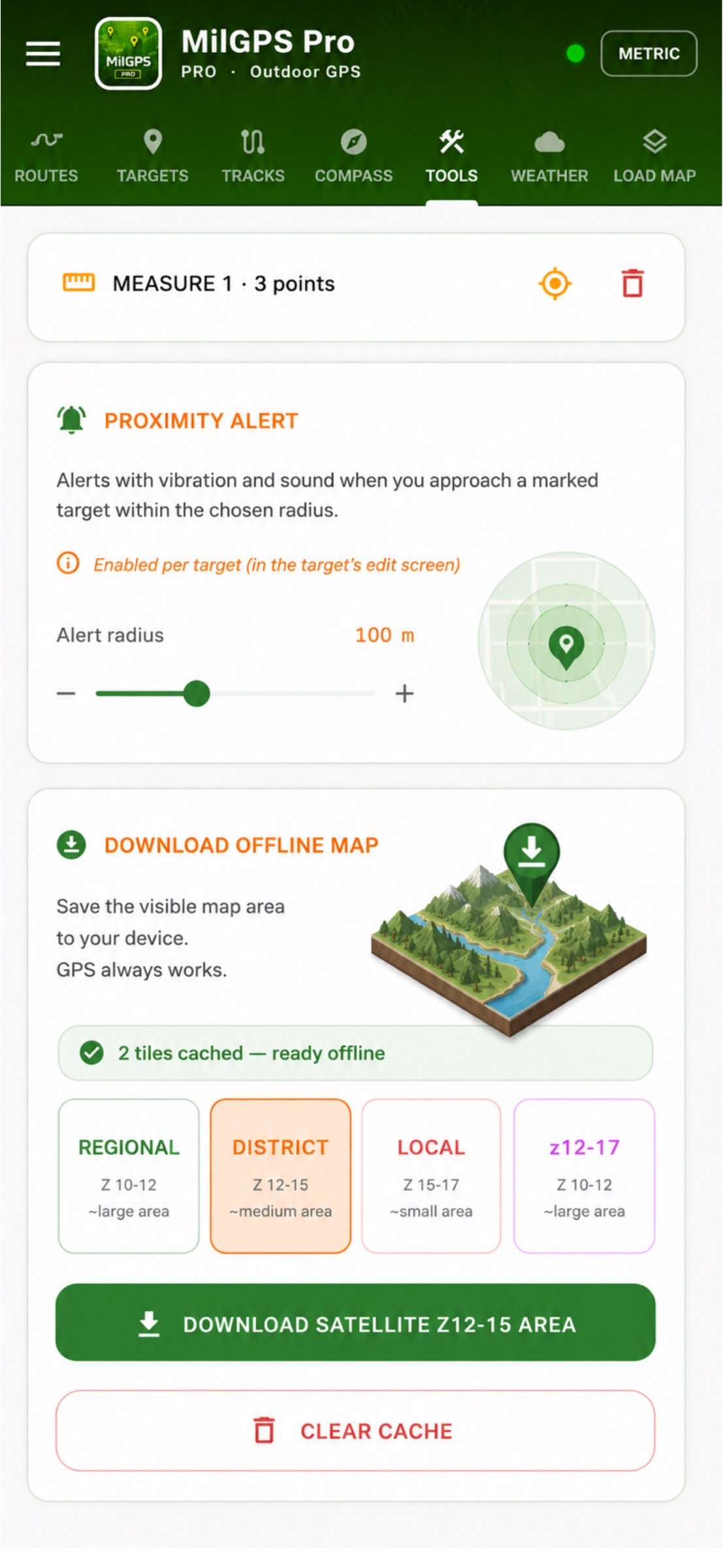
- Offline map download and caching
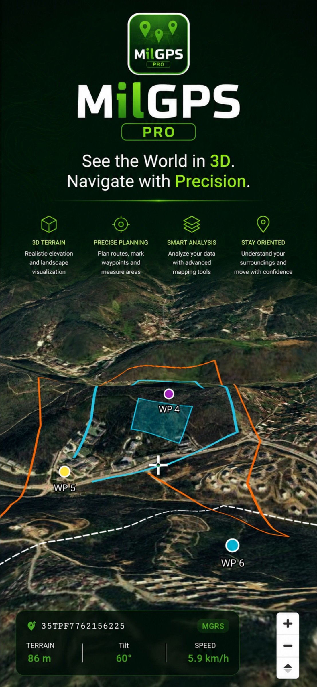
- 3D terrain view
TARGET MANAGEMENT
- Unlimited waypoint storage
- Long-press on map to instantly add a target
- Manual MGRS coordinate entry
- Import from GPX, KML, KMZ, CSV, and MGRS list
- Move, rename, and delete targets
- Export all targets as GPX
- Deep link target sharing
- Distance and bearing to target
COMPASS & NAVIGATION
- Real-time digital military compass
- Absolute and relative bearing display
- Target bearing indicator
- Route deviation warning
- ETA (estimated time of arrival) calculation
- Radar sweep compass display
ROUTE & MISSION MODE
- Draw routes directly on the map
- Multi-point route planning
- Save and load routes
- GPX route import/export
- Mission mode: active navigation with route tracking
- Route deviation indicator
- Total distance calculation
TRACK RECORDING
- Automatic track recording
- Stop and pause support
- Live speed, max speed, average speed
- Total ascent and descent calculation
- Max/min altitude tracking
- View saved tracks on the map
- Export tracks as GPX
SENSORS & LIVE DATA
- GPS accuracy indicator
- Altitude and terrain type (Flat / Hill / Mountain / High Altitude)
- Barometer and atmospheric pressure
- Live speed (km/h and mph)
- Local time and Zulu (UTC) DTG display
- Metric / Imperial unit toggle
TOOLS
- Coordinate converter (LAT/LON to MGRS/UTM)
- Area calculation
- Distance measurer
- Offline map downloader (Regional / District / Neighborhood zoom levels)
RELIABILITY & PERFORMANCE
- Full offline operation without internet connection
- Offline use with cached maps
- Background location tracking
- Optimized for low battery consumption
- All data stored on-device, privacy first
WHO IS IT FOR?
- Military personnel and security professionals
- Search and rescue teams
- Mountaineers and trekking enthusiasts
- Orienteering athletes
- Hunters and off-road drivers
- Map and navigation enthusiasts
Know your position at all times. Reach your objective in any condition.
LANGUAGE SUPPORT
With this update, MilGPS PRO is fully available in 32 languages. You can switch languages instantly from the sidebar menu within the app.
Supported languages:
Turkish, English, German, French, Spanish, Italian, Portuguese, Russian, Arabic, Chinese (Simplified), Japanese, Korean, Hindi, Bengali, Indonesian, Dutch, Polish, Swedish, Ukrainian, Vietnamese, Persian.
License: Commercial
MilGPS PRO is a professional-grade military GPS navigation app that puts everything you need in the field into a single application. Built for terrain, operations, and navigation.
LOCATION & COORDINATE SYSTEMS
- MGRS (Military Grid Reference System) — full 10-digit precision
- UTM coordinate system
- USNG (US National Grid)
- QTH Locator
- Decimal and DMS LAT/LON formats
- One-tap format switching
- Instant coordinate copy
ADVANCED MAP SYSTEM
- 6 map layers: Satellite, Topographic, Road, Hybrid, Terrain, Bing Satellite
- Military grid line overlay
- Hillshade relief, contour lines, and road name overlays
- Layer transparency control
- Map search by coordinate (MGRS, LAT/LON, DMS)
- Offline map download and caching
- 3D terrain view
TARGET MANAGEMENT
- Unlimited waypoint storage
- Long-press on map to instantly add a target
- Manual MGRS coordinate entry
- Import from GPX, KML, KMZ, CSV, and MGRS list
- Move, rename, and delete targets
- Export all targets as GPX
- Deep link target sharing
- Distance and bearing to target
COMPASS & NAVIGATION
- Real-time digital military compass
- Absolute and relative bearing display
- Target bearing indicator
- Route deviation warning
- ETA (estimated time of arrival) calculation
- Radar sweep compass display
ROUTE & MISSION MODE
- Draw routes directly on the map
- Multi-point route planning
- Save and load routes
- GPX route import/export
- Mission mode: active navigation with route tracking
- Route deviation indicator
- Total distance calculation
TRACK RECORDING
- Automatic track recording
- Stop and pause support
- Live speed, max speed, average speed
- Total ascent and descent calculation
- Max/min altitude tracking
- View saved tracks on the map
- Export tracks as GPX
SENSORS & LIVE DATA
- GPS accuracy indicator
- Altitude and terrain type (Flat / Hill / Mountain / High Altitude)
- Barometer and atmospheric pressure
- Live speed (km/h and mph)
- Local time and Zulu (UTC) DTG display
- Metric / Imperial unit toggle
TOOLS
- Coordinate converter (LAT/LON to MGRS/UTM)
- Area calculation
- Distance measurer
- Offline map downloader (Regional / District / Neighborhood zoom levels)
RELIABILITY & PERFORMANCE
- Full offline operation without internet connection
- Offline use with cached maps
- Background location tracking
- Optimized for low battery consumption
- All data stored on-device, privacy first
WHO IS IT FOR?
- Military personnel and security professionals
- Search and rescue teams
- Mountaineers and trekking enthusiasts
- Orienteering athletes
- Hunters and off-road drivers
- Map and navigation enthusiasts
Know your position at all times. Reach your objective in any condition.
LANGUAGE SUPPORT
With this update, MilGPS PRO is fully available in 32 languages. You can switch languages instantly from the sidebar menu within the app.
Supported languages:
Turkish, English, German, French, Spanish, Italian, Portuguese, Russian, Arabic, Chinese (Simplified), Japanese, Korean, Hindi, Bengali, Indonesian, Dutch, Polish, Swedish, Ukrainian, Vietnamese, Persian.
License: Commercial
| Release info | Update on Nov 11, 2026 |
|---|---|
| Release notes | • Landscape mode • Automatic route drawing along roads • Alfa interface theme • Sequential waypoint names • Searched point now stays on the map • Shapefile, large KMZ and image + world file support • Sharper GeoPDF • ED50 in CSV import, new SAD69 coordinates • Move areas on the map |
| Listing data | App Store |
Reviews
No reviews yet. Be the first to review MilGPS PRO.
Used MilGPS PRO? Tell other visitors what you thought.
Log in to write a reviewOther products by this publisher
- "No Distractions" for YouTube 4.10 ----
- #Bible 11.6 "Incredible App - My sister shared this app with me a few weeks ago and it is truly incredible.
- #filmphotography 1.4.2 So, you decided to shoot on film?
- $quirrel 1.5.1 $quirrel Budget & Finance helps you plan each paycheck, track spending, manage debt, and see what is safe to spend before the next payday.
- % Percentage Calculator Pro 1.41 This is the Pro version of % Percentage Calculator.
Most viewed iOS Navigation
-
1
 Compass App 1.0.5
Find your direction with style.
-
2
 CARFACE Car Widgets & Lyrics 1.2.1
Make every drive feel more personal with CarFace.
-
3
 iGlide Lite 2.9.66
NaviLogic iGlide - the Soaring Navigation app for iOS
-
4
 Open Road 1.2
Open Road is the one driving app for your iPhone.
-
5
 Turo 26.45.1
Turo is a better car rental app for travelers who want to rent a car without the rental counter.
-
6
 Fly Delta 7.17.3
Welcome to Fly Delta, Delta’s award winning iOS app.
-
7
 Kruger Birding by Firefinch 7.6.0
Go birding in South Africa's foremost birding spot: the world renowned Kruger National Park!
-
8
 Uber 3.747.10000
Join the millions of riders who trust Uber for their everyday travel needs.
-
9
 Lyft 2026.43.3
Get where you’re going with Lyft.
-
10
 Amtrak 6.1.8
Discover the convenience of traveling with Amtrak.
Most downloaded iOS Navigation
-
1
 Live Traffic 2.4
Navigate the globe with live traffic updates, satellite views, and location tools that make every journey clearer, smarter, and more confident from the very first tap.
-
2
 Peru’s Best 2.5
PERU’S BEST is the ideal travel guide to this extraordinary country.
-
3
 Outdoor Photography Magazine 7.2.10
Outdoor Photography is the magazine for photographers who are passionate about being out in wild places, seeing inspiring nature and having great adventures.
-
4
 Grand Egyptian Museum (GEM) 0.1.060
You could call this a coincidence but the acronym of the Grand Egyptian Museum is an apt title for the GEM, which is truly one!
-
5
 Pocket Luach Deluxe 60058
Pocket Luach Deluxe is a Jewish calendar, zmanim, Siddur, Tehillim, and personal-event companion for iPhone, iPad, and Apple Watch.
-
6
 Passeporté 1.3.2
Passeporté reads the NFC chip in your biometric passport or national eID card, verifies its authenticity, and stores the data securely on your device.
-
7
 Great Circle Map 1.7.5
A globe you can turn in any direction, including straight over the poles.
-
8
 UK Map 4.12
* Unlimited free map downloads based on Ordnance Survey® OpenData, at 1:25,000 and 1:10,000 scales, and now also paid map downloads at 1:50,000, 1:25,000 and 1:10,000 scales, just like the paper maps.
-
9
 Connecticut-Parks & Trails 1.0
App Feature
-
10
 Cell Phone Towers World Map 1.1.6
219 countres !! The world's largest Database of Cell & Net Towers