MGRS GPS 1.3
MGRS GPS turns your iPhone into a fast, glanceable military grid reference readout — built for soldiers, search-and-rescue teams, hunters, hikers, orienteers, and field researchers who think in grids and often work without a signal.
Download
32.90 MB
18downloads
3this week
FreeCommercial
0reviews
Screenshots
About MGRS GPS
MGRS GPS turns your iPhone into a fast, glanceable military grid reference readout — built for soldiers, search-and-rescue teams, hunters, hikers, orienteers, and field researchers who think in grids and often work without a signal.
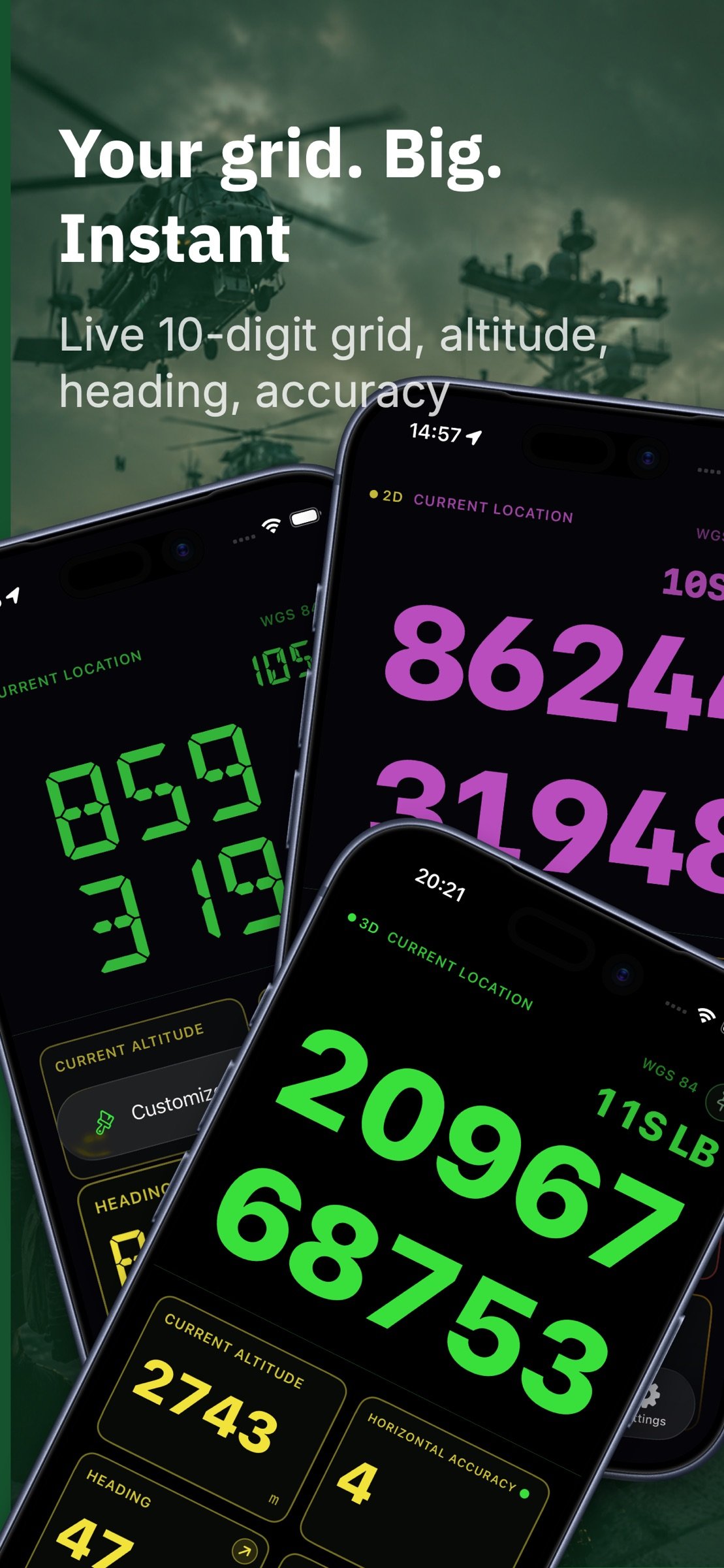
Your position is shown as a large, high-contrast MGRS grid you can read at arm's length and copy with one tap. Mark waypoints, organize them into color-coded overlays, navigate with a clear bearing-and-distance display, record breadcrumb tracks, and keep working when the cell signal drops.
POSITION, ANY FORMAT
• MGRS / USNG military grid reference
• UTM / UPS
• Latitude / Longitude (decimal, DDM, DMS)
• OSGB British National Grid
• Show up to three formats at once
• Each extra coordinate format can now be shown in its own datum
MAKE IT YOURS
• Choose the typeface and color of the grid readout and every data tile
• Six style packs, from instrument green to a true 14-segment amber LCD
• Style one tile on its own, or hand the whole screen to the readout
ONE-TAP SHARING
• Tap any readout to copy your grid instantly
• Share via the system share sheet
• Send a waypoint as a QR code
WAYPOINTS & OVERLAYS
• Mark your current location, a map point, or type a grid
• Group waypoints into toggleable, color-coded overlays
• Draw lines and polygons for routes, sectors, and boundaries
• Plan multi-point routes with per-leg distance and bearing
• Projected waypoints — create a point from a range and bearing off any origin
• Military symbols for friendly, hostile, neutral, and unknown units
MAP WITH A REAL GRID
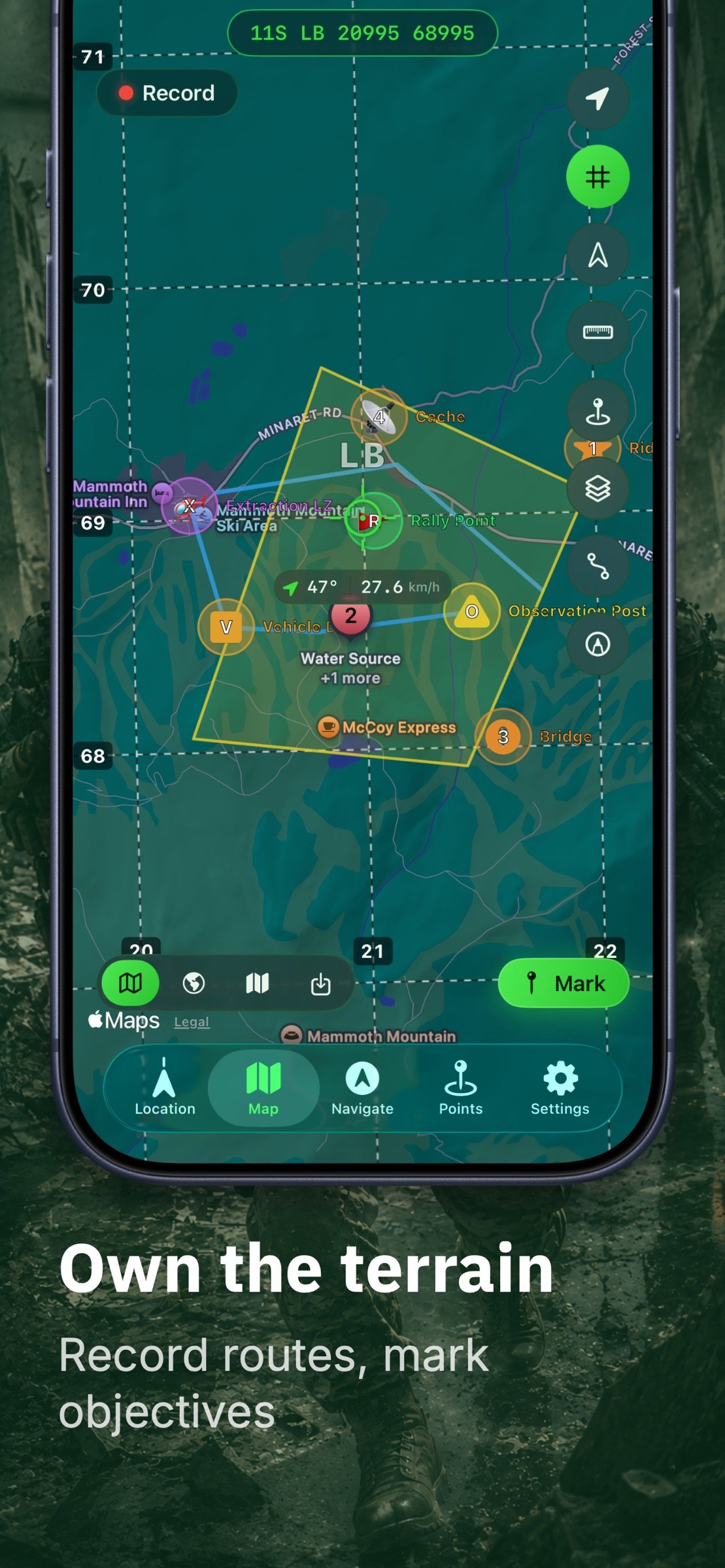
• Smooth, labeled MGRS / UTM grid overlay
• Measure ruler reads distance in degrees AND mils
• Range rings around your position, the map centre, or any waypoint
• Area shapes — place a square, rectangle, or circle from a centre point and a size
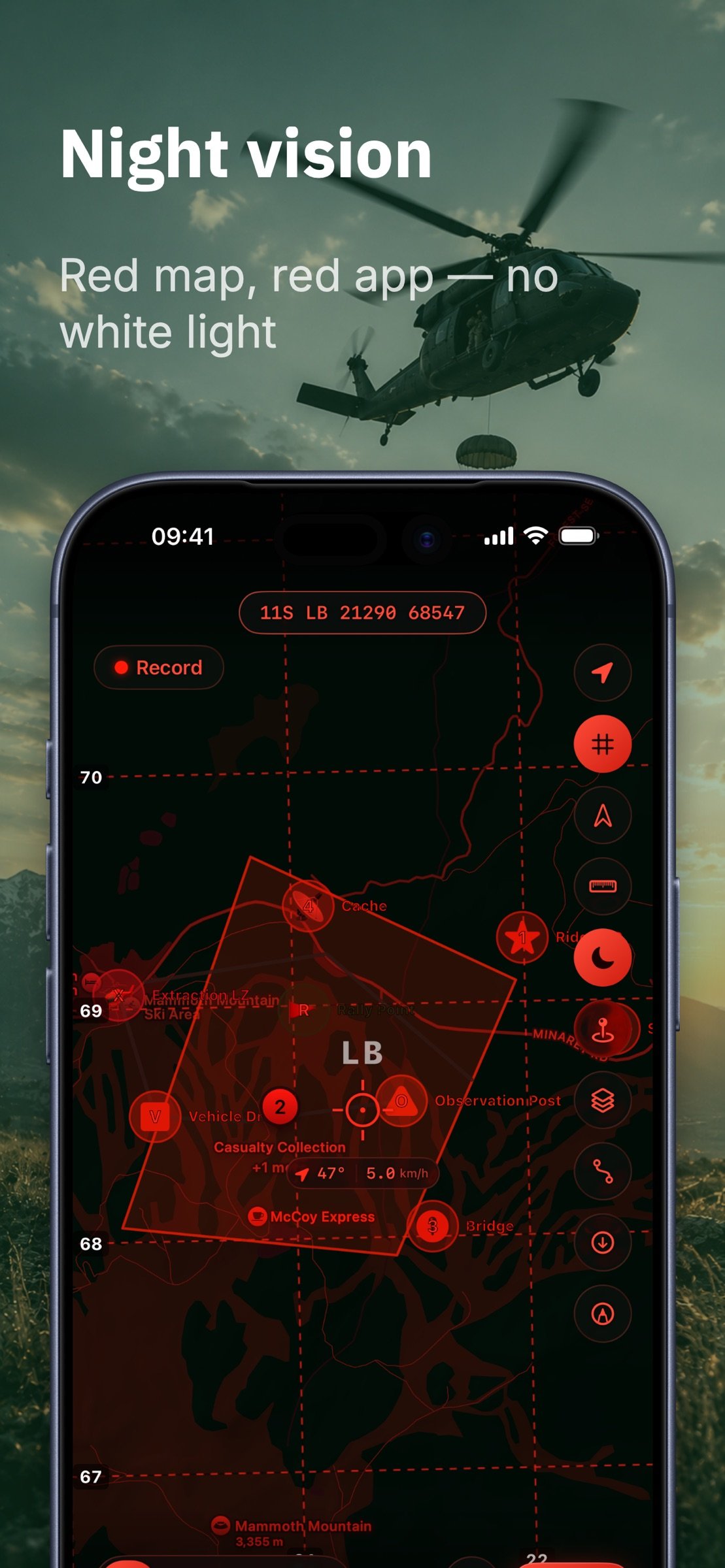
• Night vision — the whole app turns red, map included, with a one-tap switch on the Map screen
NAVIGATE
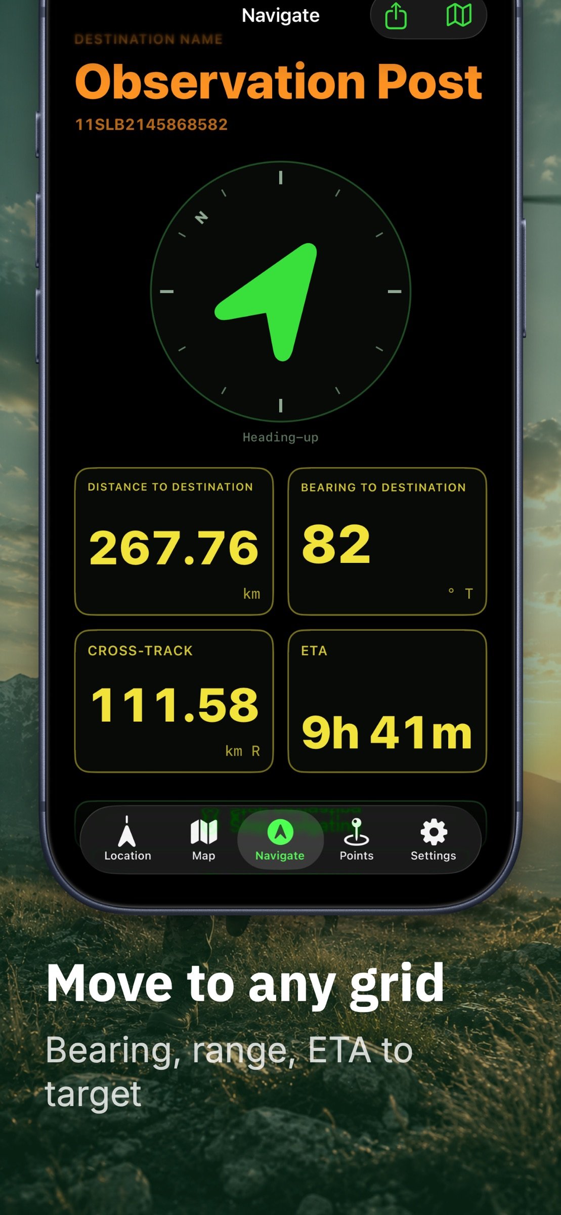
• Big bearing arrow, distance, cross-track, and ETA
• True, magnetic, or grid north reference
• Offline magnetic declination from an embedded World Magnetic Model (WMM2025)
• Arrival alert with haptic feedback
WORKS OFFLINE
• Built-in USGS topographic, imagery, and shaded-relief basemaps
• Download map areas for offline use — frame a box, pick the detail level, and see the tile count and size before it starts
• Offline Maps manager: rename, delete, and see what each area costs on disk
• Import your own offline maps (MBTiles raster)
• Add your own tile server for coverage outside the US
• Core navigation works with no cell signal
TRACK RECORDING
• Record breadcrumb tracks with distance, elevation gain, and time
• Export tracks as GPX
IMPORT & EXPORT
• Full GPX import / export (waypoints + tracks)
• KML and CSV import / export
APPLE WATCH
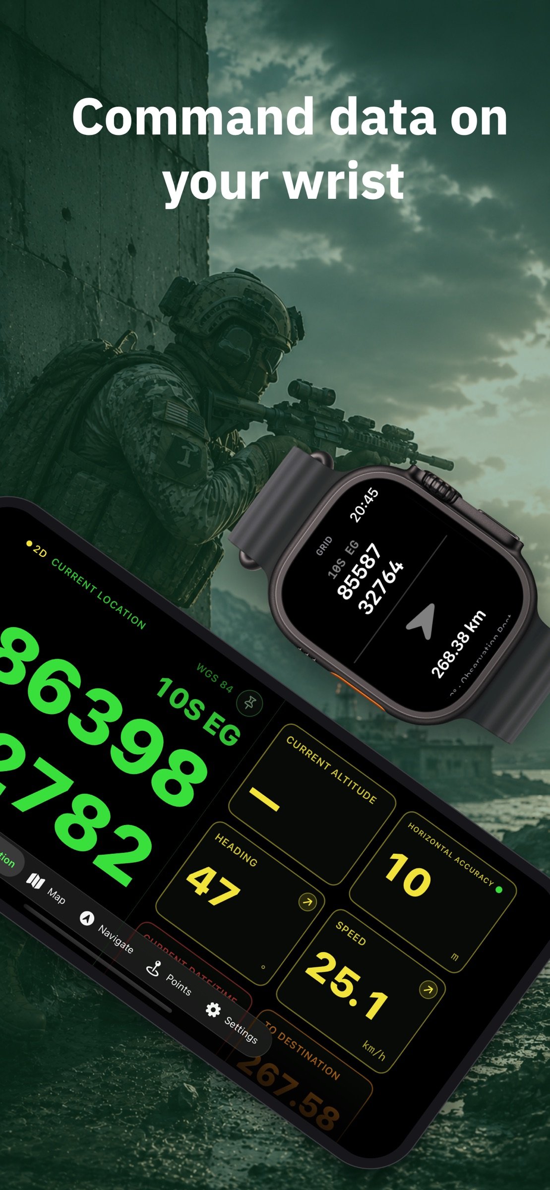
• Glance at your grid and bearing on your wrist
PRIVATE BY DESIGN
• No ads
• No subscriptions
• No accounts, no cloud sign-in
• No analytics SDKs or third-party trackers
• Your data stays on your device
MGRS GPS is a one-time purchase — every feature is included. No subscriptions, no in-app purchases, and no ads, ever.
Not certified for aviation, marine, surveying, live-fire, or military operations. Always carry a backup means of navigation.
License: Commercial
Your position is shown as a large, high-contrast MGRS grid you can read at arm's length and copy with one tap. Mark waypoints, organize them into color-coded overlays, navigate with a clear bearing-and-distance display, record breadcrumb tracks, and keep working when the cell signal drops.
POSITION, ANY FORMAT
• MGRS / USNG military grid reference
• UTM / UPS
• Latitude / Longitude (decimal, DDM, DMS)
• OSGB British National Grid
• Show up to three formats at once
• Each extra coordinate format can now be shown in its own datum
MAKE IT YOURS
• Choose the typeface and color of the grid readout and every data tile
• Six style packs, from instrument green to a true 14-segment amber LCD
• Style one tile on its own, or hand the whole screen to the readout
ONE-TAP SHARING
• Tap any readout to copy your grid instantly
• Share via the system share sheet
• Send a waypoint as a QR code
WAYPOINTS & OVERLAYS
• Mark your current location, a map point, or type a grid
• Group waypoints into toggleable, color-coded overlays
• Draw lines and polygons for routes, sectors, and boundaries
• Plan multi-point routes with per-leg distance and bearing
• Projected waypoints — create a point from a range and bearing off any origin
• Military symbols for friendly, hostile, neutral, and unknown units
MAP WITH A REAL GRID
• Smooth, labeled MGRS / UTM grid overlay
• Measure ruler reads distance in degrees AND mils
• Range rings around your position, the map centre, or any waypoint
• Area shapes — place a square, rectangle, or circle from a centre point and a size
• Night vision — the whole app turns red, map included, with a one-tap switch on the Map screen
NAVIGATE
• Big bearing arrow, distance, cross-track, and ETA
• True, magnetic, or grid north reference
• Offline magnetic declination from an embedded World Magnetic Model (WMM2025)
• Arrival alert with haptic feedback
WORKS OFFLINE
• Built-in USGS topographic, imagery, and shaded-relief basemaps
• Download map areas for offline use — frame a box, pick the detail level, and see the tile count and size before it starts
• Offline Maps manager: rename, delete, and see what each area costs on disk
• Import your own offline maps (MBTiles raster)
• Add your own tile server for coverage outside the US
• Core navigation works with no cell signal
TRACK RECORDING
• Record breadcrumb tracks with distance, elevation gain, and time
• Export tracks as GPX
IMPORT & EXPORT
• Full GPX import / export (waypoints + tracks)
• KML and CSV import / export
APPLE WATCH
• Glance at your grid and bearing on your wrist
PRIVATE BY DESIGN
• No ads
• No subscriptions
• No accounts, no cloud sign-in
• No analytics SDKs or third-party trackers
• Your data stays on your device
MGRS GPS is a one-time purchase — every feature is included. No subscriptions, no in-app purchases, and no ads, ever.
Not certified for aviation, marine, surveying, live-fire, or military operations. Always carry a backup means of navigation.
License: Commercial
| Release info | New Release on Sep 05, 2026 |
|---|---|
| Release notes | What's new: • Choose the typeface and color of the grid readout and every data tile • Six style packs, from instrument green to a true 14-segment amber LCD • Long-press any tile to give just that one its own font, color or size • Home layout — alignment, split rows, the label row, tile columns and height, plus a minimal mode • Night vision still overrides everything, and colors too pale for the light theme are darkened automatically • The home screen now scrolls in portrait, and the map's search button sits beside the coordinate pill No ads, no subscriptions, no tracking. Feedback is welcome! |
| Listing data | App Store |
Reviews
No reviews yet. Be the first to review MGRS GPS.
Used MGRS GPS? Tell other visitors what you thought.
Log in to write a reviewOther products by this publisher
- "No Distractions" for YouTube 4.10 ----
- #Bible 11.6.1 "Incredible App - My sister shared this app with me a few weeks ago and it is truly incredible.
- #filmphotography 1.4.2 So, you decided to shoot on film?
- $quirrel 1.5.1 $quirrel Budget & Finance helps you plan each paycheck, track spending, manage debt, and see what is safe to spend before the next payday.
- % Percentage Calculator Pro 1.41 This is the Pro version of % Percentage Calculator.
Most viewed iOS Navigation
-
1
 Compass App 1.0.5
Find your direction with style.
-
2
 CARFACE Car Widgets & Lyrics 1.2.1
Make every drive feel more personal with CarFace.
-
3
 Open Road 1.2
Open Road is the one driving app for your iPhone.
-
4
 iGlide Lite 2.9.66
NaviLogic iGlide - the Soaring Navigation app for iOS
-
5
 Turo 26.46.0
Turo is a better car rental app for travelers who want to rent a car without the rental counter.
-
6
 Pocket Luach Deluxe 60058
Pocket Luach Deluxe is a Jewish calendar, zmanim, Siddur, Tehillim, and personal-event companion for iPhone, iPad, and Apple Watch.
-
7
 Fly Delta 7.17.3
Welcome to Fly Delta, Delta’s award winning iOS app.
-
8
 Amtrak 6.1.8
Discover the convenience of traveling with Amtrak.
-
9
 Uber 3.748.10001
Join the millions of riders who trust Uber for their everyday travel needs.
-
10
 Lyft 2026.44.3
Get where you’re going with Lyft.
Most downloaded iOS Navigation
-
1
 Live Traffic 2.4
Navigate the globe with live traffic updates, satellite views, and location tools that make every journey clearer, smarter, and more confident from the very first tap.
-
2
 Peru’s Best 2.5
PERU’S BEST is the ideal travel guide to this extraordinary country.
-
3
 Outdoor Photography Magazine 7.2.10
Outdoor Photography is the magazine for photographers who are passionate about being out in wild places, seeing inspiring nature and having great adventures.
-
4
 Grand Egyptian Museum (GEM) 0.1.060
You could call this a coincidence but the acronym of the Grand Egyptian Museum is an apt title for the GEM, which is truly one!
-
5
Pocket Luach Deluxe 60058
Pocket Luach Deluxe is a Jewish calendar, zmanim, Siddur, Tehillim, and personal-event companion for iPhone, iPad, and Apple Watch.
-
6
 Passeporté 1.3.2
Passeporté reads the NFC chip in your biometric passport or national eID card, verifies its authenticity, and stores the data securely on your device.
-
7
 Great Circle Map 1.7.5
A globe you can turn in any direction, including straight over the poles.
-
8
 UK Map 4.12
* Unlimited free map downloads based on Ordnance Survey® OpenData, at 1:25,000 and 1:10,000 scales, and now also paid map downloads at 1:50,000, 1:25,000 and 1:10,000 scales, just like the paper maps.
-
9
 Connecticut-Parks & Trails 1.0
App Feature
-
10
 Cell Phone Towers World Map 1.1.6
219 countres !! The world's largest Database of Cell & Net Towers