Marine Navigation-USA Lake Map 150.0.0
Marine Navigation App offers access to NOAA marine vector charts, freshwater lake maps, USACE inland river maps.
Download
48.47 MB
20downloads
0this week
FreeCommercial
0reviews
Screenshots

About Marine Navigation-USA Lake Map
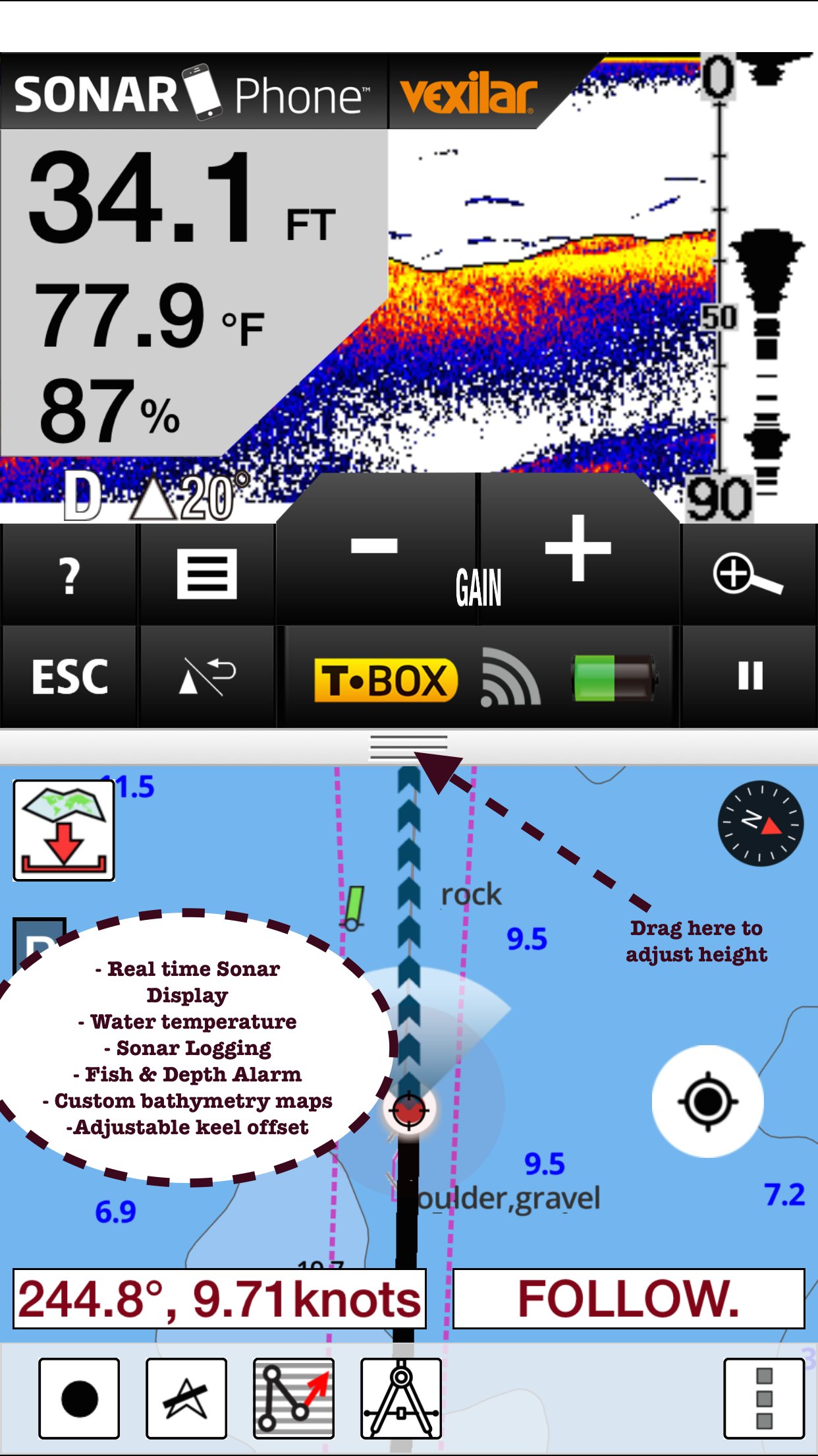
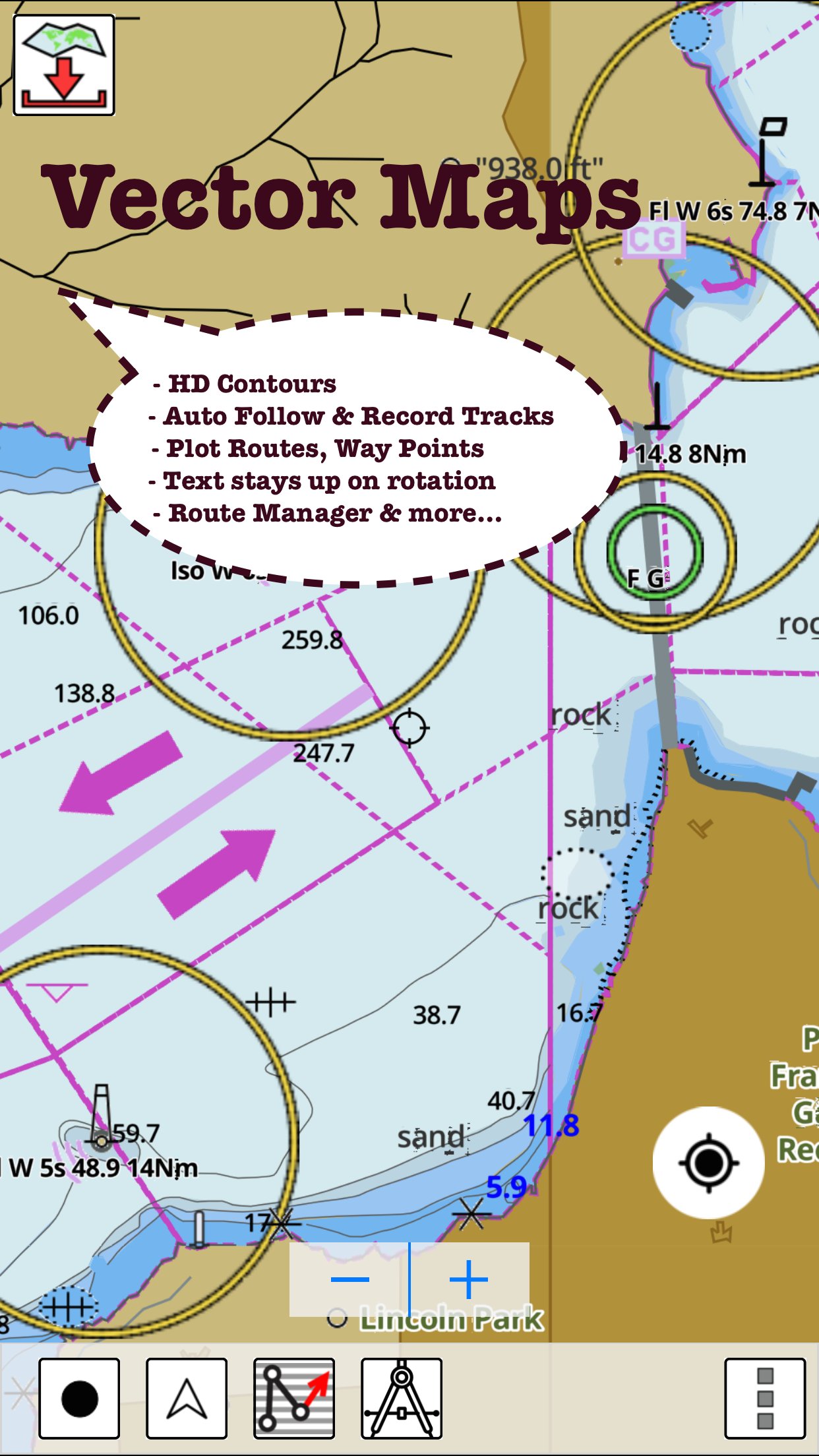
Marine Navigation App offers access to NOAA marine vector charts, freshwater lake maps, USACE inland river maps. Only marine GPS app to have route assistance with Voice Prompts for marine navigation. It has route manager to create new boating routes or import existing GPX/KML routes. It supports Nautical Charts course up orientation. Includes Tide & Currents prediction.
* Hardware/GPU accelarated vector charts (text stays upright on rotation).
* Voice Prompts for marine navigation (requires GPS )
* 1ft / 3ft depth contour maps for anglers for selected lake maps.
* Supports GPX/KML for boating route editing/import.
* Tide & Currents prediction.
* Seamless chart quilting of marine charts
* Enter way points
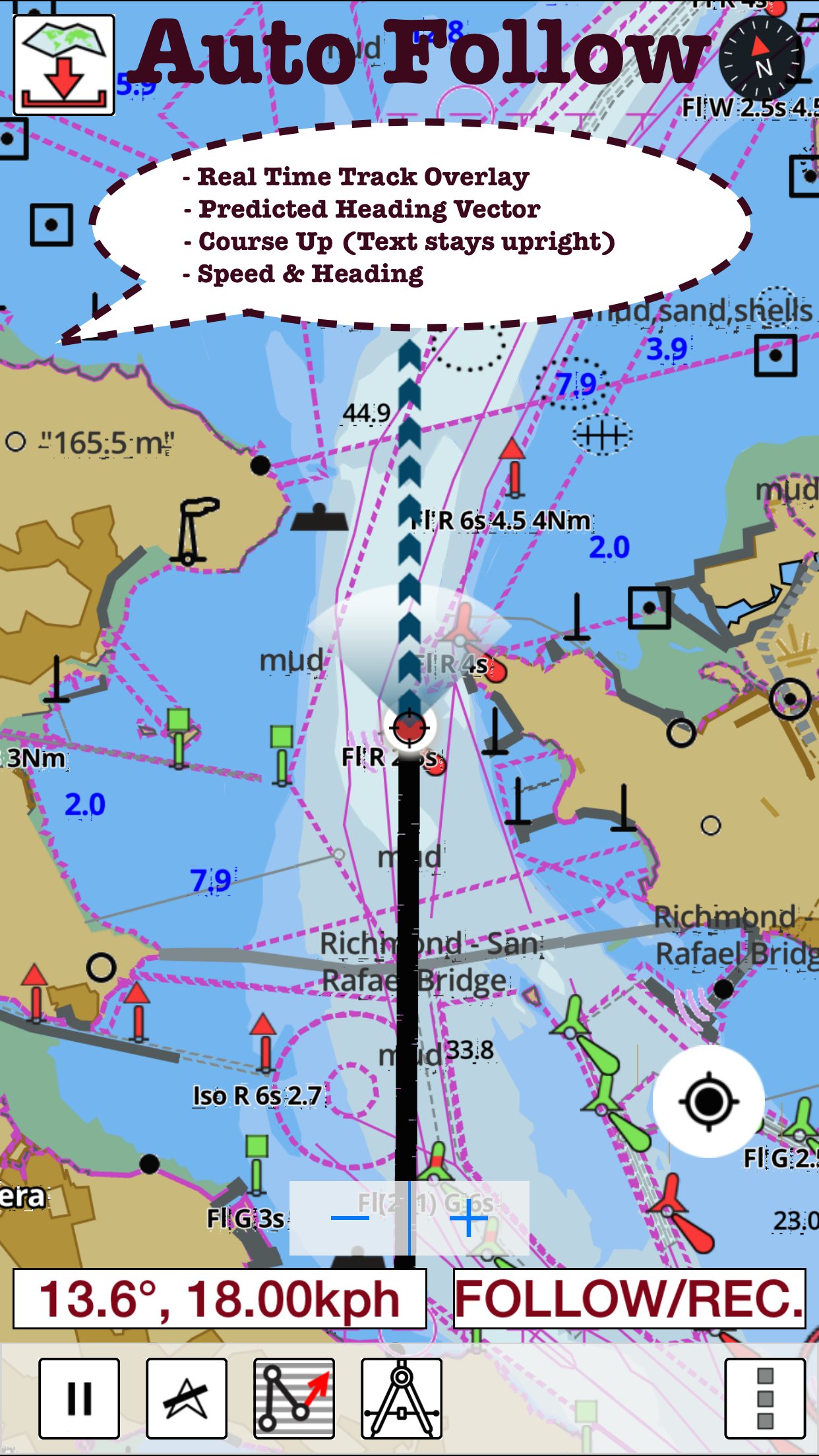
* Record tracks, Autofollow with realtime track overlay
* Voice Prompts for marine navigation (requires GPS )
-prompts when approaching a boating route marker
-Continous distance and ETA updates
-Alerts when sailing/boating off route
-Alerts when boating in wrong direction
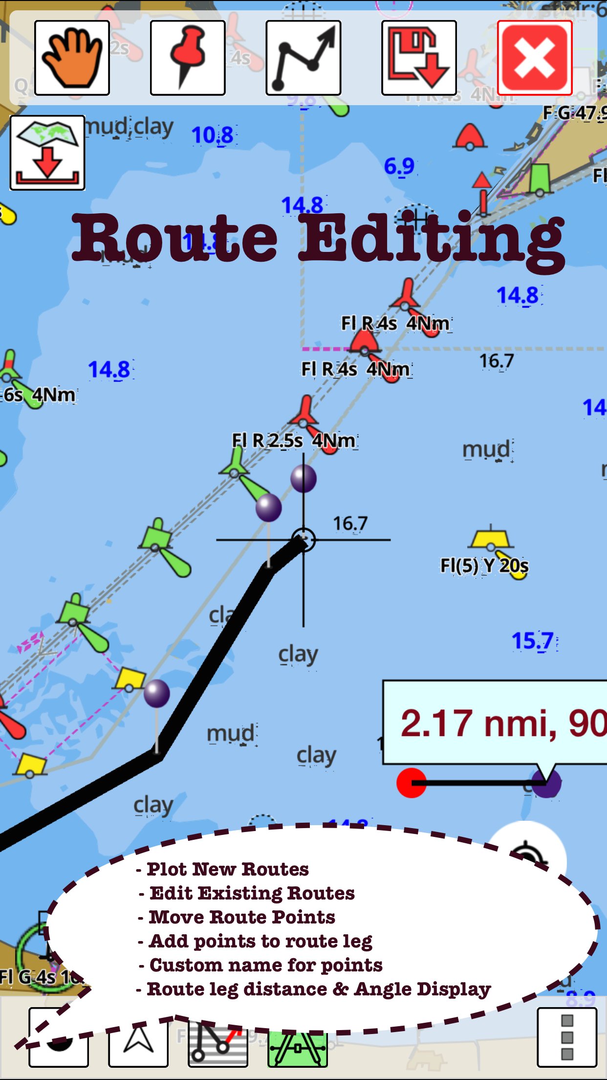
*Route Editing/Creation
-Create routes from scratch
-Edit existing GPX/KML routes.
-Add custom description to any route point.
-Drop markers along route.
* Offline NOAA marine, lake & river charts
-Visually download using grid
-Textual search
* Tide & Currents
- High / Low tides.
- Tidal Currents.
- Active currents stations.
*Seamless chart quilting of marine charts
*Distance Bearing tool
*Create custom way points
- Using GPS
-Select point on map
-Manually enter latitude & longitude coordinates
*Pan/Zoom/My Location
* Record Marine GPS tracks
* View tracks overlay
* Live track animation
* Track analytics/stats
* Export GPX trcks.
-Export to SDCard
-Share GPX tracks with friends.
* Auto Follow Mode (Course up)
-Continuously updates boat's location on chart
- Adjustable update frequency
Sample Nautical Charts (please visit [link removed] for complete list)
SUGARLOAF KEY-KEY WEST
PORT RICHEY TAMPA BAY - CLEARWATER HBR
EAST BAY-WEST BAY FLORIDA
ST JOSEPH, ST ANDREW BAYS
INTRACOASTAL WATERWAY MATECUMBE-GRASSY KEY
CHESAPEAKE BAY CAPE CHARLES-NORFOLK HARBOR
ANCLOTE KEYS-CRYSTAL RIVER
ST JOSEPH SOUND
MIAMI HARBOR
Minnesota lakes - Kabetogama, Minnetonka, Waconia,Leech,Mille Lacs
Lake Keowee,Jocassee,Hartwell,Greenwood,Lake Murray
Mark Twain,Ozarks,Table Rock
Lake St. Clair
Lake Kentucky
KEY WEST-THE MISSISSIPPI RIVER
SAN PEDRO CHANNEL
LAKE MICHIGAN STONY LAKE-POINT BETSIE
APALACHICOLA BAY-CAPE SAN BLAS
EAST CAPE-MORMON KEY
CAPE HENLOPEN-INDIAN RIVER INLET
CHESAPEAKE BAY CAPE HENRY-THIMBLE SHOAL LIGHT
DULUTH-SUPERIOR HARBOR
MONHEGAN ISLAND-CAPE ELIZABETH
LAKE ONTARIO - CLAYTON-FALSE DUCKS ISL
Lake Winnipesaukee
SAN FRANCISCO ENTRANCE
MIAMI-MARATHON, FLORIDA BAY
CAPE MAY-FENWICK ISLAND
MISSISSIPPI RIVER-GALVESTON
CAPE CANAVERAL-KEY WEST
DELAWARE RIVER WILMINGTON-PHILADELPHIA
FLORIDA KEYS SOMBRERO KEY-SAND KEY
SAN PABLO BAY
RAINY LAKE BIG ISLAND MINN-OAKPOINT ISL ONT
INTRACOASTAL WATERWAY - BISCAYNE BAY
EVERGLADES NTL PARK - SHARK RVR-LOSTMANS RVR
MIAMI-MARATHON & FLORIDA BAY
BLACKBURN BAY
LAKE HURON
LAKE TAHOE
STRAITS OF MACKINAC
NORFOLK HARBOR & ELIZABETH RIVER
SAN DIEGO-SANTA ROSA ISLAND
DELAWARE BAY
CHOPTANK RIVER CAMBRIDGE-GREENSBORO
FORT LAUDERDALE PORT EVERGLADES
ST SIMONS SOUND-TOLOMATO RIVER
CHESAPEAKE DELAWARE CANAL
CAPE MENDOCINO
STRAIT OF JUAN DE FUCA ENTRANCE
PORT RICHEY CLEARWATER HBR
PAMPANO BEACH-HALLADALE FLORIDA
LAKE ERIE
LAKE MICHIGAN INCLUDING GREEN BAY
MAIMI-MARATHON and FLORIDA BAY
SANTA CATALINA ISLAND
APALACHICOLA BAY-LAKE WIMICO
Battery Disclaimer:
"Continued use of GPS running in the background can dramatically decrease battery life."
License: Commercial
* Hardware/GPU accelarated vector charts (text stays upright on rotation).
* Voice Prompts for marine navigation (requires GPS )
* 1ft / 3ft depth contour maps for anglers for selected lake maps.
* Supports GPX/KML for boating route editing/import.
* Tide & Currents prediction.
* Seamless chart quilting of marine charts
* Enter way points
* Record tracks, Autofollow with realtime track overlay
* Voice Prompts for marine navigation (requires GPS )
-prompts when approaching a boating route marker
-Continous distance and ETA updates
-Alerts when sailing/boating off route
-Alerts when boating in wrong direction
*Route Editing/Creation
-Create routes from scratch
-Edit existing GPX/KML routes.
-Add custom description to any route point.
-Drop markers along route.
* Offline NOAA marine, lake & river charts
-Visually download using grid
-Textual search
* Tide & Currents
- High / Low tides.
- Tidal Currents.
- Active currents stations.
*Seamless chart quilting of marine charts
*Distance Bearing tool
*Create custom way points
- Using GPS
-Select point on map
-Manually enter latitude & longitude coordinates
*Pan/Zoom/My Location
* Record Marine GPS tracks
* View tracks overlay
* Live track animation
* Track analytics/stats
* Export GPX trcks.
-Export to SDCard
-Share GPX tracks with friends.
* Auto Follow Mode (Course up)
-Continuously updates boat's location on chart
- Adjustable update frequency
Sample Nautical Charts (please visit [link removed] for complete list)
SUGARLOAF KEY-KEY WEST
PORT RICHEY TAMPA BAY - CLEARWATER HBR
EAST BAY-WEST BAY FLORIDA
ST JOSEPH, ST ANDREW BAYS
INTRACOASTAL WATERWAY MATECUMBE-GRASSY KEY
CHESAPEAKE BAY CAPE CHARLES-NORFOLK HARBOR
ANCLOTE KEYS-CRYSTAL RIVER
ST JOSEPH SOUND
MIAMI HARBOR
Minnesota lakes - Kabetogama, Minnetonka, Waconia,Leech,Mille Lacs
Lake Keowee,Jocassee,Hartwell,Greenwood,Lake Murray
Mark Twain,Ozarks,Table Rock
Lake St. Clair
Lake Kentucky
KEY WEST-THE MISSISSIPPI RIVER
SAN PEDRO CHANNEL
LAKE MICHIGAN STONY LAKE-POINT BETSIE
APALACHICOLA BAY-CAPE SAN BLAS
EAST CAPE-MORMON KEY
CAPE HENLOPEN-INDIAN RIVER INLET
CHESAPEAKE BAY CAPE HENRY-THIMBLE SHOAL LIGHT
DULUTH-SUPERIOR HARBOR
MONHEGAN ISLAND-CAPE ELIZABETH
LAKE ONTARIO - CLAYTON-FALSE DUCKS ISL
Lake Winnipesaukee
SAN FRANCISCO ENTRANCE
MIAMI-MARATHON, FLORIDA BAY
CAPE MAY-FENWICK ISLAND
MISSISSIPPI RIVER-GALVESTON
CAPE CANAVERAL-KEY WEST
DELAWARE RIVER WILMINGTON-PHILADELPHIA
FLORIDA KEYS SOMBRERO KEY-SAND KEY
SAN PABLO BAY
RAINY LAKE BIG ISLAND MINN-OAKPOINT ISL ONT
INTRACOASTAL WATERWAY - BISCAYNE BAY
EVERGLADES NTL PARK - SHARK RVR-LOSTMANS RVR
MIAMI-MARATHON & FLORIDA BAY
BLACKBURN BAY
LAKE HURON
LAKE TAHOE
STRAITS OF MACKINAC
NORFOLK HARBOR & ELIZABETH RIVER
SAN DIEGO-SANTA ROSA ISLAND
DELAWARE BAY
CHOPTANK RIVER CAMBRIDGE-GREENSBORO
FORT LAUDERDALE PORT EVERGLADES
ST SIMONS SOUND-TOLOMATO RIVER
CHESAPEAKE DELAWARE CANAL
CAPE MENDOCINO
STRAIT OF JUAN DE FUCA ENTRANCE
PORT RICHEY CLEARWATER HBR
PAMPANO BEACH-HALLADALE FLORIDA
LAKE ERIE
LAKE MICHIGAN INCLUDING GREEN BAY
MAIMI-MARATHON and FLORIDA BAY
SANTA CATALINA ISLAND
APALACHICOLA BAY-LAKE WIMICO
Battery Disclaimer:
"Continued use of GPS running in the background can dramatically decrease battery life."
License: Commercial
| Release info | New Release on Oct 29, 2024 |
|---|---|
| Release notes | - Relief Shading - Automatic Routing - Lake Temperatures - Compiled with laest version of Xcode |
| Listing data | App Store |
Reviews
No reviews yet. Be the first to review Marine Navigation-USA Lake Map.
Used Marine Navigation-USA Lake Map? Tell other visitors what you thought.
Log in to write a reviewOther products by this publisher
- "No Distractions" for YouTube 4.10 ----
- #Bible 11.6 "Incredible App - My sister shared this app with me a few weeks ago and it is truly incredible.
- #filmphotography 1.4.2 So, you decided to shoot on film?
- $quirrel 1.5.1 $quirrel Budget & Finance helps you plan each paycheck, track spending, manage debt, and see what is safe to spend before the next payday.
- % Percentage Calculator Pro 1.41 This is the Pro version of % Percentage Calculator.
Most viewed iOS Navigation
-
1
 Compass App 1.0.5
Find your direction with style.
-
2
 CARFACE Car Widgets & Lyrics 1.2.1
Make every drive feel more personal with CarFace.
-
3
 iGlide Lite 2.9.66
NaviLogic iGlide - the Soaring Navigation app for iOS
-
4
 Open Road 1.2
Open Road is the one driving app for your iPhone.
-
5
 Turo 26.45.1
Turo is a better car rental app for travelers who want to rent a car without the rental counter.
-
6
 Fly Delta 7.17.3
Welcome to Fly Delta, Delta’s award winning iOS app.
-
7
 Uber 3.748.10001
Join the millions of riders who trust Uber for their everyday travel needs.
-
8
 Lyft 2026.44.3
Get where you’re going with Lyft.
-
9
 Kruger Birding by Firefinch 7.6.0
Go birding in South Africa's foremost birding spot: the world renowned Kruger National Park!
-
10
 Amtrak 6.1.8
Discover the convenience of traveling with Amtrak.
Most downloaded iOS Navigation
-
1
 Live Traffic 2.4
Navigate the globe with live traffic updates, satellite views, and location tools that make every journey clearer, smarter, and more confident from the very first tap.
-
2
 Peru’s Best 2.5
PERU’S BEST is the ideal travel guide to this extraordinary country.
-
3
 Outdoor Photography Magazine 7.2.10
Outdoor Photography is the magazine for photographers who are passionate about being out in wild places, seeing inspiring nature and having great adventures.
-
4
 Pocket Luach Deluxe 60058
Pocket Luach Deluxe is a Jewish calendar, zmanim, Siddur, Tehillim, and personal-event companion for iPhone, iPad, and Apple Watch.
-
5
 Grand Egyptian Museum (GEM) 0.1.060
You could call this a coincidence but the acronym of the Grand Egyptian Museum is an apt title for the GEM, which is truly one!
-
6
 Passeporté 1.3.2
Passeporté reads the NFC chip in your biometric passport or national eID card, verifies its authenticity, and stores the data securely on your device.
-
7
 Great Circle Map 1.7.5
A globe you can turn in any direction, including straight over the poles.
-
8
 UK Map 4.12
* Unlimited free map downloads based on Ordnance Survey® OpenData, at 1:25,000 and 1:10,000 scales, and now also paid map downloads at 1:50,000, 1:25,000 and 1:10,000 scales, just like the paper maps.
-
9
 Connecticut-Parks & Trails 1.0
App Feature
-
10
 Cell Phone Towers World Map 1.1.6
219 countres !! The world's largest Database of Cell & Net Towers