
Live Satellite View & GPS Maps 1.0.7
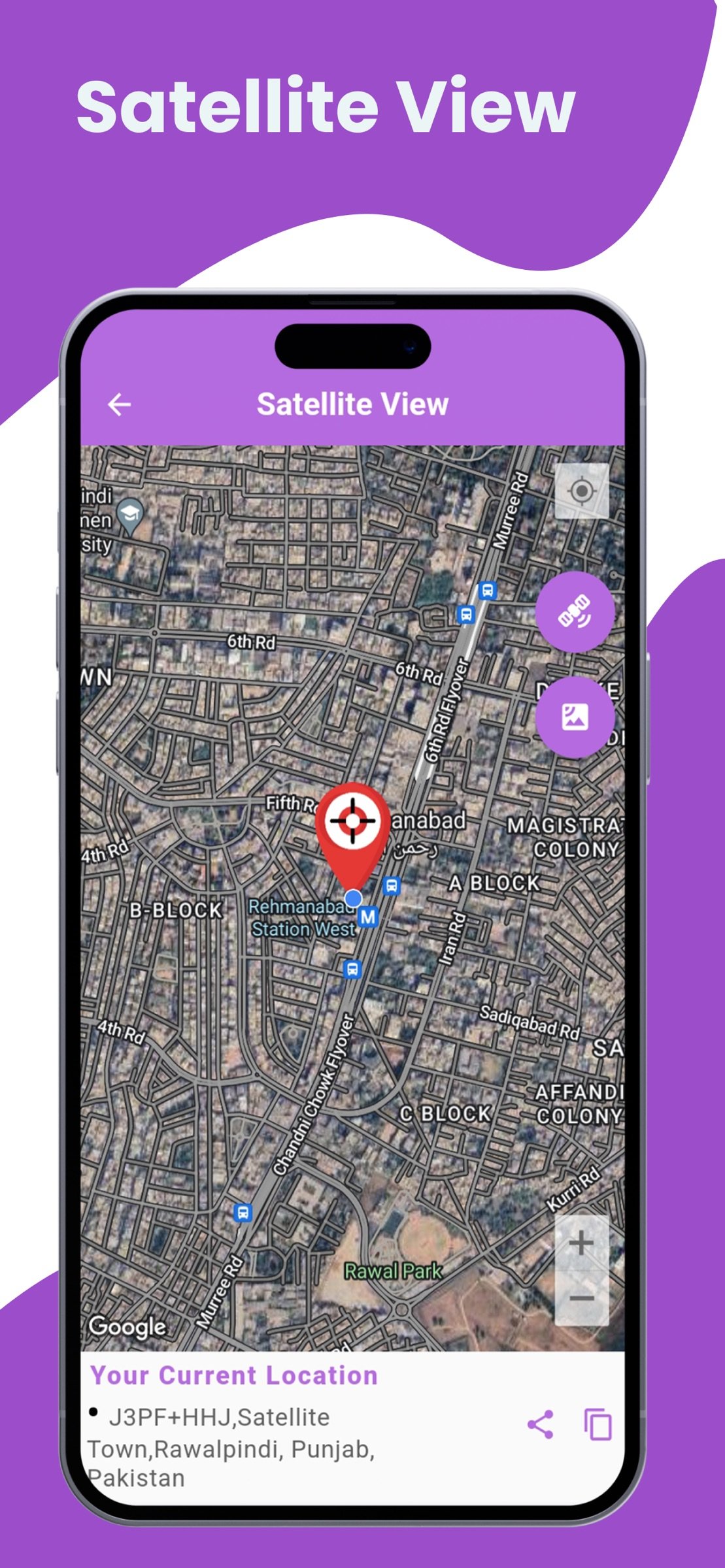
Satellite View is your ultimate tool for exploring the world from a whole new perspective!
Download
89.87 MB
20downloads
0this week
FreeFreeware
0reviews
Screenshots
About Live Satellite View & GPS Maps
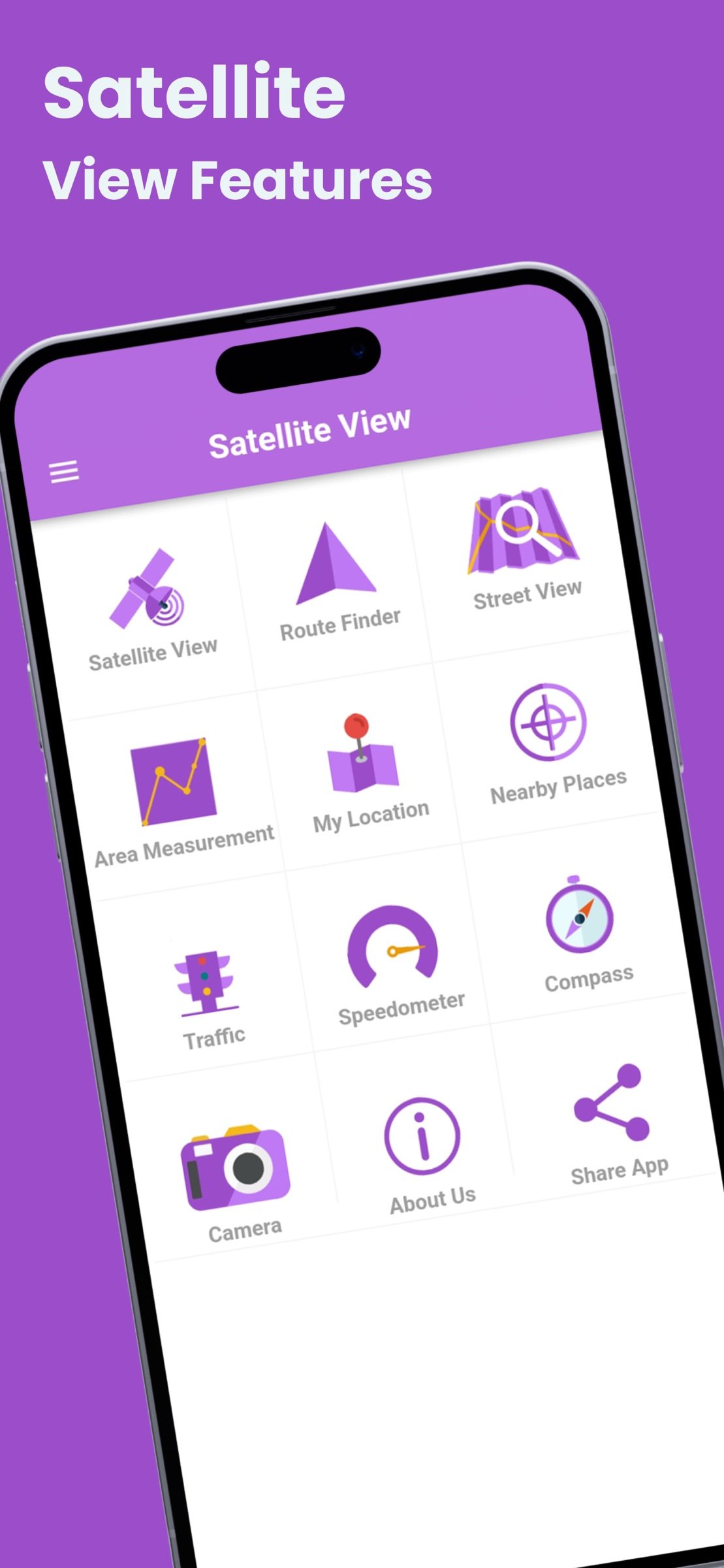
Satellite View is your ultimate tool for exploring the world from a whole new perspective! With high-resolution satellite imagery and real-time GPS tracking, this app lets you view any location on Earth from space. Whether you're planning a trip, exploring remote regions, or simply curious about the world around you, Satellite View offers seamless access to a wealth of geographical data, all at your fingertips.
Key Features:
* Real-Time Satellite Imagery: Access up-to-date satellite images of any location worldwide, allowing you to explore Earth with vivid, high-resolution details.
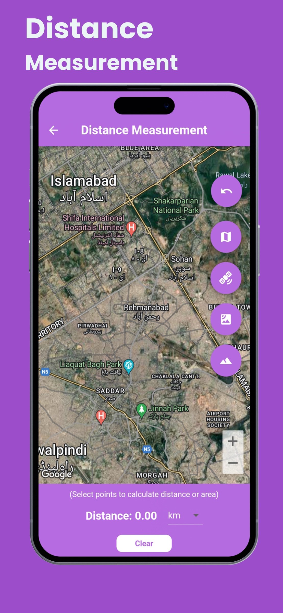
* Interactive Maps & Navigation: Seamlessly switch between satellite, terrain, and hybrid map views to navigate and explore locations with ease.
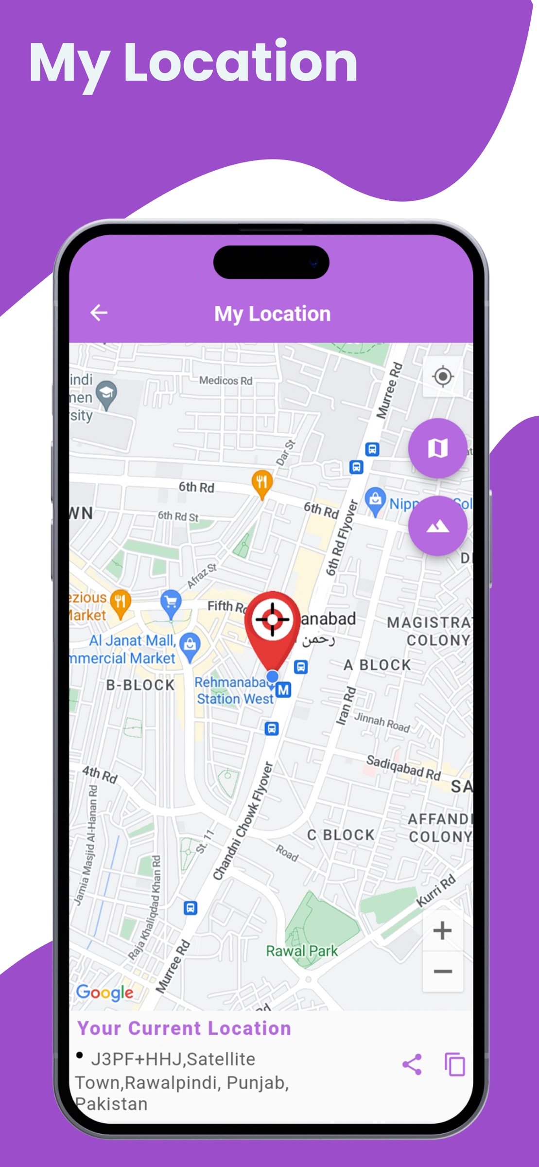
* GPS Tracking: Pinpoint your exact location with live GPS tracking, making it easy to plan routes and discover places nearby.
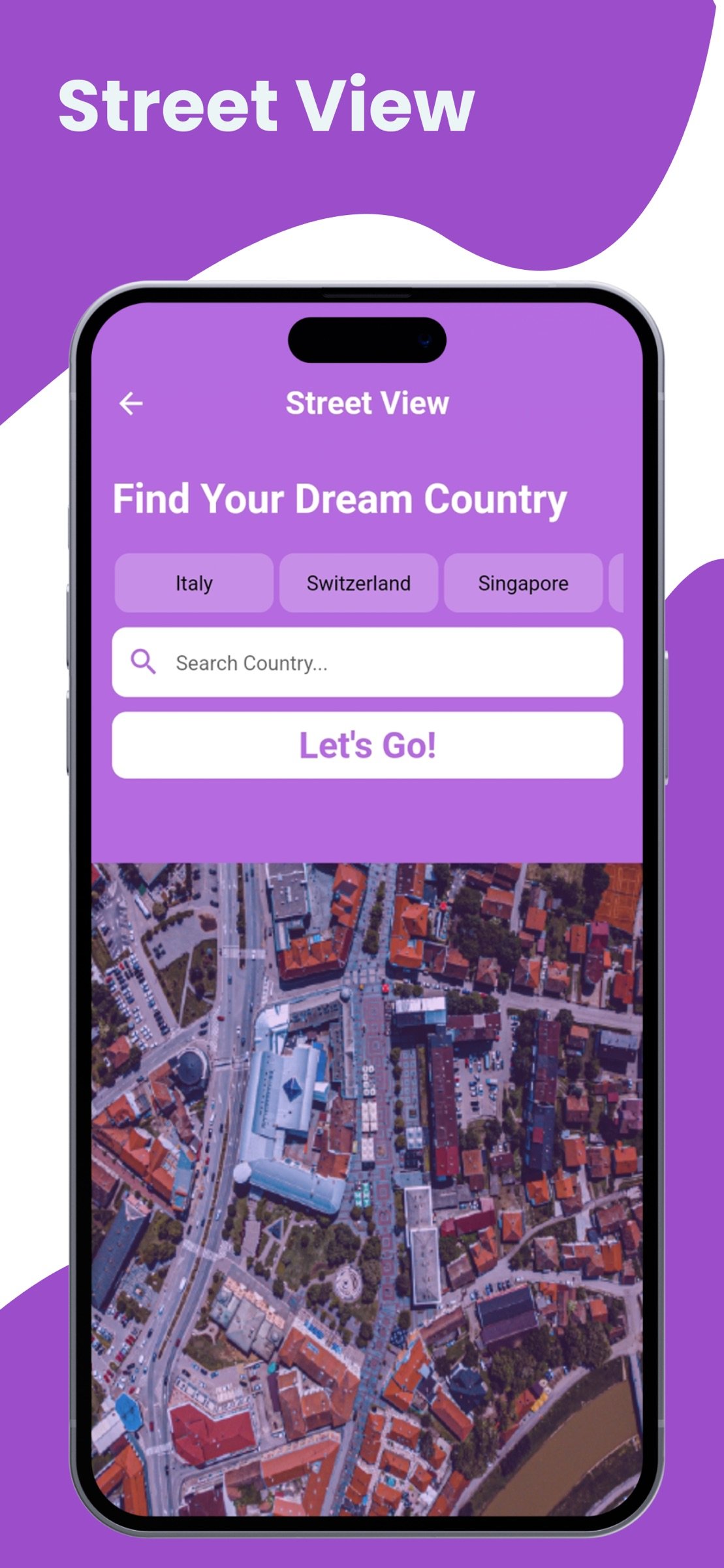
* Global Coverage: View satellite images from every corner of the planet, including urban areas, landscapes, oceans, and even remote regions.
* Zoom In/Out: Enjoy smooth zooming features, enabling you to get a closer look at both small and large geographical features.
* Satellite Layers & Customization: Toggle various layers, such as terrain, roads, borders, and more, for a personalized map experience.
* Historical Imagery: Explore past satellite imagery to see how specific areas have changed over time.
* User-Friendly Interface: Designed with simplicity in mind, the app’s intuitive interface makes it easy for users of all ages to navigate and explore.
* Offline Mode: Download specific regions for offline use, allowing you to access satellite imagery even when you’re not connected to the internet.
* Travel Planning: Get a bird's-eye view of destinations to plan your trips and understand the geography of your surroundings.
* Education & Learning: Ideal for students and researchers, the app provides an interactive platform for learning about the Earth’s geography, climate, and ecosystems.
* Outdoor Adventures: Use the satellite imagery to explore hiking trails, camping spots, and remote natural areas with real-world accuracy.
* Real Estate & Property Search: Explore property locations, assess landscapes, and analyze the proximity of amenities and infrastructure.
*
With Satellite View, you can explore Earth’s beauty, discover hidden locations, and view the planet as you've never seen before. Stay up-to-date with the latest satellite imagery and make informed decisions with real-time GPS data. Whether you’re a traveler, student, or outdoor enthusiast, Satellite View is your go-to app for exploring the world.
License: Free
Key Features:
* Real-Time Satellite Imagery: Access up-to-date satellite images of any location worldwide, allowing you to explore Earth with vivid, high-resolution details.
* Interactive Maps & Navigation: Seamlessly switch between satellite, terrain, and hybrid map views to navigate and explore locations with ease.
* GPS Tracking: Pinpoint your exact location with live GPS tracking, making it easy to plan routes and discover places nearby.
* Global Coverage: View satellite images from every corner of the planet, including urban areas, landscapes, oceans, and even remote regions.
* Zoom In/Out: Enjoy smooth zooming features, enabling you to get a closer look at both small and large geographical features.
* Satellite Layers & Customization: Toggle various layers, such as terrain, roads, borders, and more, for a personalized map experience.
* Historical Imagery: Explore past satellite imagery to see how specific areas have changed over time.
* User-Friendly Interface: Designed with simplicity in mind, the app’s intuitive interface makes it easy for users of all ages to navigate and explore.
* Offline Mode: Download specific regions for offline use, allowing you to access satellite imagery even when you’re not connected to the internet.
* Travel Planning: Get a bird's-eye view of destinations to plan your trips and understand the geography of your surroundings.
* Education & Learning: Ideal for students and researchers, the app provides an interactive platform for learning about the Earth’s geography, climate, and ecosystems.
* Outdoor Adventures: Use the satellite imagery to explore hiking trails, camping spots, and remote natural areas with real-world accuracy.
* Real Estate & Property Search: Explore property locations, assess landscapes, and analyze the proximity of amenities and infrastructure.
*
With Satellite View, you can explore Earth’s beauty, discover hidden locations, and view the planet as you've never seen before. Stay up-to-date with the latest satellite imagery and make informed decisions with real-time GPS data. Whether you’re a traveler, student, or outdoor enthusiast, Satellite View is your go-to app for exploring the world.
License: Free
| Release info | New Release on May 31, 2025 |
|---|---|
| Release notes | -bug fix |
| Listing data | App Store |
Reviews
No reviews yet. Be the first to review Live Satellite View & GPS Maps.
Used Live Satellite View & GPS Maps? Tell other visitors what you thought.
Log in to write a reviewOther products by this publisher
- "No Distractions" for YouTube 4.10 ----
- #Bible 11.6 "Incredible App - My sister shared this app with me a few weeks ago and it is truly incredible.
- #filmphotography 1.4.2 So, you decided to shoot on film?
- $quirrel 1.5.1 $quirrel Budget & Finance helps you plan each paycheck, track spending, manage debt, and see what is safe to spend before the next payday.
- % Percentage Calculator Pro 1.41 This is the Pro version of % Percentage Calculator.
Most viewed iOS Navigation
-
1
 Compass App 1.0.5
Find your direction with style.
-
2
 CARFACE Car Widgets & Lyrics 1.2.1
Make every drive feel more personal with CarFace.
-
3
 iGlide Lite 2.9.66
NaviLogic iGlide - the Soaring Navigation app for iOS
-
4
 Open Road 1.2
Open Road is the one driving app for your iPhone.
-
5
 Turo 26.45.1
Turo is a better car rental app for travelers who want to rent a car without the rental counter.
-
6
 Fly Delta 7.17.3
Welcome to Fly Delta, Delta’s award winning iOS app.
-
7
 Kruger Birding by Firefinch 7.6.0
Go birding in South Africa's foremost birding spot: the world renowned Kruger National Park!
-
8
 Uber 3.747.10000
Join the millions of riders who trust Uber for their everyday travel needs.
-
9
 Lyft 2026.43.3
Get where you’re going with Lyft.
-
10
 Amtrak 6.1.8
Discover the convenience of traveling with Amtrak.
Most downloaded iOS Navigation
-
1
 Live Traffic 2.4
Navigate the globe with live traffic updates, satellite views, and location tools that make every journey clearer, smarter, and more confident from the very first tap.
-
2
 Peru’s Best 2.5
PERU’S BEST is the ideal travel guide to this extraordinary country.
-
3
 Outdoor Photography Magazine 7.2.10
Outdoor Photography is the magazine for photographers who are passionate about being out in wild places, seeing inspiring nature and having great adventures.
-
4
 Grand Egyptian Museum (GEM) 0.1.060
You could call this a coincidence but the acronym of the Grand Egyptian Museum is an apt title for the GEM, which is truly one!
-
5
 Pocket Luach Deluxe 60058
Pocket Luach Deluxe is a Jewish calendar, zmanim, Siddur, Tehillim, and personal-event companion for iPhone, iPad, and Apple Watch.
-
6
 Passeporté 1.3.2
Passeporté reads the NFC chip in your biometric passport or national eID card, verifies its authenticity, and stores the data securely on your device.
-
7
 Great Circle Map 1.7.5
A globe you can turn in any direction, including straight over the poles.
-
8
 UK Map 4.12
* Unlimited free map downloads based on Ordnance Survey® OpenData, at 1:25,000 and 1:10,000 scales, and now also paid map downloads at 1:50,000, 1:25,000 and 1:10,000 scales, just like the paper maps.
-
9
 Connecticut-Parks & Trails 1.0
App Feature
-
10
 Cell Phone Towers World Map 1.1.6
219 countres !! The world's largest Database of Cell & Net Towers