LeadNav GPS 6.51.3
LEADNAV GPS is the professional off-road GPS for iPhone and iPad.
Download
39.70 MB
5downloads
1this week
FreeCommercial
0reviews
Screenshots
About LeadNav GPS
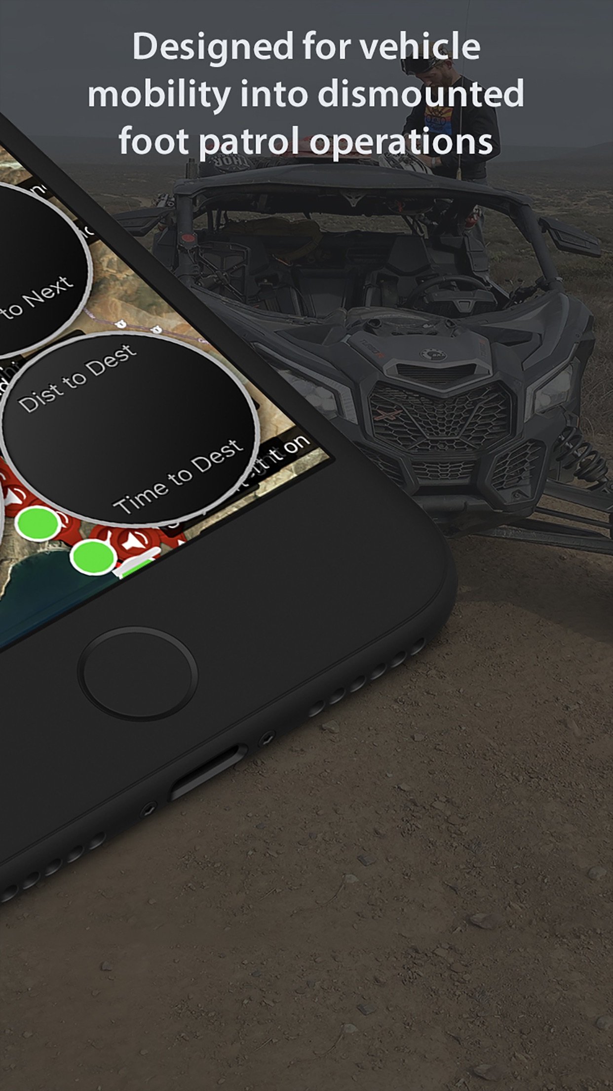
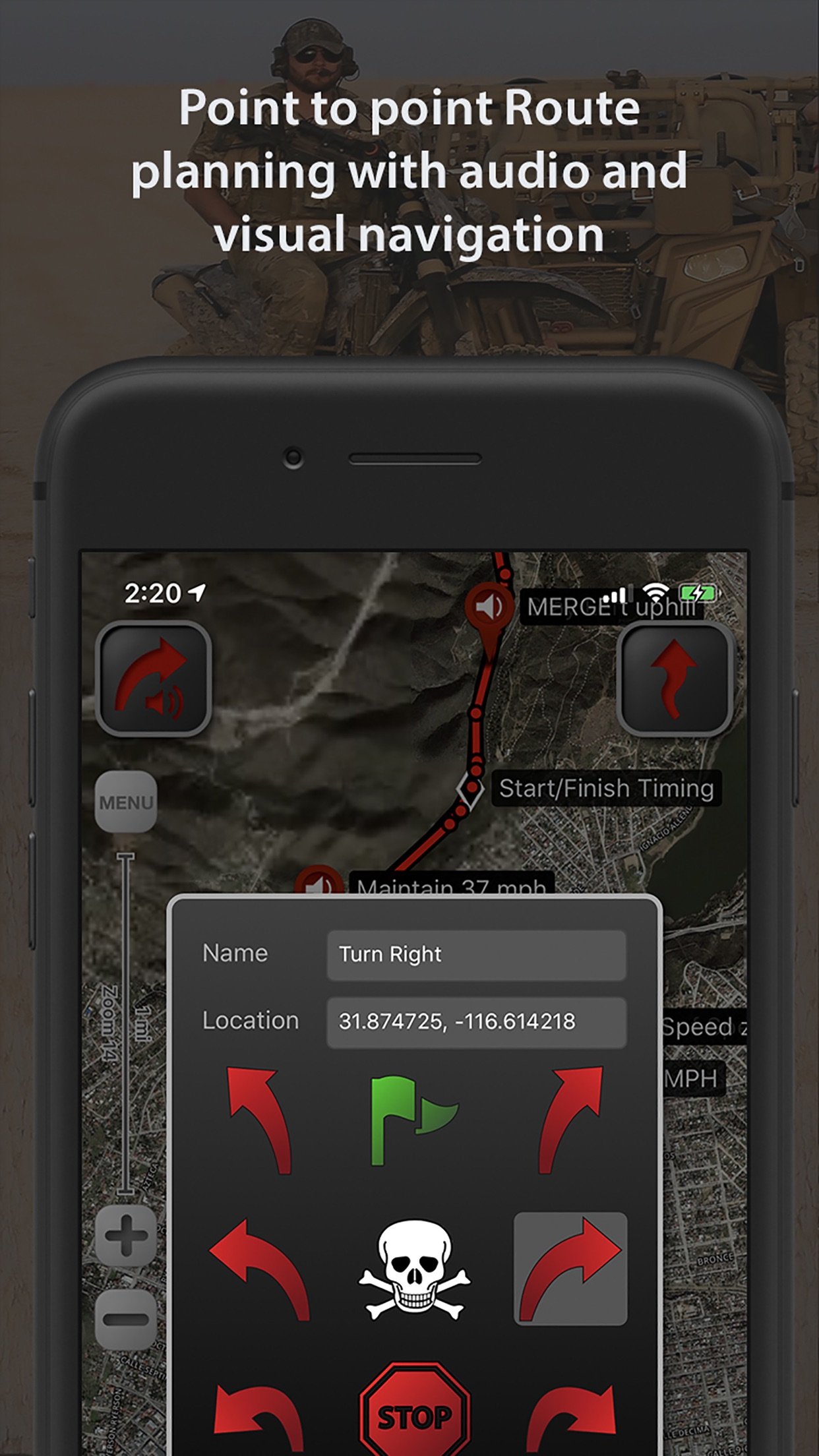
LEADNAV GPS is the professional off-road GPS for iPhone and iPad. Plan the route at home, run it with turn-by-turn voice guidance where there are no roads, and put your whole team on one map. Built for teams that work and travel off the grid: search and rescue, security details, expeditions, hunting camps, work crews, race teams and their chase crews.
NAVIGATE WHERE THERE ARE NO ROADS
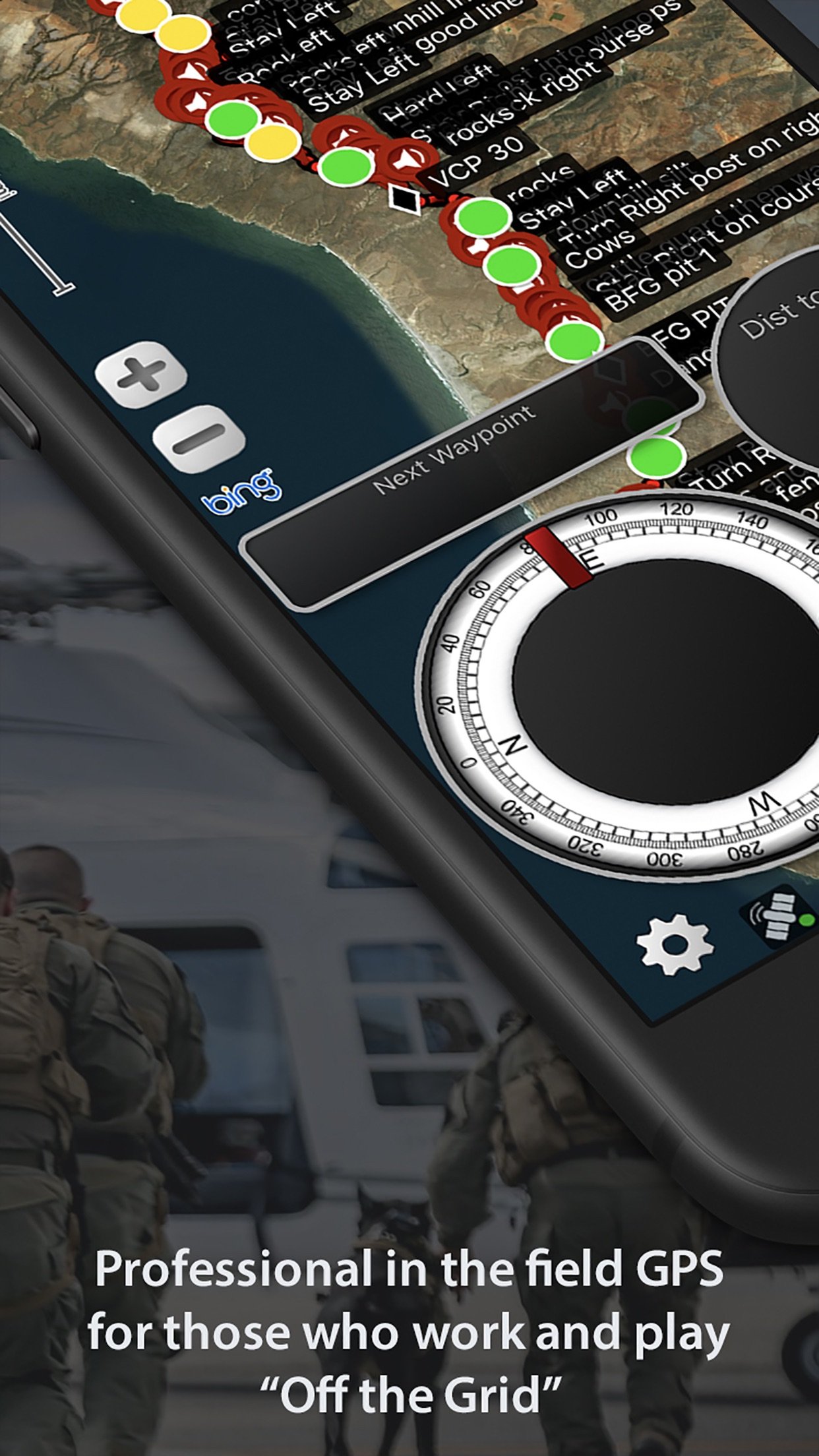
• Turn-by-turn voice guidance from routes you build or import. Waypoints speak by name as you approach them.
• Red warning rings and blue proximity rings that adjust to your speed, so the call comes when you need it.
• Any ring you cross alerts, on the route or off it. Serpentine points keep you on the line without a word.
• Works with no signal at all. Navigation never needs a connection.
• Record tracks, convert them to routes, reverse a route to come back the way you went.
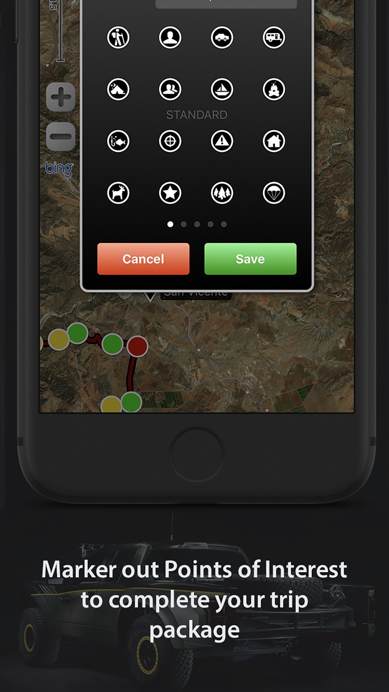
• Drop markers for anything you want to find again. Recon, Aviation and Hunting marker sets are included for everyone.
• Compatible with Bluetooth headsets, helmet intercoms and speakers for eyes-free navigation.
TRIP PACKAGES
• One file per trip, event or property: routes, tracks and markers together, with categories and Recently Deleted.
• Built on the GPX standard. Import from and export to any GPS device or planning software.
• Share a whole Trip Package with your team by AirDrop, Messages or email.
• Route Editor with Undo, Join Multiple Routes, Convert Markers to Audio Waypoints, Export to GPS Unit for Garmin, Lowrance and other units.
YOUR WHOLE TEAM ON ONE MAP
• Group tracking is included with the app. One Team Code, a QR or an invite link builds the team. Teammates join in seconds and see each other live.
• Runs over any internet connection: cellular, Wi-Fi at camp, or vehicle-mounted satellite internet such as Starlink.
• Keeps sharing with the screen locked when you turn on background tracking.
• No account, no login, nothing to sign up for. Your team identity is a random code you can reset any time.
COMMS (PRO LICENSE)
• Hold to talk with your teams from the pad on the map or from a wireless button. Release to send.
• Every message is written out as text in the team thread, so a call you missed at speed is still there when you look down.
• Several teams at once, each with its own channel and switch. Faster updates, teammate speed, off-screen arrows and breadcrumb trails.
PRERUNNING TOOLS (PRO LICENSE)
• PreRunner Bar and Pocket PreRunner: one-tap waypoint drops at speed, with a wipe-safe screen lock.
• Wireless buttons: drop waypoints, record tracks, zoom and talk with your hands on the wheel. Part of our patent-pending prerunning system.
• Waypoint Mic: hands-free voice notes at speed through your helmet comms.
• Speed Highlighter: paint the route green, yellow and red as you run it.
• Package Rules: proximity rings and marker symbols by name, saved in the file for everyone you share it with.
• Off Route Alert: hear it the moment you leave the line, and which side the route is on.
• Edit at speed: tap any waypoint in run mode to edit or delete it.
OFFLINE MAPS
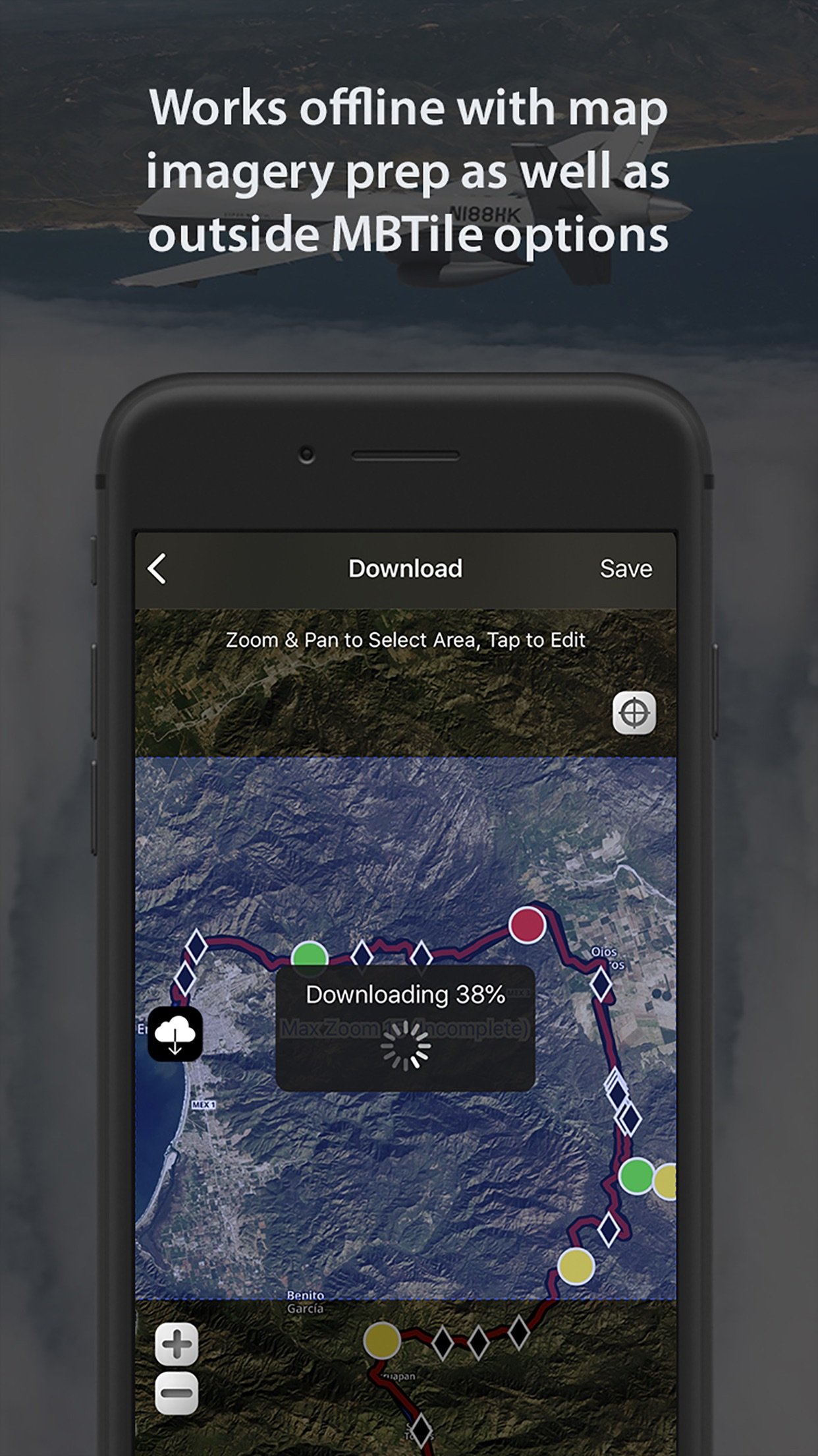
• Free online map sources include USGS Satellite, USGS Topo and OpenStreetMap.
• The Entry and Pro Licenses add offline map imagery for every map type, MBTiles import and overlays, and custom map URLs. Select areas and store them before you go. Maps are provided by outside services and are subject to change.
LICENSES
The app is a one-time purchase. Entry and Pro are auto-renewing licenses, managed in your Apple account. Details at leadnavgps.com/pricing.
NOTES
• This is a high-powered GPS and needs power for prolonged use in the field. Continued background GPS use can dramatically decrease battery life.
• Wi-Fi-only iPads have no internal GPS chip. Use a cellular model, or an external GPS receiver with the app.
• Group tracking and Comms need an internet connection. Navigation does not.
License: Commercial
NAVIGATE WHERE THERE ARE NO ROADS
• Turn-by-turn voice guidance from routes you build or import. Waypoints speak by name as you approach them.
• Red warning rings and blue proximity rings that adjust to your speed, so the call comes when you need it.
• Any ring you cross alerts, on the route or off it. Serpentine points keep you on the line without a word.
• Works with no signal at all. Navigation never needs a connection.
• Record tracks, convert them to routes, reverse a route to come back the way you went.
• Drop markers for anything you want to find again. Recon, Aviation and Hunting marker sets are included for everyone.
• Compatible with Bluetooth headsets, helmet intercoms and speakers for eyes-free navigation.
TRIP PACKAGES
• One file per trip, event or property: routes, tracks and markers together, with categories and Recently Deleted.
• Built on the GPX standard. Import from and export to any GPS device or planning software.
• Share a whole Trip Package with your team by AirDrop, Messages or email.
• Route Editor with Undo, Join Multiple Routes, Convert Markers to Audio Waypoints, Export to GPS Unit for Garmin, Lowrance and other units.
YOUR WHOLE TEAM ON ONE MAP
• Group tracking is included with the app. One Team Code, a QR or an invite link builds the team. Teammates join in seconds and see each other live.
• Runs over any internet connection: cellular, Wi-Fi at camp, or vehicle-mounted satellite internet such as Starlink.
• Keeps sharing with the screen locked when you turn on background tracking.
• No account, no login, nothing to sign up for. Your team identity is a random code you can reset any time.
COMMS (PRO LICENSE)
• Hold to talk with your teams from the pad on the map or from a wireless button. Release to send.
• Every message is written out as text in the team thread, so a call you missed at speed is still there when you look down.
• Several teams at once, each with its own channel and switch. Faster updates, teammate speed, off-screen arrows and breadcrumb trails.
PRERUNNING TOOLS (PRO LICENSE)
• PreRunner Bar and Pocket PreRunner: one-tap waypoint drops at speed, with a wipe-safe screen lock.
• Wireless buttons: drop waypoints, record tracks, zoom and talk with your hands on the wheel. Part of our patent-pending prerunning system.
• Waypoint Mic: hands-free voice notes at speed through your helmet comms.
• Speed Highlighter: paint the route green, yellow and red as you run it.
• Package Rules: proximity rings and marker symbols by name, saved in the file for everyone you share it with.
• Off Route Alert: hear it the moment you leave the line, and which side the route is on.
• Edit at speed: tap any waypoint in run mode to edit or delete it.
OFFLINE MAPS
• Free online map sources include USGS Satellite, USGS Topo and OpenStreetMap.
• The Entry and Pro Licenses add offline map imagery for every map type, MBTiles import and overlays, and custom map URLs. Select areas and store them before you go. Maps are provided by outside services and are subject to change.
LICENSES
The app is a one-time purchase. Entry and Pro are auto-renewing licenses, managed in your Apple account. Details at leadnavgps.com/pricing.
NOTES
• This is a high-powered GPS and needs power for prolonged use in the field. Continued background GPS use can dramatically decrease battery life.
• Wi-Fi-only iPads have no internal GPS chip. Use a cellular model, or an external GPS receiver with the app.
• Group tracking and Comms need an internet connection. Navigation does not.
License: Commercial
| Release info | Update on Nov 04, 2026 |
|---|---|
| Release notes | The "Matlock" update and just a small feature request for this current Baja 1000 pre-run - All this update does is make the "Undo" button on the PreRunner KeyPad require a Double-Tap to undo your last Waypoint drop to prevent accidental deletes of your last Waypoint note Everything else is working fantastically from what I am hearing so keep the feedback coming! Damian LEADNAV |
| Listing data | App Store |
Reviews
No reviews yet. Be the first to review LeadNav GPS.
Used LeadNav GPS? Tell other visitors what you thought.
Log in to write a reviewOther products by this publisher
- "No Distractions" for YouTube 4.10 ----
- #Bible 11.5 "Incredible App - My sister shared this app with me a few weeks ago and it is truly incredible.
- #filmphotography 1.4.2 So, you decided to shoot on film?
- $quirrel 1.5.1 $quirrel Budget & Finance helps you plan each paycheck, track spending, manage debt, and see what is safe to spend before the next payday.
- % Percentage Calculator Pro 1.41 This is the Pro version of % Percentage Calculator.
Most viewed iOS Navigation
-
1
 Compass App 1.0.5
Find your direction with style.
-
2
 CARFACE Car Widgets & Lyrics 1.2.0
Make every drive feel more personal with CarFace.
-
3
 Turo 26.44.1
Turo is a better car rental app for travelers who want to rent a car without the rental counter.
-
4
 iGlide Lite 2.9.66
NaviLogic iGlide - the Soaring Navigation app for iOS
-
5
 Open Road 1.2
Open Road is the one driving app for your iPhone.
-
6
 Amtrak 6.1.8
Discover the convenience of traveling with Amtrak.
-
7
 Kruger Birding by Firefinch 7.2.0
Go birding in South Africa's foremost birding spot: the world renowned Kruger National Park!
-
8
 Lyft 2026.42.3
Get where you’re going with Lyft.
-
9
 Waymo 155
Get there with The World’s Most Experienced Driver™
-
10
 American Airlines 2026.33
With the American Airlines app, you’re covered with the information you need exactly when you need it.
Most downloaded iOS Navigation
-
1
 Live Traffic 2.4
Navigate the globe with live traffic updates, satellite views, and location tools that make every journey clearer, smarter, and more confident from the very first tap.
-
2
 Peru’s Best 2.5
PERU’S BEST is the ideal travel guide to this extraordinary country.
-
3
 Grand Egyptian Museum (GEM) 0.1.054
You could call this a coincidence but the acronym of the Grand Egyptian Museum is an apt title for the GEM, which is truly one!
-
4
 Pocket Luach Deluxe 60058
Pocket Luach Deluxe is a Jewish calendar, zmanim, Siddur, Tehillim, and personal-event companion for iPhone, iPad, and Apple Watch.
-
5
 Outdoor Photography Magazine 7.2.10
Outdoor Photography is the magazine for photographers who are passionate about being out in wild places, seeing inspiring nature and having great adventures.
-
6
 Great Circle Map 1.7.4
A globe you can turn in any direction, including straight over the poles.
-
7
 Passeporté 1.3.2
Passeporté reads the NFC chip in your biometric passport or national eID card, verifies its authenticity, and stores the data securely on your device.
-
8
 Cell Phone Towers World Map 1.1.6
219 countres !! The world's largest Database of Cell & Net Towers
-
9
 UK Map 4.12
* Unlimited free map downloads based on Ordnance Survey® OpenData, at 1:25,000 and 1:10,000 scales, and now also paid map downloads at 1:50,000, 1:25,000 and 1:10,000 scales, just like the paper maps.
-
10
 Lime 3.288.0
You have places to be and people to see.