KARTAL MGRS 1.0
The comprehensive navigation suite for the field, missions, and professional outdoor use.
Download
28.55 MB
13downloads
0this week
FreeCommercial
0reviews
Screenshots
About KARTAL MGRS
The comprehensive navigation suite for the field, missions, and professional outdoor use. Kartal MGRS is a high-precision GPS and mapping application designed specifically for military personnel, search and rescue teams, and outdoor professionals who require absolute accuracy.
Master the terrain with a modern interface, robust offline support, and advanced tactical features designed for reliability in the most demanding environments.
Precision Coordinate Systems
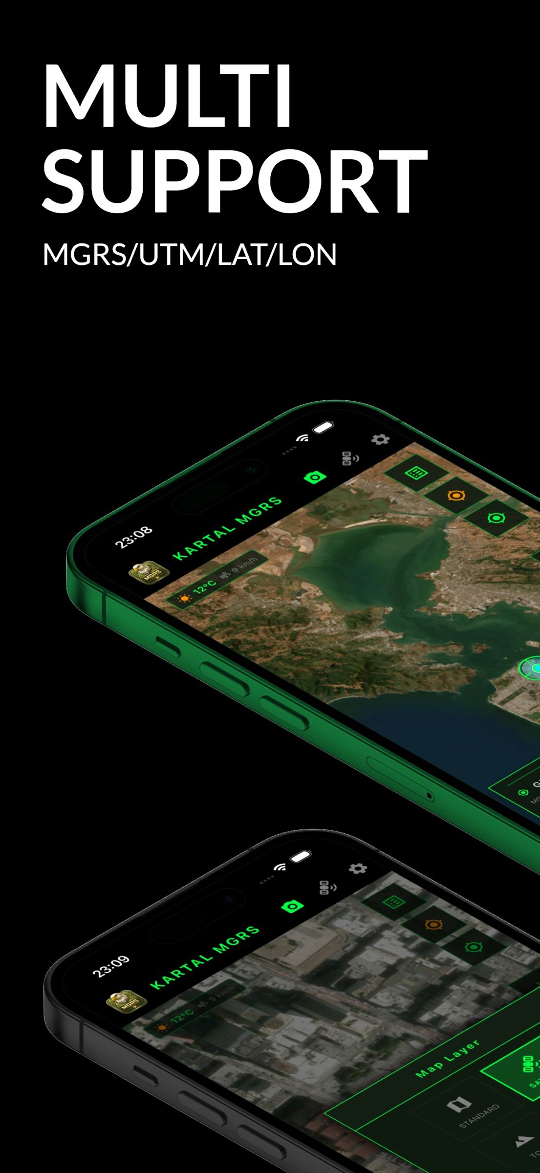
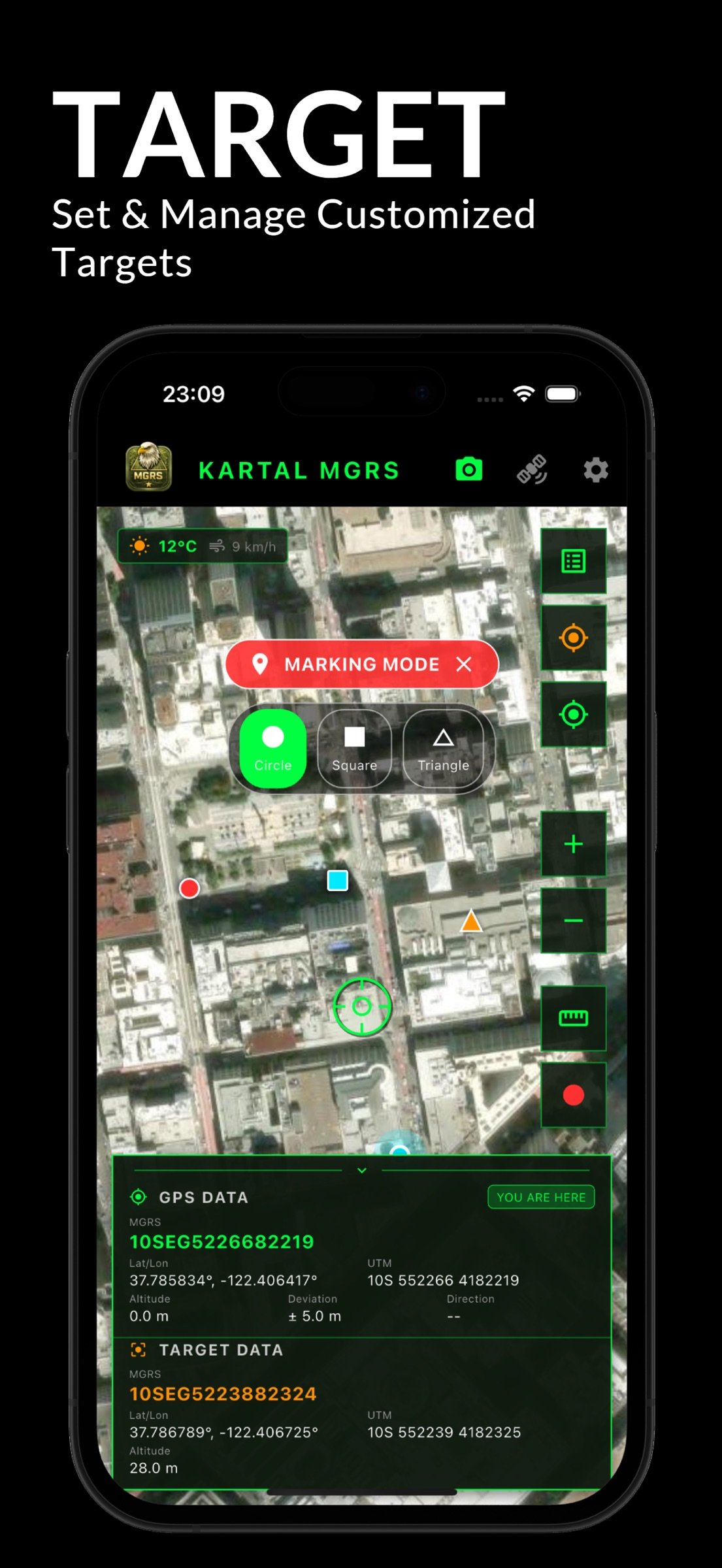
-Real-Time Tracking: Instant support for MGRS, UTM, Latitude/Longitude, and Military Grid systems.
-Go-To-Coord: Navigate directly to specific coordinate inputs with high-precision guidance.
-Precise Sharing: Share your location in professional MGRS and UTM formats for seamless team coordination.
Professional Map Management and Offline Access
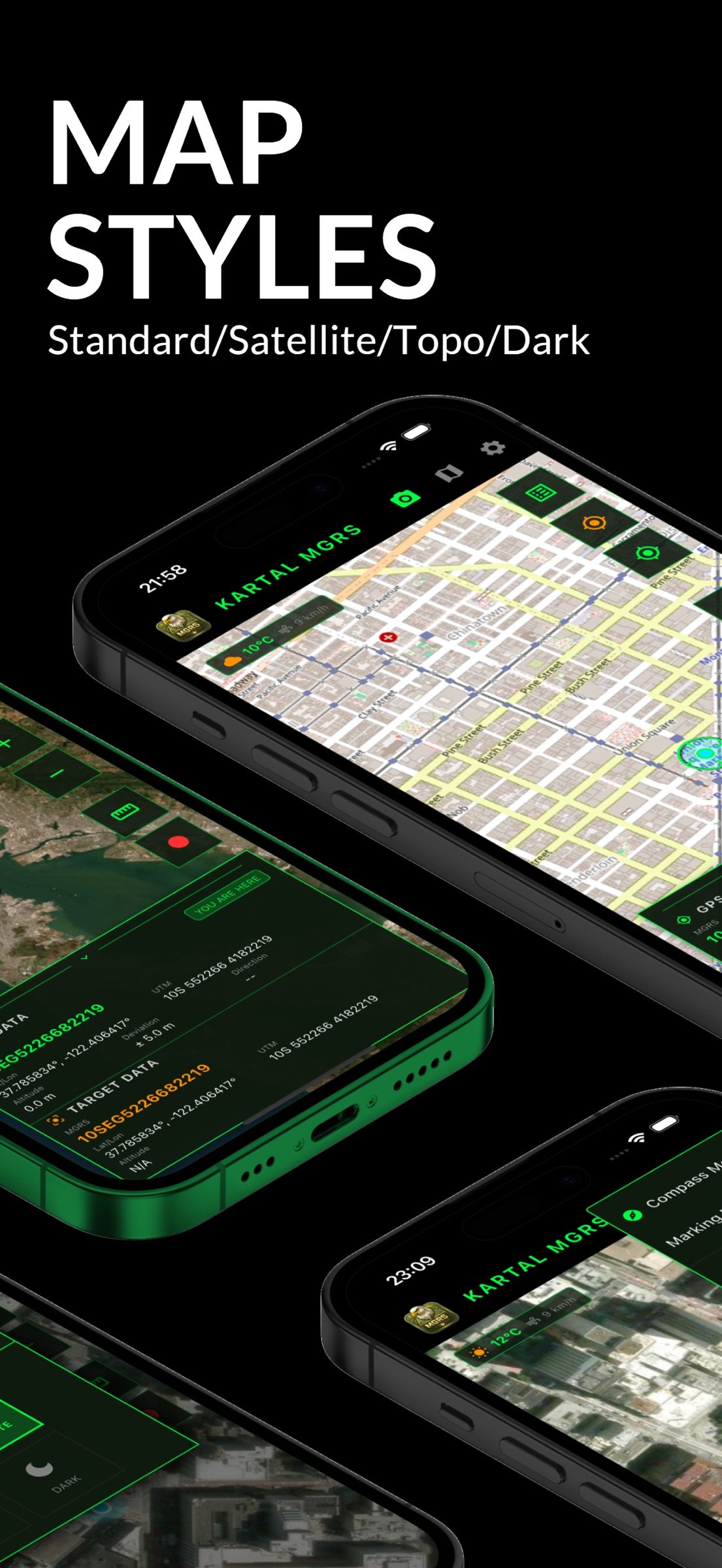
-Map Variety: Access Standard, Satellite, Topographical, and Dark Mode map layers.
-Offline Maps: Download specific map regions to ensure functionality in areas without cellular or data coverage.
-Custom Layers: Full support for importing your own MBTiles, KML, KMZ, GPX, and GeoJSON files.
Tactical Camera and Metadata
-Data Overlay: Automatically stamp coordinates, direction (Azimuth), and timestamps directly onto your photos.
-Professional Documentation: Use tactical overlays for mission reporting and terrain analysis.
Advanced Compass and Angular Units
-Universal Standards: Comprehensive support for 360 Degrees, NATO Mils (6400), and Grad units.
-Directional Accuracy: Switch between Magnetic and True North for pinpoint navigation.
Measurement and Target Management
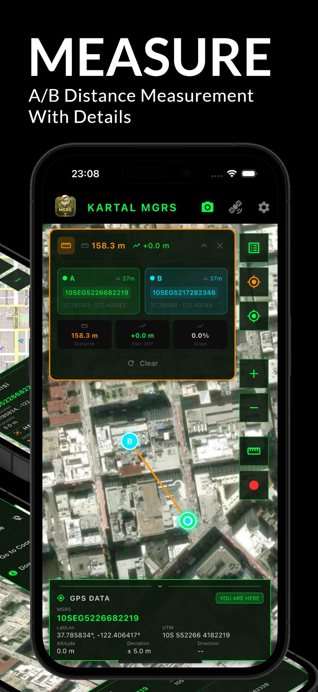
-Terrain Analysis: Measure distance, elevation difference, and slope between any two points or from your current position.
-Target List: Save critical waypoints, customize icons, and organize your operational routes.
Track Recording and Data Export
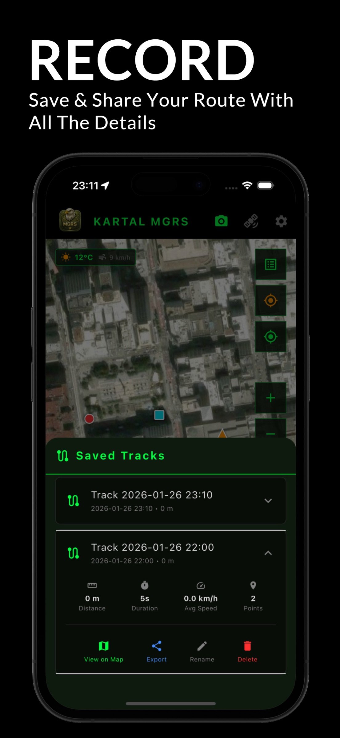
-Mission Logging: Record your movement, tracking average speed, duration, and distance.
-Universal Compatibility: Export your recorded tracks in GPX, KML, or KMZ formats for use in other GIS platforms.
Night Mode HUD
-Tactical Visibility: Low-light red filter support to preserve night vision and maintain operational stealth.
WHY KARTAL MGRS?
-Simple and Powerful: A streamlined interface that prioritizes fast access to critical tools over complex menus.
-Battery Efficiency: Optimized GPS algorithms to extend device battery life during prolonged field use.
-Secure and Independent: Your data remains on your device. No cloud dependency or external data tracking.
License: Commercial
Master the terrain with a modern interface, robust offline support, and advanced tactical features designed for reliability in the most demanding environments.
Precision Coordinate Systems
-Real-Time Tracking: Instant support for MGRS, UTM, Latitude/Longitude, and Military Grid systems.
-Go-To-Coord: Navigate directly to specific coordinate inputs with high-precision guidance.
-Precise Sharing: Share your location in professional MGRS and UTM formats for seamless team coordination.
Professional Map Management and Offline Access
-Map Variety: Access Standard, Satellite, Topographical, and Dark Mode map layers.
-Offline Maps: Download specific map regions to ensure functionality in areas without cellular or data coverage.
-Custom Layers: Full support for importing your own MBTiles, KML, KMZ, GPX, and GeoJSON files.
Tactical Camera and Metadata
-Data Overlay: Automatically stamp coordinates, direction (Azimuth), and timestamps directly onto your photos.
-Professional Documentation: Use tactical overlays for mission reporting and terrain analysis.
Advanced Compass and Angular Units
-Universal Standards: Comprehensive support for 360 Degrees, NATO Mils (6400), and Grad units.
-Directional Accuracy: Switch between Magnetic and True North for pinpoint navigation.
Measurement and Target Management
-Terrain Analysis: Measure distance, elevation difference, and slope between any two points or from your current position.
-Target List: Save critical waypoints, customize icons, and organize your operational routes.
Track Recording and Data Export
-Mission Logging: Record your movement, tracking average speed, duration, and distance.
-Universal Compatibility: Export your recorded tracks in GPX, KML, or KMZ formats for use in other GIS platforms.
Night Mode HUD
-Tactical Visibility: Low-light red filter support to preserve night vision and maintain operational stealth.
WHY KARTAL MGRS?
-Simple and Powerful: A streamlined interface that prioritizes fast access to critical tools over complex menus.
-Battery Efficiency: Optimized GPS algorithms to extend device battery life during prolonged field use.
-Secure and Independent: Your data remains on your device. No cloud dependency or external data tracking.
License: Commercial
| Release info | New Release on Feb 17, 2026 |
|---|---|
| Listing data | App Store |
Reviews
No reviews yet. Be the first to review KARTAL MGRS.
Used KARTAL MGRS? Tell other visitors what you thought.
Log in to write a reviewOther products by this publisher
- "No Distractions" for YouTube 4.10 ----
- #Bible 11.6.1 "Incredible App - My sister shared this app with me a few weeks ago and it is truly incredible.
- #filmphotography 1.4.2 So, you decided to shoot on film?
- #LookBusy Fake Calendar Events 1.0.6 Look Busy scans your work calendar for open time slots and fills them with realistic-looking (but secretly fake) work events.
- #Small Talk Is Canceled 1.0.2 #Small Talk Is Canceled — Conversations That Matter
Most viewed iOS Navigation
-
1
 Compass App 1.0.5
Find your direction with style.
-
2
 Open Road 1.2
Open Road is the one driving app for your iPhone.
-
3
 CARFACE Car Widgets & Lyrics 1.2.1
Make every drive feel more personal with CarFace.
-
4
 iGlide Lite 2.9.66
NaviLogic iGlide - the Soaring Navigation app for iOS
-
5
 Turo 26.46.0
Turo is a better car rental app for travelers who want to rent a car without the rental counter.
-
6
 Pocket Luach Deluxe 60058
Pocket Luach Deluxe is a Jewish calendar, zmanim, Siddur, Tehillim, and personal-event companion for iPhone, iPad, and Apple Watch.
-
7
 Lyft 2026.44.3
Get where you’re going with Lyft.
-
8
 Fly Delta 7.17.3
Welcome to Fly Delta, Delta’s award winning iOS app.
-
9
 Amtrak 6.1.8
Discover the convenience of traveling with Amtrak.
-
10
 Grand Egyptian Museum (GEM) 0.1.060
You could call this a coincidence but the acronym of the Grand Egyptian Museum is an apt title for the GEM, which is truly one!
Most downloaded iOS Navigation
-
1
 Live Traffic 2.4
Navigate the globe with live traffic updates, satellite views, and location tools that make every journey clearer, smarter, and more confident from the very first tap.
-
2
 Peru’s Best 2.5
PERU’S BEST is the ideal travel guide to this extraordinary country.
-
3
Grand Egyptian Museum (GEM) 0.1.060
You could call this a coincidence but the acronym of the Grand Egyptian Museum is an apt title for the GEM, which is truly one!
-
4
 Outdoor Photography Magazine 7.2.10
Outdoor Photography is the magazine for photographers who are passionate about being out in wild places, seeing inspiring nature and having great adventures.
-
5
Pocket Luach Deluxe 60058
Pocket Luach Deluxe is a Jewish calendar, zmanim, Siddur, Tehillim, and personal-event companion for iPhone, iPad, and Apple Watch.
-
6
 Passeporté 1.3.2
Passeporté reads the NFC chip in your biometric passport or national eID card, verifies its authenticity, and stores the data securely on your device.
-
7
 UK Map 4.12
* Unlimited free map downloads based on Ordnance Survey® OpenData, at 1:25,000 and 1:10,000 scales, and now also paid map downloads at 1:50,000, 1:25,000 and 1:10,000 scales, just like the paper maps.
-
8
 Great Circle Map 1.7.5
A globe you can turn in any direction, including straight over the poles.
-
9
 Connecticut-Parks & Trails 1.0
App Feature
-
10
 Cell Phone Towers World Map 1.1.6
219 countres !! The world's largest Database of Cell & Net Towers