Hawaii Ocean Map 1.8.1
Hawaii Ocean Map brings professional-grade seafloor mapping to your iPhone and iPad.
Download
18.68 MB
7downloads
3this week
FreeCommercial
0reviews
Screenshots
About Hawaii Ocean Map
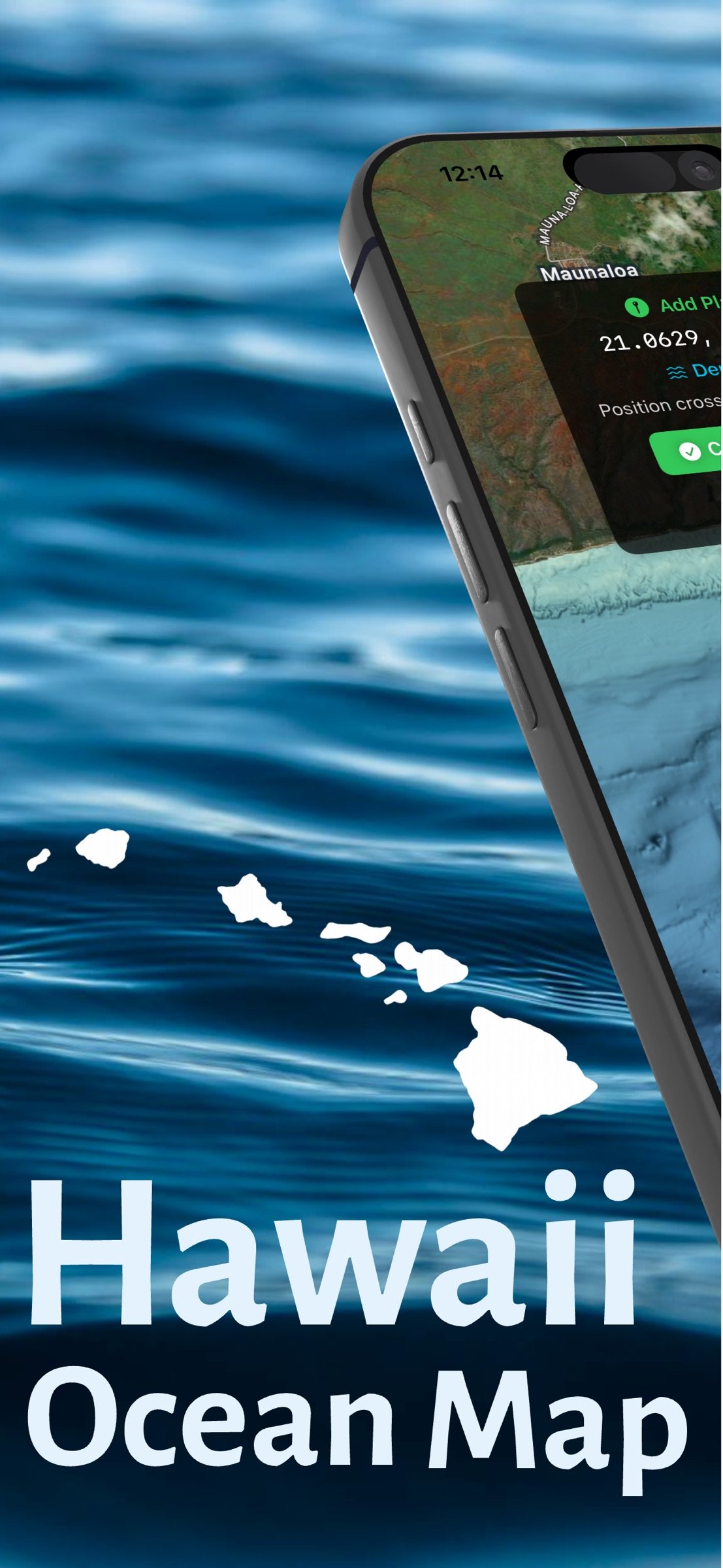
Hawaii Ocean Map brings professional-grade seafloor mapping to your iPhone and iPad. Explore the depths around the Hawaiian Islands with NOAA's high-resolution bathymetry data—all available offline, with no subscription required.
PROFESSIONAL DEPTH DATA
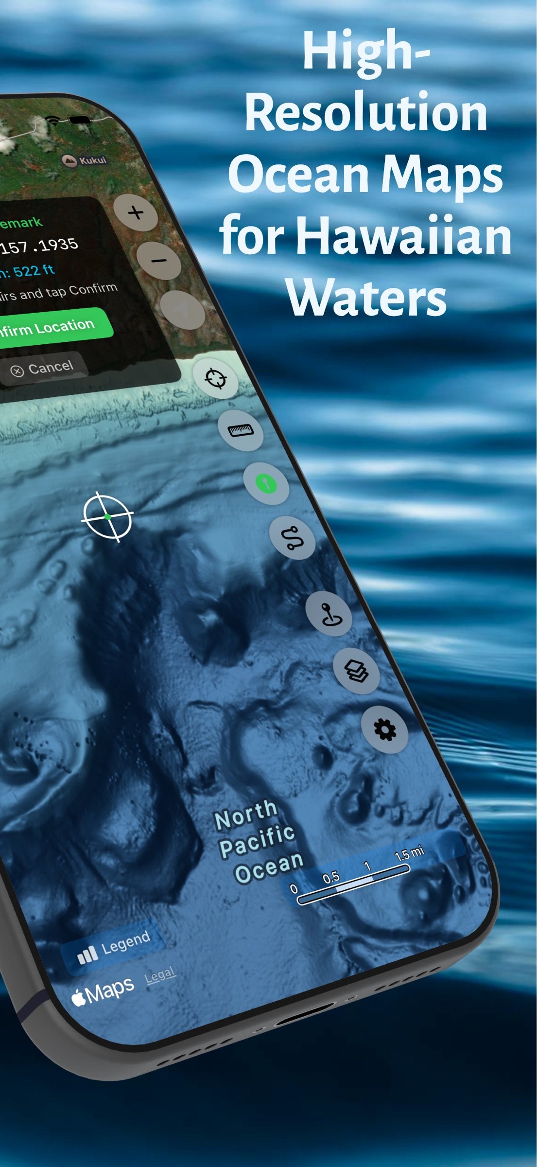
Access detailed ocean floor topography derived from NOAA's Continuously Updated Digital Elevation Model (CUDEM) at approximately 3-meter resolution. Find underwater features including reefs, ledges, channels, and drop-offs with precision.
DEPTH CONTOUR LINES
Toggle fathom lines at 40, 100, 200, 500, 750, 1,000, 1,500, and 2,000 fathoms, drawn and labeled on top of the color bathymetry.
WORKS OFFLINE
Download maps before you head out. Whether you're miles offshore or in areas with no cell coverage, your depth data is always available. Perfect for ocean adventures beyond the reach of cellular networks.
INSTANT DEPTH QUERIES
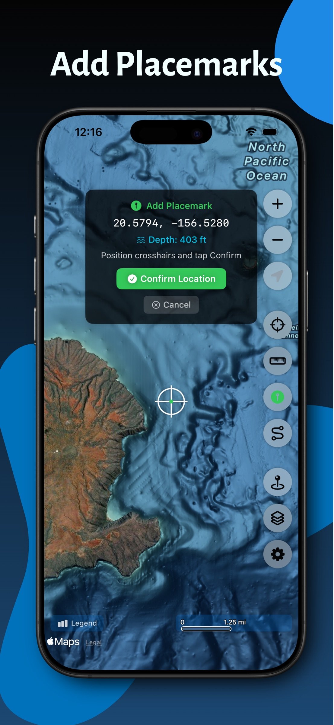
Tap anywhere on the map to instantly see the water depth at that location. Plan routes, identify fishing spots, or explore underwater terrain with a simple touch.
SAVE LOCATIONS
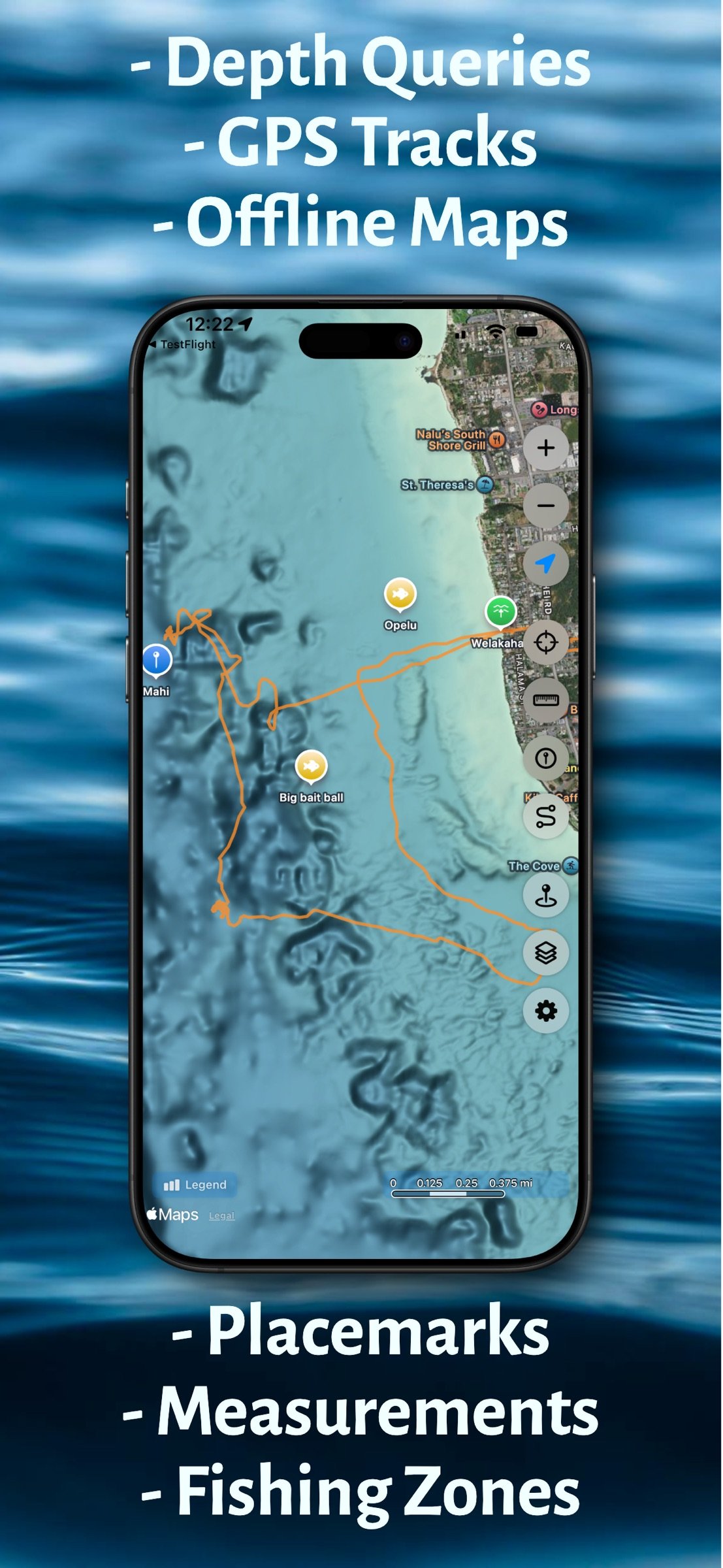
Mark and save your favorite spots with custom placemarks. Add names, notes, and organize your locations for quick reference on future trips.
NAVIGATE TO WAYPOINTS
Select any saved or imported placemark and get live bearing, distance, and a compass guiding you to your destination. Keep your eyes on the water while the app points the way.
RECORD GPS TRACKS
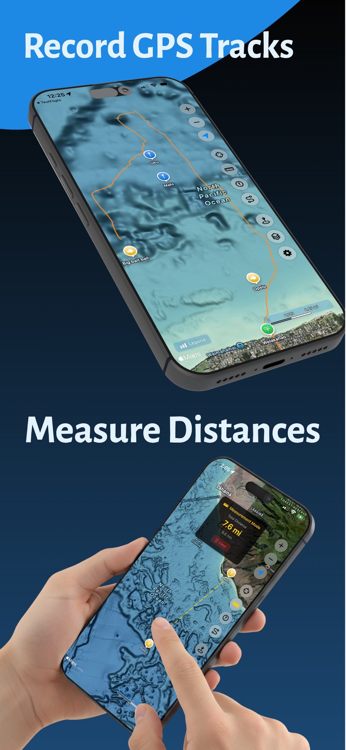
Capture your routes as you explore Hawaii's waters. Start, pause, and resume recording, then export your tracks as standard GPX files to share or analyze. Your tracks sync automatically across all your devices via iCloud.
MAP LAYERS
Toggle and explore ocean overlays from one dedicated page—depth contour lines, fishing restriction zones, ORMA ocean recreation areas, humpback whale sanctuary boundaries, submarine cables, and curated points of interest including harbors, boat ramps, FAD buoys, surf spots, dive spots, and lifeguard towers. Zoom directly to any layer on the map.
IMPORT YOUR SPOTS
Bring years of accumulated spots with you. Import KML, KMZ, and GPX files—exports from Google Earth, Navionics, Garmin, and most chartplotters and fishing apps—and each file becomes its own map layer of points, lines, and areas. Rename, show, or hide every layer, tap any feature for details, save any imported waypoint as a placemark of your own, and your imported layers sync across all your devices via iCloud.
MEASURE DISTANCE & BEARING
Use the built-in measurement tool to calculate distances between points on the map, with the heading and return bearing for your current leg — shown as true or magnetic to match your compass. Drag any point to fine-tune it, delete a single point, or undo the last one. Save any point — or every point at once — as placemarks, each with its depth filled in automatically.
FULL ISLAND COVERAGE
Complete bathymetry coverage for all major Hawaiian Islands—Oahu, Maui, Big Island, Kauai, Molokai, Lanai, and surrounding waters.
NO SUBSCRIPTIONS
One purchase, lifetime access. No recurring fees, no in-app purchases, no ads.
Ideal for boaters, fishermen, divers, snorkelers, kayakers, and anyone who wants to understand what lies beneath Hawaii's beautiful waters.
IMPORTANT: For informational and recreational purposes only. Not a marine navigation device. Always use official nautical charts and proper navigation equipment when on the water. Full terms at hawaiiocean.app/terms.
License: Commercial
PROFESSIONAL DEPTH DATA
Access detailed ocean floor topography derived from NOAA's Continuously Updated Digital Elevation Model (CUDEM) at approximately 3-meter resolution. Find underwater features including reefs, ledges, channels, and drop-offs with precision.
DEPTH CONTOUR LINES
Toggle fathom lines at 40, 100, 200, 500, 750, 1,000, 1,500, and 2,000 fathoms, drawn and labeled on top of the color bathymetry.
WORKS OFFLINE
Download maps before you head out. Whether you're miles offshore or in areas with no cell coverage, your depth data is always available. Perfect for ocean adventures beyond the reach of cellular networks.
INSTANT DEPTH QUERIES
Tap anywhere on the map to instantly see the water depth at that location. Plan routes, identify fishing spots, or explore underwater terrain with a simple touch.
SAVE LOCATIONS
Mark and save your favorite spots with custom placemarks. Add names, notes, and organize your locations for quick reference on future trips.
NAVIGATE TO WAYPOINTS
Select any saved or imported placemark and get live bearing, distance, and a compass guiding you to your destination. Keep your eyes on the water while the app points the way.
RECORD GPS TRACKS
Capture your routes as you explore Hawaii's waters. Start, pause, and resume recording, then export your tracks as standard GPX files to share or analyze. Your tracks sync automatically across all your devices via iCloud.
MAP LAYERS
Toggle and explore ocean overlays from one dedicated page—depth contour lines, fishing restriction zones, ORMA ocean recreation areas, humpback whale sanctuary boundaries, submarine cables, and curated points of interest including harbors, boat ramps, FAD buoys, surf spots, dive spots, and lifeguard towers. Zoom directly to any layer on the map.
IMPORT YOUR SPOTS
Bring years of accumulated spots with you. Import KML, KMZ, and GPX files—exports from Google Earth, Navionics, Garmin, and most chartplotters and fishing apps—and each file becomes its own map layer of points, lines, and areas. Rename, show, or hide every layer, tap any feature for details, save any imported waypoint as a placemark of your own, and your imported layers sync across all your devices via iCloud.
MEASURE DISTANCE & BEARING
Use the built-in measurement tool to calculate distances between points on the map, with the heading and return bearing for your current leg — shown as true or magnetic to match your compass. Drag any point to fine-tune it, delete a single point, or undo the last one. Save any point — or every point at once — as placemarks, each with its depth filled in automatically.
FULL ISLAND COVERAGE
Complete bathymetry coverage for all major Hawaiian Islands—Oahu, Maui, Big Island, Kauai, Molokai, Lanai, and surrounding waters.
NO SUBSCRIPTIONS
One purchase, lifetime access. No recurring fees, no in-app purchases, no ads.
Ideal for boaters, fishermen, divers, snorkelers, kayakers, and anyone who wants to understand what lies beneath Hawaii's beautiful waters.
IMPORTANT: For informational and recreational purposes only. Not a marine navigation device. Always use official nautical charts and proper navigation equipment when on the water. Full terms at hawaiiocean.app/terms.
License: Commercial
| Release info | New Release on Sep 02, 2026 |
|---|---|
| Release notes | SAVE IMPORTED WAYPOINTS AS PLACEMARKS Tap any waypoint from an imported KML, KMZ, or GPX layer and save it as a placemark of your own - depth filled in automatically, ready to favorite, rename, or navigate to. UPDATED FAD STATUSES Refreshed from the Hawaii Institute of Marine Biology (September 2026). Six FADs are back in service - Oahu S (Pokai Bay) and HH (Ewa), and Kauai Z, CK, EK, and WK - while Big Island A (Ka Lae) is newly missing. |
| Listing data | App Store |
Reviews
No reviews yet. Be the first to review Hawaii Ocean Map.
Used Hawaii Ocean Map? Tell other visitors what you thought.
Log in to write a reviewOther products by this publisher
- "No Distractions" for YouTube 4.10 ----
- #Bible 11.6 "Incredible App - My sister shared this app with me a few weeks ago and it is truly incredible.
- #filmphotography 1.4.2 So, you decided to shoot on film?
- $quirrel 1.5.1 $quirrel Budget & Finance helps you plan each paycheck, track spending, manage debt, and see what is safe to spend before the next payday.
- % Percentage Calculator Pro 1.41 This is the Pro version of % Percentage Calculator.
Most viewed iOS Navigation
-
1
 Compass App 1.0.5
Find your direction with style.
-
2
 CARFACE Car Widgets & Lyrics 1.2.1
Make every drive feel more personal with CarFace.
-
3
 iGlide Lite 2.9.66
NaviLogic iGlide - the Soaring Navigation app for iOS
-
4
 Open Road 1.2
Open Road is the one driving app for your iPhone.
-
5
 Turo 26.45.1
Turo is a better car rental app for travelers who want to rent a car without the rental counter.
-
6
 Fly Delta 7.17.3
Welcome to Fly Delta, Delta’s award winning iOS app.
-
7
 Kruger Birding by Firefinch 7.6.0
Go birding in South Africa's foremost birding spot: the world renowned Kruger National Park!
-
8
 Uber 3.747.10000
Join the millions of riders who trust Uber for their everyday travel needs.
-
9
 Lyft 2026.43.3
Get where you’re going with Lyft.
-
10
 Amtrak 6.1.8
Discover the convenience of traveling with Amtrak.
Most downloaded iOS Navigation
-
1
 Live Traffic 2.4
Navigate the globe with live traffic updates, satellite views, and location tools that make every journey clearer, smarter, and more confident from the very first tap.
-
2
 Peru’s Best 2.5
PERU’S BEST is the ideal travel guide to this extraordinary country.
-
3
 Grand Egyptian Museum (GEM) 0.1.060
You could call this a coincidence but the acronym of the Grand Egyptian Museum is an apt title for the GEM, which is truly one!
-
4
 Pocket Luach Deluxe 60058
Pocket Luach Deluxe is a Jewish calendar, zmanim, Siddur, Tehillim, and personal-event companion for iPhone, iPad, and Apple Watch.
-
5
 Outdoor Photography Magazine 7.2.10
Outdoor Photography is the magazine for photographers who are passionate about being out in wild places, seeing inspiring nature and having great adventures.
-
6
 Passeporté 1.3.2
Passeporté reads the NFC chip in your biometric passport or national eID card, verifies its authenticity, and stores the data securely on your device.
-
7
 Great Circle Map 1.7.5
A globe you can turn in any direction, including straight over the poles.
-
8
 UK Map 4.12
* Unlimited free map downloads based on Ordnance Survey® OpenData, at 1:25,000 and 1:10,000 scales, and now also paid map downloads at 1:50,000, 1:25,000 and 1:10,000 scales, just like the paper maps.
-
9
 Connecticut-Parks & Trails 1.0
App Feature
-
10
 Cell Phone Towers World Map 1.1.6
219 countres !! The world's largest Database of Cell & Net Towers