5downloads
2this week
FreeCommercial
0reviews
Screenshots
About Gridwalk
Say the grid. Know your pace. Fix where you are.
Gridwalk does the map-and-compass arithmetic of land navigation, one screen for each job. There is no map to load and nothing to sign up for.
CONVERT ANY GRID
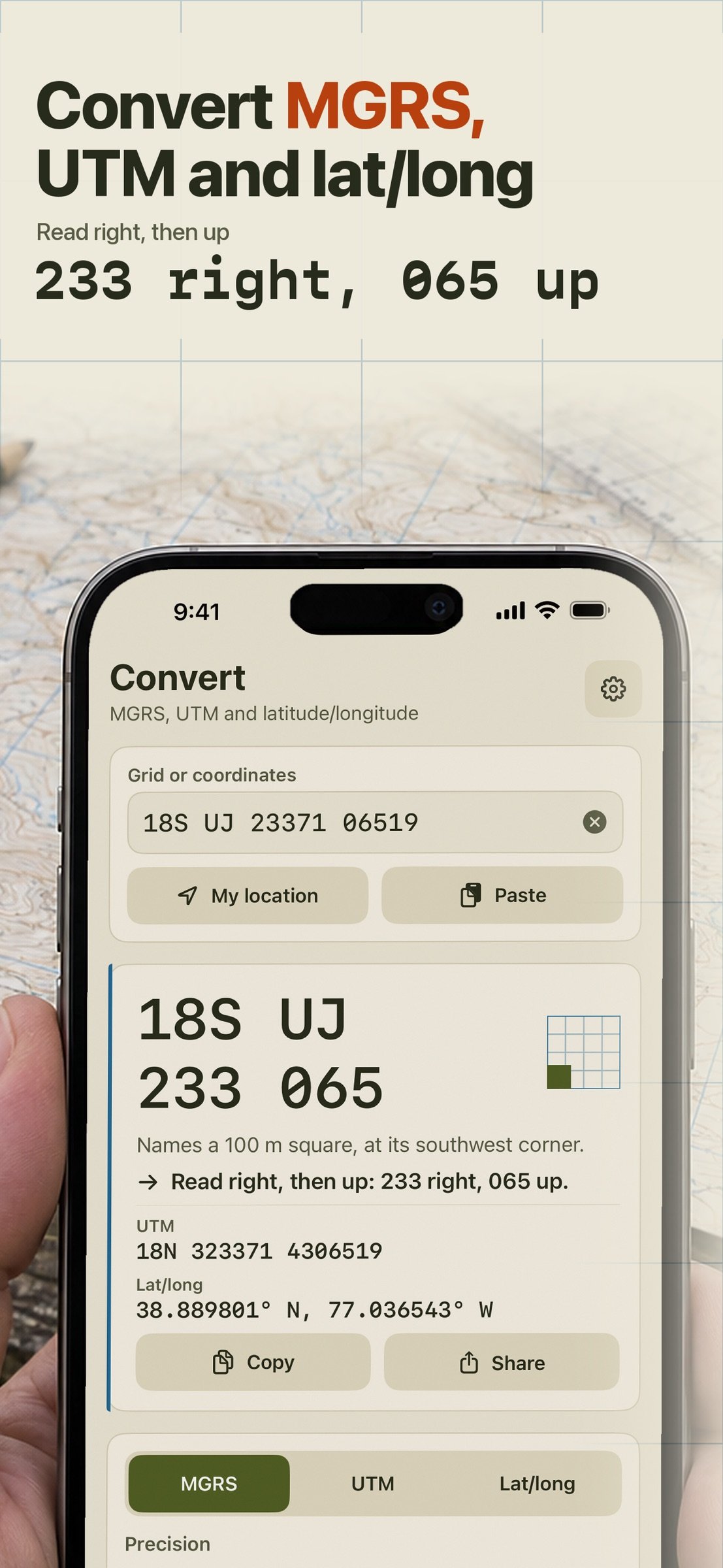
Type an MGRS, UTM or latitude/longitude (decimal degrees, degrees and minutes, or degrees, minutes and seconds) and read the others at once. Pick the precision from 10 km down to 1 m and see the square it names. Gridwalk says it the way you read it off a map: right, then up. WGS84 and NAD83 (the same to a metre or two) plus ED50 for European maps. Tap My position to fill in where you are; if you would rather not share it, type the grid.
COUNT YOUR PACE IN BEADS
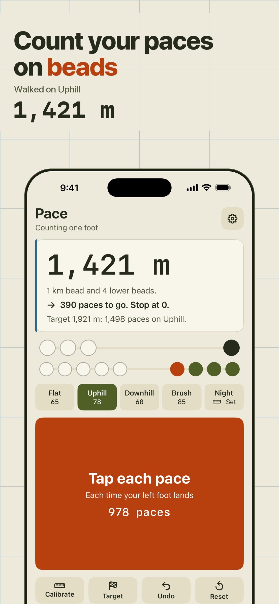
Walk a measured course once and Gridwalk keeps your pace per 100 metres for flat, uphill and downhill, plus two terrains you name. Then walk: tap each pace and the bead strip slides, four 1 km beads and nine 100 m beads, the way the pace beads on your pack do. Change terrain mid-leg and it keeps the sum. Count every step or one foot only, your choice, and the screen says which.
FIX WHERE YOU ARE
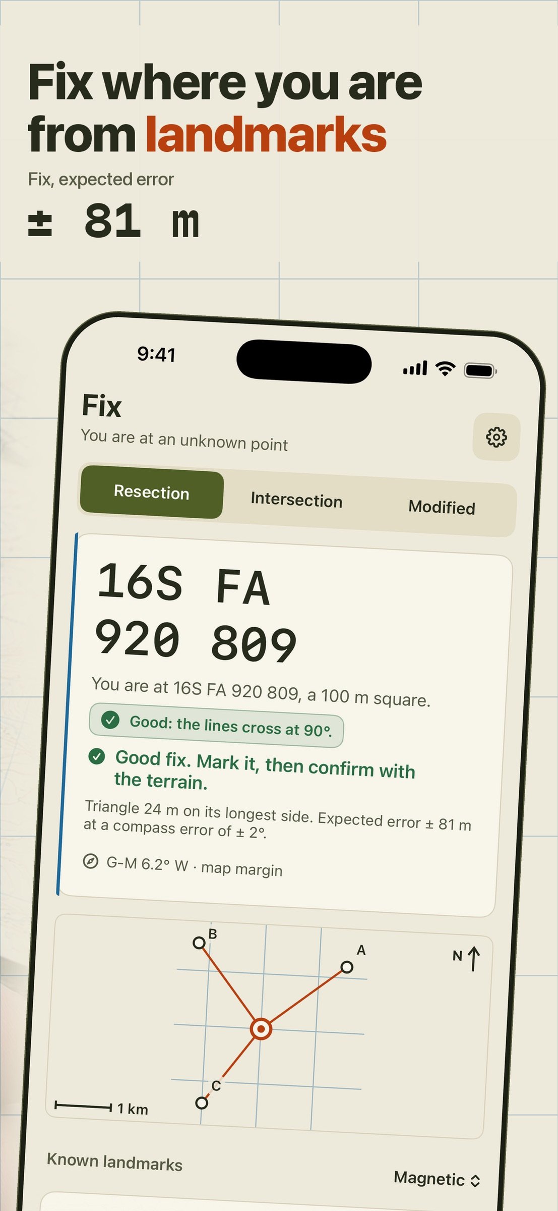
Take two or three bearings on landmarks you can find on the map with your own compass and type them in. Gridwalk turns magnetic into grid, draws the rays back from the landmarks and gives you the fix. With three bearings it shows the triangle and tells you whether it is a good fix or whether to pick a landmark at a different angle. The same screen does intersection, to locate a distant point from two places you know, and modified resection along a road or a stream.
PLAN EVERY LEG
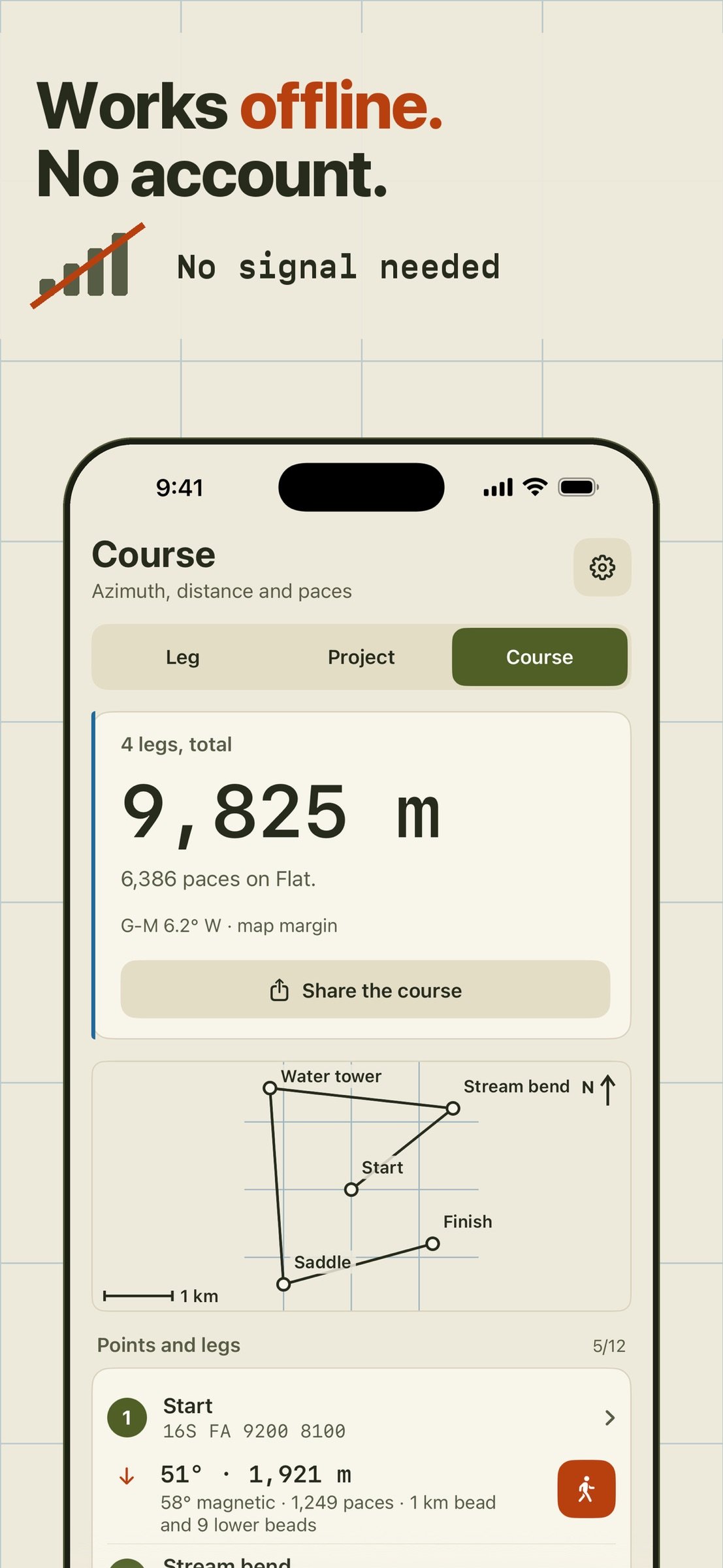
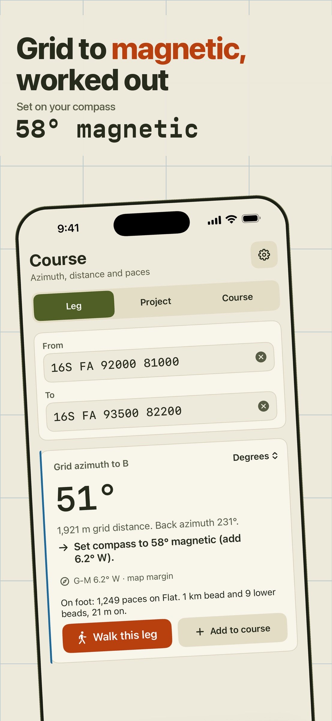
Enter the points of your course. For each leg you get the grid azimuth, the magnetic azimuth to set on your compass, the back azimuth, the distance, and the paces and beads for your terrain, in degrees or mils. Or start from a point, an azimuth and a distance and get the new grid.
MAGNETIC AND GRID, WITHOUT THE SIGN MISTAKES
Type the grid-magnetic angle printed in your map's margin, or let Gridwalk look up the declination for today's date with the World Magnetic Model 2025 (built in, valid to the end of 2029, no signal needed). The results say in words what to add or subtract. The map's printed value always wins.
MAP SCALE, WITHOUT THE CALCULATOR
Measure in millimetres on a 1:25,000, 1:50,000, 1:100,000 or your own scale and read metres, beads and paces. See how wide a grid square is on paper. Convert degrees, mils and grads.
BUILT FOR THE FIELD
Big targets for gloved hands. Day, night and red modes that keep your night vision. Works in portrait and landscape on iPhone and iPad. In English.
FOR
Cadets and soldiers learning land navigation, search-and-rescue volunteers, hunters, hikers and orienteers, geocachers.
PLEASE NOTE
Gridwalk is a calculator, not a navigator. Carry a map and a compass. Your phone's position is only as good as its view of the sky, iPads without GPS cannot give a position, and many land navigation courses and tests do not allow phones. Gridwalk is not affiliated with or endorsed by any military or government body.
Your points, pace counts and courses stay on your phone.
License: Commercial
Gridwalk does the map-and-compass arithmetic of land navigation, one screen for each job. There is no map to load and nothing to sign up for.
CONVERT ANY GRID
Type an MGRS, UTM or latitude/longitude (decimal degrees, degrees and minutes, or degrees, minutes and seconds) and read the others at once. Pick the precision from 10 km down to 1 m and see the square it names. Gridwalk says it the way you read it off a map: right, then up. WGS84 and NAD83 (the same to a metre or two) plus ED50 for European maps. Tap My position to fill in where you are; if you would rather not share it, type the grid.
COUNT YOUR PACE IN BEADS
Walk a measured course once and Gridwalk keeps your pace per 100 metres for flat, uphill and downhill, plus two terrains you name. Then walk: tap each pace and the bead strip slides, four 1 km beads and nine 100 m beads, the way the pace beads on your pack do. Change terrain mid-leg and it keeps the sum. Count every step or one foot only, your choice, and the screen says which.
FIX WHERE YOU ARE
Take two or three bearings on landmarks you can find on the map with your own compass and type them in. Gridwalk turns magnetic into grid, draws the rays back from the landmarks and gives you the fix. With three bearings it shows the triangle and tells you whether it is a good fix or whether to pick a landmark at a different angle. The same screen does intersection, to locate a distant point from two places you know, and modified resection along a road or a stream.
PLAN EVERY LEG
Enter the points of your course. For each leg you get the grid azimuth, the magnetic azimuth to set on your compass, the back azimuth, the distance, and the paces and beads for your terrain, in degrees or mils. Or start from a point, an azimuth and a distance and get the new grid.
MAGNETIC AND GRID, WITHOUT THE SIGN MISTAKES
Type the grid-magnetic angle printed in your map's margin, or let Gridwalk look up the declination for today's date with the World Magnetic Model 2025 (built in, valid to the end of 2029, no signal needed). The results say in words what to add or subtract. The map's printed value always wins.
MAP SCALE, WITHOUT THE CALCULATOR
Measure in millimetres on a 1:25,000, 1:50,000, 1:100,000 or your own scale and read metres, beads and paces. See how wide a grid square is on paper. Convert degrees, mils and grads.
BUILT FOR THE FIELD
Big targets for gloved hands. Day, night and red modes that keep your night vision. Works in portrait and landscape on iPhone and iPad. In English.
FOR
Cadets and soldiers learning land navigation, search-and-rescue volunteers, hunters, hikers and orienteers, geocachers.
PLEASE NOTE
Gridwalk is a calculator, not a navigator. Carry a map and a compass. Your phone's position is only as good as its view of the sky, iPads without GPS cannot give a position, and many land navigation courses and tests do not allow phones. Gridwalk is not affiliated with or endorsed by any military or government body.
Your points, pace counts and courses stay on your phone.
License: Commercial
| Release info | New Release on Nov 05, 2026 |
|---|---|
| Listing data | App Store |
Reviews
No reviews yet. Be the first to review Gridwalk.
Used Gridwalk? Tell other visitors what you thought.
Log in to write a reviewOther products by this publisher
- "No Distractions" for YouTube 4.10 ----
- #Bible 11.6 "Incredible App - My sister shared this app with me a few weeks ago and it is truly incredible.
- #filmphotography 1.4.2 So, you decided to shoot on film?
- $quirrel 1.5.1 $quirrel Budget & Finance helps you plan each paycheck, track spending, manage debt, and see what is safe to spend before the next payday.
- % Percentage Calculator Pro 1.41 This is the Pro version of % Percentage Calculator.
Most viewed iOS Navigation
-
1
 Compass App 1.0.5
Find your direction with style.
-
2
 CARFACE Car Widgets & Lyrics 1.2.1
Make every drive feel more personal with CarFace.
-
3
 iGlide Lite 2.9.66
NaviLogic iGlide - the Soaring Navigation app for iOS
-
4
 Open Road 1.2
Open Road is the one driving app for your iPhone.
-
5
 Turo 26.46.0
Turo is a better car rental app for travelers who want to rent a car without the rental counter.
-
6
 Fly Delta 7.17.3
Welcome to Fly Delta, Delta’s award winning iOS app.
-
7
 Uber 3.748.10001
Join the millions of riders who trust Uber for their everyday travel needs.
-
8
 Lyft 2026.44.3
Get where you’re going with Lyft.
-
9
 Amtrak 6.1.8
Discover the convenience of traveling with Amtrak.
-
10
 Kruger Birding by Firefinch 7.6.0
Go birding in South Africa's foremost birding spot: the world renowned Kruger National Park!
Most downloaded iOS Navigation
-
1
 Live Traffic 2.4
Navigate the globe with live traffic updates, satellite views, and location tools that make every journey clearer, smarter, and more confident from the very first tap.
-
2
 Peru’s Best 2.5
PERU’S BEST is the ideal travel guide to this extraordinary country.
-
3
 Outdoor Photography Magazine 7.2.10
Outdoor Photography is the magazine for photographers who are passionate about being out in wild places, seeing inspiring nature and having great adventures.
-
4
 Pocket Luach Deluxe 60058
Pocket Luach Deluxe is a Jewish calendar, zmanim, Siddur, Tehillim, and personal-event companion for iPhone, iPad, and Apple Watch.
-
5
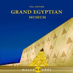 Grand Egyptian Museum (GEM) 0.1.060
You could call this a coincidence but the acronym of the Grand Egyptian Museum is an apt title for the GEM, which is truly one!
-
6
 Passeporté 1.3.2
Passeporté reads the NFC chip in your biometric passport or national eID card, verifies its authenticity, and stores the data securely on your device.
-
7
 Great Circle Map 1.7.5
A globe you can turn in any direction, including straight over the poles.
-
8
 UK Map 4.12
* Unlimited free map downloads based on Ordnance Survey® OpenData, at 1:25,000 and 1:10,000 scales, and now also paid map downloads at 1:50,000, 1:25,000 and 1:10,000 scales, just like the paper maps.
-
9
 Connecticut-Parks & Trails 1.0
App Feature
-
10
 Cell Phone Towers World Map 1.1.6
219 countres !! The world's largest Database of Cell & Net Towers