
12downloads
12this week
FreeFreeware
0reviews
Screenshots
About Garmin Pilot
*30 Days Free Trial on initial download!*
Plan. File. Fly. Log.
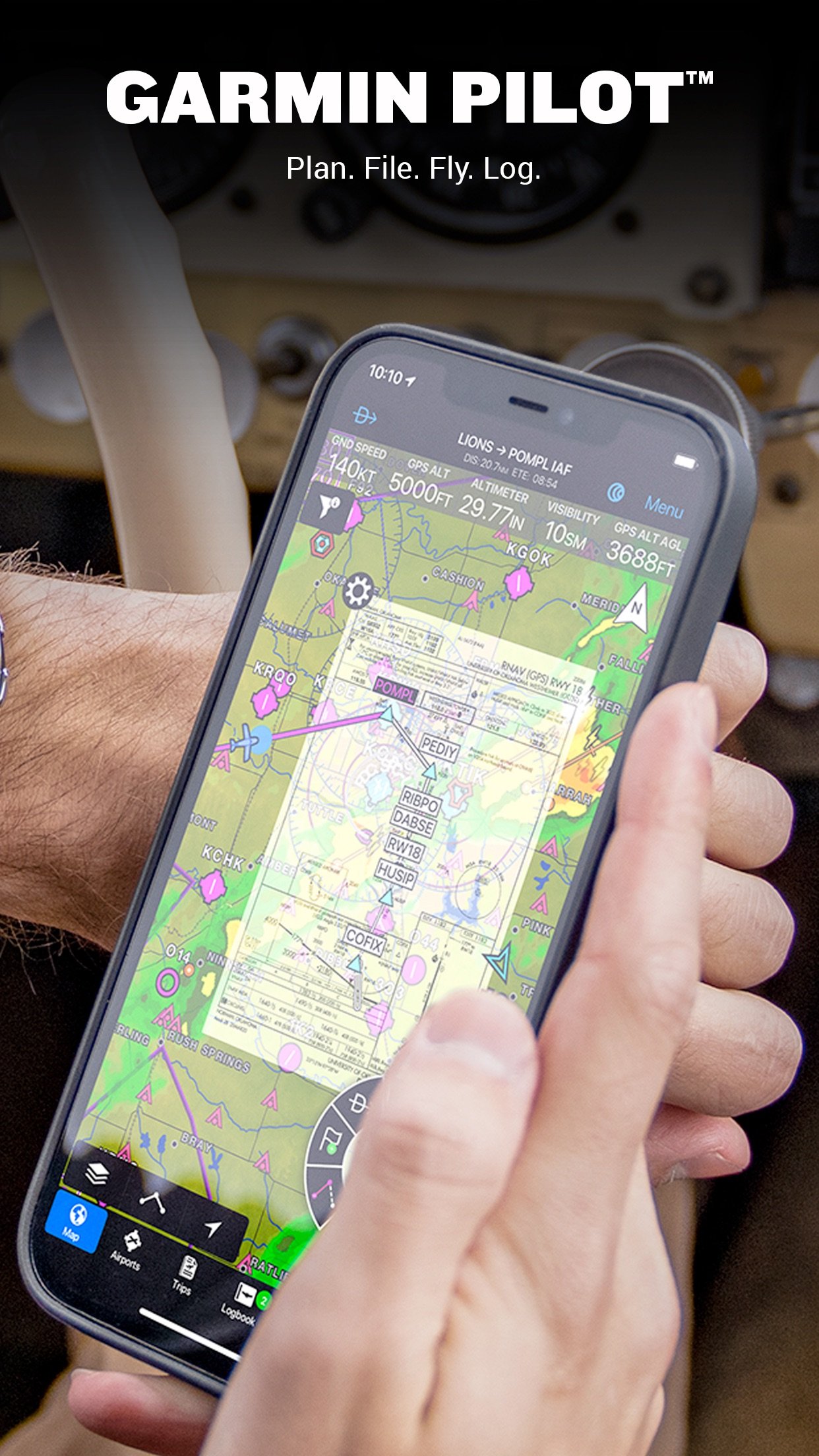
Garmin Pilot is the most comprehensive suite of tools for the iPad designed specifically for general aviation and corporate pilots. Flight planning, charts, interactive maps, weather briefing resources and navigation capabilities; it’s all included. The app’s intuitive interface mirrors those on the newest Garmin touchscreen avionics so you can go seamlessly from preflight to inflight.
Plan
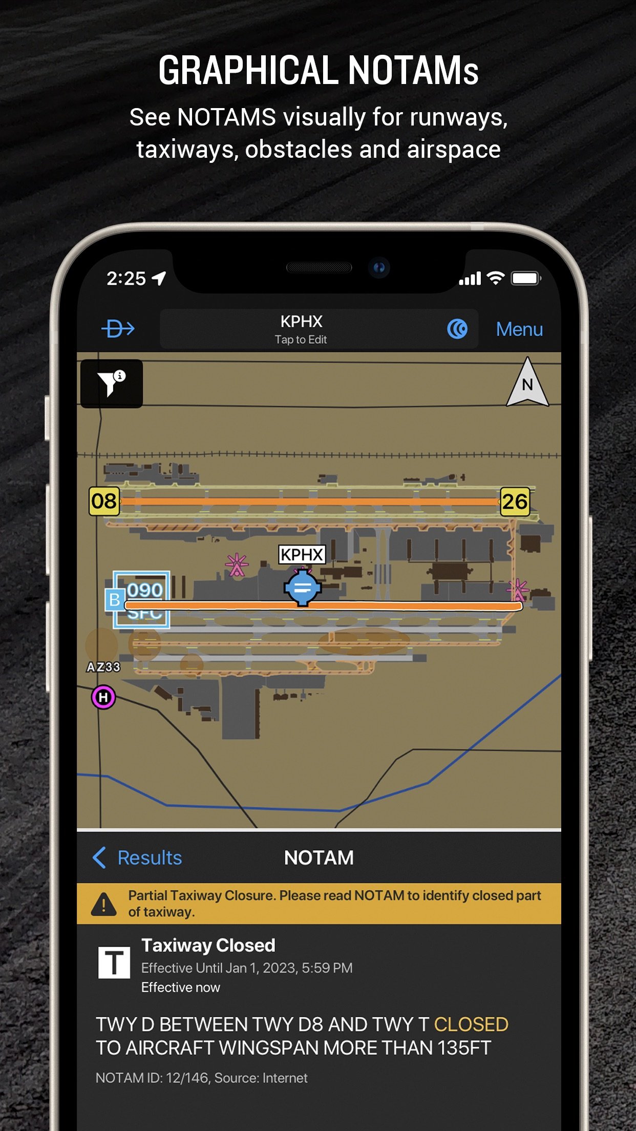
Garmin Pilot’s powerful capabilities start with pre-flight planning, providing pilots with the most comprehensive aviation weather information to make better-informed flight decisions. Pilots can check NEXRAD radar, visible and infrared cloud imagery, METARs, TAFs, AIRMETs, SIGMETs, PIREPs, NOTAMs, winds and temperature aloft, TFRs and lightning data. With Garmin Pilot, data can be displayed over Garmin’s interactive maps that support track-up navigation, VFR sectional or an IFR low or high en-route chart to visualize the weather for your route. Add text-based weather widgets and use the exclusive NavTrack feature to view weather along the planned route.
File
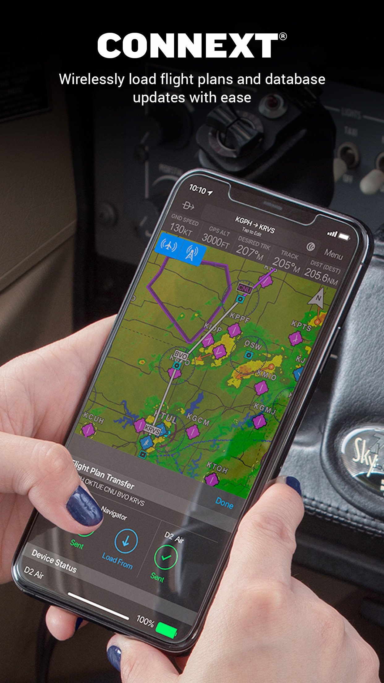
With Garmin Pilot, users can easily enter a flight plan and interactively edit it on the map. Pre-loaded forms make it quick to save and reuse data for frequently flown routes. And when the flight plan is ready, Garmin Pilot makes it simple to file, amend or close the flight plan via Leidos Flight Service or DUATS.
Fly
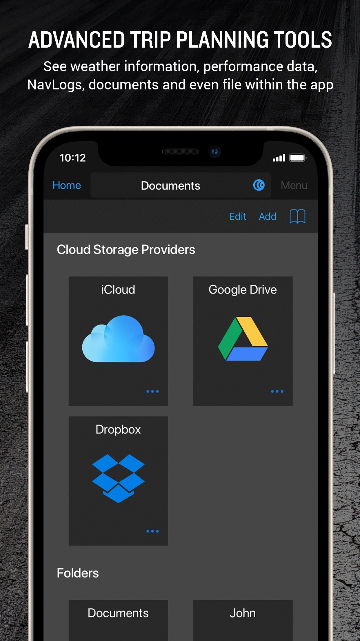
Garmin Pilot provides full en-route navigation capability on its moving map. Pilots can also navigate with Garmin’s patented panel, a GPS-driven instrument pack with a graphical HSI directional display and indicators for groundspeed, altitude and vertical speed. After takeoff, pilots can continue to view real-time weather in the U.S. and traffic information by wirelessly connecting to Garmin’s GDL 50 series portable ADS-B Receiver (sold separately).
Log
Garmin Pilot includes a comprehensive electronic logbook that syncs with flyGarmin. The logbook automatically generates entries based upon GPS data collected during the flight, tracks currency, supports manual entries, endorsements and creates reports.
Garmin Pilot U.S. Standard:
- Rich, interactive maps support Track-Up navigation
- Charts: VFR Sectionals, low and high IFR en-route, airport diagrams and approach procedures
- Ability to view Jeppesen Terminal Charts (Jeppesen echart subscription required)
- Weather Maps: Animated radar, Infrared and Visible Satellite, AIRMETs, SIGMETs, Lightning, TFRs and more!
- Extensive text products: METARs, TAFs, Winds Aloft, PIREPs, AIRMETs, SIGMETs, Area Forecasts and NOTAMs
- AOPA Airport Directory
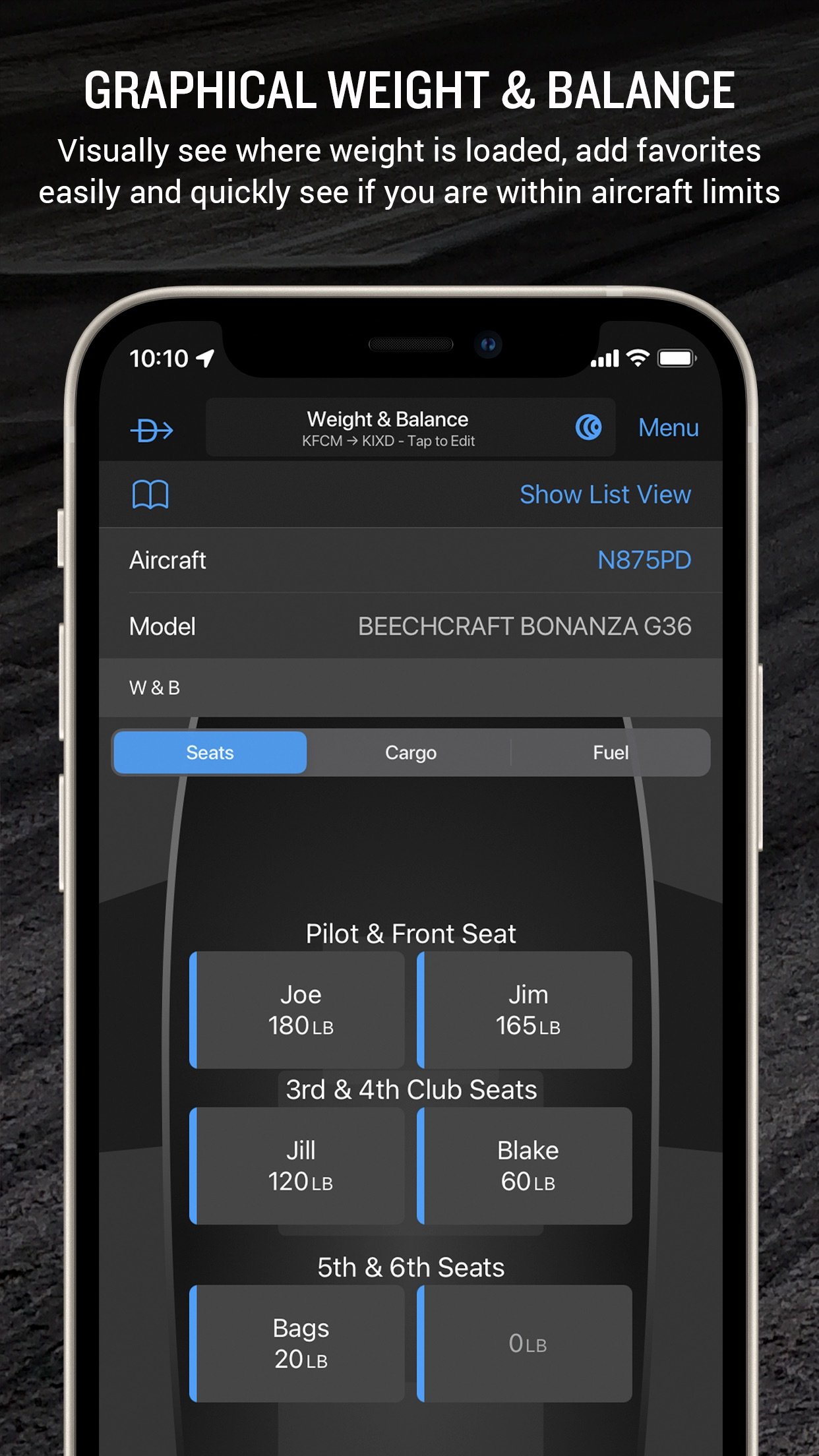
- Weight and Balance
- Checklists
- Flight plan filing via Leidos Flight Services
- Garmin patented navigation panel
- Terrain and Obstacles
- Smart Airspace
- Fast Find predictive Waypoint Entry
- Logbook
- Optional VFR Premium: Synthetic Vision (SVX), Terrain and obstacle alerting, and Garmin SafeTaxi®
- Optional IFR Premium: VFR Premium plus geo-referenced Garmin FliteCharts®
Garmin Pilot has regional offerings for Africa, Asia, Australia, Canada, Europe and Latin America. Features include:
- Worldwide Jeppesen NavData
- Rich, interactive maps support Track-Up navigation
- Radar and Satellite imagery for Western Europe, U.S., Canada and Australia
- Ability to view Jeppesen Terminal Charts (Jeppesen echart subscription required)
- Worldwide METARs, TAFs, AIRMETs, SIGMETs, NOTAMs and winds aloft
- VFR Flight Plan Filing
- IFR autorouting and Flight plan filing in Europe
- Terrain and Obstacles with alerting
- Synthetic Vision (SVX)
- Smart Airspace
- Logbook
- Optional VFR charts from DFS, IGN and NATS and IFR enroute charts from EuroControl
- Optional Garmin FliteCharts® and SafeTaxi® diagrams available on a country-by-country basis
*Note: Use of GPS running in the background may decrease battery life.*
*Note: One subscription to Garmin Pilot may be used on three devices.*
Plan. File. Fly. Log.
Garmin Pilot is the most comprehensive suite of tools for the iPad designed specifically for general aviation and corporate pilots. Flight planning, charts, interactive maps, weather briefing resources and navigation capabilities; it’s all included. The app’s intuitive interface mirrors those on the newest Garmin touchscreen avionics so you can go seamlessly from preflight to inflight.
Plan
Garmin Pilot’s powerful capabilities start with pre-flight planning, providing pilots with the most comprehensive aviation weather information to make better-informed flight decisions. Pilots can check NEXRAD radar, visible and infrared cloud imagery, METARs, TAFs, AIRMETs, SIGMETs, PIREPs, NOTAMs, winds and temperature aloft, TFRs and lightning data. With Garmin Pilot, data can be displayed over Garmin’s interactive maps that support track-up navigation, VFR sectional or an IFR low or high en-route chart to visualize the weather for your route. Add text-based weather widgets and use the exclusive NavTrack feature to view weather along the planned route.
File
With Garmin Pilot, users can easily enter a flight plan and interactively edit it on the map. Pre-loaded forms make it quick to save and reuse data for frequently flown routes. And when the flight plan is ready, Garmin Pilot makes it simple to file, amend or close the flight plan via Leidos Flight Service or DUATS.
Fly
Garmin Pilot provides full en-route navigation capability on its moving map. Pilots can also navigate with Garmin’s patented panel, a GPS-driven instrument pack with a graphical HSI directional display and indicators for groundspeed, altitude and vertical speed. After takeoff, pilots can continue to view real-time weather in the U.S. and traffic information by wirelessly connecting to Garmin’s GDL 50 series portable ADS-B Receiver (sold separately).
Log
Garmin Pilot includes a comprehensive electronic logbook that syncs with flyGarmin. The logbook automatically generates entries based upon GPS data collected during the flight, tracks currency, supports manual entries, endorsements and creates reports.
Garmin Pilot U.S. Standard:
- Rich, interactive maps support Track-Up navigation
- Charts: VFR Sectionals, low and high IFR en-route, airport diagrams and approach procedures
- Ability to view Jeppesen Terminal Charts (Jeppesen echart subscription required)
- Weather Maps: Animated radar, Infrared and Visible Satellite, AIRMETs, SIGMETs, Lightning, TFRs and more!
- Extensive text products: METARs, TAFs, Winds Aloft, PIREPs, AIRMETs, SIGMETs, Area Forecasts and NOTAMs
- AOPA Airport Directory
- Weight and Balance
- Checklists
- Flight plan filing via Leidos Flight Services
- Garmin patented navigation panel
- Terrain and Obstacles
- Smart Airspace
- Fast Find predictive Waypoint Entry
- Logbook
- Optional VFR Premium: Synthetic Vision (SVX), Terrain and obstacle alerting, and Garmin SafeTaxi®
- Optional IFR Premium: VFR Premium plus geo-referenced Garmin FliteCharts®
Garmin Pilot has regional offerings for Africa, Asia, Australia, Canada, Europe and Latin America. Features include:
- Worldwide Jeppesen NavData
- Rich, interactive maps support Track-Up navigation
- Radar and Satellite imagery for Western Europe, U.S., Canada and Australia
- Ability to view Jeppesen Terminal Charts (Jeppesen echart subscription required)
- Worldwide METARs, TAFs, AIRMETs, SIGMETs, NOTAMs and winds aloft
- VFR Flight Plan Filing
- IFR autorouting and Flight plan filing in Europe
- Terrain and Obstacles with alerting
- Synthetic Vision (SVX)
- Smart Airspace
- Logbook
- Optional VFR charts from DFS, IGN and NATS and IFR enroute charts from EuroControl
- Optional Garmin FliteCharts® and SafeTaxi® diagrams available on a country-by-country basis
*Note: Use of GPS running in the background may decrease battery life.*
*Note: One subscription to Garmin Pilot may be used on three devices.*
| Release info | Update on Nov 02, 2026 |
|---|---|
| Release notes | - Added support for the MARQ 3 watch - Resolved watch connection issues |
| Listing data | App Store |
Reviews
No reviews yet. Be the first to review Garmin Pilot.
Used Garmin Pilot? Tell other visitors what you thought.
Log in to write a reviewOther products by this publisher
- "No Distractions" for YouTube 4.10 ----
- #Bible 11.5 "Incredible App - My sister shared this app with me a few weeks ago and it is truly incredible.
- #filmphotography 1.4.2 So, you decided to shoot on film?
- $quirrel 1.5.1 $quirrel Budget & Finance helps you plan each paycheck, track spending, manage debt, and see what is safe to spend before the next payday.
- % Percentage Calculator Pro 1.41 This is the Pro version of % Percentage Calculator.
Most viewed iOS Weather
-
1
 MesoRadar 1.5.0
Live radar, warnings and snow forecasts, simple enough for anyone.
-
2
 METAR Widgets 1.9
What better way to keep abreast of current conditions than with a beautiful METAR widget, right on your home screen?
-
3
 MeteoSwiss 3.6.1
Intuitive, personalised and innovative: the MeteoSwiss app is your comprehensive companion for all weather information in Switzerland – compact and always up to date.
-
4
 Weather UAE 4.1.30
The National Center of Meteorology, a UAE federal government entity has developed this Mobile application as an additional way of communicating and serving its clients through providing a continuous informational multi-view feed on high-resolution w…
-
5
 Firespot 6.1
Firespot is the most comprehensive source of real-time wildfire data.
-
6
 WeatherBug 6.9.2
A brand-new WeatherBug is here!
-
7
 HF Weather Fax 1.6
Do you want to get your weather charts without using an internet connection or a dedicated computer?
-
8
 Tide Times 3.2
Tide Times offers a simple and accurate 7-day forecast for UK tidal time.
-
9
 AccuWeather 21.0.29
Download AccuWeather®, The Most Trusted Weather App.
-
10
 WeatherLCD 25.0
Why pay for multiple apps that provide U.S.
Most downloaded iOS Weather
-
1
HF Weather Fax 1.6
Do you want to get your weather charts without using an internet connection or a dedicated computer?
-
2
WeatherBug 6.9.2
A brand-new WeatherBug is here!
- 3 (Not Boring) Weather 3.54 ~ WEATHER DOESN’T HAVE TO BE BORING ~
-
4
 Windy.com 51.030231
A UNIQUE WEATHER FORECAST VISUALISATION
-
5
 El Niño Forecast 1.3
Track El Niño and La Niña like an expert.
-
6
 Moonlitt 2.10.1
#1 Moon Tracker App • Apple Design Award 2026 Winner • App of the Day • Great on iOS 26
-
7
 National Weather Forecast Data 1.33
The fastest way to access NWS/NOAA weather data.
-
8
 Zoom Earth 6.3.3
INTERACTIVE WEATHER MAP
-
9
 Weatherly 1.2.0
Weatherly provides current conditions, hourly forecasts, 7-day forecasts, precipitation details, sunrise and sunset times, plus essential data including wind, humidity, pressure, UV index, visibility, and Apparent temperature.
-
10
 NW Florida Beach Flags 2.3
Planning a beach day in Northwest Florida?