0downloads
0this week
FreeFreeware
0reviews
Screenshots
About Firesource
Firesource's features:
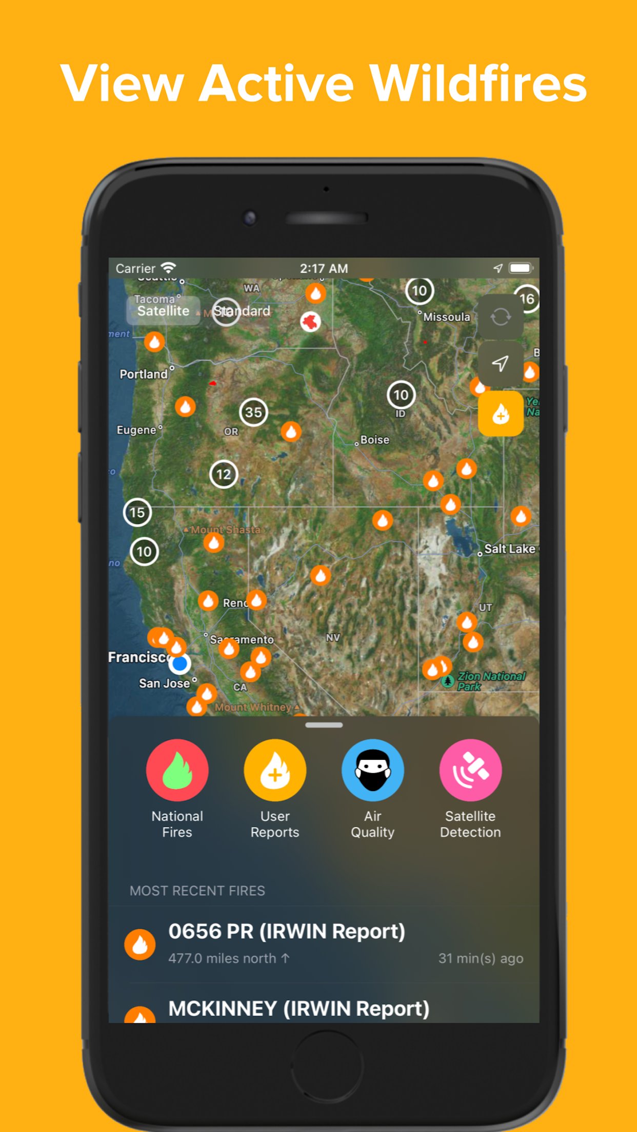
o Live fire feed - both on map and in scrollable menu
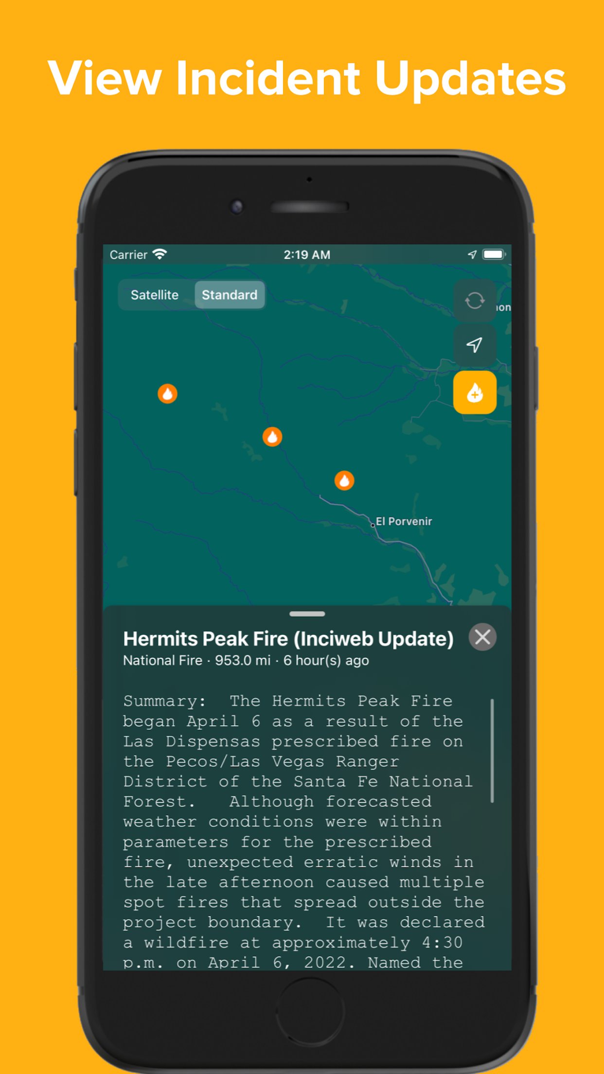
o Local and national fire incidents - news updates and reports
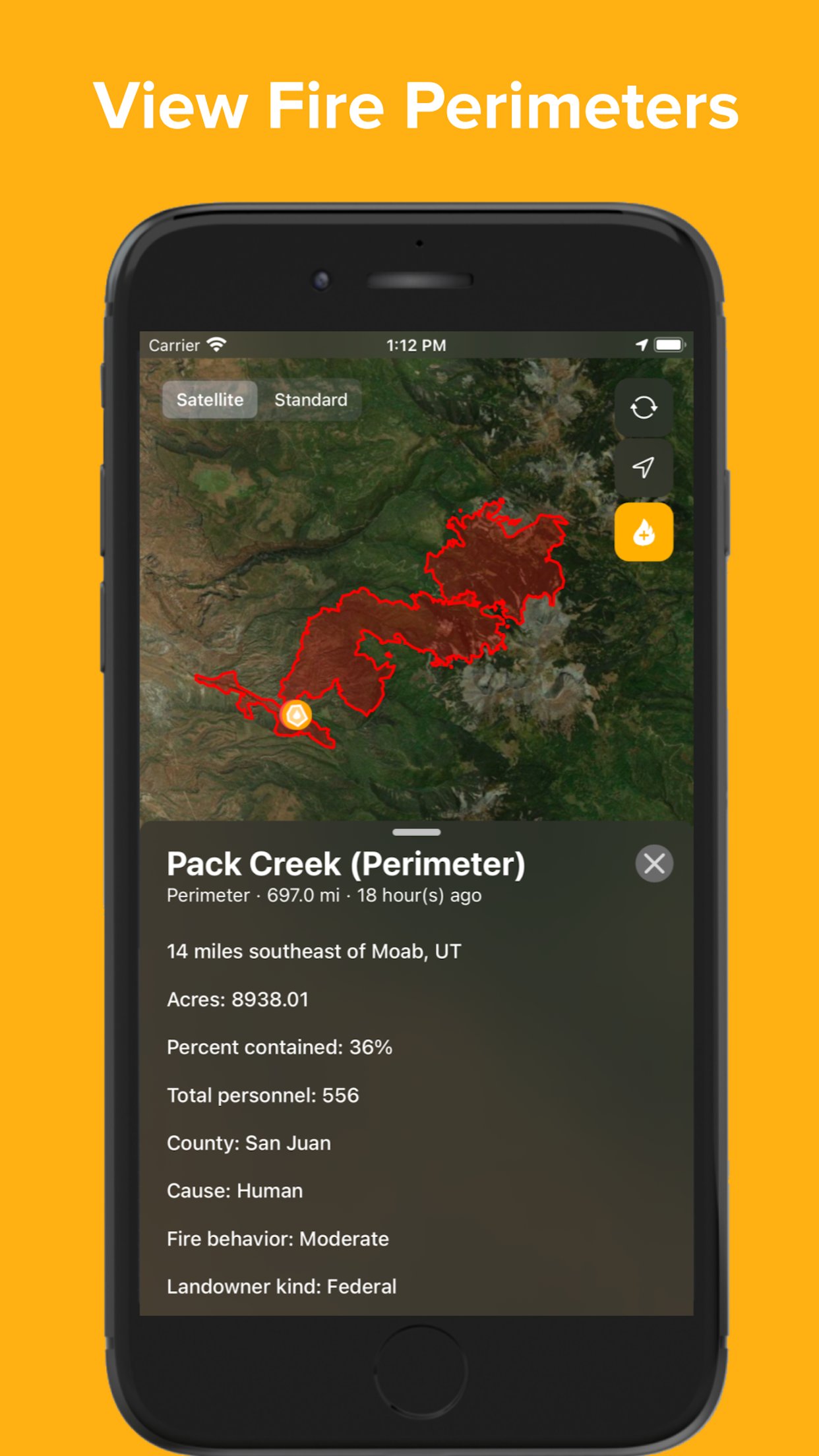
o Fire perimeters - access all realtime fire perimeters at once with information about fire growth and progress, including acreage, containment, personnel, fire cause, and fire behavior
o Report a fire - instantly inform other users of a nearby fire by pressing the + button, taking a picture of the fire, and submitting
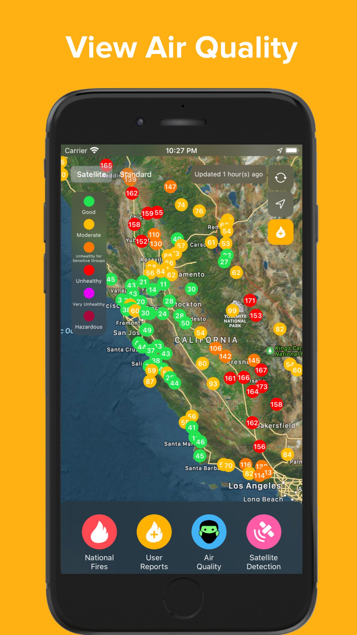
o Air quality - see the effects of recent fires by viewing realtime air quality measurements across the country
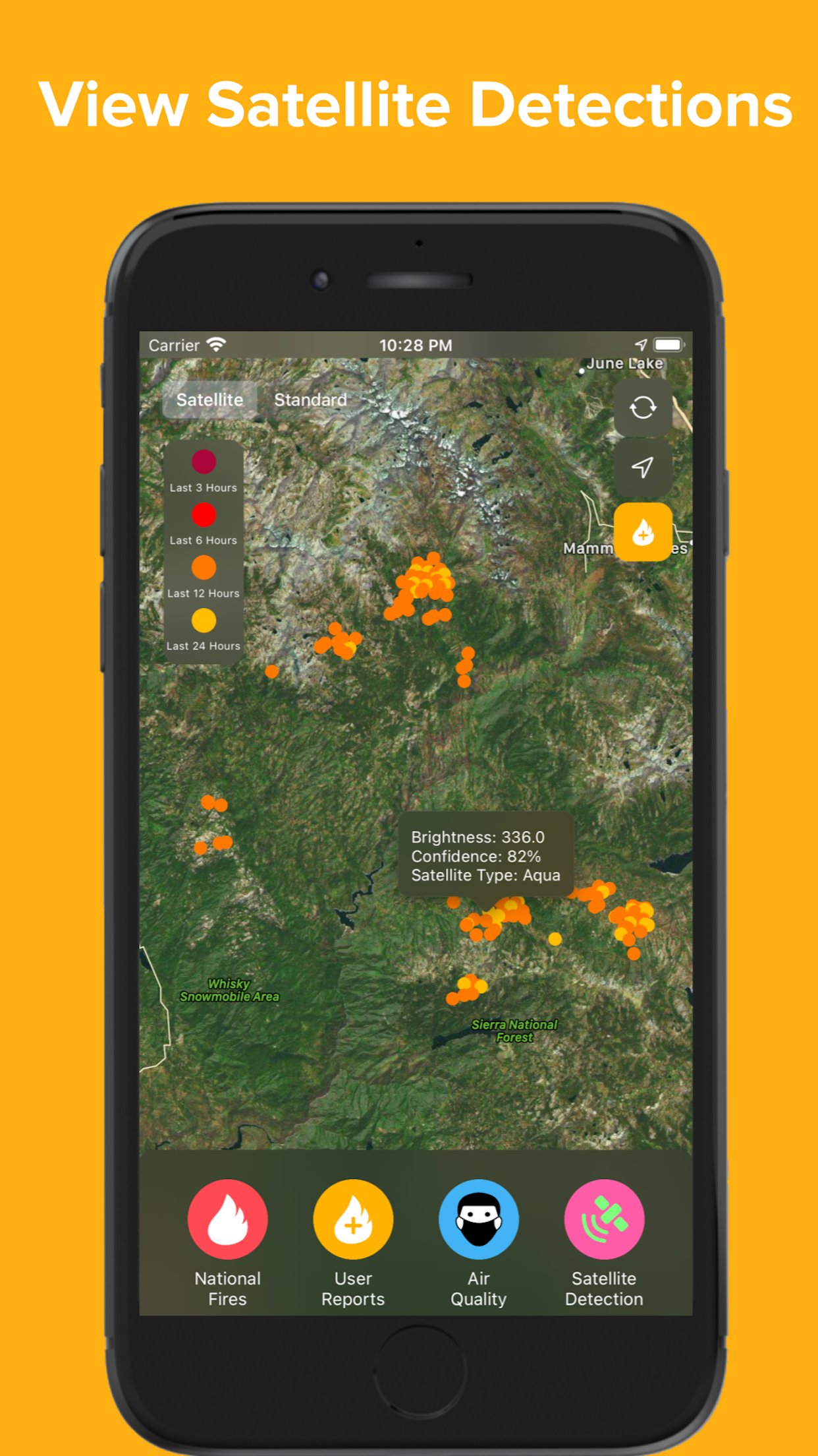
o Satellite fire detections can indicate new fires and how current fires are spreading
National Fires (InciWeb, Cal Fire, IRWIN):
InciWeb is an interagency incident management system run by the National Wildfire Coordinating Group. InciWeb collects wildfire incident data from several agencies across the United States and provides all of this data together in several feeds. Firesource presents wildfire incidents reported by InciWeb in real time, providing the fire's location and detailed status. Learn more about InciWeb at their website: [link removed]. Learn more about Cal Fire, which also provides incident information, at their website: [link removed]. Learn more about IRWIN, the data hub of fire reports, at [link removed].
National Fires (Perimeters):
Perimeter data is provided by the Wildland Fire Interagency Geospatial Services (WFIGS) Group and hosted in the National Interagency Fire Center ArcGIS Online Organization (The NIFC Org). Firesource displays fire perimeters and descriptions of their progress in the 'National Fires' tab of the menu, with this information updated on a regular basis. Learn more about the NIFC at their website: [link removed]
User-Reported Fires:
Allowing app users to report a fire and immediately inform other users is an essential aspect of Firesource. To report a fire, press the yellow + button in the top right corner of the map, select the type of fire (vehicle fire, forest fire, terrain fire, structure fire), take a photo of the fire, and press submit. To ensure the validity of fire reports, the user must take a photo of the fire and cannot access Camera Roll to select a picture. Please note that submitting a fire report automatically creates the report at the user's location, to further ensure that the fire is local and valid. When viewing user-reported fires in the feed, other users can 'rate' the fire report by confirming that it is active, contained, or a spam reporting.
Air Quality:
Air quality measurements from across the United States are collected from AirNow.gov, which provides national air quality data using the Air Quality Index (AQI). This data is color-coded to provide information about health concerns due to PM2.5 pollutants.
Satellite-Detected Fires:
Thermal hotspot detections are displayed and collected from NASA's Moderate Resolution Imaging Spectroradiometer (MODIS), which is an instrument on the Terra and Aqua satellites. Information provided from MODIS about each detection includes brightness (brightness temperature in Kelvin of a fire pixel) and confidence (quality of fire pixel). These fire detections are extremely useful, as they can indicate new fires and fire spread. Learn more about MODIS at their website: [link removed]
Firesource is not affiliated with any government agencies.
Firesource is only available for iPhone and iPad in the United States, Canada, and Australia.
Privacy Policy: [link removed]
Learn more and contact us at [link removed]
License: Free
o Live fire feed - both on map and in scrollable menu
o Local and national fire incidents - news updates and reports
o Fire perimeters - access all realtime fire perimeters at once with information about fire growth and progress, including acreage, containment, personnel, fire cause, and fire behavior
o Report a fire - instantly inform other users of a nearby fire by pressing the + button, taking a picture of the fire, and submitting
o Air quality - see the effects of recent fires by viewing realtime air quality measurements across the country
o Satellite fire detections can indicate new fires and how current fires are spreading
National Fires (InciWeb, Cal Fire, IRWIN):
InciWeb is an interagency incident management system run by the National Wildfire Coordinating Group. InciWeb collects wildfire incident data from several agencies across the United States and provides all of this data together in several feeds. Firesource presents wildfire incidents reported by InciWeb in real time, providing the fire's location and detailed status. Learn more about InciWeb at their website: [link removed]. Learn more about Cal Fire, which also provides incident information, at their website: [link removed]. Learn more about IRWIN, the data hub of fire reports, at [link removed].
National Fires (Perimeters):
Perimeter data is provided by the Wildland Fire Interagency Geospatial Services (WFIGS) Group and hosted in the National Interagency Fire Center ArcGIS Online Organization (The NIFC Org). Firesource displays fire perimeters and descriptions of their progress in the 'National Fires' tab of the menu, with this information updated on a regular basis. Learn more about the NIFC at their website: [link removed]
User-Reported Fires:
Allowing app users to report a fire and immediately inform other users is an essential aspect of Firesource. To report a fire, press the yellow + button in the top right corner of the map, select the type of fire (vehicle fire, forest fire, terrain fire, structure fire), take a photo of the fire, and press submit. To ensure the validity of fire reports, the user must take a photo of the fire and cannot access Camera Roll to select a picture. Please note that submitting a fire report automatically creates the report at the user's location, to further ensure that the fire is local and valid. When viewing user-reported fires in the feed, other users can 'rate' the fire report by confirming that it is active, contained, or a spam reporting.
Air Quality:
Air quality measurements from across the United States are collected from AirNow.gov, which provides national air quality data using the Air Quality Index (AQI). This data is color-coded to provide information about health concerns due to PM2.5 pollutants.
Satellite-Detected Fires:
Thermal hotspot detections are displayed and collected from NASA's Moderate Resolution Imaging Spectroradiometer (MODIS), which is an instrument on the Terra and Aqua satellites. Information provided from MODIS about each detection includes brightness (brightness temperature in Kelvin of a fire pixel) and confidence (quality of fire pixel). These fire detections are extremely useful, as they can indicate new fires and fire spread. Learn more about MODIS at their website: [link removed]
Firesource is not affiliated with any government agencies.
Firesource is only available for iPhone and iPad in the United States, Canada, and Australia.
Privacy Policy: [link removed]
Learn more and contact us at [link removed]
License: Free
| Release info | New Release on Apr 11, 2023 |
|---|---|
| Release notes | - UI/UX improvements - Bug fixes |
| Listing data | App Store |
Reviews
No reviews yet. Be the first to review Firesource.
Used Firesource? Tell other visitors what you thought.
Log in to write a reviewOther products by this publisher
- #Bible 11.5 "Incredible App - My sister shared this app with me a few weeks ago and it is truly incredible.
- % Percentage Calculator Pro 1.41 This is the Pro version of % Percentage Calculator.
- (beat) for iOS 0.5.8 An elegant Fountain screenwriting app, created by a screenwriter for screenwriters.
- (Deep) HIARCS Chess Explorer 1.14 Chess database, analysis and game playing program
- (How to) Pronounce PRO 1.5.6 This is a PRO version of (How to) Pronounce.
Most viewed iOS Weather
-
1
 WeatherBug 6.9.1
Download the most popular free weather app powered by the largest professional weather network in the world!
WeatherBug 6.9.1
Download the most popular free weather app powered by the largest professional weather network in the world!
-
2
 CNN Weather 1.11
Know more. Plan better.
CNN Weather 1.11
Know more. Plan better.
-
3
 NOAA Weather Radar Live Map 43.0.7
NOAA Weather Radar Live Map: Weather forecast to protect you against severe weather alerts, storms, and natural disasters
NOAA Weather Radar Live Map 43.0.7
NOAA Weather Radar Live Map: Weather forecast to protect you against severe weather alerts, storms, and natural disasters
-
4
 AccuWeather 21.0.27
Download AccuWeather®, The Most Trusted Weather App.
AccuWeather 21.0.27
Download AccuWeather®, The Most Trusted Weather App.
-
5
 Zoom Earth 6.3.1
INTERACTIVE WEATHER MAP
Zoom Earth 6.3.1
INTERACTIVE WEATHER MAP
-
6
 Windy.com 51.030224
A UNIQUE WEATHER FORECAST VISUALISATION
Windy.com 51.030224
A UNIQUE WEATHER FORECAST VISUALISATION
-
7
 RainViewer 8.2.1
Live weather radar, nowcast and rain alerts, hyperlocal forecast and hurricane tracker, built to help you see, understand, and act on rain before it changes.
RainViewer 8.2.1
Live weather radar, nowcast and rain alerts, hyperlocal forecast and hurricane tracker, built to help you see, understand, and act on rain before it changes.
-
8
 My Earthquake Alerts & Feed 26.6.1
My Earthquake Alerts is a powerful earthquake monitoring app which delivers all of the information you need, with push notifications included, all free of charge.
My Earthquake Alerts & Feed 26.6.1
My Earthquake Alerts is a powerful earthquake monitoring app which delivers all of the information you need, with push notifications included, all free of charge.
-
9
 WeatherWise.app 1.9.1
Stay one step ahead of severe weather.
WeatherWise.app 1.9.1
Stay one step ahead of severe weather.
-
10
 The Weather Channel 16.28
The Weather Channel is the World's Most Accurate Forecaster*.
The Weather Channel 16.28
The Weather Channel is the World's Most Accurate Forecaster*.
Most downloaded iOS Weather
-
1
AccuWeather 21.0.27
Download AccuWeather®, The Most Trusted Weather App.
-
2
WeatherBug 6.9.1
Download the most popular free weather app powered by the largest professional weather network in the world!
-
3
NOAA Weather Radar Live Map 43.0.7
NOAA Weather Radar Live Map: Weather forecast to protect you against severe weather alerts, storms, and natural disasters
-
4
The Weather Channel 16.28
The Weather Channel is the World's Most Accurate Forecaster*.
-
5
Zoom Earth 6.3.1
INTERACTIVE WEATHER MAP
-
6
 MyRadar Accurate Weather Radar 7.127.0
Thanks to everyone for making MyRadar so successful, with over 50 million downloads!
MyRadar Accurate Weather Radar 7.127.0
Thanks to everyone for making MyRadar so successful, with over 50 million downloads!
-
7
 National Hurricane Center Data 1.111
Download the most comprehensive Hurricane Tracker app for iOS.
National Hurricane Center Data 1.111
Download the most comprehensive Hurricane Tracker app for iOS.
-
8
 OpenSnow 8.2.0
OpenSnow is your trusted source for the most accurate snow forecast, snow report, and severe weather maps.
OpenSnow 8.2.0
OpenSnow is your trusted source for the most accurate snow forecast, snow report, and severe weather maps.
-
9
 Radar HD Future Weather Radar 2.0
Fast. Simple. Predictive high-resolution Weather Radar.
Radar HD Future Weather Radar 2.0
Fast. Simple. Predictive high-resolution Weather Radar.
-
10
My Earthquake Alerts & Feed 26.6.1
My Earthquake Alerts is a powerful earthquake monitoring app which delivers all of the information you need, with push notifications included, all free of charge.