FireMapper 1.382
FireMapper is designed for firefighters for quickly generating bushfire and other incident maps.
Download
53.25 MB
10downloads
4this week
FreeCommercial
0reviews
Screenshots
About FireMapper
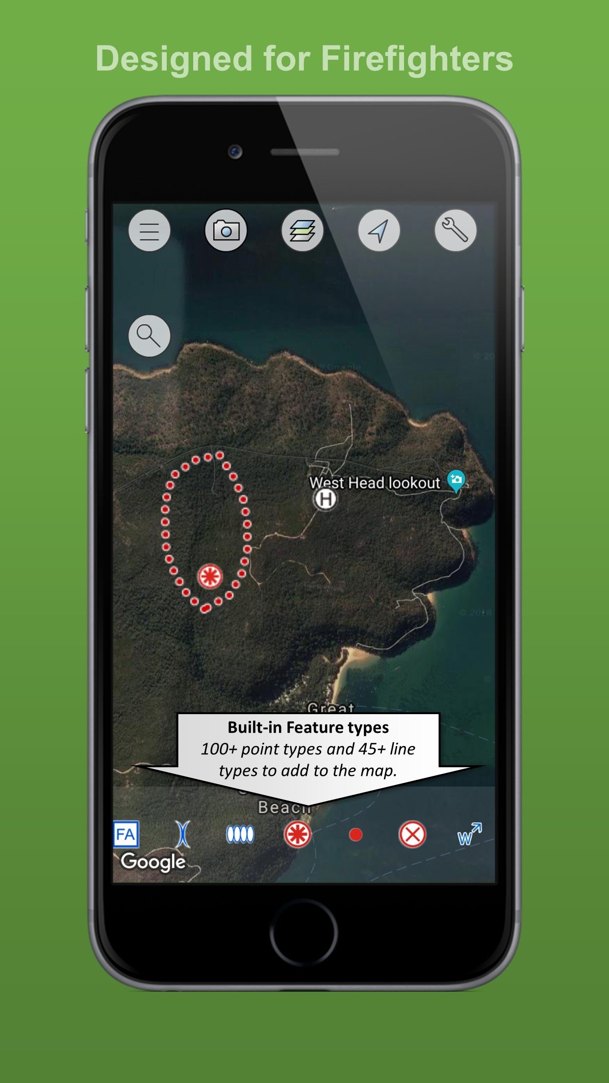
FireMapper is designed for firefighters for quickly generating bushfire and other incident maps. The applications provides a simple interface for drawing maps and exporting via Email.
Maps are stored on the local device and can be created or used offline. No internet connection is required for collecting data.
FACEBOOK & SUPPORT:
Like us on Facebook to be notified of future updates and developments.
[link removed]
MAP EXPORT FORMATS:
Multiple points can be drawn on the map and exported in the same email. The map data can be exported as:
* GPX (suitable for ArcGIS, MapDesk and other popular GIS products, QGIS)
* KML (suitable for Google Maps & Google Earth)
* CSV (suitable for Microsoft Excel & Google Spreadsheets)
* JPG (photo of the map)
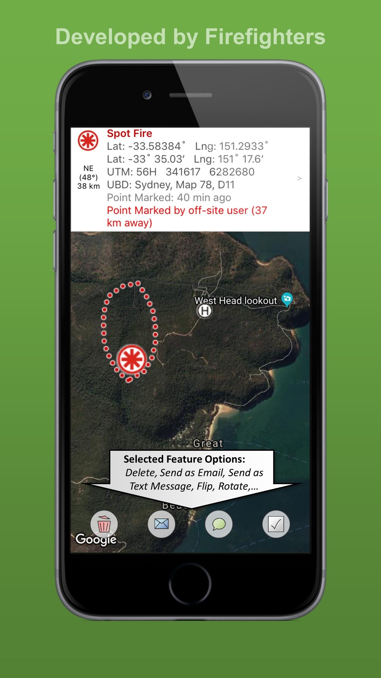
You can also send points & lines as a text message.
GPS CAMERA:
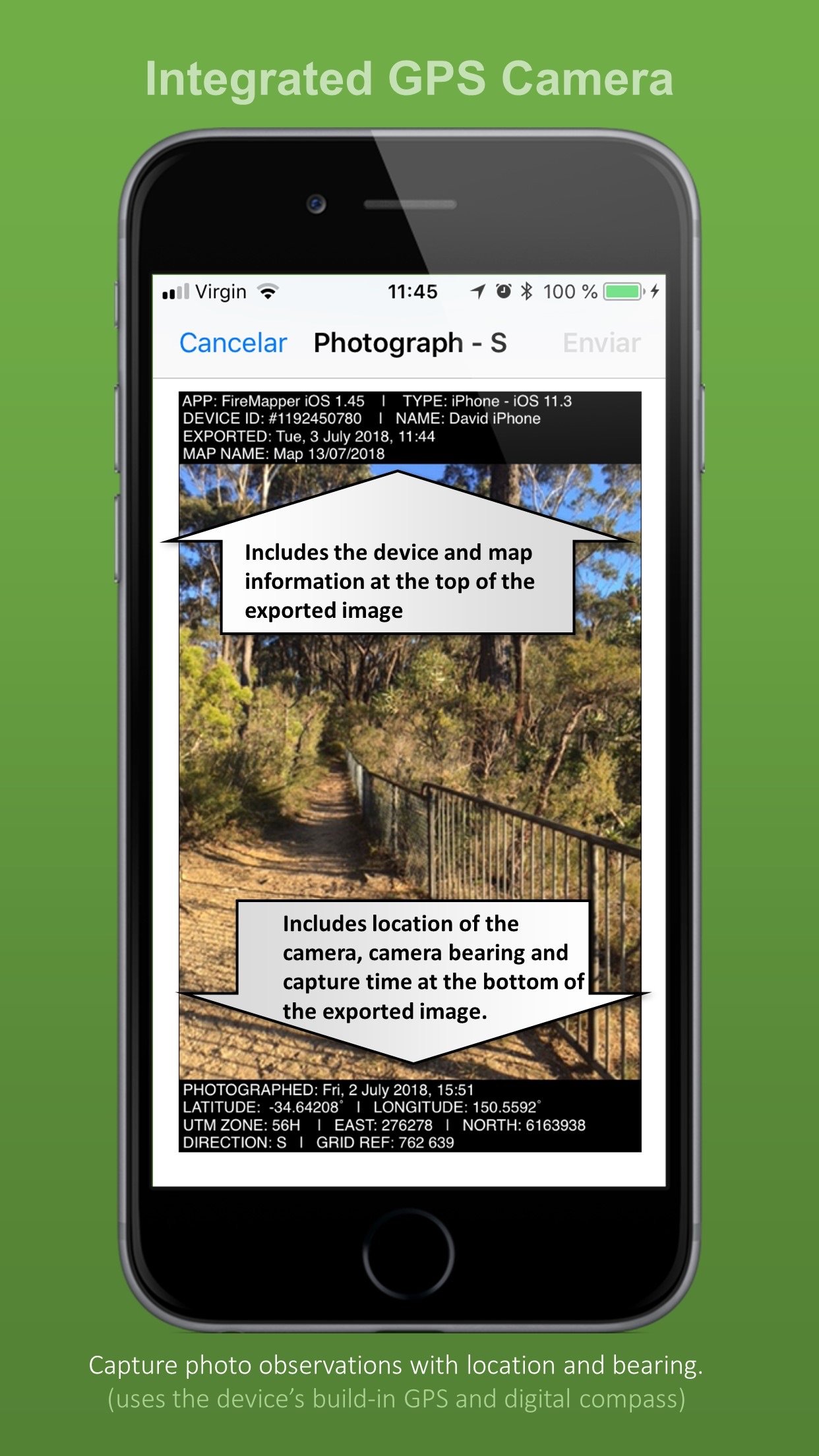
Take geo-referenced photos and display the location and bearing on the map.
GPS RECORDING:
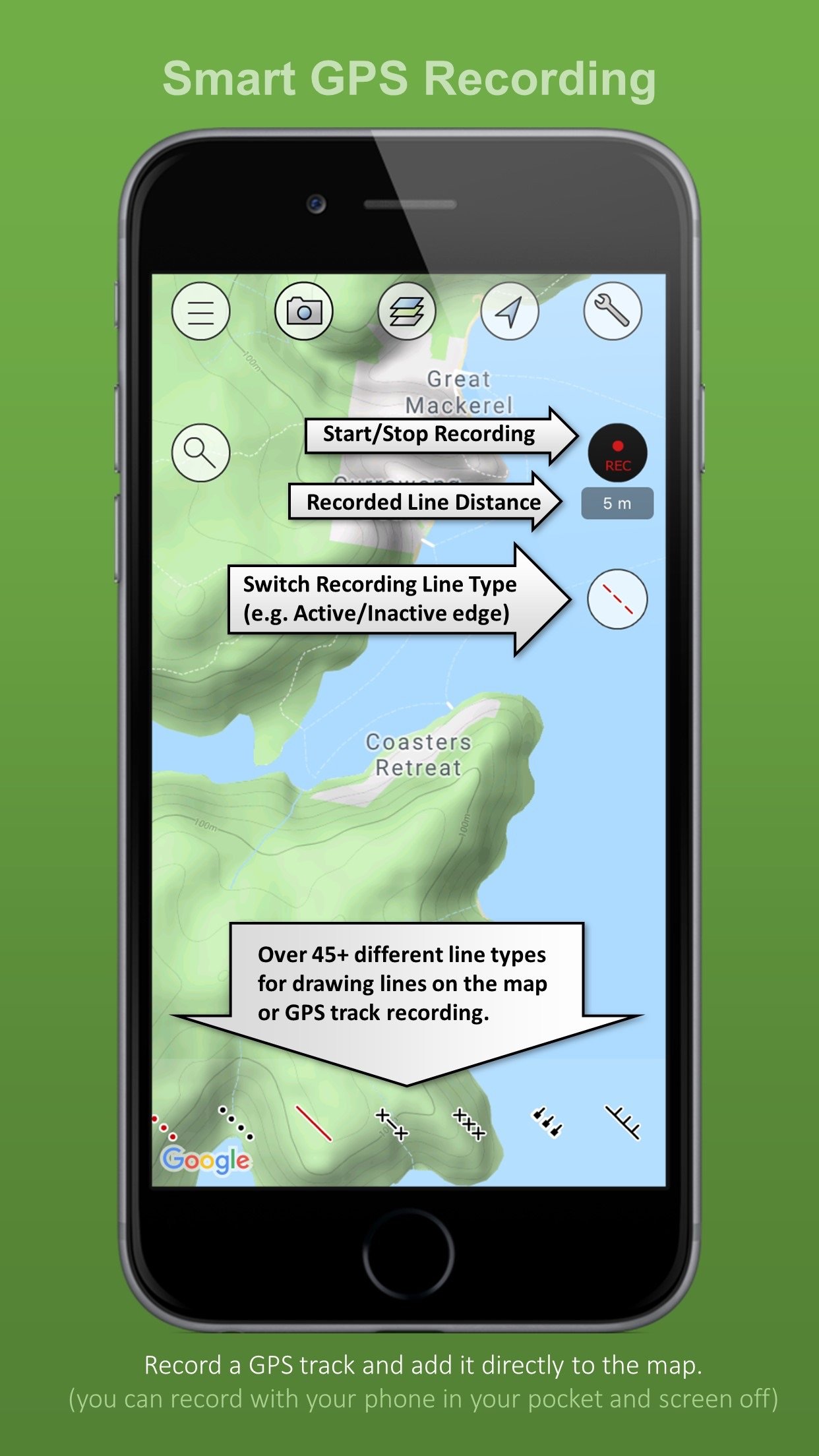
FireMapper supports GPS recording in the background. Continued use of GPS running in the background can dramatically decrease battery life.
BUSHFIRE SYMBOLS:
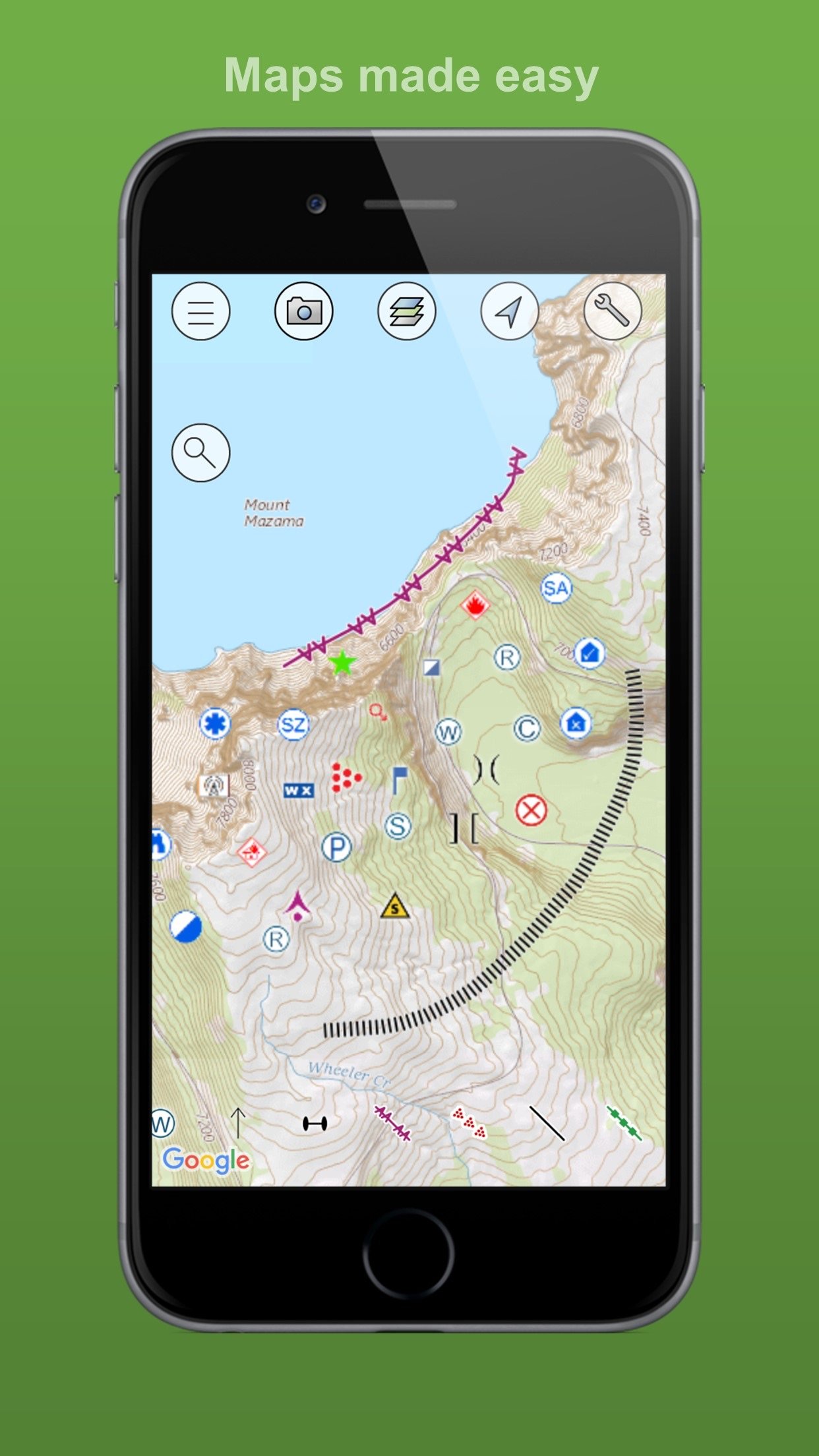
This version contains bush firefighting symbols that are commonly used in Australia, USA & Canada with support for:
* National All Hazards Symbology Set
* USA Interagency Wildfire Point Symbols
Including the following icons:
Hydrant, Water Point, Fire Origin, Spot Fire, Aerial Ignition, Hotspot, Defendable/Not Defendable Asset, Threatened Asset, Indigenous Site, Historic Site, Hazmat,Flora/Fauna, Airbase, Helibase, Helibase,Smoker Standing/Down,Tree Down, Medical, Mobile Weather Station, Portable Communications, Access Point, Control Point, Road Closure, RAFT, Drop Zone, Assembly area, Staging area, Base camp, Control Centre, Divisonal/Sector Command, Evacuation Area/Center, Escape Route, Refuge area, Property damage and more....
LOCATION FORMATS:
-Latitude/Longitude (Decimal Degrees and Degree Minutes/Aviation)
- UTM Coordinates
- 1:25 000, 1:50 000 & 1:100 000 map sheet references
- UBD Map References (Sydney, Canberra, Adelaide, Perth)
INTEGRATED SEARCH:
Search by address, suburb, latitude/longitude, utm coordinates, grid references, place name, point type and more.
OFFLINE SUPPORT:
Maps can be created offline without an internet connection. Map layers are cached for offline support
MULTIPLE MAP LAYERS:
- Standard
- Satellite/Hybrid
- Terrain/Topographic
- US Topographic
- Australian Topographic
- NZ Topographic
and more....
License: Commercial
Maps are stored on the local device and can be created or used offline. No internet connection is required for collecting data.
FACEBOOK & SUPPORT:
Like us on Facebook to be notified of future updates and developments.
[link removed]
MAP EXPORT FORMATS:
Multiple points can be drawn on the map and exported in the same email. The map data can be exported as:
* GPX (suitable for ArcGIS, MapDesk and other popular GIS products, QGIS)
* KML (suitable for Google Maps & Google Earth)
* CSV (suitable for Microsoft Excel & Google Spreadsheets)
* JPG (photo of the map)
You can also send points & lines as a text message.
GPS CAMERA:
Take geo-referenced photos and display the location and bearing on the map.
GPS RECORDING:
FireMapper supports GPS recording in the background. Continued use of GPS running in the background can dramatically decrease battery life.
BUSHFIRE SYMBOLS:
This version contains bush firefighting symbols that are commonly used in Australia, USA & Canada with support for:
* National All Hazards Symbology Set
* USA Interagency Wildfire Point Symbols
Including the following icons:
Hydrant, Water Point, Fire Origin, Spot Fire, Aerial Ignition, Hotspot, Defendable/Not Defendable Asset, Threatened Asset, Indigenous Site, Historic Site, Hazmat,Flora/Fauna, Airbase, Helibase, Helibase,Smoker Standing/Down,Tree Down, Medical, Mobile Weather Station, Portable Communications, Access Point, Control Point, Road Closure, RAFT, Drop Zone, Assembly area, Staging area, Base camp, Control Centre, Divisonal/Sector Command, Evacuation Area/Center, Escape Route, Refuge area, Property damage and more....
LOCATION FORMATS:
-Latitude/Longitude (Decimal Degrees and Degree Minutes/Aviation)
- UTM Coordinates
- 1:25 000, 1:50 000 & 1:100 000 map sheet references
- UBD Map References (Sydney, Canberra, Adelaide, Perth)
INTEGRATED SEARCH:
Search by address, suburb, latitude/longitude, utm coordinates, grid references, place name, point type and more.
OFFLINE SUPPORT:
Maps can be created offline without an internet connection. Map layers are cached for offline support
MULTIPLE MAP LAYERS:
- Standard
- Satellite/Hybrid
- Terrain/Topographic
- US Topographic
- Australian Topographic
- NZ Topographic
and more....
License: Commercial
| Release info | New Release on Jun 21, 2026 |
|---|---|
| Release notes | * Background Location Sharing |
| Listing data | App Store |
Reviews
No reviews yet. Be the first to review FireMapper.
Used FireMapper? Tell other visitors what you thought.
Log in to write a reviewOther products by this publisher
- "No Distractions" for YouTube 4.10 ----
- #Bible 11.6 "Incredible App - My sister shared this app with me a few weeks ago and it is truly incredible.
- #filmphotography 1.4.2 So, you decided to shoot on film?
- $quirrel 1.5.1 $quirrel Budget & Finance helps you plan each paycheck, track spending, manage debt, and see what is safe to spend before the next payday.
- % Percentage Calculator Pro 1.41 This is the Pro version of % Percentage Calculator.
Most viewed iOS Navigation
-
1
 Compass App 1.0.5
Find your direction with style.
-
2
 CARFACE Car Widgets & Lyrics 1.2.1
Make every drive feel more personal with CarFace.
-
3
 iGlide Lite 2.9.66
NaviLogic iGlide - the Soaring Navigation app for iOS
-
4
 Open Road 1.2
Open Road is the one driving app for your iPhone.
-
5
 Turo 26.45.1
Turo is a better car rental app for travelers who want to rent a car without the rental counter.
-
6
 Fly Delta 7.17.3
Welcome to Fly Delta, Delta’s award winning iOS app.
-
7
 Kruger Birding by Firefinch 7.6.0
Go birding in South Africa's foremost birding spot: the world renowned Kruger National Park!
-
8
 Uber 3.747.10000
Join the millions of riders who trust Uber for their everyday travel needs.
-
9
 Lyft 2026.43.3
Get where you’re going with Lyft.
-
10
 Amtrak 6.1.8
Discover the convenience of traveling with Amtrak.
Most downloaded iOS Navigation
-
1
 Live Traffic 2.4
Navigate the globe with live traffic updates, satellite views, and location tools that make every journey clearer, smarter, and more confident from the very first tap.
-
2
 Peru’s Best 2.5
PERU’S BEST is the ideal travel guide to this extraordinary country.
-
3
 Grand Egyptian Museum (GEM) 0.1.060
You could call this a coincidence but the acronym of the Grand Egyptian Museum is an apt title for the GEM, which is truly one!
-
4
 Pocket Luach Deluxe 60058
Pocket Luach Deluxe is a Jewish calendar, zmanim, Siddur, Tehillim, and personal-event companion for iPhone, iPad, and Apple Watch.
-
5
 Outdoor Photography Magazine 7.2.10
Outdoor Photography is the magazine for photographers who are passionate about being out in wild places, seeing inspiring nature and having great adventures.
-
6
 Passeporté 1.3.2
Passeporté reads the NFC chip in your biometric passport or national eID card, verifies its authenticity, and stores the data securely on your device.
-
7
 Great Circle Map 1.7.5
A globe you can turn in any direction, including straight over the poles.
-
8
 UK Map 4.12
* Unlimited free map downloads based on Ordnance Survey® OpenData, at 1:25,000 and 1:10,000 scales, and now also paid map downloads at 1:50,000, 1:25,000 and 1:10,000 scales, just like the paper maps.
-
9
 Connecticut-Parks & Trails 1.0
App Feature
-
10
 Cell Phone Towers World Map 1.1.6
219 countres !! The world's largest Database of Cell & Net Towers